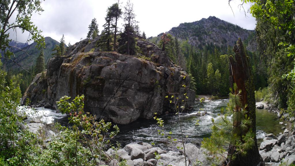
Icicle Creek runs cold and fast out of the Alpine Lakes Wilderness, through a granite canyon where the Stuart Range stands over the road and the creek pools deep and green below the bridges. One road follows it up from Leavenworth, about twenty miles from pavement to road’s end, and nearly every campground in this valley stands along that single road. The road also serves the Enchantments permit area, whose trailheads stand up the Forest Road 7601 spur and at the Snow Lakes Trailhead on the main road.
Eight Forest Service campgrounds serve the road, and three private parks stand on the road and in Leavenworth at its foot. One campground, Eightmile, reserves about three fifths of its sites ahead. The rest of the road’s individual sites are first come, claimed by arriving. That split between one bookable campground and a first come road runs through everything below.
We know this road from its upper end. We hiked the Icicle Gorge loop that threads past its upper campgrounds in September 2022. Across four trips we have also walked out of both Enchantments trailheads at the tops of their spurs, twice through the whole permit area in a day. We have not stayed in any of these campgrounds. The campground guidance here rests on the land managers’ own pages, checked in November 2026, and the trail guidance on those hikes and the Washington Trails Association’s reporting.
This canyon sits inside the wider Central Cascades camping between Stevens Pass and Snoqualmie Pass. Lake Wenatchee, one drainage north, has its own guide in this series.
In this guide
- Icicle Creek camping at a glance
- Choosing a campground on Icicle Creek
- Eightmile Campground
- Bridge Creek Campground
- Rock Island Campground
- Campgrounds up Icicle Creek Road
- Private campgrounds and RV parks near Leavenworth
- Booking the Icicle Creek campgrounds
- When the campgrounds are full
- Hiking on Icicle Creek
- Backpacking and the Enchantments trailheads
- Seasons and winter on Icicle Creek Road
- Fire restrictions and emergencies
- Camping with an RV on Icicle Creek
- Dispersed camping on Icicle Creek
- Frequently asked questions
- Sources
Icicle Creek camping at a glance
The campgrounds divide by water and by certainty. Eightmile, at the road’s lower end, is the one campground that takes reservations for individual sites, and it carries drinking water, a camp host, and firewood for sale. Above it the road’s individual sites run first come to its end. Three of the eight campgrounds carry no drinking water at all, and none of the eight has showers or a dump station. A camper who needs a hookup sleeps in Leavenworth, at one of the private parks named later in this guide.
The table below runs in road order, from Leavenworth outward, whatever order the entries themselves take. Group camping rides inside the entries too. Three of the eight carry a reservable group site beside their individual sites, and a fourth entry, the Icicle Group Campground, is a group facility itself; those ride inside their entries rather than in rows of their own.
| Campground | Where on the road | Sites | How you get a site | Water |
|---|---|---|---|---|
| Eightmile Campground | About mile 8 | 45, plus a group site | About 60 percent reservable, the rest first come | Hand pumps |
| Bridge Creek Campground | About mile 9 | 6, plus a group site | First come; the group site by reservation | None |
| Icicle Group Campground | About mile 10 | 1 group site, tents only | Reservations | None |
| Johnny Creek Campground | About mile 12 | 65 | First come | Drinking water |
| Ida Creek Campground | About mile 13 | 10 | First come | None |
| Chatter Creek Campground | About mile 16 | 12, plus a group site | First come; the group site by reservation | Drinking water |
| Rock Island Campground | About mile 17 | 22 | First come | Drinking water |
| Blackpine Horse Camp | About mile 18 | 10 | First come | Water |
One more name belongs in this section, because old listings still send campers to it. Tumwater Campground, on US-2 in Tumwater Canyon west of Leavenworth, has been closed since 2014 and takes no campers; a separate Tumwater Group Site stands on Recreation.gov, and the Wenatchee River Ranger District can confirm whether it is taking reservations.
Choosing a campground on Icicle Creek
The first decision is certainty. Eightmile Campground is the only campground on the road where a site can be booked ahead, and only about three fifths of its sites take reservations. Every other individual site on the road is first come, claimed by physically arriving. A camper who needs a guaranteed Friday night in July books Eightmile the winter before, or plans to arrive early and work up the road.
We speak to that uncertainty from experience. We have wanted to camp on this road for years and have looked into these campgrounds more than once. We never have, because apart from Eightmile’s reservable share there is no way to know a site will be waiting on arrival, and this is a busy road in a busy valley.
The second decision is water. Eightmile, Johnny Creek, Chatter Creek, and Rock Island carry drinking water, and Blackpine carries water. Bridge Creek, Ida Creek, and Icicle Group carry none, and a camper bound for those three hauls every drop in from Leavenworth or fills at a campground that has it. No federal campground on the road has showers, and none has a dump station. Those two facts shape packing more than any other in this guide.
Elevation works quietly alongside the road. The campgrounds climb from 1,900 feet at Eightmile to 2,900 feet at Blackpine, and the upper campgrounds run cooler nights and a later spring than the lower road. A party camping in May or October trades the upper campgrounds’ cooler nights for the lower road’s milder air, and a party in August makes the opposite trade gladly. Eightmile sits at the bottom of that climb, the road’s mildest campground and its only reservable one for individual sites.
The third decision is the road itself. The campgrounds up to Ida Creek stand on or at the end of the pavement. Above about mile 13 the road turns to gravel, crosses the creek at about mile 15, and runs single lane in places to its end. Chatter Creek, Rock Island, and Blackpine trade a rougher drive for the gorge country, where the creek runs through its gorge and the trails start at the campgrounds themselves. The creek-side sites at the lower campgrounds are the ones campers ask for by name, and they go first.
Groups have four answers on this road. The Eightmile Group Site holds 70 people beside the campground itself. The Bridge Creek and Chatter Creek group sites hold 70 and 45. The Icicle Group Campground holds 30 at a tent site a short walk from its gate. All four book through Recreation.gov, and the group sites are the only reservable beds on the road besides Eightmile’s split.
Stock parties have one answer, and it is at the road’s end. Blackpine Horse Camp is the road’s horse camp, with three trails leaving its reach. A party with a trailer and horses plans around Blackpine or does not camp on this road at all.
Cell service is the last thing to plan around. No agency page for any campground on this road publishes coverage, and campers report little to no service at the upper campgrounds. Treat the road as offline. Download the Recreation.gov app and any maps before leaving Leavenworth, because paying for a first come site by Scan and Pay runs through that app.
Leavenworth stands at the road’s foot with what a camper needs. Groceries, fuel, and the Wenatchee River Ranger District office, at 600 Sherbourne Street, are all in town, no more than about 3 miles from where Icicle Road leaves US-2. On the road itself, the only store is the camp store at the private Icicle River RV Resort near mile 3, beside the Leavenworth National Fish Hatchery’s day use grounds. Above that there is nothing to buy. Firewood is the one exception up the road, sold at host sites where the campgrounds below name it, and everything else rides in from town.
Eightmile Campground
Quick facts: 45 sites, 41 single and 4 double, sized for 2 tents, or 1 RV plus 1 tent, with 2 vehicles at most and a 50-foot vehicle maximum; about 60 percent of sites reservable at least 3 days ahead and the rest first come, paid by Scan and Pay on site; generally May to October; drinking water from hand pumps; vault toilets, 3; no showers and no hookups; $24 a night for a single site and $48 for a double, extra vehicles $11, with half off the single site fee on senior and access passes; firewood $10 a bundle at the host site; elevation 1,900 feet; on Icicle Creek about 8 miles from Leavenworth.
Eightmile Campground is the road’s front door and its fullest campground, set under pine and fir on the bank of Icicle Creek where the Eightmile Creek drainage comes in. It is the only campground on the road with a booking split. About 60 percent of its sites can be reserved on Recreation.gov, made at least 3 days ahead. The remaining 40 percent are first come. A camper can therefore play this campground two ways, booked months out or tried on arrival, and that choice is why it leads this guide.
Every site carries a picnic table and a fire ring, and the spurs are paved. Some tent sites among the inventory are walk-in sites. Drinking water comes from hand pumps near the sites, and three vault toilets serve the campground.
Campers note the pumps can run at low pressure, so a party that needs volume fills its containers with patience. Firewood sells at the host site at $10 a bundle. The hosts matter here beyond the firewood. A reviewer describes an actively staffed campground in season, its host placing their arriving party into a site that fit, and counts several host sites taken out of the bookable inventory. That is worth knowing when the reservable map looks tighter than 45 sites suggest. Anglers fish the creek from this campground, and the Fourth of July Creek Trailhead, one of the road’s steep ridge trails, stands a short drive below it.
The creek-side sites are the prize and they go first. A camper arriving without a booking for a summer weekend can find a thin field. One Saturday arrival found exactly one open first come site long enough for a truck and trailer. Few of the first come sites fit longer rigs at all. A camper in a long RV or trailer should read the 40 percent first come share as smaller in practice, and should treat the reservable share as the reliable play.
The Eightmile Group Site stands inside this campground as its own reservable facility, one group site holding up to 70 people and 25 vehicles. It books by reservation only, on Recreation.gov, at $152 a night. Drinking water and vault toilets serve it, and it carries a group campfire ring and picnic tables. The group site was damaged in the December 2025 flooding on Icicle Creek, and its facility record reports that it was cleaned up and reopened for reservation. That is dated status from its own record, checked in November 2026, and a group booking for a future season should confirm it on the listing before counting on it.
Bridge Creek Campground
Quick facts: 6 single sites and 1 group site, single sites sized for 2 vehicles at most; single sites first come and the group site by reservation; May to October; no drinking water; 1 vault toilet; no hookups; $24 a night for a single site, extra vehicles $11, and $152 a night for the group site; trailers 19 feet at most; elevation 2,100 feet; at the confluence of Bridge Creek and Icicle Creek, about 9 miles from Leavenworth.
Bridge Creek Campground is the smallest full campground on the road, six single sites at the confluence where Bridge Creek meets Icicle Creek. What gives it weight beyond its size is its position. Bridge Creek is where the campground road and the Enchantments trailhead road part company.
The single sites are first come and cannot be reserved, and they carry no drinking water, so a camper here hauls water in or filters from the creeks. One vault toilet serves the campground. Trailers are limited to 19 feet, the tightest cap on the road, which makes this a tent and small rig campground in practice. The junction beside the campground is also where Forest Road 7601 leaves the main road for the Eightmile and Stuart Lake trailheads, so this small campground sits at the Enchantments’ front gate. Its group site is its second half, and it is large, one group site holding up to 70 people and 35 vehicles. It books by reservation only, on Recreation.gov, at $152 a night. The trailheads themselves are covered in the backpacking section below. This entry claims the campground only.
Rock Island Campground
Quick facts: 22 sites, 20 single and 2 double, sized for 2 tents, or 1 RV plus 1 tent, with 2 vehicles at most; first come, paid by Scan and Pay on site; drinking water; vault toilets; no hookups; $24 a night for a single site and $40 for a double, extra vehicles $11, with half off the single site fee on senior and access passes; elevation 2,800 feet; on both sides of Icicle Creek, 17 miles from Leavenworth.
Rock Island Campground is the last general campground on the road, and the only one that stands on both banks of the creek. The road first crosses the creek at about mile 15, on its way up the far bank; here it crosses back on the Rock Island Bridge, and sites line both sides. The sites on the far bank sit across the bridge, on the gorge trail’s side of the creek. The Icicle Gorge loop trail passes through the campground on its way around the gorge, so hikers walk its edge all day, and the bridge above the sites is one of the gorge’s viewpoints.
It is first come only, paid by Scan and Pay, and a concessionaire operates it for the Forest Service. It carries drinking water and vault toilets on its Forest Service page, which puts it ahead of the smaller campgrounds below it on services. Its double sites price at $40, less than the doubles at Eightmile and Johnny Creek, a small oddity in the road’s fee pattern that its own page states directly. The campground stands in the road’s upper country, where the December 2025 floods damaged the road itself. Storm and landslide orders can close the upper end of this road for whole seasons at a time. Where any given order’s gate stands in this reach is a question for the forest’s alerts page and the ranger district, not for a guide written months ahead. The seasons section below carries that in its standing form.
Campgrounds up Icicle Creek Road
Above Bridge Creek the road runs as one first come stretch of campgrounds, none of them reservable site by site. The pavement holds to about mile 13, past Johnny Creek and Ida Creek. Above that the road is gravel, crosses the creek once, and thins to the gorge reach, where Chatter Creek, Rock Island just above it, and the horse camp at the road’s end serve the trailheads. There are no services of any kind above the camp store at mile 3, and every individual site in this section is claimed the same way, by driving up and arriving. The one exception leads the section. The Icicle Group Campground books ahead, as a single facility.
Icicle Group Campground
Quick facts: 1 group site, tents only, for up to 30 people, reached by a walk of about 500 feet from the parking area outside the gate; reservations through Recreation.gov; no drinking water; portable toilets; no electric hookups; picnic tables and a fire pit; elevation 2,300 feet; on Icicle Creek about 10.2 miles from Leavenworth.
Icicle Group Campground is the road’s walk-in group site, a single tent-only camping area set back from the road behind a gate. Campers park outside the gate, where the Forest Service counts room for about 4 medium cars, and walk their gear about 500 feet in to the site. That carry is the campground’s character. It trades vehicle convenience for a group site that feels removed from the road, under pine and fir on the creek’s bank.
The site takes up to 30 people. Its facility record allows six vehicles, a figure that stands unreconciled beside the Forest Service page’s count of room for about 4 medium cars at the gate, and a group planning on more vehicles than that should ask the ranger district which number governs. There is no drinking water, and the facility page is direct about it, telling groups to bring every drop they need. Portable toilets are provided. A group that can carry its water and its gear in gets a group camp that feels removed from the road.
Johnny Creek Campground
Quick facts: 65 sites across an Upper loop and a Lower loop, each site with a table, a fire ring, and a grate, sized for 2 tents, or 1 RV plus 1 tent, with 2 vehicles at most and trailers to 50 feet; first come, paid by Scan and Pay on site; drinking water; vault toilets; no hookups; $24 a night for a single site and $48 for a double, extra vehicles $11, with half off the single site fee on senior and access passes; firewood for sale from the camp host; elevation 2,400 feet; at the Johnny Creek confluence, 12 miles from Leavenworth.
Johnny Creek Campground is the largest first come campground on the road, 65 sites in two loops at the Johnny Creek confluence. The Lower loop stands close to Icicle Creek. The Upper loop stands above the road. That geography runs the campground’s whole rhythm, because the Lower loop’s creek-side sites are the ones campers want, and the Upper loop is where the road’s overflow lands.
Every site carries a table, a fire ring, and a grate, and firewood sells from the camp host. Drinking water and vault toilets serve both loops. Reviewers and the campground’s own review summaries agree on the pattern here, and it is the strongest first come pattern on the road. The Lower loop fills before the Upper loop, and on summer weekends the whole campground can fill. A camper set on a creek-side site arrives before Friday. A camper who arrives to a full Lower loop still has the Upper loop’s depth to work with, which is more fallback than any other first come campground on the road offers.
The practical way to work a first come campground this size is the morning, when sites turn over as campers leave and an arriving party has its best chance at a creek-side site. It is a practice, not a promise. It works best on weekdays and on Sunday, as the weekend’s campers leave, and it fails on the summer Saturdays, when the campground fills outright. A party that cannot afford the gamble should be looking at Eightmile’s reservable share for the next trip, not circling this loop.
Ida Creek Campground
Quick facts: 10 sites, sized for 2 tents, or 1 RV plus 1 tent, with 2 vehicles at most and trailers to 30 feet; first come, operated by a concessionaire for the Forest Service, and wheelchair accessible; no drinking water; vault toilets; no hookups; $24 a night, extra vehicles $11, with half off the single site fee on senior and access passes; elevation 2,500 feet; at the Ida Creek confluence, 13 miles from Leavenworth.
Ida Creek Campground is a small, quiet campground at the Ida Creek confluence, and it holds a geographic distinction. It is the last campground on the paved reach of the road. Everything above it is gravel. Ten sites, first come, run by the Forest Service’s concessionaire, with vault toilets and no drinking water. The absence of water is the planning fact here. A camper who stops at Ida Creek carries water in, or fills at Johnny Creek, the next campground below, where drinking water is available.
Its size works for it and against it. Ten sites is a small inventory, and a party set on Ida Creek arrives early or holds a second choice on the same drive. What the agency pages settle is the campground itself, small, paved-road, and creek-side at the confluence, and the draft of a trip here should rest on that rather than on borrowed texture from bigger campgrounds.
Chatter Creek Campground
Quick facts: 12 single sites and 1 group site; single sites first come and the group site by reservation in advance; May to October; potable water; 1 vault toilet; garbage service; no hookups; $24 a night for a single site, extra vehicles $11, and $152 a night for the group site, with half off the single site fee on senior and access passes; a group shelter with a fireplace; elevation 2,700 feet; at the Chatter Creek confluence, about 16 miles from Leavenworth.
Chatter Creek Campground stands where the road enters the gorge country, at the Chatter Creek confluence past the old Chatter Creek Guard Station. The Forest Service calls it heavily used in its own description, and the reason stands at its door. Two trailheads share this reach, the Icicle Gorge Trailhead just up the road and the Chatter Creek Trailhead at the campground, so the campground serves hikers as much as it serves campers.
Twelve single sites cannot be reserved. The campground carries potable water, a vault toilet, garbage service, and picnic tables, a fuller service set than the smaller campgrounds below it. Its group site is a separate reservable facility, one group site holding up to 45 people and 12 vehicles. It books by reservation in advance, on Recreation.gov, at $152 a night. It carries drinking water and accessible vault toilets, a group campfire ring and picnic tables, with check in at 2 p.m. and check out at noon. The small group shelter with a fireplace stands with the group facilities. The trails from this reach, the gorge loop and the steep Chatter Creek Trail toward Icicle Ridge, are covered in the hiking section below.
Blackpine Horse Camp
Quick facts: 10 single sites; first come, paid by Scan and Pay on site; water; a vault toilet; extra vehicles $11; elevation 2,900 feet; on Blackpine Creek at about mile 18, at the end of the campground road.
Blackpine Horse Camp is the last developed campground on the road, a small first come camp on Blackpine Creek, the road’s horse camp, kept for the stock parties who ride this end of the valley. Three trails leave from its reach, Icicle Creek Trail 1551, Jack Creek Trail, and Blackjack Ridge Trail 1565, which is the camp’s whole purpose. Getting there is part of its character. The road turns to gravel at about mile 13 and crosses Icicle Creek at about mile 15, and the camp stands at 2,900 feet, the highest campground in this guide.
Its listing records ten single sites, drinking water, and a vault toilet. It does not describe stock facilities. A party travelling with horses should ask the Wenatchee River Ranger District about corrals, high lines, and stock water before hauling up. The Icicle Creek Trailhead stands about a mile above the camp, at the end of the road. The camp also stands in the upper road country the December 2025 storm orders govern, and its own listing has carried a closure notice for washout damage. Whether the road and the camp are open in a given season is a status to check on the forest’s alerts page before the drive, never a thing to assume from a guide.
Private campgrounds and RV parks near Leavenworth
Three private parks carry the hookups and the overflow that the federal road cannot. They are named here at awareness weight, for the camper whose rig needs power and water or whose weekend the road has already filled.
Icicle River RV Resort stands on lower Icicle Road at about mile 3, the only private park on the road itself. It runs seasonally, from April into October. The operator describes more than 75 sites with full hookups at 30 and 50 amps, plus 8 rental cabins, a camp store, laundry, and showers and restrooms. For a camper based on Icicle Creek who needs hookups, it is the one address actually on the road.
Leavenworth KOA stands in town on the Wenatchee River, at the east side of Leavenworth, and it is open all year. It is the large scale answer, with full hookup sites for rigs up to 65 feet, camping cabins and deluxe cabins, a pool open from Memorial Day to Labor Day, a hot tub, and a shuttle into town. When the federal road fills on an event weekend, this is where the overflow mostly lands.
Alpine View RV Park stands just off US-2 at the west edge of town, about a quarter mile from downtown, and it is open all year. The operator counts 30 sites, with full hookups on part of the park, pull through sites, tent sites, showers and restrooms, and fire rings. Its directory listing carries a dump station, the only one named at a park in this guide, and its reviewers return to one honest texture in review after review, US-2 noise at the roadside sites. A camper who needs the dump and the hookups and sleeps through traffic is served here. A light sleeper should know before booking.
Booking the Icicle Creek campgrounds
One system runs every reservable bed on this road, Recreation.gov, and it runs in two forms. Eightmile’s individual sites book up to six months in advance on a rolling daily window that releases at 10 a.m. Eastern. Group sites book up to twelve months in advance on the same rolling form. Everything reservable on the road, Eightmile’s share and the four group sites, moves inside those two windows.
Eightmile adds its own local rule on top of the window. Reservations there cannot be made less than 3 days in advance. A camper inside that 3 day line is in the first come market whether they planned to be or not. Its split runs about 60 percent reservable and 40 percent first come, and the first come share is claimed by arriving, paying on site by Scan and Pay through the Recreation.gov app.
The group sites book as whole facilities, one reservation for the site. The Eightmile Group Site, the Bridge Creek Group Site, the Chatter Creek Group Site, and the Icicle Group Campground each take a single party per night, at the capacities their entries carry. Group cancellations close to arrival carry the system’s group terms, so a group books its real dates the first time.
First come payment runs the other way, on arrival and on site. A camper claims an open site by physically arriving, then pays by scanning the site’s code with the Recreation.gov app, the Scan and Pay system every first come campground on this road uses. The system’s own advice is to have the app ready before arrival, because service at a campground can be limited or absent. On this road, treat that as the rule and load the app in Leavenworth, not at the site post.
Check in and check out run by the facility, where a facility posts them. The Chatter Creek Group Site takes check in at 2 p.m. and check out at noon. At the first come campgrounds there is no desk and no posted hour. Arriving is the check in, and the site is the camper’s once it is paid for.
No pass pays a camping fee anywhere on this road. The Interagency Senior, Access, Golden Age, and Golden Access passes cut the single site fee in half at the campgrounds whose pages print the rule, which is most of them. The discount applies to the single site fee, and the extra vehicle fee stands outside it.
Two rules bind every site on the road, and they close this section. A camper may not camp or occupy a single location on this forest for longer than 14 consecutive days. After 14 days the camper must leave the forest and stay away 30 days before returning, and the maximum is 28 days in a calendar year. Food storage is the second rule. Food, pet food, containers with food residue, and refuse must be stored at all times except while being prepared, eaten, or transported, in a certified bear resistant container, in a hard sided vehicle secured against wildlife, or in a hard sided building. Feeding wildlife is prohibited. Pets stay restrained or leashed in the developed campgrounds, and campfires belong in the rings, grates, and fireplaces the forest provides.
When the campgrounds are full
The road fills in a pattern, and the pattern has edges. Creek-side sites go first, at Eightmile and in Johnny Creek’s Lower loop, which fills before its Upper loop. On summer weekends Johnny Creek can fill outright, and Eightmile’s first come remnant runs thin for long rigs even when tent sites remain.
The working responses follow from the pattern. Arrive on a weekday or before Friday for the first come campgrounds. Work up the road rather than down, since a full Johnny Creek Lower loop still leaves its Upper loop, and the upper campgrounds sit beyond the point where most of the town’s weekend traffic turns around. Hold Eightmile’s reservable share as the booked alternative for the next trip rather than as a same day hope, because its 3 day advance rule closes it to late deciders.
When the road is full, the private parks in Leavenworth are the fallback, named in the section above. The town side of camping sells out on event and summer weekends too. A camper shut out of both falls back on the pattern our own trips have taken, a night in Leavenworth or driving back to Seattle at the end of the day. That fallback is not certain either. In season, Leavenworth’s lodging books out, and the rooms that remain run expensive. The pivot that always holds is the day use this valley does better than almost anywhere. On the lower road, the Leavenworth National Fish Hatchery’s day use grounds at about mile 3 make the valley’s easiest stop on the way in or out, a picnic ground on the creek beside the one camp store on the road. A day trip built on the gorge loop and a Leavenworth dinner is not a failed camping trip.
Hiking on Icicle Creek
The day hike this road is known for is the Icicle Gorge Trail, a loop of about 4 miles that follows both banks of the creek through its gorge. The trailhead stands just past Chatter Creek Campground, at about mile 16.5. The trailhead kiosk signs the loop as the River Trail, an easy loop hike of 4 miles, and the name on the sign and the name on the maps are the same walk. A Northwest Forest Pass or an interagency pass covers parking, and day passes are sold at the trailhead. A second trailhead stands at the Rock Island end of the loop.
We hiked this loop in September 2022. It crosses the creek on bridges above the gorge’s deepest water, passes the overlook above the canyon, and comes back down the far bank past the Rock Island Bridge, where the loop shares ground with Rock Island Campground. It is a gentle trail by mountain standards, wide and well travelled, and the creek does the work. The water below the bridges runs the green and aqua shades that give this drainage its postcards, over bedrock worn smooth by the current. It is also the walk this road offers a party with small children, four gentle miles in which the creek does the entertaining, and those creekside hours are the everyday substance of the benefits of being outside for a child.
The loop is built as an interpretive trail, with signs along it on the valley’s ecology, and it crosses Trout Creek and Jack Creek on small bridges on the far bank. On the far bank it also passes Rock Island Campground’s sites before crossing back at the Rock Island Bridge, where a water fountain and vault toilets stand beside the trail. A shorter add-on climbs from the loop’s lower half. The Icicle Gorge View Trail, signed at the kiosk as the View Trail, runs about 1.25 miles to higher views over the canyon, at a moderately difficult grade. A party with an extra hour and working legs takes the loop and the viewpoint together.
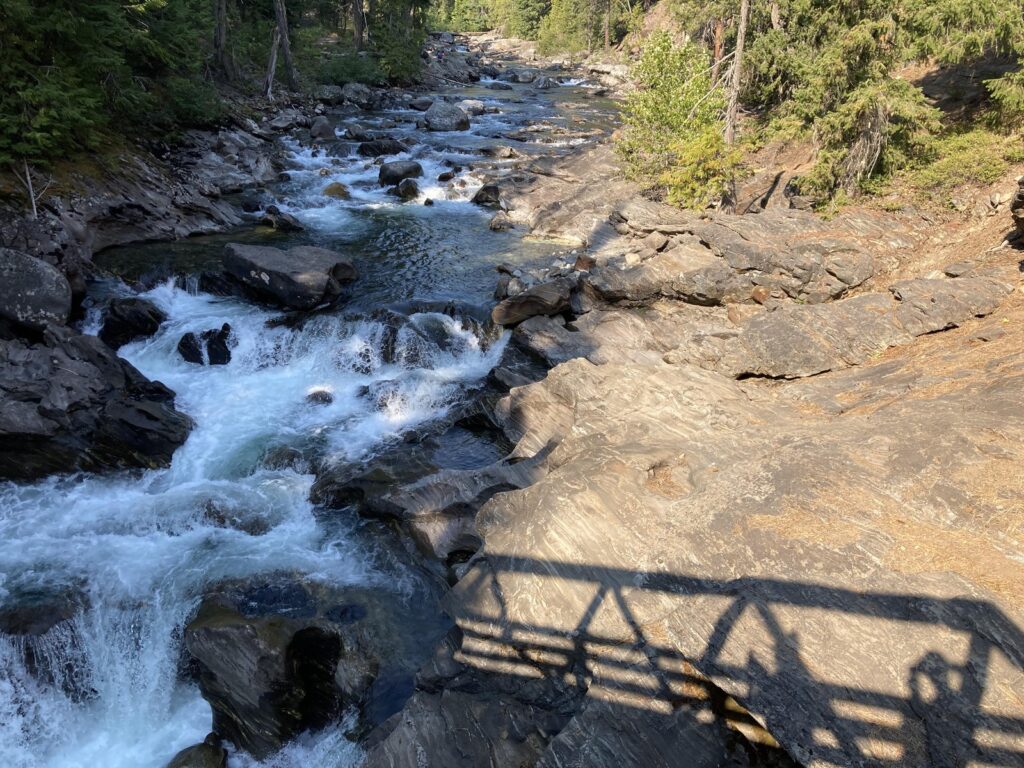
The gorge reach also holds the road’s swimming, and it is important to be exact about what that means. No agency page for this valley designates a swimming area, a beach, or a swim site anywhere on it. What exists is a pattern every hiker and camper in the record describes. Deep pools lie below the gorge bridges and below the Chatter Creek bridge, where a cascade feeds a deep pool with a sandbar. The water in them is cold, in every account. Campers swim in this creek, in its pools, as a matter of course. They do it as creek access, at their own judgment, in water that lives up to the creek’s name.
Two harder trails share the campground reach. The Chatter Creek Trail climbs steeply from its trailhead at Chatter Creek Campground toward Grindstone Mountain and the Icicle Ridge country, thick underbrush and real elevation, a different undertaking from the gorge loop in every way. The Fourth of July Creek Trail, lower on the road at about mile 5 to 6, climbs just as steeply to ridge line views over the valley and the Stuart Range. Both are covered by the Washington Trails Association’s hike pages, which are the right planning source for either.
Backpacking and the Enchantments trailheads
This road is the front door of the Enchantments, the permit area in the Alpine Lakes Wilderness above the canyon. Three trailheads serve it, two of them at the top of the Forest Road 7601 spur and one on the main road. Two of the three, Stuart Lake and Snow Lakes, bracket the through route across the permit area; the third serves the Eightmile and Caroline Zone from the same spur. Everything in this section is about reaching and using those trailheads. The permit area itself begins where the trails climb out of the canyon.
The Stuart Lake Trailhead stands at the end of Forest Road 7601, about 4 miles up the spur from its turnoff at the Bridge Creek reach, at about 3,400 feet. It serves the Stuart Lake Trail and the Colchuck Lake Trail, which between them reach the Stuart Zone, the Colchuck Zone, and the Core over Aasgard Pass. The spur is the drive every Enchantments trip starts with. It is rough and potholed, rough enough that the accounts of this road warn low cars off it. The Forest Service calls the neighbouring Eightmile spur steep and washboarded and recommends high clearance, and the accounts of this road agree in stronger language.
Parking at the Stuart Lake Trailhead works like this. A Northwest Forest Pass or an interagency pass must be on display, and day passes are sold at the trailhead. Overnight parking rides on the permit itself. The permit includes an Overnight Visitor Parking Pass, two included, valid only for the permit’s dates and displayed on the dashboard. The Forest Service designates separate day use and overnight parking areas. If the lot fills, road parking is allowed on one side of the road only, as posted. Parking is prohibited along the left hand side of Forest Road 7601. Violators are ticketed and towed. The trailhead is heavily trafficked with limited parking, in the Forest Service’s own words, and a shuttle operator on this road reports almost 200 vehicles here on peak weekends. Arrive early, carpool, or arrange a drop off.
The Snow Lakes Trailhead stands on the main road at mile 4.3, on the paved reach, at about 1,400 feet. Its parking rule is the same system in a smaller lot. A Northwest Forest Pass, an interagency pass, or the permit’s Overnight Visitor Parking Pass must be on display, for vehicles in the lot or on the road, and day passes are sold at the trailhead. Its Forest Service page asks visitors to leave the designated overnight parking for permit holders, and it warns directly that parking is limited and visitors may have to park miles away from the trailhead. It has the smallest lot of the three trailheads, so it is the one to reach first in the morning.
The Eightmile Trailhead stands on Forest Road 7601 below the Stuart Lake Trailhead, at 3,300 feet, serving Eightmile Lake and Lake Caroline in the Eightmile and Caroline Zone. Day hikers use it too, for Eightmile Lake, one of the road’s classic lake hikes, under the same day use permit form as the overnight trailheads. Its road is the same steep, washboarded spur, which the Forest Service says becomes rougher as the season progresses, with high clearance recommended. Its page calls it a heavily trafficked trailhead with limited parking, and a forest order prohibits parking in its marked areas. The same pass and permit rules apply on its road. Forest Road 7601 is closed to vehicles every winter, for all three of the spur’s destinations.
The permit system, at the depth a driver needs, works as follows. From May 15 through October 31, every user of the permit area needs a permit, day and overnight alike. Day users fill out a free, self-issued day use permit at any of the three trailheads and display a Northwest Forest Pass. Overnight users must hold an Enchantments permit for one of five zones, the Core, Colchuck Lake, Stuart Lake, Snow Lakes, and Eightmile and Caroline, each with its own daily quota. The Core allows 24 people a day. The other zones run by groups, 3 groups a day at Colchuck and at Eightmile and Caroline, 4 at Stuart, and 5 at Snow Lakes.
Most overnight permits go through the advanced lottery. Applications run February 15 through March 1, results come March 17, and winners must confirm and pay by March 31. Unclaimed awards return to the system on April 1, at about 7 a.m. Pacific. The application fee is $6, nonrefundable, and the permit itself costs $5 per person per day. Applying early in the window confers no advantage, because applications are drawn in random order.
The daily lottery holds back one permit per zone per day and runs seven days a week, entered on a mobile device the day before the trip, inside a geofence around the Leavenworth Ranger Station, the ranger district office in Leavenworth named in this guide’s fire and emergencies section. One permit per person per season is the limit, and an applicant cannot also ride as an alternate on another application. Groups are capped at 8 people, and a trip is capped at 14 days. A permit is not a screen shot. Permits are printed and signed, carried with photo ID, and a permit on a phone is not valid. The print window opens 14 days before the trip. Stock is prohibited on the Snow Lakes and Colchuck Lake trails, and is allowed on the Stuart Lake Trail only from the first Saturday after Labor Day to the end of the year.
For the 2024 season, the Forest Service’s published results record 42,765 applications and 2,741 permits awarded, a success rate of about 6.4 percent. The Core drew hardest, at about 2.2 percent of the applications that asked for it.
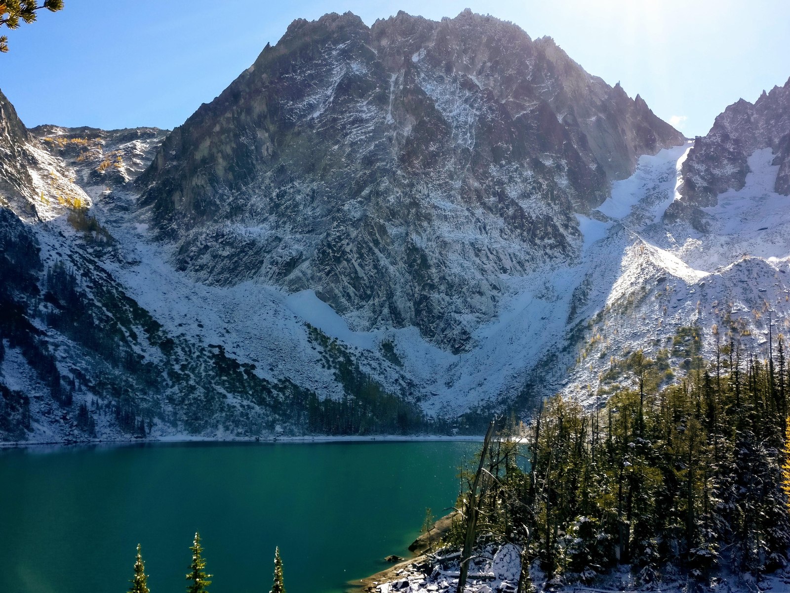
Day hikers are the other half of the traffic at these trailheads, and the day use side runs simpler. A day trip to Stuart Lake or Colchuck Lake needs the free self-issued permit from the trailhead kiosk and the pass on the dashboard, and nothing else. Colchuck Lake is the day hike most of them are making, the blue lake under the wall that the through route climbs on its way over the pass.
We know the Stuart Lake and Snow Lakes trailheads as a route, because together they make the through hike of the permit area. Twice, in 2014 and again in 2021 or earlier, we have day hiked the whole traverse. The route runs in at the Stuart Lake Trailhead, up past Colchuck Lake and over Aasgard Pass, through the Core, and out at the Snow Lakes Trailhead the same day. A separate day hike took us to Colchuck Lake on its own, in a year we remember as maybe 2019. Our backpacking trip in the permit area was in August 2015. That record is why this guide treats the parking, the passes, and the lottery calendar as the facts that matter here. They are the facts a trip on this road turns on.
A through hike is also a two trailhead problem, and it is worth solving on paper before the day. The route starts at one lot and ends at another, miles apart on the same spur and road. A party solves it with two vehicles, one spotted at the Snow Lakes Trailhead in the morning, or with a shuttle or a drop off arranged in Leavenworth. The day use permit is filled in at the starting trailhead, and the parking rules at each end are the ones this section has already laid out. Nobody walks the road between the lots at the end of that day by choice.
The night before a through hike raises the same question from the other side. A campsite on this road would be the ideal base camp, minutes from the start and no morning drive. Ours has never worked out that way. With nearly every site on the road first come and the valley this busy, we have realistically ended up in an Airbnb in Leavenworth, or driving back to Seattle at the end of the day.
Two rules shape any overnight trip and belong with the permits. No dogs are allowed anywhere in the permit area. Campfires are prohibited above 5,000 feet and within half a mile of any lake, which is most of the permit area. Outside the permit season, from November into May, permits are not required and visitors self-register at the trailhead.
The Icicle Creek Trailhead stands at the very end of the road, at about mile 19 to 20 and 2,800 feet, serving Icicle Creek Trail 1551 into the Alpine Lakes Wilderness west of the permit area. The trailhead also serves the French Creek Trail, 1595, and trails 1564 and 1592. It is a different system from the Enchantments trailheads in the one way that matters most to some parties. It stands outside the permit area, and dogs are allowed on its trails. Its own page calls it heavily used. Its pass and lot details are thinner on its page than the Enchantments trailheads’ are on theirs. Check the trailhead’s current fee and parking rules with the ranger district or the forest’s site list before a trip that depends on them.
Its vehicle access is cut by the same storm closure described in the seasons section. The trailhead stands beyond the closure’s start point on any reading of the order, inside the closed reach while the order stands. That status is dated, and it belongs to the forest’s alerts page.
The Enchantments permit area itself, its five zones, its lakes, and the routes between them, has its own coverage in this series.
Seasons and winter on Icicle Creek Road
The campgrounds with printed seasons, Eightmile, Bridge Creek, and Chatter Creek, run May to October, Eightmile generally so, and that is the road’s season shape. Spring comes late to the upper road and autumn early, and the campgrounds at 2,700 and 2,800 feet feel both ends of it. Several of the road’s Forest Service campground pages carried a closed banner when this guide was checked in November 2026, which is the ordinary off season state, not news about any one campground.
The road’s two surfaces set the year’s rhythm as much as the calendar does. Pavement runs from Leavenworth to about mile 13. Above that the road is gravel, narrower, and rougher, and it crosses the creek at about mile 15 on the way to Rock Island and Blackpine. In a normal year that upper road is a summer road, slow going in any vehicle.
Storm years break that rhythm, and this is one. The December 2025 flooding damaged the upper end of this road. A storm closure order now closes the upper end of Forest Road 7600, from a point partway up it to the end of the road. The order stands in force through December 31, 2027, unless the forest rescinds it sooner. Orders like it can close the upper end of this road for whole seasons at a time, and they change by rescission, not by the calendar. The standing instruction is the durable one. Before any trip that depends on the upper road, check the forest’s alerts page for the current orders, and let that page, not this guide, say what is open.
Winter closes the road in a different way. Plowing ends on the lower road at about mile 8 to 9, around the Eightmile Road junction and Bridge Creek Campground, and the exact point moves with the year and the storms. Beyond the plow point the unplowed road becomes a winter route for skiers, snowshoers, and snowmobiles.
Trip reports from flood winters describe the road closed at one point after another by snow and slide damage, which is the winter traveller’s version of the same standing instruction. Check the current state before going. Forest Road 7601, the spur to the Eightmile and Stuart Lake trailheads, is closed to vehicles every winter to protect its roadbed. This guide’s winter account is a researched one. We have no winter use of this road to report, and the winter traveller’s sources are the forest’s winter recreation pages and the local reporting the ranger district points to.
Fire restrictions and emergencies
Fire rules on this road come in layers, and the strictest layer in force governs. Check them in this order. First, the Forest Service’s alerts and orders for the Okanogan-Wenatchee National Forest, which set the rules on the federal campgrounds themselves. In summer the forest can restrict or ban campfires across its land, and those restrictions lift and return with conditions. Second, Chelan County’s own framework, in county code chapter 7.52, which governs the private land at the road’s foot.
County restrictions begin each year on June 1 in the Valley Zone and expand on July 1 to the Mountain Zone, where these campgrounds sit. Residential campfires are prohibited from July 1 under the county framework, coal briquettes are prohibited from July 1 as well, propane is always allowed, and all county restrictions lift on October 1 unless the county commissioners extend them. The county fire district that covers this valley posts the current restriction stage and points to the state’s burn ban map.
What that means at a campsite is simple to state and worth stating exactly. In a federal campground, a campfire belongs in the ring or grate provided, and whether fires are allowed at all on a given weekend is a question the forest’s current alerts answer, not this guide. Fireworks are banned year round in unincorporated Chelan County outside a New Year’s Eve window. Buy firewood where you burn it. Host sites on this road sell it at $10 a bundle where their entries name it. Inside the Enchantments permit area the fire rule is stricter and permanent. Campfires are prohibited there above 5,000 feet and within half a mile of any lake, in every season, and the backpacking section carries that rule in its place.
For emergencies, the hospital town is Leavenworth. Cascade Medical, at 817 Commercial Street in Leavenworth, runs an emergency department and an ambulance service for the town and the surrounding country, and it is the nearest hospital to every campground in this guide. County 911 dispatch is RiverCom, the dispatch centre for Chelan and Douglas counties.
Chelan County Emergency Management runs the county’s alert system, Everbridge, which sends text, email, and voicemail alerts to registered users with a Chelan County address, and the county’s emergency incidents map carries evacuation status. Call 911 first. Cell service is reported little to none at the upper campgrounds, so a party that wants a reliable way to call out carries a satellite communicator. The campground pages themselves print no emergency information, which is why this section carries the valley’s emergency facts in one place. For everything short of an emergency, the Wenatchee River Ranger District in Leavenworth, at 600 Sherbourne Street, (509) 548-2550, is this road’s office.
Camping with an RV on Icicle Creek
An RV works on this road inside firm limits, and the limits are worth reading before the drive rather than at the turnoff. No federal campground on the road has hookups of any kind. The size caps run by campground. Bridge Creek takes trailers to 19 feet at most, the tightest cap on the road. Ida Creek takes trailers to 30 feet. Eightmile allows vehicles to 50 feet, and Johnny Creek’s Forest Service page sets its trailer maximum at 50 feet. Rock Island’s pages print no trailer limit, and a driver of a long rig should treat that silence as a reason to ask the ranger district, not as permission.
The first come system also runs smaller for long rigs than the headline numbers suggest. At Eightmile, campers arriving for the first come share on a summer Saturday describe finding very few open sites that fit a truck and trailer, which is why this guide keeps pointing long rigs at the reservable share. Above mile 13 the gravel road, the creek crossing at about mile 15, and the single lane stretches set a practical ceiling of their own, whatever a campground’s printed cap says.
There is no dump station at any federal campground on the road. A camper who needs one uses the private parks in Leavenworth, whose directory listings carry a dump station at Alpine View RV Park, or a hookup site at the KOA or at Icicle River RV Resort on the lower road. Water fills run the same way. The federal campgrounds’ hand pumps and spigots are for jugs and buckets, and their notices ask campers not to attach RV hoses to them. Fill the tank before you come, in the campgrounds’ own words.
Dispersed camping on Icicle Creek
Dispersed camping along this road is mostly closed, by orders that have stood for decades, and a camper who assumes the usual national forest rule will be wrong here. A forest order from 1995 prohibits camping within 150 feet of the centre lines of Icicle Road, Eightmile Road, Icicle Creek, Eightmile Creek, Stuart Creek, and Mountaineer Creek. The same order prohibits camping at the Stuart Lake Trailhead parking lot. A second standing order prohibits camping in the drainage between Icicle Creek and Icicle Road anywhere outside a developed campground, from the Snow Lakes Trailhead west to Rock Island Campground. A third restricts camping at the forest’s administrative sites around Leavenworth.
Together those orders close the exact layer of camping this valley would otherwise invite, the pullout beside the creek and the flat spot under the trees along the road. What dispersed camping remains lawful above Rock Island and in the side drainages is a question this guide does not inventory. The sources opened for it do not settle the remainder, and guessing at it would put campers on the wrong side of an order. The Wenatchee River Ranger District in Leavenworth is the authority for what remains open, and its answer is the one to camp on.
Frequently asked questions
Can you reserve a campsite on Icicle Creek?
At one campground, in part. About 60 percent of Eightmile Campground’s sites take reservations on Recreation.gov, made at least 3 days ahead and up to six months out. The four group sites, at Eightmile, Bridge Creek, Chatter Creek, and the Icicle Group Campground, also book ahead, up to twelve months out. Every other site on the road is first come, claimed by arriving in person.
Which campgrounds on Icicle Creek have drinking water?
Five of the eight do. Eightmile has hand pumps, and Johnny Creek, Chatter Creek, and Rock Island carry drinking water, and Blackpine carries water. Bridge Creek, Ida Creek, and Icicle Group have none, and campers there bring their water in. None of the eight has showers.
Is Tumwater Campground open?
No. Tumwater Campground, on US-2 in Tumwater Canyon, has been closed since 2014 and takes no campers. A separate Tumwater Group Site stands on Recreation.gov, and the Wenatchee River Ranger District can confirm whether it is taking reservations.
Do you need a permit to use the Enchantments trailheads?
From May 15 through October 31, yes, at two levels. Day users fill out a free, self-issued day use permit at the trailhead and display a Northwest Forest Pass. Overnight trips need an Enchantments permit for a named zone and dates, won in the February lottery, held back for the daily lottery, or picked up from unclaimed awards released on April 1. Outside that season, no permit is required and visitors self-register.
Can you camp beside the road or the creek for free?
Almost nowhere on this road. Forest orders prohibit camping within 150 feet of the road and the creek centre lines, and prohibit camping between the creek and the road outside a developed campground from the Snow Lakes Trailhead to Rock Island. What remains lawful above Rock Island and in side drainages is a question for the Wenatchee River Ranger District.
Can you swim in Icicle Creek?
People do, in the creek’s deep pools, and no agency designates a swim site anywhere on this road. The best documented pools are on the Icicle Gorge reach, below the gorge bridges and below the Chatter Creek bridge. The water is cold, in every account this guide’s research read. Swim as creek access, at your own judgment, and never as a campground amenity, because it is not one.
Is there cell service on Icicle Creek Road?
Plan for little to none. No agency page publishes coverage for this road, and campers report no service at the upper campgrounds. Download the Recreation.gov app, which the first come payment system runs through, and any maps you need, before leaving Leavenworth.
How far up the road are the campgrounds?
Leavenworth sits at the road’s foot, and the campgrounds run from about mile 8 to about mile 18 of a road that ends near mile 20. The upper campgrounds, Chatter Creek, Rock Island, and Blackpine, stand on a road that turns to gravel at about mile 13 and slows down from there. Budget the drive by the road’s surface, not by the mileage.
Can you camp on Icicle Creek in winter?
Not in the federal campgrounds, whose printed seasons end in October and which showed closed for the winter when this guide was checked. Plowing ends on the lower road at about mile 8 to 9, and the road above that becomes a ski, snowshoe, and snowmobile route. The two private parks in Leavenworth, the KOA and Alpine View, are open all year, and they are the winter camping answer for this valley.
Is there a dump station on Icicle Creek Road?
Not at any federal campground on the road. No Forest Service page for any of the eight campgrounds lists one. The one dump station named anywhere near this valley in this guide’s research is named at Alpine View RV Park in Leavenworth, on a directory listing rather than on the park’s own pages. Confirm it with the park before counting on it.
Are dogs allowed?
In the campgrounds, yes, leashed or restrained under the forest’s developed site rules. In the Enchantments permit area, no, not on any trail and not in any season. A dog hikes the gorge loop and the road’s other trails, and it waits out any trip into the permit area itself.
When does Icicle Creek Road close?
The road does not close on a fixed date. Its campgrounds with printed seasons run May to October, generally in Eightmile’s case, plowing ends on the lower road in winter at about mile 8 to 9, and the Forest Road 7601 spur to the Enchantments trailheads closes to vehicles every winter. Storm and fire orders can also close the upper road for whole seasons at a time. The forest’s alerts page carries the current orders, and it is the check to make before any trip up the road.
Sources
Checked November 2026. Wenatchee River Ranger District and Okanogan-Wenatchee National Forest campground pages for Eightmile, Bridge Creek, Icicle Group, Johnny Creek, Ida Creek, Chatter Creek, Rock Island, and Blackpine Horse Camp, fs.usda.gov. The same forest’s trailhead pages for the Stuart Lake, Snow Lakes, Eightmile, and Icicle Creek trailheads, fs.usda.gov. Their Recreation.gov facility listings for the same campgrounds and for the Eightmile, Bridge Creek, and Chatter Creek group sites and the Icicle Group Campground, and Recreation.gov’s Enchantment Permit Area lottery pages and Northwest Forest Pass pages, recreation.gov. The Forest Service’s published advanced lottery results for the 2024 season.
Forest orders for the Okanogan-Wenatchee National Forest, including the forest wide stay limit and food storage orders, the 1995 Icicle Road camping restriction order, and the district’s storm damaged roads closure order, fs.usda.gov. Chelan County Code 7.52 and the county’s fire prevention and emergency management pages, co.chelan.wa.us. Washington Trails Association hike pages and trip reports for the Icicle Gorge loop, Chatter Creek, and Fourth of July Creek trails, wta.org. Icicle River RV Resort, Leavenworth KOA, and Alpine View RV Park, the operators’ own pages and directory listings. Cascade Medical, Leavenworth, for the hospital district’s coverage of the Icicle Creek valley.