The Enchantments is a high basin of clear lakes, larch stands, and bare rock in the Alpine Lakes Wilderness, reached from three trailheads on one road out of Leavenworth. Its lakes step from about 4,400 feet to about 7,800, forest at the bottom and bare alpine rock at the top. Two facts organize any trip here. Camping overnight takes a permit, won in a lottery each February. Day hiking takes no permit at all.
We have made four trips into this basin. We backpacked here in August 2015, in from the Snow Lakes Trailhead and camped at Snow Lake, day hiking up into the Core from that camp and sleeping in a hammock under a tarp. Twice we have hiked the whole route in a single day, in at the Stuart Lake Trailhead, past Colchuck Lake, over Aasgard Pass, through the Core, and out at Snow Lakes Trailhead. Once more we day hiked to Colchuck Lake on its own. The permit and camping sections below come from the permit system’s own pages, checked in November 2026. The route sections come from those trips and the Washington Trails Association’s reporting.
This basin sits inside the wider Central Cascades country between Stevens Pass and Snoqualmie Pass. The campgrounds and trailhead parking on the road below it have their own guide, Icicle Creek camping, and this page picks up where the road ends and the trails begin.
In this guide
- The Enchantments at a glance
- Do you need a permit for the Enchantments
- The Enchantments lottery
- Choosing a zone
- Rules that shape an Enchantments trip
- Camping in the Enchantments
- If you do not win the lottery
- Colchuck Lake
- The Enchantments traverse
- Snow Lakes
- Stuart Lake
- Eightmile Lake and Lake Caroline
- Seasons and conditions
- Fire restrictions and emergencies
- Frequently asked questions
- Sources
The Enchantments at a glance
The permit area divides into five zones, and the zones divide the whole planning problem. One zone, the Core, holds the high lake basin most people picture. Each of the other four holds a destination lake or lake pair at the top of its trail: Colchuck Lake, Stuart Lake, the Snow Lakes, and Eightmile Lake with Lake Caroline. Each zone takes its own small number of new groups or people each day. The table runs in the permit system’s own order, the order Recreation.gov presents the zones in.
| Zone | Daily quota | Entry point | Success rate, 2024 lottery |
|---|---|---|---|
| Core Enchantment Zone | 24 people | Either trailhead | 2.22 percent |
| Colchuck Lake Zone | 3 groups | Stuart Lake Trailhead | 2.62 percent |
| Stuart Lake Zone | 4 groups | Stuart Lake Trailhead | 9.15 percent |
| Snow Lake Zone | 5 groups | Snow Lakes Trailhead | 7.27 percent |
| Eightmile/Caroline Zone | 3 groups | Eightmile Trailhead | 14.02 percent |
The success rates are the Forest Service’s published results for the 2024 season, the newest set the Forest Service has published. The quotas count two different things. The Core counts people, 24 a day in total. The other four zones count groups, so a group of two and a group of eight spend the same one slot. One permit in each zone is held back every day for the daily lottery, which for the Core means eight of its 24 people.
The season itself runs May 15 to October 31. Inside it, an overnight trip needs a permit for a named zone. A day trip needs no overnight permit on any route in this guide, and no day use quota exists.
Do you need a permit for the Enchantments
For camping overnight, yes. From May 15 through October 31, every overnight visitor to the Enchantment Permit Area must hold a permit for a named zone and specific dates. The name is the permit system’s own, and the permit is won in one of the two lotteries below or picked up from a cancellation. There is no legal way to hike in, camp first, and sort the paperwork later. Rangers check permits and photo ID on the trails.
For going there for the day, no overnight permit is needed at all. A day user fills out a free, self-issued day use permit at any of the three trailheads and displays a parking pass, and that is the whole requirement. Day use is allowed across all five zones on that day permit, so a day hiker can legally hike from a trailhead to the far side of the Core and back out in a long day. No source for this guide lists any limit on how many day users may enter.
The three trailheads are the area’s only doors, and each door serves named zones. Stuart Lake Trailhead serves the Colchuck and Stuart zones and the Core from the west. Snow Lakes Trailhead serves the Snow zone and the Core from below. Eightmile Trailhead serves the Eightmile/Caroline zone alone. Each zone is entered from its own trailhead, and the Core alone can be entered from either of two, which is why the route entries below are organized by the trailhead a party actually parks at.
The parking pass is its own piece of the system, and it works two ways. An overnight permit includes two Overnight Visitor Parking Passes, valid only for the dates on the permit and displayed on the dashboard. A day user displays a Northwest Forest Pass instead, which can be bought at the trailhead, online, or at the Wenatchee River Ranger District station in Leavenworth. The detailed parking picture at each lot lives in the Icicle Creek camping guide, which carries the full parking record at each trailhead, including the Stuart Lake lot a Core entry uses.
What an overnight permit buys is narrow and specific. It buys the right to sleep in one named zone, camping only in previously impacted sites, for up to 14 days, with a group of up to eight. It does not reserve a campsite, guarantee a parking space beyond the pass on the dashboard, or excuse anyone from the area’s rules, which the rules section below collects.
A permit is also specific in ways that surprise first time winners. It is valid only for its exact dates and its named zone, and it is not valid if the trip starts on any other date. The whole group begins together on the start date and camps together each night. Nobody may leave and re-enter on a different date under the same permit. A party planning to split, meet late, or sleep apart from the group is planning a different trip from the one the permit describes, day use across zones being the only wandering the system allows.
Outside the season, the permit system stands down. From November 1 to May 14 no permit is required for day or overnight use, and visitors self-register at the trailhead instead. Winter and early spring trips here are mountaineering undertakings rather than hikes, and the seasons section takes up what that means.
The Enchantments lottery
Overnight permits are distributed by lottery because demand overwhelms the quotas by an order of magnitude. Most permits go in the advanced lottery each February. The rest move through a daily lottery during the season, an April release of unclaimed awards, and cancellations that return to the system through the season. This section takes the advanced lottery first, then the daily one.
The two lotteries serve two different kinds of planner. The advanced lottery is for a trip designed in winter, with dates, a zone, and a group settled months ahead. The daily lottery is for a trip seized in season, by a party already near Leavenworth with a free tomorrow. A party that loses in February still has the daily lottery waiting in season, and a party that wins plans around its dates. The fees are the same either way.
The lottery calendar
The calendar runs on the same dates every year, and the Forest Service confirms the window as the annual pattern. Applications open February 15 and close March 1. Results are announced March 17. Winners must accept, confirm, and pay by March 31 at 11:59 p.m. Pacific.
Awards nobody claims return to the reservation system on April 1, at about 7 a.m. Pacific, open to anyone.
Those dates are given here as the annual pattern. The coming season’s own calendar posts on Recreation.gov’s Enchantment Permit Area Advanced Lottery page, and the dates for a specific year are final only when they appear there. Check that page before building a February around the pattern, because a pattern is a habit, not a promise about a year that has not posted yet.
The window rewards preparation rather than speed. Applying on February 15 buys nothing over applying on February 28, because the system evaluates applications in random order. What the two weeks are for is deciding the application itself, the zones, dates, and group sizes in the sections below, since an application cannot be reshaped after the draw.
Winning is a two step process, and the second step loses permits every year. After March 17, a successful applicant must return to Recreation.gov, accept the award, give an exit date, and pay the permit fees by the March 31 deadline. An award nobody completes that step for is not saved, argued over, or extended. It goes back into the system on April 1 with the rest of the unclaimed pool.
Your odds by zone
The Forest Service publishes its lottery results, and its numbers are the honest answer to the question every applicant asks. For the 2024 season, the newest set published, 42,765 applications entered the advanced lottery and 2,741 permits were awarded, about 6.4 percent overall. The average hides the spread. Where an application points matters more than anything else on it.
| Zone, 2024 season | Permits awarded | Success rate |
|---|---|---|
| Core Enchantment Zone | 790 | 2.22 percent |
| Colchuck Lake Zone | 380 | 2.62 percent |
| Stuart Lake Zone | 529 | 9.15 percent |
| Snow Lake Zone | 689 | 7.27 percent |
| Eightmile/Caroline Zone | 353 | 14.02 percent |
The success rate is the share of applications carrying an entry for that zone which won that zone. Read it as the price of ambition. An application pointed at the Core alone faced roughly one chance in forty-five. An application pointed at Eightmile/Caroline faced roughly one in seven. The zone section below works through what each choice buys on the ground.
Demand has climbed for a decade to reach these odds. The Forest Service’s historical series counts 2,330 applications in 2012, 12,034 in 2015, 24,614 in 2019, and 39,695 in 2021, before the 42,765 of 2024. The quotas did not grow with the applications. Nothing in the published series suggests the draw is getting easier.
Finer patterns sit inside the published data, and they are worth knowing for what they are. Analysis of the Forest Service’s own results, published by independent analysts rather than the Forest Service itself, finds Sunday and Monday start dates faring best, then Tuesday and Wednesday, and May and October faring best among months, then June and September. That is analysis of the official data, not the Forest Service’s own statement.
One quirk of the counting explains why the Core can award the most permits and still be the worst bet. Its 790 awards went to groups of every size, because its quota counts individual people, up to 24 a day. The group zones awarded fewer permits because each award spends a whole day slot on one party, whether that party is two people or eight. An applicant choosing between zones is choosing between those two kinds of scarcity.
Fees, refunds, and the rules of the draw
Entering costs $6 per application, nonrefundable whether the application wins or loses. A won permit costs $5 per person per day, paid at confirmation. A four person group on a three day trip pays $60 in permit fees on top of the $6. Cancel up to 22 days before the trip and the permit fee comes back, though the $6 never does. Cancel inside 21 days, or get weathered out, and there is no refund.
The Forest Service states that the recreation fee finances the on the ground administration and management of the permit area. Neither fee buys a parking space, a campsite, or a rescue.
Each application carries up to three entries, each a zone, a start date, and a group size, and the draw can award at most one permit per application. One permit per person per season is the hard rule around everything.
A person who applies cannot also serve as an alternate on someone else’s application in the same season. An alternate group leader must hold a Recreation.gov account, must accept within 72 hours, and cannot be added or changed after the award. Permits are not transferable, ever. The permit holder must be 18 or older.
The three entries are where an application’s strategy lives. A worked example makes the shape concrete. A party might enter the Core for a Friday in August at its true group size, then Colchuck for the same weekend as its second entry, then Eightmile/Caroline for a September weekend as its third.
The draw tests the entries in random application order against the quotas, and the at most one permit can come back to an application. Entries pointed at three different levels of scarcity are the standard form, because three entries pointed at the Core face the Core’s odds three times over.
Group size deserves care on a Core application. The Core quota counts people, and a Core group cannot grow after the award, so the size on the application is the size of the trip. The other four zones count groups, and their permits can add members later, up to eight, inside the change window the rules section below sets out. In every zone, all group members must start on the permit’s date and camp together with the permit holder each night.
The daily lottery
One permit in each zone is held back from the advanced draw for a daily lottery that runs through the season. For the Core, that daily share is eight people. The daily lottery runs seven days a week on Recreation.gov’s current text. Older guides describe a weekday only lottery, and that form is superseded, but the daily lottery page on Recreation.gov is the check before any trip built on it.
To enter, a hiker applies on a mobile device the day before the start date, from inside a geofence area around Leavenworth. The guides and the ranger district’s materials agree that the geofence is a one mile radius around the Leavenworth Ranger Station and that applications run from 7 to 10 a.m. Pacific. The daily page itself is the authority, and it takes a minute to check from the same phone the application goes in on.
Entering means being there. The application goes in on a mobile device, on the daily lottery’s own page, by a person physically inside the geofence the day before the hike. That makes the daily lottery a tool for parties already in the Leavenworth area with a flexible next day, not a remote second chance for the whole applicant pool. The one permit per person per season rule applies here too, so a daily win spends the season’s one permit just as an advanced win does.
The daily lottery is stricter than the advanced one in two ways. It allows no alternate group leaders, so the person who wins is the person who goes. And its permits may be shown on a phone, the one place in this permit system where a phone display counts, where an advanced permit must be printed and signed. Daily lottery cancellations are not refunded.
A daily win comes with one practical wrinkle Recreation.gov answers directly. The permit can live on the phone, but the car still needs its parking pass on the dashboard. A winner who cannot print the pass writes the permit number down and posts that in the vehicle instead. Small details of that kind are what the daily page exists for, and it repays the minute it takes to read on the morning of an application.
After the lottery
Losing in March is not the end of the season. On April 1, at about 7 a.m. Pacific, every award nobody confirmed returns to the reservation system, first come, and they go first come to whoever is ready. Through the season after that, cancellations return to the same page as they happen, and a patient checker with flexible dates picks up real permits this way.
The cancellation pool rewards a specific kind of readiness. Permits surface one at a time, at odd hours, for whatever dates the cancelling party held, and they go to whoever is looking. A checker who knows their party’s size, their zone order, and their date range in advance can take one before it goes. A checker still deciding what they want watches it go. The lottery section’s work, done in February, is what makes a July cancellation usable.
The strategy the published data supports is unglamorous. Choose zones with the odds in view rather than by the photograph. Choose the dates the analysis favors, Sundays and Mondays and the shoulder months, where the calendar allows. Keep a Core group small, since its quota counts heads.
And consider the compromise several guides name, holding a permit for a lake zone and day hiking into the Core from camp, which sleeps legally and still stands in the high basin. There is no further trick. The draw is random, and the applicants who treat it that way plan the best backup trips.
Choosing a zone
A permit is held for one zone, and the group camps in that zone every night. Two facts soften the choice. A Core permit holder may camp in any of the five zones, and day use crosses all zones freely, so any permit holder can hike anywhere the trails go. What the zone really decides is where the tent stands at night, and how hard the permit was to win.
Core Enchantment Zone
The Core is the prize and the hardest draw in the system, 24 people a day and a 2.22 percent success rate in 2024. It holds the high basin itself, the chain of lakes above Aasgard Pass and below the Snow Lakes descent, at elevations where the Forest Service recommends the trip for experienced hikers prepared for arduous travel. Visitors typically plan at least three or four days for it. A Core application should name the smallest group that will actually go, because the size cannot grow after the award.
Its 24 daily places split between the two lotteries, 16 through the advanced draw and 8 through the daily one. A Core holder may also camp in any other zone, the only permit in the system with that freedom. The freedom runs one way. No other zone’s permit may camp in the Core.
Colchuck Lake Zone
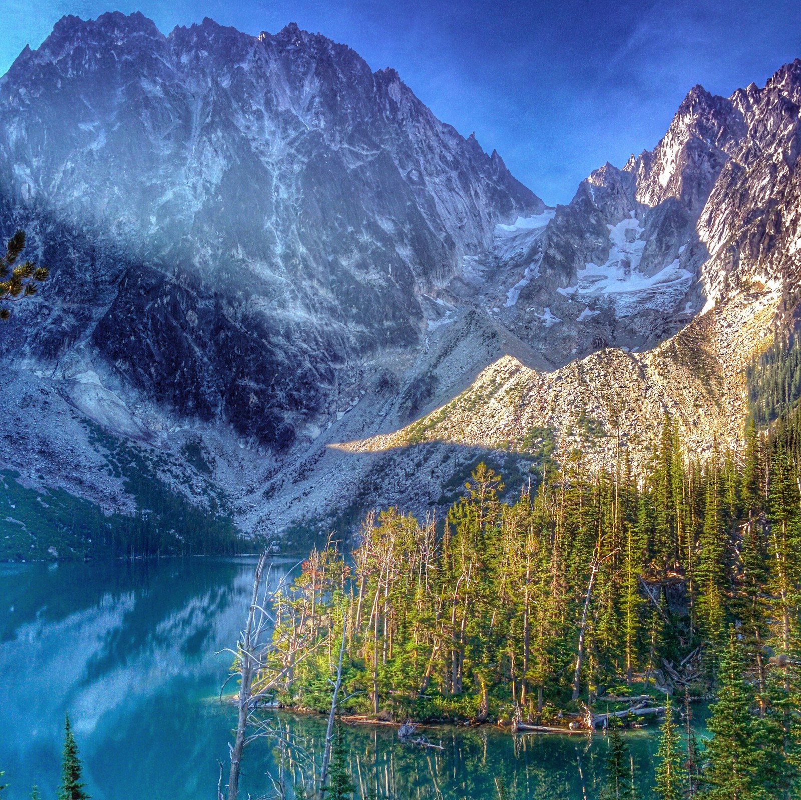
Colchuck takes three groups a day, and its 2.62 percent success rate is nearly as hard as the Core’s. What it buys is a camp at the basin’s Colchuck Lake itself, with Aasgard Pass climbing from the lake’s far shore, so a Colchuck group can day hike into the Core with light packs and return to the same camp. It is the permit for a party that wants the high basin by day and one fixed camp by night.
Stuart Lake Zone
Stuart takes four groups a day and returned 9.15 percent in 2024, the second best odds in the system. The lake sits at the end of the quieter of the two trails from the Stuart Lake Trailhead, and trip reports describe a peaceful, lightly trafficked shore against the Colchuck side’s crowds. It is the zone for a party content to be beside the basin rather than in it.
Snow Lake Zone
Snow takes five groups a day, the largest group quota, and returned 7.27 percent in 2024. Its camps stand at the top of the traverse’s long exit trail, and a Snow permit is the natural base for hiking up into the lower Core by day. It is also the zone whose permit holders have the traverse’s descent already hiked on the way in, which settles the route’s hardest question early.
Eightmile/Caroline Zone
Eightmile/Caroline takes three groups a day and returned 14.02 percent in 2024, the best published odds on this page by a wide margin. Its two lakes sit lower and gentler than the rest of the permit area, on the Eightmile Trailhead side of the basin. It is also the one zone the traverse never touches. The lakes drain down Eightmile Creek in their own valley west of the Core, and no trail joins them to the Colchuck and Snow Lakes line. The paired route entry below treats both lakes in full. For an applicant whose goal is a legal night in the permit area with a real chance of getting one, this is the zone the data points to.
The choice, in the end, is between a photograph and a probability. The Core and Colchuck sell the famous shores at odds that lose about thirty-nine times in forty. Stuart and Snow sell real alpine lakes at odds a determined applicant can plan around.
Eightmile/Caroline sells the permit area itself, its quietest corner, at odds near one in seven, the best in the system. Every one of those is a defensible application. The published data simply asks that it be made with open eyes.
Rules that shape an Enchantments trip
The rules below are the permit system’s own, and rangers enforce them on the trail. A group may hold at most eight people, stock included, and a trip may run at most 14 days. No dogs are allowed anywhere in the permit area, on any trail, at any lake. There are no campfires above 5,000 feet or within half a mile of any lake, which in practice means no campfires anywhere this guide sends an overnight trip.
The permit itself travels with the group. An advanced lottery permit must be printed and signed and carried with photo ID, and an unsigned permit shown on a phone is not valid. The print window opens 14 days before the trip. All group members must begin on the reserved date and camp with the permit holder, and a group may not leave and re-enter on a later date under the same permit.
Changes run on a narrowing clock. Eight days or more before the entry date, a trip can add days and, outside the Core, add members up to eight, at $5 per person per day. The zone and the entry date never change. Inside seven days nothing changes, and once a permit is printed, changes can be made only at the Leavenworth Ranger Station in person.
Two route rules belong here because they shape itineraries. Stock is prohibited on the Snow Lake and Colchuck Lake trails, so horses reach this basin, if at all, by other routes. And camping happens only in previously impacted sites, never on vegetation, a rule the camping section takes up next.
The penalties behind the rules are stated on the permit itself. Breaking the permit terms or the wilderness regulations can bring citations for every member of the group, end the trip on the spot, and cost future permits. Two permits also cannot be combined to manufacture a group larger than eight. The system treats eight as a ceiling, not a building block.
Camping in the Enchantments
Overnight life here runs on impacted ground. Campers pitch only in previously impacted sites, on bare ground and rock where parties have camped before, and never on the basin’s vegetation. Sites are not numbered, reserved, or improved, and the rule against improving them is explicit, no moving rocks, no building walls, no disturbing soil. A party that arrives to find its hoped-for shore occupied walks on to the next impacted ground.
Trip length is the camper’s own choice inside the 14 day cap, and the Forest Service gives the Core its expected shape, at least three or four days for a trip that crosses the basin at a human pace. The lake zones invite shorter trips. The Forest Service sketches a few days at one lake with day hikes from camp, where a Core trip is planned at three or four days at least. The permit charges by the day, $5 per person, so length is a budget line as well as an itinerary one.
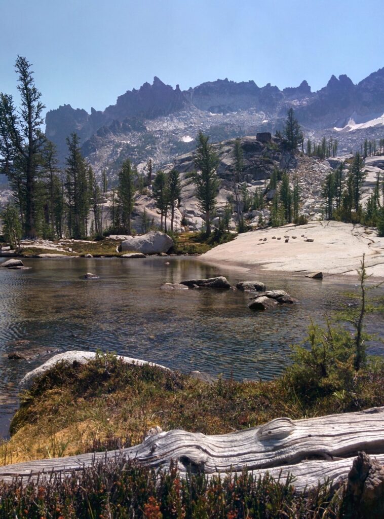
In the Core, campsites stand along the common route among the lakes, and seven toilets stand along that route, signed, which the rangers ask campers to note when choosing where to pitch. Water comes from the lakes and streams, at lake edges and at inlets and outlets in the Core, and it is treated before drinking as standard practice. At Colchuck, campsites stand near the lake with toilets in the camping area.
In the Snow Lake Zone, camps stand at Nada Lake on the way up and at the Snow Lakes themselves. At Lake Caroline, campsites stand at the lake. For Stuart Lake, no source describes the campsites beyond the impacted sites rule.
Where no toilet stands, the system’s rule is a cat hole six to eight inches deep, at least 200 feet from water sources and campsites, with toilet paper packed out. Urinating on vegetation or soil is prohibited; Recreation.gov directs hikers to bare rock, gravel, and boulder gaps instead.
Travel between sites follows the same ethic. The ranger reports ask hikers to stay on rock, gravel, and snow rather than vegetation, and in the Core, marker poles and stacked rocks trace the already impacted route from lake to lake. A party that finds itself wading through heather has left the route, and the reports’ advice is to backtrack to durable ground rather than push on. The basin tolerates thousands of visitors a year because most of them stay on stone.
The basin’s goats need more than a sentence, because there are a lot of them and they are a genuine hazard in a way that surprises people. Mountain goats live in the Core and around the high lakes, and on our trips they were a common sight around the lakes and near camp, habituated enough that trip reports describe them grazing among the tents at dawn. They look tame. They are not. They are after salt, the salt in urine and in sweat soaked gear, and years of easy pickings around camps and trails have made them bold.
Recreation.gov’s permit page is blunt about the rules, and they are rules, not advice. Do not approach the goats, feed them, pet them, or pose for a selfie with them. Urinate on bare rock, in boulder gaps, or in the toilets provided, never on vegetation or inside a campsite, because goats dig up the soil for the salt and gather where people have relieved themselves, and that habituation can turn aggressive. If a goat presses in and feels like a threat, the page’s instruction is to clap your hands or throw small rocks at it. Treat every goat in the basin as the wild animal it is.
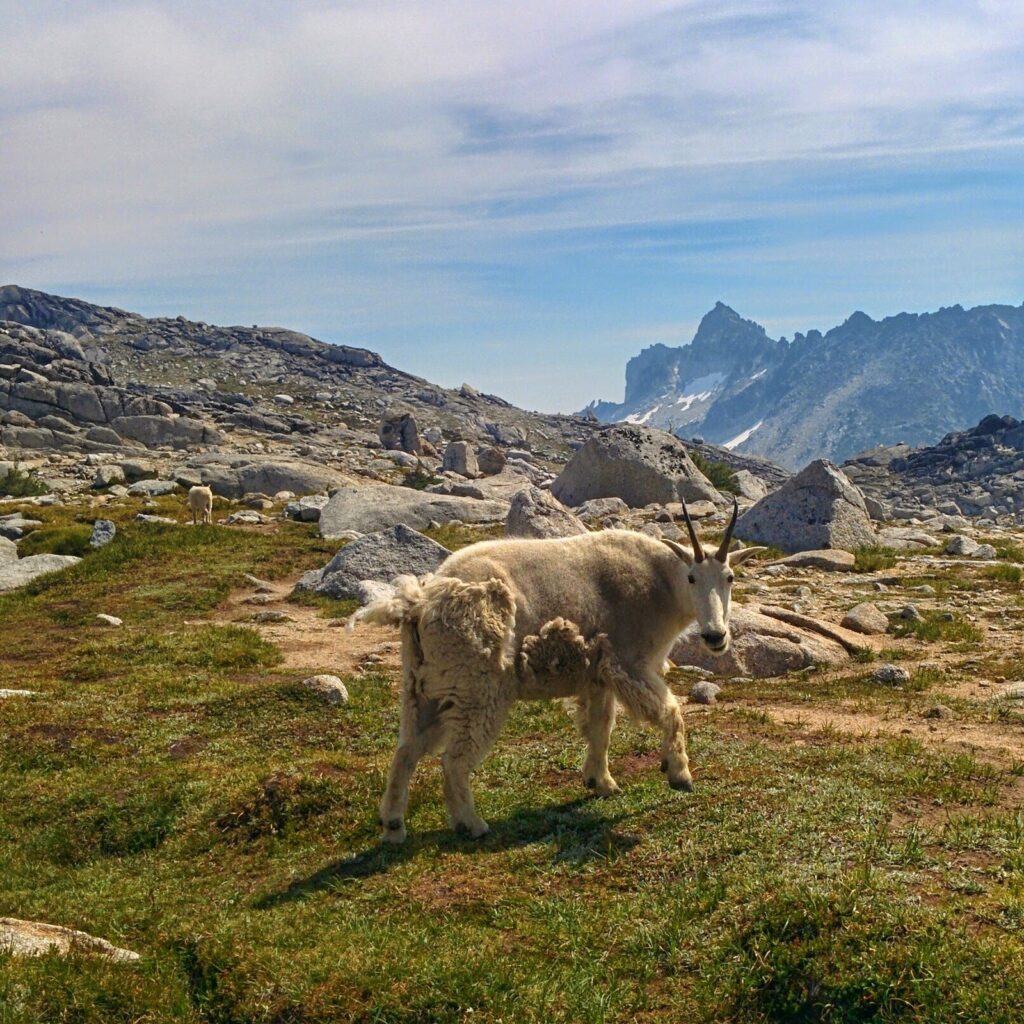
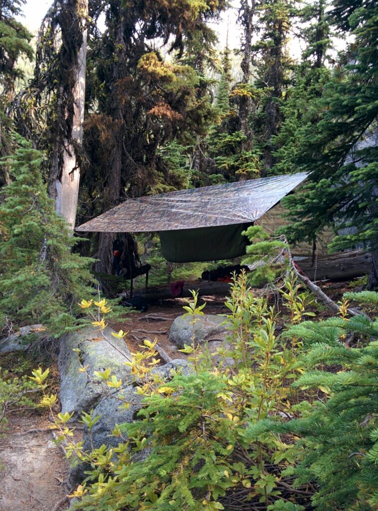
Our own overnight here was a hammock camp at Snow Lake in August 2015, strung under a tarp. It taught the same lesson the rules teach. Everything a party needs rides in on its back, everything rides out again, and the ground a party sleeps on should show no sign of the sleeping.
If you do not win the lottery
Most applications lose. In 2024, about nineteen of every twenty did, and multi-year losing stretches are the normal background in the firsthand accounts of this place. The community’s standard move after a loss is not to abandon the basin. It is to go for the day.
Everything in the second half of this guide stays open without an overnight permit. Colchuck Lake as a day hike is the single most searched trip in this country. The full traverse in a day is the standard way most people on the trail see the whole route. Stuart Lake and Eightmile Lake wait at the same trailheads, at day hike distance, with no draw attached to a day trip at all. A day in the basin still banks the part of the trip a permit cannot add to, because the focus and mood reset that time outside produces comes from hours on the trail, not from where the tent stands.
The April 1 release, the cancellations, and the daily lottery in the lottery section above all remain live chances at a legal night. Losing the draw decides where a party sleeps. It does not decide whether the party goes.
Colchuck Lake
Quick facts: Stuart Lake Trailhead, Northwest Forest Pass for day use or the overnight permit’s parking pass on permit dates; 8.0 miles roundtrip with 2,280 feet of gain; overnight in the Colchuck Lake Zone, 3 groups a day, day use on the free self-issued trailhead permit; permit season May 15 to October 31; water from the lake, treated; campsites near the lake with toilets in the camping area.
Colchuck Lake is the basin’s front door and its most wanted view, a deep blue lake at about 5,570 feet held under the walls of Dragontail and Colchuck peaks. The route starts on the Stuart Lake Trail and shares it for just over two miles, then breaks off at the junction, crosses Mountaineer Creek again, and climbs in earnest to the shore. The day hike to it is the standard form of the trip.
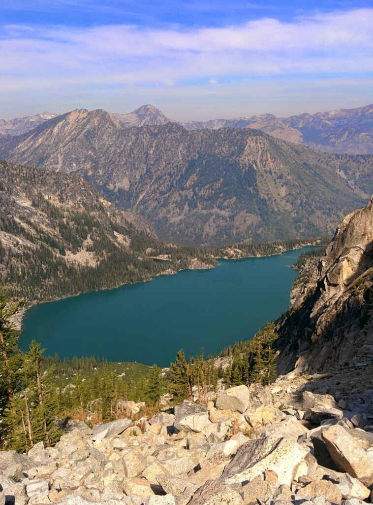
As a day hike, Colchuck asks for fitness and little else. There is no overnight permit to win, no quota on day users, and no decision beyond the weather and the party’s legs. The shore rewards the climb with the full granite amphitheater, and the lake’s far end gives the day its natural second act, the first clear look at Aasgard Pass rising to the Core.
The day’s rhythm is set early. The shared first miles climb the valley floor with the Stuart-bound minority, and at the junction the Colchuck Lake Trail breaks off to the left and begins to climb in earnest, over roots and rock that the ranger reports describe as heavily trafficked and eroded in places.
As an overnight, Colchuck is the base camp play. A group camped at the lake can leave the heavy gear at the shore and climb Aasgard with daypacks, spend the day in the high basin, and descend to the same camp. Firsthand accounts describe exactly this trip. It is the closest an overnight party gets to the Core without holding the Core’s own permit, at odds nearly as hard as the Core’s, 2.62 percent in 2024.
We have stood at this lake on three separate trips, twice passing through on the way up Aasgard and once on a day hike of its own, in a year we remember as maybe 2019. The through trips treat the lake as a threshold, the place where the trail stops climbing a forested valley and starts climbing a mountain. The day hike treats it as the destination, and on its own terms it is enough of one.
From the shore, the route to the pass walks the lake’s edge to its far end, where the climb begins. Day hikers bound for the lake only will watch the backpacking parties peel off there and start up the boulder field. The shoreline itself is the day’s resting place, granite slabs and cold water under two of the Stuart Range’s biggest walls, and it earns a slow hour even from parties in a hurry.
The pass above the lake gets its full treatment inside the traverse entry below, where it belongs. What belongs here is the warning in short form. Aasgard climbs about 1,900 to 2,200 feet in under a mile from the far shore, it holds snow well into summer, and Recreation.gov’s permit page records that hikers have died on it glissading into creeks and snowpack holes. A day hiker who goes up it has stopped day hiking to Colchuck and started the traverse, and should be equipped and timed for exactly that.
The Enchantments traverse
Quick facts: Stuart Lake Trailhead in and Snow Lakes Trailhead out, Northwest Forest Pass or the overnight permit’s parking pass at each end, with the shuttle pattern below joining the two lots; about 18 miles one way, with about 4,500 to 5,000 feet of gain and about 7,000 feet of loss in this direction; a day traverse needs no overnight permit, and an overnight traverse is a Core permit in practice; permit season May 15 to October 31 for overnight use; water from the lakes and streams along the route, treated.
The Enchantments traverse, also called the thru hike or through hike in the guides that plan it, walks the whole permit area in one line. In at the Stuart Lake Trailhead, up past Colchuck Lake, over Aasgard Pass, through the Core lake by lake, and down the long Snow Lakes trail to the car. Because overnight permits are so competitive, this route done in a single day is the standard way most people on the trail see the entire route.
It is a point to point hike between two trailheads on the same road system, which is why its logistics get a section of their own below. Every other entry in this guide starts and ends at the same lot. This one starts at the basin’s west door and ends at its lower door, and everything about planning it, the shuttle, the start time, the bailout points, follows from that single fact.
The distance is about 18 miles, and the elevation is where honesty requires a range. The trail sources put this direction at about 4,500 to 5,000 feet of gain and about 7,000 feet of loss, and they do not reconcile to one number. GPS tracks in published trip accounts disagree with the published figures and with each other, one widely read account recording close to 24 miles against a planned 18. Plan on the range, carry the longer day in mind, and let the party’s own track say what it says at the end.
Planned as a day, the traverse runs 12 to 15 hours or more in the reported range of firsthand accounts, for parties that start before dawn and move steadily. The shape of the day is uneven. The climb to Colchuck and up Aasgard comes on fresh legs. The Core crosses high and comparatively gently.
Then comes the Snow Lakes descent, six hours in one representative account, and repeatedly described as the underestimated half of the route. A party that budgets its energy for the pass and nothing after it has misread the day.
The Core crossing is the day’s reward and its middle third. From the top of Aasgard the route drops into the upper basin and threads the chain of lakes, past granite slabs and larch stands, under Prusik Peak, and down to Lake Viviane at the basin’s lower lip. The walking there is comparatively gentle and the navigation is cairn to cairn on durable ground. It is also the section with no shortcut. A party at Viviane is committed to the Snow Lakes descent, hours from the car in either direction.
Timing discipline is the traverse’s real permit. Parties start at or before dawn, because the day has no slack in it, and the first decision point comes early. A party that reaches Colchuck behind its own schedule faces the day’s real decision at the lake, because everything after the pass is commitment. The reported times assume steady movement and short stops.
Taken as an overnight trip instead, the traverse becomes the Core permit’s classic trip, three or four days at the Forest Service’s own estimate, with the same line hiked at camp to camp pace. The route does not change. The day hiker and the backpacker share every mile of it, and each envies the other at a different hour of the day.
This is our route. We have hiked it twice as day hikes, in 2014 and again in 2021 or earlier, both times in this direction. What the day asks, in our experience of it, is not any single hard move. It is the accumulation, a pass climbed before midday and a descent that is still going in the evening, with the high basin in between as the reason the whole thing is worth doing. A party should be honest about whether it has a 15 hour mountain day in it before it is standing at Colchuck looking up.
Aasgard Pass
Aasgard Pass is the traverse’s crux in every season. From Colchuck’s far shore it climbs about 1,900 to 2,200 feet in under a mile to a top at about 7,800 feet, the figures printed as a band because the sources split inside it. The warning on Recreation.gov’s permit page belongs at the head of any treatment of the pass. Hikers have died glissading into creeks and holes in the snowpack here, and the pass is not advised for hikers unprepared for steep snow travel.
It is also, in our experience, the basin’s real boundary. Everything below Colchuck is approach country, however fine the lake at the end of it. The Enchantments people picture, the chain of high lakes set in open granite, begins at the top of this climb. From Colchuck’s shore a party is not even looking at the Enchantments. It is looking at the wall that hides them, a high pass with a glacier spilling down its middle, or what is left of one. The basin shows itself only from the top of the climb, and then all at once.
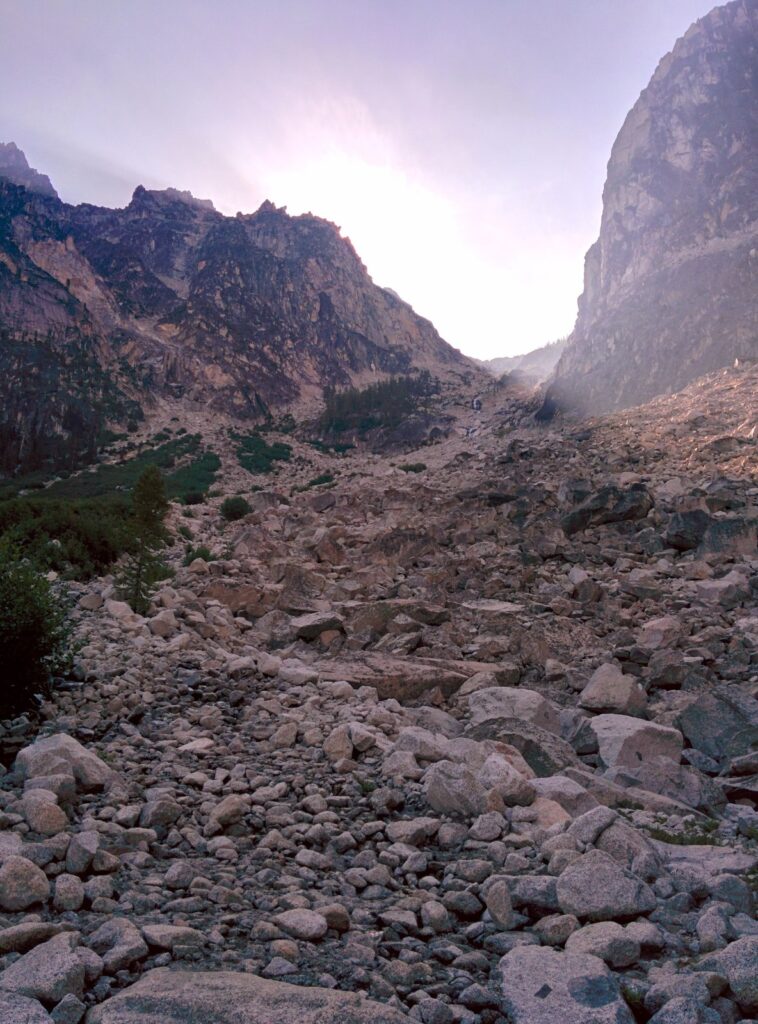
The standing cautions from the ranger and reporter record are specific. Stay climber’s left, away from the creek drainage and its waterfall. Expect loose rock and gravel on the descent, where slipping is reported even in good conditions. Expect route finding work among cairns and social trails in the boulder field, and expect snow to persist on the pass and in the Core well into summer, with melting snow bridges over the creeks it crosses.
None of this is generic mountain advice. Each line of it is this pass, in the reports of the people who work and walk it.
The pass is also descended, by Core parties exiting through Colchuck and by Colchuck campers returning from a day above. Descending it is slow going on the loose surface, with the lake far below. A party planning to descend Aasgard late in a long day should hold something in reserve for it. The traverse parties who exit at Snow Lakes have chosen, among other things, never to descend it at all.
The traverse in reverse
The route walks the other way, and the elevation logic argues against it for most parties. From Snow Lakes Trailhead the climb is longer and steadier, reaching the Core from below Lake Viviane, and the Mountaineers put the reverse at 18.0 miles with about 6,500 feet of gain. The Stuart start climbs Aasgard and nets roughly 2,600 feet less gain than the reverse, a difference the elevation gap between the trailheads explains. The reverse also saves Aasgard for a descent on tired legs, the direction the loose surface punishes most. Parties with a reason to hike it this way should plan it as the bigger day it is.
The reverse has one honest advantage. It climbs the Snow Lakes trail fresh, in the cool of the morning, instead of descending it wrecked in the evening, and it sees the Core in the afternoon. Parties based at the Snow Lakes end, or hiking to a car spotted at Stuart, take that trade. It remains the less described direction in published accounts.
Cars and shuttles between the trailheads
A one way hike ends at a different lot from where it started, and the logistics come out the same in every account of the traverse. Plant the car at Snow Lakes Trailhead, ride a shuttle up to the Stuart Lake Trailhead in the morning, and hike back to the car. The walk then ends at the vehicle, with no return trip hanging over the descent.
Two Leavenworth operators run shuttles between the trailheads. The Loop Connector charges $27 per passenger on its own booking page, meets its riders at the Snow Lakes lot, and runs Thursday through Sunday mornings in season, booked online ahead. Leavenworth Shuttle and Taxi runs the same route as the second operator. Shuttles book out on peak weekends, and the failure is a familiar story, a party that left booking late and found every seat gone the week before, hiking Colchuck as an out and back instead. Book the shuttle when the date is set, not when the week arrives.
A party with two cars can run the shuttle itself. Leave one car at Snow Lakes in the morning, drive up together to Stuart, and hike back to the waiting car, remembering that the keys to the Snow Lakes car have to make the hike too. The two car version sets its own schedule and costs nothing, at the price of the dawn drive between the lots and a car spotted the night before or the same morning, which means an early start to the day before the hike itself begins. Either way, the logistics are settled before the hike starts, and the descent ends at a vehicle the party controls.
The home base question rides with the logistics. For our own through hikes, a camp on Icicle Creek would be the ideal base, but the road’s campgrounds are first come in a busy valley and certainty is hard to hold. Realistically, our parties have ended those trips in Leavenworth lodging or on the drive back to Seattle. A party planning its first traverse should settle where it sleeps the night before and the night after with the same care it settles the shuttle.
Snow Lakes
Quick facts: Snow Lakes Trailhead, Northwest Forest Pass for day use or the overnight permit’s parking pass on permit dates; 14.0 miles roundtrip with 4,300 feet of gain; overnight in the Snow Lake Zone, 5 groups a day, day use on the free self-issued trailhead permit; permit season May 15 to October 31; water from Nada Lake and the Snow Lakes, treated; camps at Nada Lake and at the Snow Lakes.
Snow Lakes is the traverse’s exit half standing as a destination in its own right. The trail climbs from Icicle Creek past Nada Lake, at 10.6 miles roundtrip and 3,600 feet on the same trail, and continues to the pair of Snow Lakes below Lake Viviane and the lower Core. The distance and gain above are the Washington Trails Association’s figures, and they govern here.
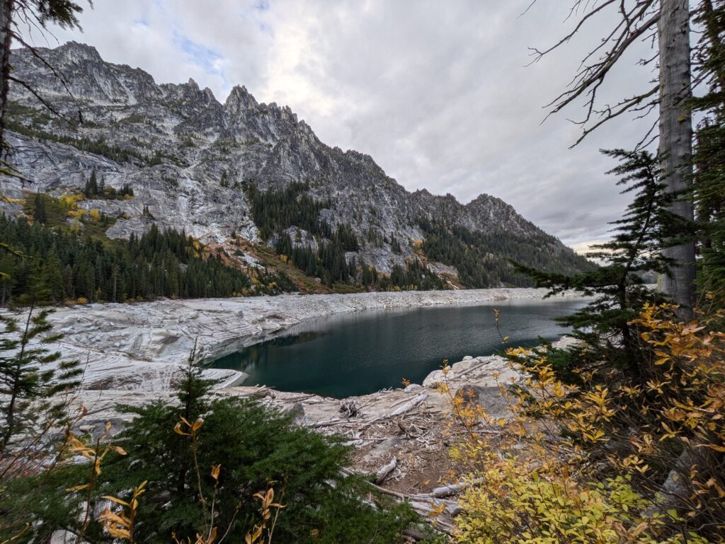
The route’s character is a long, honest climb through forest and open burn to high water. As an out and back it is the biggest day hike in this guide that never enters the Core, and the lake basin at the top, with the trail continuing above it toward Viviane, makes the end feel like a threshold rather than a wall. As an overnight, the Snow Lake Zone’s five groups a day is the largest group quota in the system, and its camps at Nada and the Snow Lakes give the zone a two level structure the other zones lack.
The Snow Lakes themselves are two, an upper and a lower lake divided by a dam, and the trip reports describe camps toward the upper lake’s far end in low water years. A Snow permit holder camped there stands one climb below Lake Viviane, close enough that a day hike into the lower Core and back is the day trip the Forest Service sketches for a three day Snow Lakes stay. That is the zone’s quiet bargain. It sells the basin’s doorstep at better odds than the basin, with the basin still reachable on day use. We have run that exact trip. Our August 2015 backpacking trip came in from the Snow Lakes side, camped at Snow Lake, and day hiked up into the Core from camp. Even at Snow Lake, a full climb below the basin, the camps felt crowded with campers.
Nada Lake deserves its own sentence in any plan, because it splits the route into two honest trips. At 10.6 miles roundtrip and 3,600 feet, Nada is a full day hike in its own right, ending at a lake below the Snow Lakes basin. It is also a legal camp inside the Snow Lake Zone, for permit holders breaking the climb into two days. A party unsure of the full Snow Lakes day can hike to Nada first and learn the trail’s character at most of its distance but a smaller share of its climb.
For traverse parties this trail is the day’s second half, and it deserves its reputation in that role. Both of our through hikes exited here, in the evening, on legs that had already climbed Aasgard, and our backpacking trip started up it. The descent is long enough that firsthand accounts plan around it, and a day hiker heading up it fresh in the morning is meeting a different trail from the one a traverse party meets at hour ten.
Stuart Lake
Quick facts: Stuart Lake Trailhead, Northwest Forest Pass for day use or the overnight permit’s parking pass on permit dates; 9.0 miles roundtrip with 1,665 feet of gain; overnight in the Stuart Lake Zone, 4 groups a day, day use on the free self-issued trailhead permit; permit season May 15 to October 31; water from the lake, treated.
Stuart Lake is the branch off the basin’s main line of travel. Most parties at this trailhead are bound for Colchuck Lake and the Core beyond it. Stuart’s trail shares the first just over two miles with theirs, then holds straight at the junction where the Colchuck Lake Trail breaks off, and rolls on toward a lake under the north side of the Stuart Range. In every trip account we found, it reads as the peaceful alternative, lightly trafficked against the Colchuck side of the same parking lot.
The numbers explain some of the quiet. At 9.0 miles and 1,665 feet it is a moderate day, easier than Colchuck on paper and ending at a lake with no famous pass above it and no traverse passing through. What it offers instead is the basin’s edge at rest, a shore where a party can sit in the Alpine Lakes Wilderness without the amphitheater crowds. Its permit odds tell the same story from the other side, 9.15 percent in 2024, the second best in the system.
The junction where the trails divide is the trailhead’s defining moment, and Stuart’s side of it rewards a second look from parties whose plans just changed. A group that arrives to a full Colchuck shore, or a member whose legs argue against the bigger day, has a complete alpine lake trip on the other fork, with the same parking pass and the same drive home. Guides to this trailhead rarely say so, because they are written for the lake with the famous name. The fork does not care which way a party turns.
The Forest Service describes an overnight trip to Stuart Lake as adequate in itself, the kind of trip a party can stretch over extra days to relax at the shore. That framing fits the lake’s record. Stuart is not a consolation for a lost Core application. It is a smaller, quieter trip that some parties would choose first if the famous names did not crowd it out of their planning.
We have not hiked to Stuart Lake, and nothing here pretends otherwise. The permit system gives it a zone and the trailhead gives it a trail, and the trip reports give it a character that the Colchuck bound majority hikes straight past.
Eightmile Lake and Lake Caroline
Quick facts: Eightmile Trailhead, Northwest Forest Pass for day use or the overnight permit’s parking pass on permit dates; Eightmile Lake 6.6 miles roundtrip with 1,300 feet of gain, Lake Caroline 11.5 miles roundtrip with 3,100 feet; overnight in the Eightmile/Caroline Zone, 3 groups a day, day use on the free self-issued trailhead permit; permit season May 15 to October 31; water from both lakes, treated; campsites at Lake Caroline.
Eightmile Lake and Lake Caroline are the permit area’s lower, gentler pair, and the only zone entered from the Eightmile Trailhead. The two trail authorities agree exactly on both routes, which happens nowhere else in this guide. Eightmile Lake, high point 4,650 feet, is the gentlest route in the permit area. Lake Caroline, high point 6,300 feet, passes Eightmile and climbs on to a higher, wilder shore.
The trailhead stands at 3,300 feet, about three miles up Forest Road 7601 from Icicle Creek Road, with the Stuart Lake Trailhead about a mile beyond it. The road is steep and grows washboarded as the season goes on, and the Forest Service recommends high clearance. Parking at the trailhead is limited, signed restrictions are enforced with fines, and the road closes to vehicles every winter. Which routes leave from the lot is this page’s whole business with it. The road’s campgrounds and the drive itself belong to the Icicle Creek guide.
The two lakes split at Little Eightmile Lake partway up. The main trail follows Eightmile Creek to Little Eightmile Lake, where a rougher branch, the Eightmile Trout Creek Trail, turns toward Lake Caroline and the slopes of Cashmere Mountain at 8,500 feet. The Forest Service describes that branch as a little rougher, with vegetation and downed trees, and the description matches the lakes’ characters. Eightmile is the hike a party takes for an easy alpine shore. Caroline is the climb it takes when it wants the basin to feel earned.
The zone’s draw is arithmetic as much as scenery. Its 14.02 percent success rate in 2024 was the best in the system, more than six times the Core’s, and the lakes it buys are real alpine water under real peaks, Eightmile in its creek drainage and Caroline below Cashmere Mountain’s slopes. A party that wants a night inside the permit area more than it wants a specific famous shore should start its application here.
For an application, this zone is also the system’s pressure valve, and it belongs in the three entry design the lottery section describes. A party whose first two entries chase the Core and Colchuck can put Eightmile/Caroline third without wasting the slot on a trip it would not happily take. The lakes are good enough to be the trip, not the consolation, and their odds are good enough to rescue a season. That combination is the strongest practical argument this page can make to a first time applicant.
We have not hiked to either lake. They stand in this guide at full treatment because a permit page that slighted its most winnable zone would be steering its readers wrong.
Seasons and conditions
The permit season runs May 15 to October 31, and the Forest Service names May, June, September, and October as shoulder seasons, when visitors should expect snow and winter-like conditions. That is the system’s own framing, and the route record agrees with it. Snow persists on Aasgard Pass and in the Core well into summer, across the very weeks when the calendar says the season is open.
High summer is the settled window, and even it is not settled at 7,800 feet. Weather in the Cascades turns fast over a basin this exposed, and a traverse party is above treeline for the middle third of its day with no short way down. Fall adds the shoulder season’s second form, reported by the district’s own rangers, ice covered granite in the Core and fast weather turns, arriving just as larch season turns the basin gold and compresses the year’s second demand peak into October.
Outside the permit season, no permit is required and visitors self-register, but the trips change kind. The trailhead roads close to vehicles in winter, Forest Road 7601 to the Eightmile and Stuart trailheads among them, closed to protect the roadbed. The pass and the basin are snowbound, the roads to the trailheads close, and a winter Enchantments trip is a mountaineering undertaking. This guide’s routes are written for the permit season and the snow free weeks at its edges, and conditions for any specific week live in the trail reports linked in the Sources.
Between the calendar and the conditions sits the practical season, and it is shorter than the permit season. The crowds concentrate in the weeks when Aasgard is down to manageable snow and the Core’s lakes are open, roughly high summer into early fall. The permit season’s edges belong to parties equipped for snow travel who accept that a May or October trip may turn around at the pass. Both choices are legitimate. Confusing one for the other is where trips go wrong.
Fire restrictions and emergencies
Fire in the permit area is governed first by a standing rule, not a seasonal one. No campfires are allowed above 5,000 feet or within half a mile of any lake, at any time of year, and that rule covers every overnight destination in this guide. A stove is the only way to cook at these lakes. Seasonal restrictions, when the forest imposes them, tighten conditions further across the wider forest, and the Forest Service’s alerts page for the Okanogan-Wenatchee National Forest is the check before any trip, linked in the Sources.
For emergencies, the shape is simple. Call 911 first. The nearest hospital is in Leavenworth, at Cascade Medical, the town every route in this guide starts from.
The Wenatchee River Ranger District, at 600 Sherbourne Street in Leavenworth, is the permit system’s own authority for questions the booking pages do not answer. Do not build a plan that depends on cell coverage in the basin. Parties carry their own margin, in time, in layers, and in the turnaround decisions the Aasgard section describes.
Frequently asked questions
Do you need a permit to hike in the Enchantments?
For a day hike, only the free self-issued day use permit at the trailhead and a parking pass. For any overnight stay between May 15 and October 31, yes, an overnight permit for a named zone, won in the advanced or daily lottery or picked up from a cancellation.
When is the Enchantments lottery, and how does it work?
Applications run February 15 to March 1 each year on Recreation.gov, with results on March 17 and confirmation and payment due by March 31. Each application carries up to three entries of zone, date, and group size, costs $6 nonrefundable, and is drawn in random order, so applying early in the window buys no advantage. The coming season’s dates are final when they post on Recreation.gov.
What are the odds of winning the Enchantments lottery?
In the Forest Service’s published results for the 2024 season, 2,741 of its 42,765 applications won permits, about 6.4 percent overall. By zone, success ran from 2.22 percent for the Core Enchantment Zone to 14.02 percent for Eightmile/Caroline. The 2024 set is the newest the Forest Service has published.
How much does an Enchantments permit cost?
Six dollars to apply, nonrefundable, and $5 per person per day if the application wins. A day hike costs nothing beyond the parking pass.
Can you hike the Enchantments in one day?
Yes. The full traverse, about 18 miles from the Stuart Lake Trailhead to the Snow Lakes Trailhead over Aasgard Pass, needs no overnight permit as a day trip, and firsthand accounts put it at 12 to 15 hours or more. It is an expert undertaking, not a loophole for the unprepared. The day hikes to Colchuck Lake, Stuart Lake, Snow Lakes, and Eightmile Lake are the other day trips the same trailheads offer.
How long is the Enchantments traverse?
About 18 miles one way. Published figures put the gain in this direction at about 4,500 to 5,000 feet with about 7,000 feet of loss, and the sources do not reconcile to a single number, so the range is the honest form.
Can you bring a dog to the Enchantments?
No. Dogs are prohibited everywhere in the permit area, on every trail and at every lake.
What happens if you do not win the lottery?
Unclaimed awards return to the reservation system on April 1 at about 7 a.m. Pacific, cancellations return through the season, and the daily lottery offers one permit per zone per day in season. Every route in this guide also remains open as a day trip with no overnight permit at all.
When is the best time to visit the Enchantments?
The permit season runs May 15 to October 31. Snow holds on Aasgard Pass and in the Core into summer, high summer is when the pass most often stands clear of the worst of its snow, and October brings larch color with shoulder season conditions, ice on the granite and fast weather turns. The best week is the one whose conditions the party is equipped for.
Sources
Checked November 2026. Recreation.gov’s Enchantment Permit Area Advanced Lottery and Daily Lottery pages, recreation.gov, for the permit requirement, the five zones and quotas, the lottery calendar and rules, the fees and cancellation terms, the daily lottery’s current form, and the area rules. The Forest Service’s Enchantments and overnight permits pages and its Eightmile Trailhead page, Okanogan-Wenatchee National Forest, fs.usda.gov, and the Forest Service’s published advanced lottery results for the 2024 season, the newest set published.
Washington Trails Association hike pages and trip reports, wta.org, for the Colchuck Lake, Stuart Lake, Snow Lakes, Eightmile Lake, and Lake Caroline routes and the traverse, with the Mountaineers route pages, mountaineers.org, as the second trail authority where the two differ slightly, as they do on the Snow Lakes figures. The Loop Connector’s own booking page for its shuttle fare and form. Wenatchee River Ranger District, Leavenworth, as the permit system’s local authority, and Cascade Medical, Leavenworth, for the hospital town.