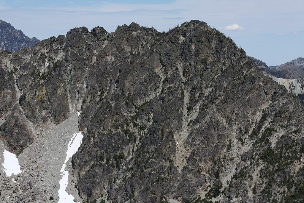
One valley northeast of Cle Elum holds sandstone bluffs, ponderosa pine, and larch that turns gold in fall. A river splits into three forks there, and you can camp beside all of it for the price of a parking pass or less. The Teanaway River runs low and clear through dry country on the sunny side of the Cascades. A weekend here can mean a shaded site by the water, a hike to a sandstone slab by lunch, and stars over a working forest by dark. It is an easy valley to start camping in, and starting is the whole point, since the returns of time outside, in focus, mood, and sleep, begin with weekends exactly like this one, close to home and cheap to run.
That working forest character is part of the draw. Cattle graze parts of this country in season. The sandstone under your boots comes from the Roslyn and Swauk formations. Cheese Rock, a pitted sandstone giant, stands as the signature formation of the valley. It is a lived-in landscape that also welcomes campers, hikers, and riders.
The place campers search for as Teanaway camping is, in its largest piece, the Teanaway Community Forest. The Washington Department of Natural Resources manages that forest. Its three campgrounds sit on the three forks of the river.
Most people use the short name, Teanaway. The signs and DNR use the full one, the Teanaway Community Forest. Both names point at the same valley and the same three campgrounds.
One fact organizes everything else in this guide. Three agencies govern the campgrounds on this one drive. The Department of Natural Resources runs the community forest campgrounds. The Forest Service runs campgrounds on the North Fork and along US 97.
The Bureau of Land Management runs one site near the town of Liberty. Each agency sets its own pass, its own fees, and its own stay limit. Learn which agency runs your campground and most of your planning questions answer themselves.
One boundary matters before you plan. Salmon La Sac is a different campground area on a different river and a different road, and it has its own guide. This guide covers the Teanaway River forks and the US 97 drive over Blewett Pass. Nothing here describes the Salmon La Sac campgrounds.
In this guide
- Teanaway camping at a glance
- Passes, agencies, and stay limits
- Teanaway Camping Area
- Blewett Pass and US-97
- Liberty Recreation Site
- Swauk Campground
- 29 Pines Campground
- Teanaway Guard Station
- The smaller campgrounds
- Dispersed camping, horse camping, and trailheads on the North Fork
- Winter camping and Sno-Parks
- Fire restrictions and emergencies
- Frequently asked questions
- Sources
Teanaway camping at a glance
Four campgrounds carry most of the camping in this valley. The Teanaway Camping Area leads the set. Liberty Recreation Site and Swauk Campground serve the US 97 drive.
29 Pines Campground anchors the North Fork. The table compares those four side by side. Each campground has its full detail in its own section below.
| Campground | Agency | Pass | Sites | Booking | Nightly cost |
|---|---|---|---|---|---|
| Teanaway Camping Area | Department of Natural Resources | Discover Pass | 55 | First come only | No fee beyond the pass |
| Liberty Recreation Site | Bureau of Land Management | No pass | 15 | First come | No fee |
| Swauk Campground | Forest Service | No pass | 19 single sites and 2 double sites | First come only with Scan and Pay | $24 a night, plus $10 for an additional vehicle |
| 29 Pines Campground | Department of Natural Resources | Discover Pass | 59 | First come only | No fee beyond the pass |
Five more places complete the set. The Teanaway Guard Station has its own section after 29 Pines. Mineral Springs Campground, Indian Camp, Beverly Campground, and Ken Wilcox Campground at Haney Meadows sit in The smaller campgrounds.
Two absences run across every public campground in this guide. No public campground here offers showers. No public campground here has a dump station. The nearest public dump station is the RV dump station at the Indian John Hill rest area.
It stands on I-90 eastbound at milepost 89, about five miles east of Cle Elum. Campers who need either one plan around that fact from the start. Bring your own water plan too, because several campgrounds here offer no drinking water at all.
Cle Elum is the service town for the whole drive. It holds the groceries and the fuel. The Cle Elum Ranger District office stands on West 2nd Street in town. Questions about the community forest go to the Department of Natural Resources Southeast Region contact in Ellensburg.
Roslyn, a few miles west of Cle Elum, adds small town character on the way in. On Teanaway Road itself, the Teanaway Country Store sells firewood, ice, groceries, and passes, in its operator’s own description. It sells no fuel. Everything else rides in from Cle Elum.
Three private parks near Cle Elum cover what the public campgrounds do not. Whispering Pines RV Park offers full hookup sites with water, power, and sewer. Sun Country Golf and RV is an RV park at a golf course, and it states 50 amp service. Trailer Corral RV Park sits on the Teanaway drive itself.
A camper who needs a full hookup sleeps at Whispering Pines. A camper who needs a shower finds one at Sun Country, which states showers and bathrooms on its own page.
Passes, agencies, and stay limits
Every rule in this section follows the agency. Read the part that matches your campground. The three systems differ on cost, on booking, and on how long you may stay. One thread runs through all three. No pass pays a camping fee anywhere in this guide.
DNR community forest
Camping in the Teanaway Community Forest costs nothing beyond a Discover Pass. The pass is the whole price. No second camping fee applies at any of the three campgrounds.
All three campgrounds are first come only. First come means a site goes to the camper who arrives and takes it. No reservation exists for these campgrounds at any time of year.
The stay limit is seven days in any 30 day period. That is the shortest stay limit in this guide. Camping is allowed only inside the three designated campgrounds.
Campfires are allowed only in approved fire pits in designated campgrounds. Cutting firewood anywhere in the community forest is not allowed. Buy firewood before you arrive or at the Teanaway Country Store.
Equestrian camping is allowed at only two of the three campgrounds. Indian Camp allows it. The Teanaway Camping Area allows it. 29 Pines does not. Riders plan around that split.
Two statewide rules from the Department of Natural Resources also apply here. Pets are allowed on a leash of up to eight feet in developed recreation facilities, and pet waste pickup is required in those facilities. Quiet hours run from 10 p.m. to 7 a.m. every day.
Engine driven generators stay off during quiet hours unless one is medically required. Both rules are statewide recreation rules. Neither one is special to this forest.
National forest
Forest Service campgrounds in this guide charge a nightly fee at developed sites. Beverly Campground, Swauk Campground, and the Mineral Springs single sites are first come only. A camper must arrive in person to take one of these sites.
Payment on site runs through Scan and Pay. Scan and Pay means you scan a code at the campground and pay by phone. No reservation channel exists for these single sites, and no reservation is required for them.
The stay limit on national forest land here is 14 days. Parking at developed trailheads takes a Northwest Forest Pass or an America the Beautiful pass. That parking rule covers trailhead parking. It does not pay any campground fee. A camper can hold the right trailhead pass and still owe the full nightly fee at the campground.
BLM land
The Bureau of Land Management runs one site in this guide. Liberty Recreation Site takes no pass and charges no fee. Its stay limit is 14 days. That simple setup makes Liberty the easiest cost calculation on the whole drive.
A Discover Pass is not valid on national forest land. A Northwest Forest Pass is not valid on Department of Natural Resources land. Each pass works only on its own agency’s land. Carry the pass your campground and your trailheads require, and expect the two systems not to honor each other.
Dispersed camping and the community forest boundary
Dispersed camping means camping outside a designated campground, with no developed site and no services. Inside the Teanaway Community Forest, dispersed camping is not allowed at all. The Department of Natural Resources states that ban in its own words. Every overnight stay inside the community forest belongs in one of its three designated campgrounds.
Above the community forest boundary, the rule changes. The North Fork road climbs past the end of the community forest onto national forest land. On that national forest land, dispersed camping is the ordinary practice. A camper may pull off and camp outside a developed campground there, under national forest rules.
This boundary matters because outside sources get it backwards. Roundups and review answers say dispersed camping exists inside the community forest. They are wrong.
The community forest ban is complete, and the open country for dispersed camping starts only above its boundary. A camper who wants a site outside a campground drives up the North Fork past the boundary. A camper who stays inside the forest uses a designated campground.
Food storage follows the agency too. On Forest Service land, a standing forest order sets the accepted forms. Store food in a bear-resistant container certified by the IGBC, the Interagency Grizzly Bear Committee. A hard-sided vehicle secured against wildlife also qualifies. A hard-sided building also qualifies.
Feeding wildlife is prohibited. On Department of Natural Resources land, the rule is simpler to state. Pack out all food and garbage. Never feed wildlife.
Cell service is thin across this valley, so treat preparation as the rule. Download the Recreation.gov app before you leave Cle Elum. Download your maps there too. A phone that works in town may show nothing at your campsite. Paper directions and a saved map solve that problem before it starts.
See Fire restrictions and emergencies.
Teanaway Camping Area
Quick facts: 55 campsites with fire rings; first come only, no reservations; seasonal closure in winter and reopening in spring; no water service, as the Department of Natural Resources prints no water service for this campground; two ADA accessible toilets; no hookups; no fee beyond a Discover Pass; stay limit seven days in 30; pets allowed on a leash of up to eight feet under DNR statewide rules; equestrian camping allowed; quiet hours 10 p.m. to 7 a.m. under DNR statewide rules.
Teanaway Camping Area carries two live names, and sorting them out is the first job at this campground. The Department of Natural Resources heads this campground Teanaway Camping Area on its Teanaway page. Its own directions for the same campground tell drivers to turn into Teanaway Campground. Both names mean this one campground on the West Fork. No Forest Service campground of either name exists anywhere in this valley.
The Department of Natural Resources counts 55 campsites here. A figure of 64 sites circulates in outside features about this valley. That figure is wrong for this campground.
DNR’s count governs, and it is 55. The same confusion swaps counts between this campground and 29 Pines in local posts. Keep each count with its own campground.
The campground sits on West Fork Teanaway Road at 1160 West Fork Teanaway Road, Cle Elum. The Department of Natural Resources manages it. A Discover Pass is the pass it takes. Pavement runs the whole way to it, on the Tahoma horsemen account.
Sites here spread along the West Fork of the Teanaway River. Each site carries a fire ring. Camper reports describe spacious sites with good separation and shade.
The same reports describe a mix of drive-in sites and walk-in sites set 20 to 50 feet off the road. Those reports also describe tables and fire pits at the sites. Treat that texture as camper reports, not as DNR’s description. DNR’s description stops at the site count, the fire rings, and the two ADA accessible toilets.
The West Fork trailhead stands just up the road, and it is the valley’s most popular hiking start, on the Washington Trails Association account. That trailhead explains much of this campground’s pull. The campground and the trailhead work as one trip. A camper sleeps here and hikes out in the morning with no second drive.
Frog Pond, Cheese Rock, and Big Sandy trails all start from this trailhead area. Cheese Rock is the standing short hike of the valley. Its pitted sandstone slab opens to views across the forest toward the Stuart Range. Bible Rock, another large sandstone slab, draws hikers on the same loop country. Route finding past Cheese Rock takes some care, on trip report accounts.
Summer weekends can fill this campground. That pattern follows from its popularity and its first come arrangement. A Friday arrival in July gambles. A Thursday arrival or a weekday trip changes the odds. Hunters also use this campground as a fall base, on camper reports.
The limits here are the community forest limits. Seven days in any 30 is the stay cap. No water service exists, so every camper hauls water in. Firewood cutting is banned across the forest, so firewood arrives with you or comes from a store. Equestrian camping is allowed here, one of only two campgrounds in the forest with that rule.
See Horse camping in the Teanaway.
Blewett Pass and US-97
US 97 leaves SR 970 at the Teanaway junction and climbs north. The highway crosses Blewett Pass, also signed Swauk Pass, at 4,124 feet. North of the pass, the highway descends toward US 2. That junction with US 2 is the northern edge of this guide.
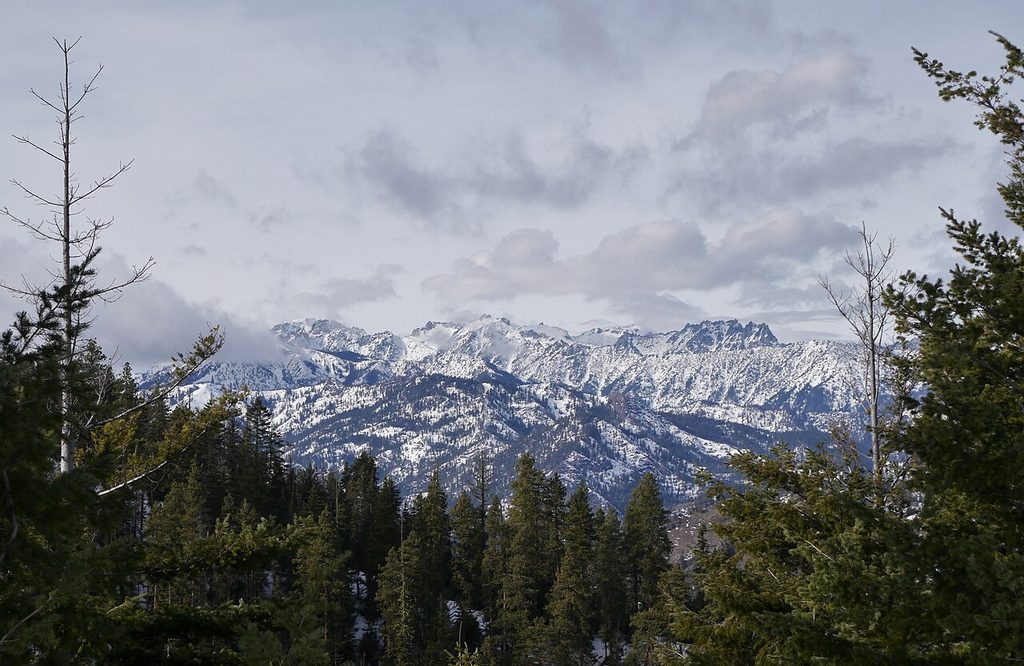
This part of the drive reads as a highway string. Two developed campgrounds stand along the highway itself. One Bureau of Land Management site sits off the highway on a side road. One high horse camp perches above the summit on forest roads. Services thin out fast once the climb starts.
Two campgrounds on this part of the drive sit in The smaller campgrounds. Mineral Springs Campground and Ken Wilcox Campground at Haney Meadows are covered there. Liberty Recreation Site comes next in this guide, and Swauk Campground follows it.
Liberty Recreation Site
Quick facts: 15 campsites; open year round, with snow closing access; no potable water; two vault toilets; no hookups; no fee; stay limit 14 days; cellular reception limited.
Liberty Recreation Site is the Bureau of Land Management site on Williams Creek, reached by Liberty Road and Pine Gulch Road off US 97. The turnoff stands 12 miles south of Swauk Pass. Liberty Road and Pine Gulch Road separate it from the highway traffic.
The Bureau of Land Management manages it, whatever review sites say. Some of them assign this site to the Forest Service and print larger site counts. BLM’s count is 15 campsites, and the agency is the Bureau of Land Management.
The setting is a creek-side camp in the trees. Each site carries a picnic table, a parking area, and a fire pit, on the Mountains to Sound Greenway Trust account. Sites spread out with good privacy on that same account.
Williams Creek runs beside the camp. The Bureau of Land Management warns that summer weekends are busy here. Most sites fill on those weekends, in BLM’s own words.
Liberty serves campers who travel self-contained and want a free base near US 97. It also serves riders and drivers using the nearby Forest Service motorized trail system. The site sits close to that trail country. A camper who needs water, hookups, or a guaranteed site should look elsewhere. A camper who brings everything and arrives early gets a quiet creek-side camp for nothing.
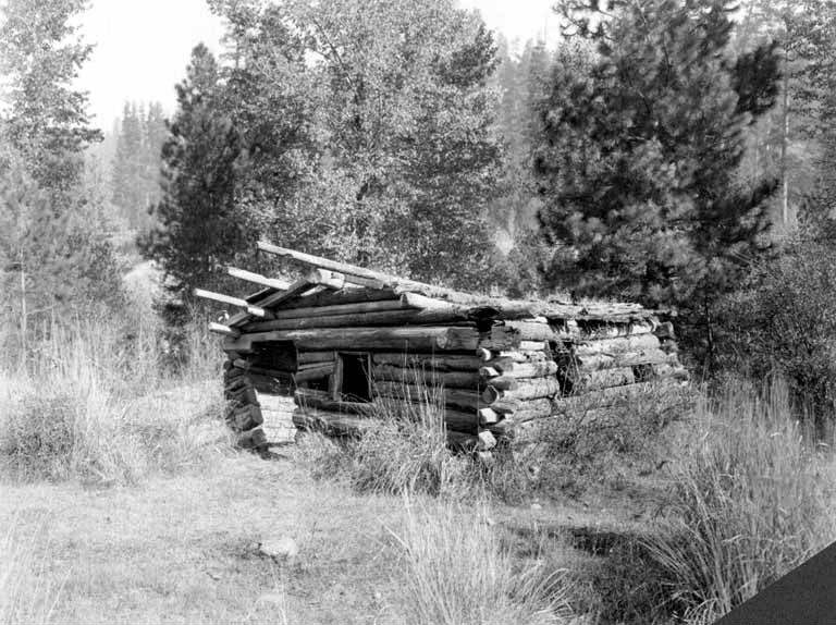
Gold turned up in nearby Swauk Creek in the 1870s. The town that grew here took the name Liberty in 1916. It stands as the oldest mining town site in Washington, on the Bureau of Land Management account. The placer mines along Swauk Creek worked the creek gravels for gold.
The limits are plain. There is no potable water and there are no hookups. Pack out your trash. Clean up after your pets.
The Bureau of Land Management states both duties in its directions for this site. Snow closes access in winter even though the site stays open on paper all year. Cellular reception is limited here, in BLM’s own words. Download what you need before you leave the highway towns.
Swauk Campground
Quick facts: 19 single campsites, 2 double campsites, and a picnic shelter; first come only, with physical arrival required and payment by Scan and Pay; two single vault toilets; no hookups; $24 a night, plus $10 for an additional vehicle, checked November 13, 2026; stay limit 14 days.
Swauk Campground is a Forest Service campground just off US 97 at 33400 State Route 97, Cle Elum, at 3,200 feet. A Northwest Forest Pass does not pay its camping fee, and no pass does. The campground stands about 26 miles north of Cle Elum on the Blewett Pass climb. It is the larger of the two developed campgrounds on the highway itself.
Large ponderosa pine and western larch shelter the sites. A creek runs behind the campsites. Fire rings and picnic tables stand at the sites. The picnic shelter gives a group one covered gathering spot.
Camper reports add a trade-off to that picture. Those reports describe tight sites, a narrow internal road, and rigs over about 30 feet maneuvering with difficulty. They also describe highway noise carrying into camp, with trucks braking on the grade until about 10 p.m. Treat all of that as camper reports, not as Forest Service fact.
The pattern still points one way. This campground works best as an overnight stop for smaller rigs. It works less well as a base camp for a large rig.
Two short hikes start at the campground itself. The Swauk Discovery Trail interprets this forest country near the campground. A trail of three quarters of a mile runs from the north end of the campground to Sculpture Rock. Both hikes sit on the Forest Service page for this campground. The campground also suits a night between Cle Elum and the Wenatchee side of the pass.
The limits here are the national forest limits. The stay cap is 14 days. No hookups exist at any site.
Carry water as if none will be available. That is the safe plan at any campground whose water status you cannot confirm. Before you drive to Swauk Campground, check the forest’s alerts page, which governs current closures and restrictions at this campground.
See Winter camping and Sno-Parks.
29 Pines Campground
Quick facts: 59 campsites with fire rings and toilets; first come only, no reservations; seasonal closure in winter and reopening in spring; no water service, as the Department of Natural Resources prints no water service for this campground; toilets; no hookups; no fee beyond a Discover Pass; stay limit seven days in 30; pets allowed on a leash of up to eight feet under DNR statewide rules; equestrian camping not allowed; quiet hours 10 p.m. to 7 a.m. under DNR statewide rules.
29 Pines Campground is a Department of Natural Resources campground at 20831 North Fork Teanaway Road, Cle Elum. It stands at the end of North Fork Teanaway Road, just past the fish hatchery. A Discover Pass is the pass it takes. It closes the North Fork drive. No developed campground stands beyond it on this road.
This is the largest campground in this guide. Its sites run along the North Fork of the Teanaway River. Fire rings stand at the sites, and toilets serve the campground. Size is its character. A large campground at the end of a long valley road absorbs crowds that would swamp the smaller campgrounds below.
The best use here is as the North Fork base. A camper based at 29 Pines sits where the community forest meets the national forest above it. The dispersed camping, horse camping, and trailhead country of the upper North Fork lies beyond this point, above the community forest boundary. Hikers and riders stage from here into that country. Anglers and creek-side campers get the river at their sites.
See Dispersed camping, horse camping, and trailheads on the North Fork.
The limits need care, because this campground’s status has moved across recent seasons. The stay limit is seven days in any 30. Equestrian camping is not allowed here, by DNR’s own rule.
No water service exists. The campground has also operated with a reduced number of sites in its south half, with posted rules and barriers marking the open part. Which sites stand open changes with conditions and work in the valley.
Before you drive to 29 Pines, check the DNR Teanaway page, which governs the current site count and closures at this campground.
Teanaway Guard Station
Quick facts: a reservable cabin sleeping two on a set of bunk beds; reservations through Recreation.gov; rental seasons early May to mid November and mid December to early April; no water; a vault toilet; no electricity; check in 2 p.m. and check out 12 p.m.; pets not allowed.
Teanaway Guard Station is a Forest Service cabin on FS Road 9737, 2.2 miles up the road, at 3,200 feet. The cabin is a rustic log cabin of 12 by 18 feet. It was built in 1950 and has rented since 2004.
The North Fork of the Teanaway River runs just across the road. Inside, one room holds the bunk beds, a wood stove, and a propane stove. A battery lantern lights the room, and guests bring its batteries. A fire pit and a vault toilet stand outside.
This cabin is the only reservable roof in this guide. Every campground around it runs first come. The cabin alone is reservable through Recreation.gov. A traveler who needs certainty in this valley books the cabin or accepts the first come gamble elsewhere.
Guests bring their own water for drinking, cooking, and washing. No water and no electricity exist at the site. No stoves or open flames are allowed in the cabin beyond its provided stove forms.
Pets are not allowed, the only no pets rule at any place in this guide. The cabin’s own listing warns that cell phone service is not available in the Teanaway area. It places the nearest services 23 miles away in Cle Elum. Plan as if both statements are true.
See Winter camping and Sno-Parks.
The smaller campgrounds
Four campgrounds in this guide are small, quiet, and easy to miss. Each one serves a narrower purpose than the big campgrounds above. They are covered compactly here, in one section.
Mineral Springs Campground
Quick facts: eight single family sites; first come only for the single sites, with physical arrival required and payment by Scan and Pay; season late May to late September; drinking water available; vault toilets; no hookups; $24 a night, plus $11 for an additional vehicle, checked November 13, 2026; stay limit 14 days.
Mineral Springs Campground is a Forest Service campground about 19 miles north of Cle Elum on US 97, at 27482 State Route 97, at 2,750 feet. Tables and campfire rings with grills stand at its sites. The campground takes its name from sulphur springs beside it. Those springs dried up more than 60 years ago, on the Forest Service page’s own history.
Its distinctive use is its group site. One group site here holds up to 50 guests. It costs $125 a night. Check in for the group site is 2 p.m. and check out is 12 p.m.
The group site is reservable, and a reservation is required for that unit. It is the one reservable campsite unit in this guide. The single sites beside it stay first come, like every other single site on the Forest Service side of this guide. A large group books the group site. Everyone else arrives and takes a chance.
The limits are the national forest limits. The stay cap is 14 days. Drinking water is available here, the one settled water supply on the US 97 arm. No hookups exist at the single sites.
Before you drive to Mineral Springs, check the forest’s alerts page, which governs current closures and restrictions on this drive.
Indian Camp
Quick facts: eleven campsites and two group campsites, all with fire rings; first come only, no reservations; seasonal closure in winter and reopening in spring; no water service, as the Department of Natural Resources prints no water service for this campground; a toilet; no hookups; no fee beyond a Discover Pass; stay limit seven days in 30; pets allowed on a leash of up to eight feet under DNR statewide rules; equestrian camping allowed; quiet hours 10 p.m. to 7 a.m. under DNR statewide rules.
Indian Camp is a Department of Natural Resources campground at 4394 Middle Fork Teanaway Road, Cle Elum, along the Middle Fork of the Teanaway River. A Discover Pass is the pass it takes. The road to it turns to gravel past the end of pavement. It is the smallest of the three community forest campgrounds.
Its distinctive use is the horse camp. Equestrian camping is allowed here, one of only two campgrounds in the community forest with that rule. The Tahoma horsemen use this campground as chapter country. Their account describes no corrals here.
It describes highline areas in the horse camps. It also notes no water close by for stock. Riders should read that as the horsemen’s account and plan water and containment accordingly. The two group campsites, each with fire rings, form part of that horse camp use.
The limits are the community forest limits. The stay cap is seven days in any 30. No water service exists for people or stock at the campground itself.
One road fact needs exact scoping. Middle Fork Road is closed past this campground, where flood damage took out a bridge. That closure blocks through travel and the Middle Fork Trail beyond the campground. It does not block access to the campground itself.
Before you drive the Middle Fork, check the DNR Teanaway page, which governs the road closure past Indian Camp.
Beverly Campground
Quick facts: 14 tent and picnic sites; first come only, with physical arrival required and payment by Scan and Pay; season mid May to late October; no potable water; vault toilets; no hookups; $10 a night, plus $5 for an additional vehicle, checked November 13, 2026; stay limit 14 days.
Beverly Campground is a Forest Service campground on FS Road 9737, 4 miles past the end of pavement, at 3,100 feet. It is the one developed national forest campground on the North Fork drive. Its sites run along the North Fork of the Teanaway River. The Guard Station cabin stands below it on the same road.
Its distinctive use is value and position. This campground carries the cheapest developed fee in this guide. It also stands as the developed base for the North Fork trail system. Trails climb from this road toward the high country above the valley. The trail names and the closure checks for that system live in the North Fork section below.
See Dispersed camping, horse camping, and trailheads on the North Fork.
The limits start with water. There is no potable water here, so every camper hauls water up the gravel road. Pack out all trash. This campground has also carried a partial closure in recent seasons, with part of the site closed under a posted banner. How much of it stands open changes with conditions in the burn and flood country above it.
Before you drive to Beverly, check the forest’s alerts page, which governs the current closure status at this campground.
Ken Wilcox Campground at Haney Meadows
Quick facts: 19 trailer and tent sites at 5,600 feet; first come only, with physical arrival required and payment by Scan and Pay; stock water only, with no potable water for people; horses and pack animals allowed.
Ken Wilcox Campground at Haney Meadows is a Forest Service campground reached from the Blewett Pass summit, about 24 miles northeast of Cle Elum. The route runs south about 4 miles on FS Road 9716 to FS Road 9712. It then runs about 4 more miles to the campground. The campground sits at Haney Meadows on Table Mountain. No other campground in this guide sits anywhere near its elevation.
Its distinctive use is the Table Mountain trail system. Trailhead parking for that system stands inside the campground. The Old Ellensburg Trail is among the routes that start here.
Riders use this campground as a horse camp for the Table Mountain country. Hikers use it as a high start that skips the long valley approaches. The meadows and the open, burned ridges above them are the draw.
The limits begin with fire history. The Table Mountain Fire burned through the country around this horse camp in September 2012. It left many downed trees and obstacles, on the Forest Service page’s own account.
Expect a burn-scarred landscape, not a shaded forest camp. Stock water only means people bring all their own drinking water. This campground was also named in the 2025 Labor Mountain closure order on this mountain.
Before you drive to Ken Wilcox, check the forest’s alerts page, which governs the current closure status at this campground.
Dispersed camping, horse camping, and trailheads on the North Fork
The North Fork road does not end at the last campground. Above the community forest boundary, the road enters national forest country. That country supports three uses that no single campground contains. Dispersed camping, horse camping, and trailheads each get their own part below.
Dispersed camping above the community forest
See Dispersed camping and the community forest boundary.
Above that boundary, practice is simple in form. Campers pull off the forest roads and camp outside developed campgrounds. The Forest Service names one such spot directly. At the Stafford Creek end of FS Road 9703, off FS Road 9737, its Iron Bear Trail page lists roadside parking, a toilet, and dispersed primitive campsites.
No site count, water supply, or fee is stated for those sites. Treat them as primitive in the full sense. Bring water, and expect nothing built beyond the toilet and the parking.
The Forest Service De Roux Trailhead page states that the trailhead doubles as a small campground. It lists hitching posts and camping areas for horses. It stands at 3,800 feet, about 8 miles up FS Road 9737.
The Forest Service states nothing more about it. No site count, fee, or water supply is published for it. Campers who use De Roux should treat it as a trailhead with horse camping areas, and confirm anything more with the Cle Elum Ranger District office in Cle Elum.
The Jungle Creek side, on FS Road 9701, has no developed camping in the Forest Service’s listings. Its trail has also stood in recent closure lists. Plan no overnight stop on that side of the valley.
Horse camping in the Teanaway
Horse camping is a working part of this valley. Four places form the set. Indian Camp allows equestrian camping under the community forest rules.
The Teanaway Camping Area allows it as well. De Roux offers camping areas for horses at its trailhead. Ken Wilcox Campground at Haney Meadows allows horses and pack animals.
The Tahoma horsemen account adds the practical texture. On that account, the community forest horse camps have no corrals. Highline areas serve instead. No water stands close by at those camps.
Gravel serves Indian Camp. Riders haul stock water, bring highline gear, and expect to manage their animals without built corrals. That texture comes from the horsemen who use these camps. It is the best practical picture available, and it is theirs, not the agencies’.
29 Pines is the exception to remember. Equestrian camping is not allowed there. A rider who arrives at the North Fork’s largest campground with a trailer has the wrong campground. Indian Camp and the West Fork are the horse doors into the community forest.
Trailheads and closure checks
The North Fork trail system climbs toward the high country of the Central Cascades. Beverly Turnpike, Stafford Creek, Standup Creek, Miller Peak, Bean Creek, and County Line are among the named routes. Iron Peak and Iron Bear country draw hikers from the Stafford Creek side. These trails serve the Teanaway crest and the Stuart Range approaches.
Parking at developed trailheads here takes a Northwest Forest Pass or an America the Beautiful pass.
See Passes, agencies, and stay limits.
Trail status in this valley is not a stable fact. Fire and flood have closed trails, roads, and campgrounds here in recent seasons, sometimes in a single order. No trail in this section should be read as open because it is named. Naming a trail here means the route exists. It does not mean the route stands open this week.
Before you hike the North Fork, check the forest’s alerts page, which governs trail and road closures on the North Fork.
See Fire restrictions and emergencies.
Winter camping and Sno-Parks
Winter is a real second season in this valley. Snow closes the summer campgrounds and opens a different system in their place. Groomed routes, Sno-Parks, and one rentable cabin carry the season.
Sno-Park access
A Sno-Park is a plowed parking area for snow recreation, and parking at one takes a Washington State Sno-Park Permit in season. The Teanaway and 29 Pines Sno-Park serves the North Fork. It is also the winter trailhead for the Guard Station cabin. The Swauk Campground Sno-Park stands at the summer campground on US 97.
It offers 25 parking spaces. Its non-motorized trails run toward Pipe Creek and Blewett Pass, part of a system of 92 kilometers of non-motorized trails in the Blewett and I-90 country. The Blewett Pass Sno-Park and the Pipe Creek Sno-Park complete the named set on this drive.
The Guard Station cabin rents through the winter season. Reaching it changes completely. FS Road 9737 closes to wheeled travel from mid November to early April.
Winter guests park at the Teanaway and 29 Pines Sno-Park. They then travel 2.2 miles to the cabin by ski, snowshoe, or snowmobile, over a groomed route. A Sno-Park Permit is required for that winter parking.
Winter road checks
US 97 over Blewett Pass is a state highway, and its winter condition reporting belongs to the Washington State Department of Transportation. Traction requirements, restrictions, and closures post there first. No other source settles the question of whether the pass is passable on a given day.
Before you drive US 97 in winter, check WSDOT’s Blewett Pass page, which governs pass restrictions and closures.
The community forest campgrounds follow a seasonal pattern instead. They close for the season in winter and reopen in spring when conditions allow. Exact dates move with the year and the snow, and the DNR Teanaway page carries the current season’s position.
Before you plan a winter trip to a community forest campground, check the DNR Teanaway page, which governs seasonal closures in the community forest.
Fire restrictions and emergencies
Fire restrictions
Fire rules in this valley stack, and the strictest layer governs. Three layers apply. The federal layer is the Forest Service, through its alerts and forest orders. The state layer is the Department of Natural Resources, through its burn restrictions for the community forest.
The county layer is Kittitas County, through the Fire Marshal burn ban page, with Fire District 7 covering the Cle Elum area. A campfire that one layer allows can still be banned by another. The strictest answer wins.
The standing fire rules live in the passes section above. That section states where campfires are allowed on each agency’s land in ordinary conditions. This section covers the layer that changes. Current restrictions sit on top of the standing rules and can tighten or ban fires outright.
See Passes, agencies, and stay limits.
A forest order can close trails, roads, and campgrounds at once. The Labor Mountain orders in recent seasons did exactly that on the North Fork. A camper who checks only a campground page can miss an order that closes the road to it. The alerts pages are the check that covers the whole system at once.
Before you build a fire or start a trip, check the forest’s alerts page, which governs current fire restrictions and closure orders on national forest land.
Before you build a fire in the community forest, check the DNR Teanaway page, which governs burn restrictions in the community forest.
Emergencies
Call 911 first in any emergency. Cell service is thin in this valley, so a call may need a drive toward Cle Elum or a move to higher country. Tell the dispatcher your road and your fork.
Ellensburg is the hospital town for this valley. Kittitas Valley Healthcare there is the county’s sole hospital. Cle Elum, much closer, offers urgent care. Ellensburg stands about 27 miles east of Cle Elum.
For wider incidents, Kittitas County speaks through the Sheriff and the county emergency alert channels. Wildfire evacuations, flood closures, and search operations post there. A camper who hears sirens or sees smoke should check the county channels before driving toward the problem.
Frequently asked questions
Is Teanaway camping free?
At some campgrounds, yes, and at others, no. The three community forest campgrounds cost nothing beyond a Discover Pass. Liberty Recreation Site costs nothing at all. The Forest Service developed campgrounds charge nightly fees. The Guard Station cabin rents through Recreation.gov.
See Passes, agencies, and stay limits.
Do you need a Discover Pass for the Teanaway?
Yes, on Department of Natural Resources land. The Discover Pass is required at all three community forest campgrounds. It does not work on national forest land. Trailhead parking there takes a Northwest Forest Pass or an America the Beautiful pass instead.
See Passes, agencies, and stay limits.
Can you camp outside a campground in the Teanaway?
No inside the community forest, and yes on national forest land above its boundary. The Department of Natural Resources bans camping outside designated campgrounds across the whole community forest. Above the boundary on the North Fork, dispersed camping is the ordinary practice on national forest land.
See Dispersed camping and the community forest boundary.
Can you reserve a campsite in the Teanaway?
Almost everything here is first come. Beverly, Swauk, and the Mineral Springs single sites take no reservations at all, and arriving in person is the only way to get one. Two exceptions exist. The Teanaway Guard Station cabin reserves through Recreation.gov. The Mineral Springs group site is reservable, and a reservation is required for that unit.
See Mineral Springs Campground.
Where can you camp with horses in the Teanaway?
Indian Camp and the Teanaway Camping Area allow equestrian camping in the community forest. De Roux offers camping areas for horses at its trailhead. Ken Wilcox Campground at Haney Meadows allows horses and pack animals. 29 Pines does not allow equestrian camping.
See Horse camping in the Teanaway.
Is there drinking water at the Teanaway campgrounds?
At one campground, yes. Mineral Springs Campground has drinking water available. Beverly Campground and Liberty Recreation Site have no potable water. The community forest campgrounds have no water service, as the Department of Natural Resources prints no water service for them. Bring water to every campground except Mineral Springs.
See 29 Pines Campground.
How long can you stay?
Seven days in any 30 day period on Department of Natural Resources land. Fourteen days on Forest Service land and at the Bureau of Land Management site. The community forest limit is the one campers most often overrun on paper, so count your days there with care.
See Passes, agencies, and stay limits.
Where is the nearest dump station?
No dump station stands at any public campground in this guide. The nearest settled public option is the RV dump station at the Indian John Hill rest area. It stands on I-90 eastbound at milepost 89, about five miles east of Cle Elum, on the Washington State Department of Transportation list of RV dump stations.
See Teanaway camping at a glance.
Can you camp in the Teanaway in winter?
Yes, in winter forms. The Sno-Parks open for snow season parking and groomed routes. The Guard Station cabin rents through its winter season, reached by ski, snowshoe, or snowmobile. The community forest campgrounds close for the season and reopen in spring. US 97 conditions in winter are a WSDOT question, checked before every drive.
See Winter camping and Sno-Parks.
Sources
- Washington Department of Natural Resources, the Teanaway Community Forest page and the statewide recreation rules, used for the three community forest campgrounds, their counts and rules, the dispersed camping ban, and the statewide pet and quiet hours rules.
- United States Forest Service, the Okanogan-Wenatchee National Forest campground pages and the forest alerts page, used for the Forest Service campgrounds, their fees and seasons, the food storage order, and closure orders.
- Recreation.gov, the Teanaway Guard Station listing and the facility listings for the Forest Service campgrounds, used for booking forms, check in and check out times, and the cabin’s facilities.
- Bureau of Land Management, the Liberty Recreation Site page and brochure, used for the site’s count, fees, stay limit, water, toilets, and pet and trash directions.
- Washington Trails Association, the Cheese Rock hike pages, trip reports, and its Teanaway Community Forest feature, used for the West Fork hiking country and the valley’s popularity picture.
- Kittitas County, the Fire Marshal burn ban page and county emergency channels, used for the county fire layer and the county emergency feed.
- Washington State Department of Transportation, the Blewett Pass page and the RV dump stations list, used for winter pass conditions and the Indian John Hill rest area dump station.