One road runs up the Cle Elum River valley from Cle Elum to the Alpine Lakes Wilderness trailheads, and every campground in the valley stands along it. The road passes a lake campground with a beach and a boat launch, campgrounds on two rivers, a horse camp, and walk-in tent sites on a mountain lake. The biggest campground sits where the pavement ends, below the trailheads.
Eight campgrounds stand along the road and its side roads, spread over about 30 miles of mountain road. Seven are Forest Service campgrounds, and the eighth is a private park in Ronald, the only place on the road with hookups. How a site is claimed changes from campground to campground. Some sites book ahead on Recreation.gov, some are first come, and some campgrounds split their sites between the two. That split runs through everything below.
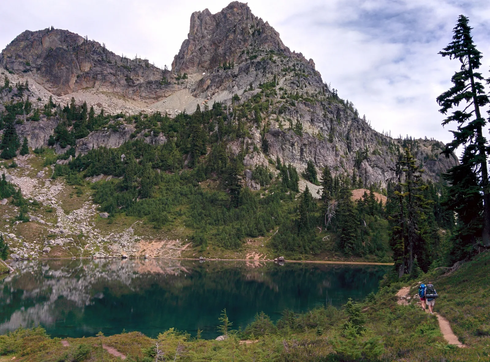
We know this road from its far end. We hiked from the trailhead where the pavement stops, to Peggy’s Pond under Cathedral Rock and up Mount Daniel in August 2016. Tuck and Robin Lakes, above the Cle Elum River, were another trip by the same road system. We have not stayed in any of these campgrounds. The campground guidance here rests on the Forest Service’s own pages and the reservation system’s listings, checked in November 2026.
This road’s country sits inside the wider Central Cascades camping between Stevens Pass and Snoqualmie Pass. The Teanaway valley, east of Cle Elum on its own road, belongs to a different guide in this series.
In this guide
- Salmon La Sac camping at a glance
- Choosing your campground on the Salmon La Sac road
- Salmon La Sac Campground
- Wish Poosh Campground
- Owhi Campground
- The Last Resort
- Cayuse Horse Camp
- Cle Elum River Campground
- Red Mountain Campground
- Fish Lake Campground
- Booking the Salmon La Sac road
- Seasons and winter
- Fire restrictions and emergencies
- Camping with an RV up the Salmon La Sac road
- Dispersed camping on the Salmon La Sac road
- Trailheads up the Salmon La Sac road
- Backpacking up the Salmon La Sac road
- Frequently asked questions
Salmon La Sac camping at a glance
Three choices shape a stay on this road: lake or river, hookups or none, and how far up the road to go. A fourth choice sits under the other three: take a reservable site where the campgrounds book them, or stay flexible where sites are first come. The choosing section that follows works through each one, campground by campground.
Two absences apply to the whole road. No public campground here has showers, and none has a dump station. Cle Elum, 19 miles below the road’s end, is the full service town. Roslyn, on the way up, covers basics closer to the lake. A general store in Ronald, partway up the road, sells gas and groceries to anyone passing.
| Campground | Where on the road | The place in a phrase | How you get a site |
|---|---|---|---|
| The Last Resort | Ronald, below the lake | The private park, with hookups and a store | Booked with the business |
| Wish Poosh Campground | About 10 miles, on Lake Cle Elum | The lake campground, with a boat launch and a beach beside it | Reservations and first come |
| Cle Elum River Campground | 15 miles, at the head of the lake | River sites and the road’s one group site | Group site by reservation, individual sites paid on site |
| Red Mountain Campground | 16 miles, on the Cle Elum River | Small and quiet, ten sites | First come only |
| Owhi Campground | 16 miles, then about 5 miles up the Cooper River road | Walk-in tent sites on Cooper Lake | First come only |
| Cayuse Horse Camp | About 19 miles, near the road’s end | The horse camp, corrals and troughs | Reservations and first come |
| Salmon La Sac Campground | 19 miles, the end of the pavement | The big riverside base below the trailheads | About 40 sites reservable, almost 30 first come |
| Fish Lake Campground | 19 miles, then 11 miles of gravel | Five walk-in sites where the river fills Tucquala Lake | First come only |
Choosing your campground on the Salmon La Sac road
The road is short enough to choose by need rather than by map. Eight campgrounds share one road system, and the differences between them are the kind that decide a trip.
Lake or river. Wish Poosh Campground is the lake campground, on the southeast shore of Lake Cle Elum, with a boat launch and a beach beside it. Every campground above it is river country, except Owhi, the walk-in campground on Cooper Lake up a side road. A camper who wants to swim, launch a boat, or fish from a kayak belongs at Wish Poosh.
Wish Poosh’s own sites are spacious and well separated, some wooded and private, some open. A camper who wants the sound of moving water beside the tent belongs at one of the river campgrounds. The river campgrounds put the tent beside running water: Salmon La Sac Campground between two rivers, Cle Elum River and Red Mountain on the Cle Elum River.
Beside the campground, Speelyi Beach gives the road its swimming place, day use only. The lake is a reservoir, and its level falls through the summer. Late in the season the falling water can close the boat launch, so check the listing before counting on it. Wish Poosh’s water system has been unreliable as well, so the lake choice comes with a bring-water note.
Hookups or none. Only one campground on this road has hookups. The Last Resort in Ronald holds nine RV sites with water and sewer hookups, and its tent sites are dry camping. A rig that needs to plug in stays in Ronald. A rig that can run on its own tanks can camp anywhere the road allows a vehicle.
No public campground has a dump station either, and the private park names none for passing rigs. A rig staying anywhere else on the road plans its dump for Cle Elum or beyond.
A group. One group site serves this road. Cle Elum River Campground holds a group site for 100 people, with its own water, tables, and fire rings with grills. A reservation is required for it, and it books up to twelve months ahead, the longest window on this road. For a reunion or a club weekend, it is the only answer at that size, and the tents a party that size pitches run up to the multi-room tents our multi-room tents guide scores.
It books through Recreation.gov, like the reservable sites. There is no first come fallback for a group, so book it early. The same road offers one roofed fallback: the 12-room motel at The Last Resort in Ronald, for the part of a group that does not camp.
Horses. Cayuse Horse Camp is the only campground on this road built for stock. Its 14 sites each carry one corral, with room for 3 horses at a single site and 4 at a double. No other campground takes horses, and Cayuse takes campers with stock only. Its riders use the trail system at the road’s end, and the Jolly Mountain trailhead stands nearby.
The corrals stand together in a common area rather than beside the sites. Two water troughs serve the corrals, and campers fill them by bucket from the handpump. A manure collection area is provided. One warning shapes who should come. The camp warns that newer, larger horse trailers do not fit its sites or its turns.
Quiet. The quiet end of this road is its walk-in end. Owhi Campground holds 22 walk-in tent sites on the shore of Cooper Lake, reached on foot from the parking area. Fish Lake Campground holds five walk-in tent sites at 3,350 feet, the highest campground on the road, with no fee at all. Both keep trailers out by their walk-in form.
Neither walk-in campground has drinking water. Owhi’s campers treat water from the lake or the Cooper River, or carry water in. Fish Lake adds no trash service to its quiet, so campers pack out everything they pack in. Among the drive-in campgrounds, Red Mountain is the quiet alternative, ten single sites on the river below the top of the road. When Owhi’s 22 sites fill, its overflow goes to the dispersed pullouts on Forest Road 46.
Most campgrounds above the lake are small ones, and the two walk-in campgrounds are the quiet end of it.
A rig. Salmon La Sac Campground has some pull-through sites for larger vehicles, letting a longer vehicle drive straight in and out without backing up. Cle Elum River takes trailers, and Wish Poosh takes RVs beside the lake, though its reviewers call it a tent and paddler campground first. No campground here posts a maximum length, and the road itself is the practical limit.
The Cooper River road to Owhi, Forest Road 46, is mostly paved and takes a careful driver. Forest Road 4330 above the anchor campground, Salmon La Sac, is narrow and steep in places, and it is not a road for trailers. Owhi and Fish Lake take tents only.
Stock trailers belong at Cayuse, which is built for them. Plan water before length. The road’s water points fill jugs, not tanks, and a rig should arrive with its fresh water tank full.
Certainty or freedom. Two campgrounds split their sites between reservations and first come. At Salmon La Sac Campground, about 40 sites take reservations and almost 30 are first come. At Cayuse Horse Camp, reservations and first come sites mix the same way.
Reservable individual sites book through Recreation.gov up to six months ahead, with new dates releasing at 10 a.m. Eastern. The Cle Elum River group site books up to twelve months ahead. Cayuse closes its reservations 4 days before arrival and asks a 2-night minimum on weekends, 3 nights on holiday weekends. At the anchor, the riverside sites are claimed first, by reservation and on arrival alike.
The first come campgrounds need no booking at all, but they need a weekday arrival. For a summer weekend, book the reservable share when the window opens, or arrive in the middle of the week rather than on Friday. A Wednesday arrival finds sites a Friday arrival will not. If the top of the road is full, work back down it. Red Mountain and the Cle Elum River sites sit minutes below, and Owhi waits up the Cooper River road.
Cayuse opens after the snow recedes. The high campgrounds open last, because their roads hold snow longest. A June stay pairs open campgrounds with high trails still under snow.
A fall stay trades the crowds for cold nights at the walk-in campgrounds. The reservable share at the anchor is the summer plan; the walk-in campgrounds are the fall plan. Winter belongs to the Sno-Park at the anchor, under a state Sno-Park permit.
What it costs. Fish Lake Campground is free. Red Mountain Campground charges $22 a night, the lowest printed fee on the road, and Owhi Campground charges $22 too. Cle Elum River Campground charges $24 a night for a single site, and the group site costs $158. Salmon La Sac Campground charges $27 for a single site and $54 for a double.
The Last Resort charges $40 a night for an RV site and $20 for a tent site. Extra vehicles cost $11 a night at Cle Elum River, Red Mountain, and Owhi, and $8 at Cayuse. Two fees are not published on their listings, so budget for them as unknowns: Wish Poosh’s nightly fee and Cayuse Horse Camp’s nightly fee.
Salmon La Sac Campground
Quick facts: 69 sites for tents and RVs, some pull-through; about 40 reservable and almost 30 first come, with the Cooper River Side units 86 to 112 reservation only under a forest order; May through September, closed to camping October through April; drinking water; vault toilets; no hookups; $27 a night for a single site and $54 for a double; check in at 2 p.m. and check out at noon; dogs on leash; firewood $10 a bundle at the host site; off-road vehicles not permitted.
Salmon La Sac Campground is the namesake at the end of the pavement, 19 miles north of Cle Elum. It stands between the Cle Elum River and the Cooper River, close to where the two meet. Its 69 sites make it the largest campground on this road and the natural base for the trailheads above it. Sites line both rivers under big trees, and the ones on the water are the prize of the campground. The drive in passes Cayuse Horse Camp and the old Cle Elum Guard Station before the entrance sign.
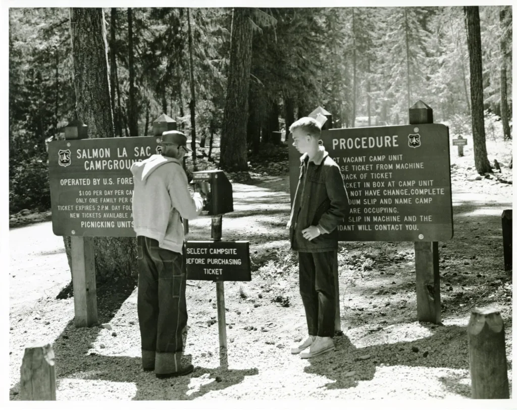
The sites are large and well separated, and some pull through, letting a longer vehicle drive straight in and out without backing up. Both rivers run fast and cold beside the sites, and the Forest Service calls the campground a prime place for hiking, fishing, swimming, and mountain biking. Bears are commonly seen in this area, and the Forest Service asks campers to store food and anything scented properly. A campground host is on site.
Booking here works two ways at once. About 40 sites take reservations up to six months ahead. Almost 30 more are first come, claimed on arrival.
One part of the campground breaks the usual first come pattern. The Cooper River Side units, numbered 86 to 112, are reservation only under a forest order, and an empty one cannot be taken without a reservation. The booking section below gives the full system for the road.
For a summer weekend, the practical advice follows from that split. Reserve a reservable site when the dates open. Or aim at the first come share in the middle of the week rather than on a Friday. The river sites go first either way. A weekday arrival also leaves the trailheads above the campground at their quietest.
Water comes from hand pumps spread through the campground. A pump fills jugs and bottles. Reviewers warn that the pumps do not take an RV hose fitting, so a rig should arrive with its fresh water tank already full. Vault toilets, which collect waste in sealed tanks without plumbing, serve the sites. Trash collection is provided.
The trailhead at the end of the road is the campground’s second purpose. The Cathedral Pass Trail crosses the Cle Elum River on a bridge, enters the Alpine Lakes Wilderness in about half a mile, and meets the Pacific Crest Trail at 4 miles. Peggy’s Pond and Cathedral Rock sit above that junction. The Polallie Ridge Trail climbs from near the campground toward Diamond Lake. The Cooper River Trail follows its river through forest, and summer trail reports describe it as a quiet path beside a cascading river.
Take care at the trailhead itself. The Cooper River Trail and the Waptus River Trail start close together there, and hikers mix them up in summer and winter alike. Check the sign for the river you mean to follow.
Winter changes the campground rather than closing the country. Camping ends in the fall, and from December through March the campground works as a Sno-Park under a state Sno-Park permit. Groomed trails for skiing and snowshoeing run through it toward the Cooper River. Snowmobiles use Forest Road 46 on the far side of that river, and winter visitors mention their sound across the water.
Wish Poosh Campground
Quick facts: 34 sites for tents and RVs; reservations and first come, with no split count published; drinking water unreliable, bring water; portable toilets while the flush toilets are out of order; no hookups; nightly fee not published on its listing; check in at 2 p.m. and check out at noon; firewood $10 a bundle; a boat launch at the campground; Speelyi Beach beside it is day use only, and camping there is prohibited.
Wish Poosh Campground is the lake campground, about 10 miles up the road on the southeast shore of Lake Cle Elum. Its 34 sites serve tents and RVs at 2,250 feet, and a boat launch puts boats on the reservoir beside them. This is the paddling and boating base for the road. It is also the easiest first stop, with Cle Elum and Roslyn a short drive back down the road.
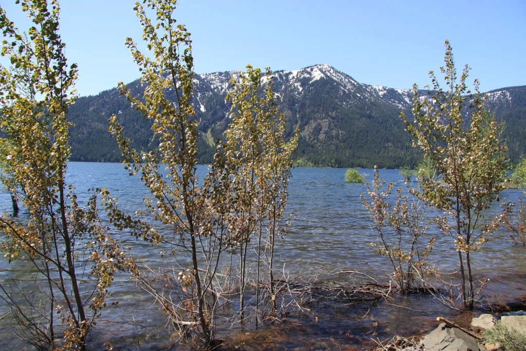
The sites are spacious and well separated. Some sit wooded and private, and some stand open. The largest sites, near the entrance, fit several tents.
Every site carries a picnic table and a campfire ring with a grill. Reviewers who stay here describe a campground that suits tent campers and paddlers best. Plan on no cell service at the sites.
The water is the day’s program. Anglers fish the lake from boats and the shore. Kayakers work the shore toward the beach. Swimmers use Speelyi Beach beside the campground. A camper can fill a day here without ever starting the car.
Beside the campground, Speelyi Beach gives the road its swimming place. Its listed uses are swimming and kayaking. It is day use only. A forest order prohibits camping there, so the beach is a day’s visit and Wish Poosh is the overnight campground beside it.
The lake is a reservoir, and its level falls through the summer. The boat launch works while the water stays high enough, and it closes when the level drops too low. Check the campground’s listing before counting on launching late in the season. The shore a camper sees in August is not the shore of June.
Water needs planning here. The campground’s drinking water system has been unreliable, and its flush toilets are out of order. Portable toilets are provided in their place. Bring your own drinking water rather than counting on the system. That advice holds even in a good year, because the system has drawn complaints across several seasons.
Owhi Campground
Quick facts: 22 walk-in tent-only sites; first come only, claimed on arrival; early June to late October; no drinking water; vault toilets; $22 a night, extra vehicles $11, paid by Scan and Pay; 2,800 feet.
Owhi Campground is the quiet campground, 22 walk-in tent sites on the shore of Cooper Lake. Every site is reached on foot from the parking area, which keeps trailers out. The lake is the whole point of the place. A stay here trades the big campground’s services for a shoreline and stillness.
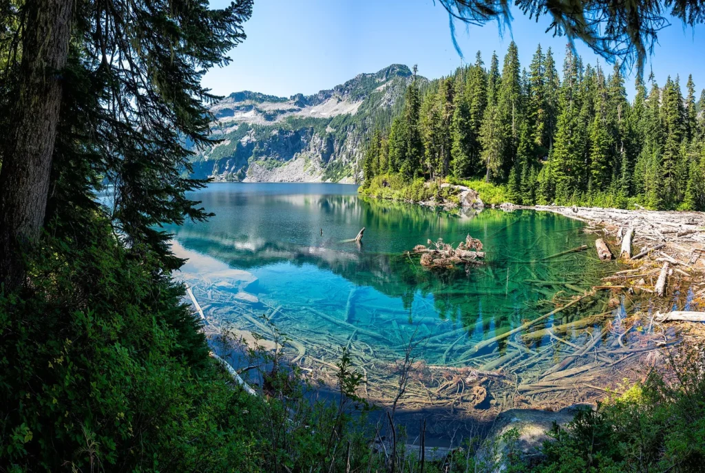
Cooper Lake fills a mountain basin at 2,800 feet, and the Cooper River runs from it down to the Cle Elum River at Salmon La Sac Campground. The sites string along the shore a short walk from the parking area. They sit close enough to reach with a cooler and a tent, and far enough in to stay quiet. A swim here is a cold one, in the way of lakes that snow feeds late.
Getting there leaves the main road. Drive 16 miles north from Cle Elum, turn onto Forest Road 46, the Cooper River road, and follow it about 5.3 miles. Turn right onto Road 4616 and continue about half a mile. The campground sits to the left on spur road 113. Forest Road 46 is mostly paved, and it is the side road a rig can work with, though Owhi itself takes tents only.
Sites are claimed on arrival, and the fee is paid by Scan and Pay, the phone payment system in the Recreation.gov app. Download the app before the trip, because the payment has to work even where a phone finds no service. Fees run from early June through early October. The campground stays open after the fee season ends, into late October. In a light snow year the campground can open by Memorial Day weekend, and fees are collected then too.
There is no drinking water at Owhi. Campers treat water from the lake or the Cooper River, or carry water in. Vault toilets serve the sites. When these 22 sites fill, campers fall back to the dispersed pullouts along Forest Road 46, which the dispersed section below describes.
The Last Resort
Quick facts: 9 RV sites with water and sewer hookups, plus dry tent sites; the only hookups on this road; $40 a night for an RV site and $20 for a tent site, with monthly RV stays at $800; WiFi at the park; a general store with gas, groceries, firewood, and ice.
The Last Resort is the road’s one private campground, in Ronald below Lake Cle Elum. It stands across the road from the lake’s southeast shore. The position is close to the water without sitting on it, and sites do not promise a lake view. That one correction, repeated by its own reviewers, is worth more than the park’s marketing.
Its nine RV sites carry water and sewer hookups, the only hookups on this road. Tent sites are dry camping, with no hookups. WiFi reaches the park. For a rig that needs to plug in, or a tent camper who wants a store at hand, this is the road’s only answer of its kind.
The business is bigger than its campsites. A motel of 12 rooms gives the group a roofed option. Rooms list at $109 for a single and $139 for a double on the business’s own reservations page.
The general store sells gas, groceries, firewood, and ice, and a restaurant stands next door. For everyone camping up the road, that store is the last full resupply before the pavement ends. Check its own site for current prices and openings, since a private business sets both.
Cayuse Horse Camp
Quick facts: 14 sites, 11 single and 3 double, for campers with stock; reservations and first come, with no split count published; reservations close 4 days before arrival; opens after the snow recedes; drinking water by handpump or spigot, and RV hoses do not attach; vault toilets; nightly fee not published on its listing; extra vehicles $8; one corral per site, at most 3 horses at a single site and 4 at a double; no high-lining and no hobbles; 6 people and 2 vehicles at a single site, 12 people and 4 vehicles at a double; check in at 2 p.m. and check out at noon; no host on site; dogs on leash.
Cayuse Horse Camp is the stock campground, a short distance below Salmon La Sac Campground near the end of the road. It is open to campers with horses or other stock only. Its 14 sites are large, built for rigs and trailers as much as for tents. This is the only campground on the road set up for horses. The setting is mixed-conifer forest in the foothills, and each site carries a picnic table and a campfire ring with a grill, with ample room to park vehicles and trailers.
The corrals stand together in a common area rather than beside the sites. Each site gets one corral. Two water troughs serve the corrals, and campers fill them by bucket from the handpump, since no separate water system fills them. Horses must stay in the corrals, and they need to be sociable, because the corrals share boundaries. A manure collection area is provided, and owners clean up after their animals.
One warning shapes who should come. The campground cannot accommodate the newer, larger horse trailers. A long modern rig may not fit the sites or the turns. Smaller trailers and tents have no such problem.
Riders leave from here onto the trail system at the road’s end, and the Jolly Mountain trailhead stands nearby. With more days, riders can work toward the Pacific Crest Trail, which the Cathedral Pass Trail meets 4 miles above the road’s end. With no host on site, the camp runs on its posted rules.
Cle Elum River Campground
Quick facts: 14 sites plus one group site; the group site takes reservations and requires one, and the individual sites are paid on site by Scan and Pay; late May to mid September; potable water; vault toilets; no electric hookups; $24 a night for a single site, extra vehicles $11, the group site $158; the group site holds 100 people; 2,250 feet.
Cle Elum River Campground sits 15 miles north of Cle Elum, at the head of Lake Cle Elum along the Cle Elum River. Its 14 sites take trailers or tents. It is the middle campground of the road, past the lake and below the big campground at the top. Campers who find the top of the road full often land here, and the river setting gives them no reason to regret it.
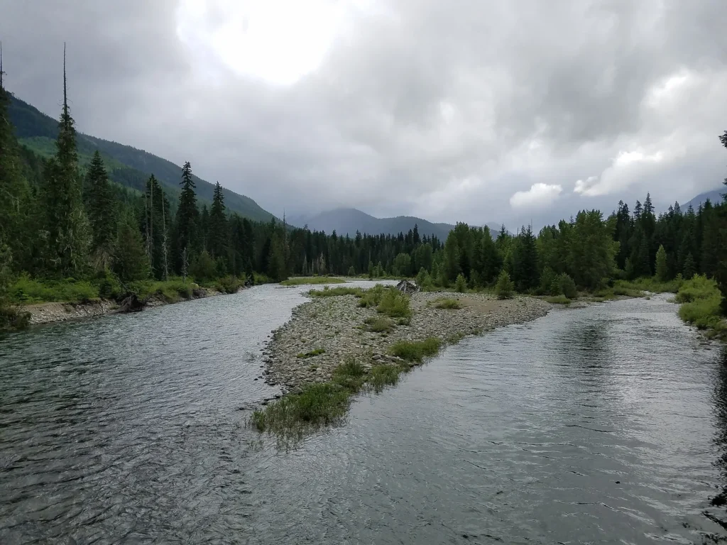
The group site is this campground’s second half. It holds up to 100 people, with its own water, picnic tables, and fire rings with grills. Check in for the group site is at 2 p.m. and check out at noon. It is the one group site on this road.
A reservation is required for it, and it books through Recreation.gov up to twelve months ahead, the longest window on this road. For a reunion or a club weekend, it is the only reservable answer on the road at that size.
The individual sites work differently. No reservation channel exists for them, and the Forest Service names none on the campground’s page. Payment is by Scan and Pay at the campground, through the Recreation.gov app. Only the group site takes reservations here.
Potable water and vault toilets serve the whole campground. Picnic tables stand at the sites, and the setting is riverbank forest where the Cle Elum River meets the head of its lake.
Red Mountain Campground
Quick facts: 10 single sites; first come only, claimed on arrival; late May to early October; no drinking water, bring water; vault toilets; $22 a night, extra vehicles $11, paid by Scan and Pay; picnic tables at the sites; 16 miles north of Cle Elum.
Red Mountain Campground is the small river campground, 10 single sites on the Cle Elum River. It sits below the top of the road, close enough to Salmon La Sac Campground to share its trailheads by a short drive. What it does not share is the crowd. Ten sites fill quietly, and many drivers pass it without knowing it exists.
Its season is the longest stated for a river campground on this road, from late May to early October. Its fee matches the road’s low end at $22 a night. There is no drinking water, so campers bring water or treat river water. Vault toilets and picnic tables are the services.
Every site is a single, so two families traveling together take two sites side by side. For a first come camper turned away at the top of the road, this is the first alternative on the way back down.
Fish Lake Campground
Quick facts: 5 walk-in tent-only sites; first come only; no drinking water; no fee; no trash receptacles, so pack out all trash; 3,350 feet.
Fish Lake Campground is the end of the line, five walk-in tent sites where the Cle Elum River fills a small mountain lake. It stands at 3,350 feet, the highest campground on this road. The road to it leaves the pavement at the top of Salmon La Sac Road and climbs 11 miles of gravel on Forest Road 4330. The drive alone filters the crowd. What waits is the quietest camping the road offers.
The lake carries two names. It was renamed from Fish Lake to Tucquala Lake, and the campground keeps the older Fish Lake name. Older maps and older searches still call both by the old name. A camper looking for this place should search both.
There is no fee, no water, and no trash service here. Campers pack out everything they pack in.
The road ends just beyond the campground at the Tucquala Meadows Trailhead. The trail from there climbs toward Tuck and Robin Lakes, in the high country above the Cle Elum River. A night at Fish Lake is the natural first chapter of that trip, or a destination in itself for anyone who values the top of a road.
Booking the Salmon La Sac road
This road has no single booking system, and the split inside its campgrounds is the fact that shapes every plan. Two of the campgrounds divide their own sites. At Salmon La Sac Campground, about 40 sites take reservations and almost 30 are first come. At Cayuse Horse Camp, reservations and first come sites mix the same way. Knowing how to claim a site at one campground does not settle the next.
Reservable individual sites book through Recreation.gov up to six months ahead. The window rolls forward daily, and new dates release at 10 a.m. Eastern. A rolling window means each morning opens one new date, six months out.
Group sites book up to twelve months ahead on the same system. Cayuse Horse Camp adds its own rules: reservations close 4 days before arrival, with a 2-night minimum on weekends and 3 nights on holiday weekends. The Cle Elum River group site is the one group site on this road, and a reservation is required for it.
Reservations carry the system’s standard terms. Cancelling two days or more before arrival costs a $10 fee. Cancelling the day before, or on the day of arrival, costs $10 and forfeits the first night. A camper who never arrives and never cancels is charged a $20 service fee and the first night as well.
The reservable sites carry a rule worth knowing before arrival. Under Forest Order 06-17-03-00-331, the units named in the order are reservation only in fact. Salmon La Sac’s Cooper River Side units 86 to 112 and the Cle Elum River group site cannot be occupied without a reservation voucher or number. An empty unit of that kind cannot be claimed on arrival. A first come camper should not count on an empty riverside unit being spare.
Red Mountain, Owhi, and the Cle Elum River individual sites take their fee by Scan and Pay. Scan and Pay runs through the Recreation.gov app, so download the app before the trip. The payment can then complete even where a phone finds no service, which is much of the upper road.
Stays have a cap. The forest’s occupancy order limits camping to 14 consecutive days in one location. After 14 consecutive days in one location, a camper must leave the forest entirely and stay away 30 days before returning, and total camping on this forest is capped at 28 days in a calendar year. Long stays are built from separate trips, not from moving site to site.
The working advice is simple. For a summer weekend, book the reservable share when the window opens. At Salmon La Sac Campground, that means booking the morning the date releases. For a first come site, arrive in the middle of the week rather than on Friday.
If the top of the road is full, work back down it. Red Mountain and the Cle Elum River sites sit minutes below, and Owhi waits up the Cooper River road.
Seasons and winter
The season runs on snow, not on the calendar. Salmon La Sac Campground opens for May through September in a normal year, and the Forest Service publishes no exact opening date. Cle Elum River runs late May to mid September.
Red Mountain runs late May to early October, and Owhi runs early June to late October. Cayuse Horse Camp opens after the snow recedes, in its listing’s own words. The high campgrounds open last, because their roads hold snow longest.
An early season stay sets its own expectations. The campgrounds open into a trail system whose upper half can hold snow well into June. A June camper sleeps in an open campground and hikes toward a snow line. Plan an early trip as a camping trip first, and let the high trails be a bonus when the snow allows.
Winter is a season here too, on different terms. The anchor campground works as a Sno-Park from December through March, under a state Sno-Park permit. Drivers report the last miles out of Roslyn icy and slow, on a road plowed only partway up. The campgrounds sleep under snow, and the road belongs to skiers, snowshoers, and snowmobiles.
Fire restrictions and emergencies
Fire follows the same pattern of a standing rule and a live check. Campfires belong in the rings provided, under whatever restriction is current, and restrictions tighten as the summer dries until they can arrive as a full ban. Firewood sells for $10 a bundle at Salmon La Sac’s host site and at Wish Poosh, and the store in Ronald sells it too. The standing lesson of this road is harsher. A single wildfire can close every developed site on it at once, because one road serves them all.
Check the Forest Service’s alerts page, the Kittitas County Fire Marshal’s burn ban page, and InciWeb before the trip, and check again from town before driving up.
Emergencies reward the same habit, a plan made before the trip. The nearest hospital is in Ellensburg, south of Cle Elum. The Kittitas County sheriff’s alerts feed and the forest’s alerts page carry changing conditions. Expect cell service to fade as the road climbs, and plan on none at the upper campgrounds. Download maps and the Recreation.gov app before leaving home, and tell someone where the car will be parked.
Camping with an RV up the Salmon La Sac road
An RV can camp on this road, but it camps without services. No public campground offers a hookup of any kind. A rig runs on its own tanks and batteries from arrival to departure. No campground here posts a maximum length, and the road itself is the practical limit, above all where the pavement ends.
The campgrounds differ in how they take a rig. Salmon La Sac Campground has some pull-through sites for larger vehicles. Cle Elum River takes trailers, and Wish Poosh takes RVs beside the lake, though its reviewers call it a tent and paddler campground first. Cayuse Horse Camp is built for stock trailers, though the newer, larger horse trailers do not fit there. The two walk-in campgrounds, Owhi and Fish Lake, take tents only.
Water is the limit to plan around. Plan on hand pumps and spigots at the water points, meant for filling jugs. Cayuse Horse Camp’s listing states the rule outright, that RV hoses do not attach. The same planning applies at the anchor. Arrive with the fresh water tank full.
The only hookups on the road belong to The Last Resort in Ronald. Its nine RV sites carry water and sewer hookups.
No public campground has a dump station, and the private park names none for passing rigs. A rig staying at a public campground should plan its dump for Cle Elum or beyond, and confirm the stop before the trip rather than on the way home. No public campground on this road has showers either. The nearest full services are back in Cle Elum and Ellensburg.
Road choice matters for trailers. Forest Road 46, the Cooper River road to Owhi, is mostly paved and workable for a careful driver. Forest Road 4330, the gravel road above the anchor to Fish Lake and Tucquala Meadows, is narrow and steep in places. It is not a trailer road.
Dispersed camping on the Salmon La Sac road
Ask campers about this road and many of them describe its pullouts, not its campgrounds. Dispersed camping, meaning camping outside a developed campground with no services provided, runs the length of the road system. For a large share of the people who camp here, camping means the pullouts. The developed campgrounds are where the rest stay.
The pattern is road by road. Pullouts line Salmon La Sac Road itself and the shore country near the lake. Forest Road 4330 climbs above the anchor for about 11 miles to Tucquala Meadows, with pullouts along the Cle Elum River. That road is narrow and steep, and it is not a road for RVs or trailers. The best pullouts go early on a summer weekend, and the midweek pattern that governs the campgrounds governs out here too.
Forest Road 46, toward Cooper Lake, is mostly paved and is the workable side for a rig. When Owhi Campground fills, its overflow goes to the pullouts on that road.
One named area anchors the west side. French Cabin Creek is a Forest Service dispersed camping area on Forest Road 4308, on the west bank of the Cle Elum River. It carries no developed services. The full treatment of dispersed camping in this country, its rules and its seasons, lives in this series’ dispersed camping guide.
The forest’s rules travel with the camper. The same stay limits apply, 14 consecutive days in one place, then off the forest entirely for 30 days before returning, with 28 days in a calendar year across the forest. Fires answer to the same restrictions as the campgrounds, checked the same way. Water, toilets, and trash service do not exist out here, and everything packed in is packed out.
Trailheads up the Salmon La Sac road
The campgrounds are one life of this road. The other is the trailheads. The pavement ends at Salmon La Sac Campground, and three trailheads leave from the road’s end at or beside the campground. The gravel road above it ends at a fourth.
A camper who sleeps at the top of the road wakes up at the door of the Alpine Lakes Wilderness. The campgrounds up here are trail bases as much as they are campsites. Parking at the Salmon La Sac and Tucquala Meadows trailheads takes a Northwest Forest Pass. The road’s hiking, in one view:
| Trail | Round trip | Elevation gain | Leaves from |
|---|---|---|---|
| Cooper River Trail | 7.8 miles | 400 feet | The road’s end |
| Waptus River Trail | 22 miles | 700 feet | The road’s end |
| Cathedral Pass Trail | 8 miles | 2,290 feet | The road’s end |
| Pete Lake Trail | 9 miles | 400 feet | The far end of Cooper Lake |
| Tuck and Robin Lakes Trail | About 12 miles | About 3,350 feet | Tucquala Meadows Trailhead |
Two rivers, two trails. The Cooper River Trail and the Waptus River Trail start close together at the road’s end, close enough that hikers mix them up in summer and winter alike. Read the sign before choosing a trail. The Cooper River Trail follows its river toward Cooper Lake, and the Waptus River Trail follows the Waptus River toward Waptus Lake and the Pacific Crest Trail. The rivers share a road and a trailhead area, and only the signs tell them apart.
Cooper River Trail. The Cooper River Trail is the gentle walk of the road’s end. It runs 7.8 miles round trip with 400 feet of gain, through old-growth forest beside a cascading river. The forest is cedar, white pine, and Douglas-fir, with vine maples that turn red and orange in autumn.
Wildflowers line the way: arrowleaf balsamroot, trillium, calypso orchids, vanilla leaf, lupine, and Indian paintbrush. Berries grow along the trail in late summer. Just after the trailhead, the trail forks. The right-hand trail climbs steeply to the rocky bluffs of Polallie Ridge. Keep left and stay close to the river.
In summer the trail draws few cars and a surprising solitude beside the cascading river. Two miles in, a riverside sitting spot makes the natural rest. The trail crosses the road 3.5 miles in and continues past a sign for Owhi Campground to Cooper Lake. Lunch spots along Cooper Lake are plentiful, and the best sit a half mile along the Pete Lake Trail, which skirts the northeast side of the lake.
Polallie Ridge. The right-hand fork at the Cooper River trailhead is the steep option. It climbs to the rocky bluffs of Polallie Ridge, and the trail runs from near the campground toward Diamond Lake. Against the Cooper River’s gentle walk, this is the climb. Trip reports find snow lingering high on the ridge well into June, and early season parties turn back in it.
Waptus River Trail. The Waptus River Trail is the long, level walk. It runs 22 miles round trip from Salmon La Sac to the Pacific Crest Trail, with 700 feet of gain and a high point of 3,100 feet. It winds through dry, open forest and past beautiful lakes in the Alpine Lakes Wilderness. Then it climbs a little before it meets the Pacific Crest Trail on a ridgeline.
Waptus Lake is the big water on the way. Few trails give this much country for this little climbing. The trail is best taken as an overnight or a long day, with a night at the lake between the hike in and the hike out. Day hikers take the first miles along the river and turn around where they please.
Cathedral Pass Trail and Peggy’s Pond. The Cathedral Pass Trail is the road’s signature climb. It leaves the trailhead at the road’s end, crosses the Cle Elum River on a bridge, and enters the Alpine Lakes Wilderness in about half a mile. It meets the Pacific Crest Trail at 4 miles.
The round trip to Cathedral Pass runs 8 miles with 2,290 feet of gain. The pass itself stands at 5,550 feet, directly beneath the spire of Cathedral Rock. Old growth forest and lakes line the climb. The trail up to the pass is a worthy destination on its own, apart from the backcountry it opens.
Squaw Lake sits 2.5 miles up the trail, a little past halfway to the pass. Peggy’s Pond lies just past the pass, reached by a rough side trail under Cathedral Rock, a small lake set in a cirque of rock and meadow. Snow lingers high on this trail well into June. An early season hiker should expect the pass to hold snow when the campground below is already open.
Mount Daniel. Above Peggy’s Pond, a scramblers’ route climbs the southeast ridge of Mount Daniel, following bootpaths between the rocks. It is a scramble, not a maintained trail, and it fills a whole day from the trailhead. Climbers commonly camp at the pond and climb from it in one long day.
We made that climb in August 2016, from Peggy’s Pond up Mount Daniel. Peggy’s Pond and the climb above it are the country we know best on this road. A climber needs a map, good weather, and an early start. The reward is the whole of the Alpine Lakes laid out below.
Pete Lake. The Pete Lake Trail starts where the Cooper River Trail ends, at the far end of Cooper Lake. It follows the Cooper River 4.5 miles to its headwater lake, through diverse old-growth forest. It ends at an alpine lake in the shadows of Big Summit Chief and Chimney Rock.
The round trip runs 9 miles with 400 feet of gain, and the high point is 3,200 feet. It is the mildest long walk on this road, a trail with something to offer hikers, campers, children, and birders alike. The Tired Creek Trail, quiet and steep, leaves it 1.2 miles from the trailhead. Past the lake, the trail continues east to a junction just before the Pacific Crest Trail. Pete Lake is a back door to the PCT as well as a destination.
Tucquala Meadows and Tuck and Robin Lakes. Forest Road 4330 ends at the Tucquala Meadows Trailhead, 11 miles of gravel above the anchor campground. The Deception Pass Trail leaves from it and passes Hyas Lake in its first miles. Hyas Lake gives the walk its first big view, Cathedral Rock across the water. The Deception Pass Trail continues past the junction toward Deception Pass itself and the Pacific Crest Trail.
Four miles from the trailhead, a signed junction turns right onto the Tuck and Robin Lakes Trail. Tuck Lake waits after a mile of increasingly steep climbing, a quiet pool in a granite basin. Past Tuck Lake, the trail grows harder to follow, marked by cairns. It climbs another 0.7 mile and 800 feet to the Robin Lakes. The Robin Lakes sit in a granite basin with big views across the Alpine Lakes.
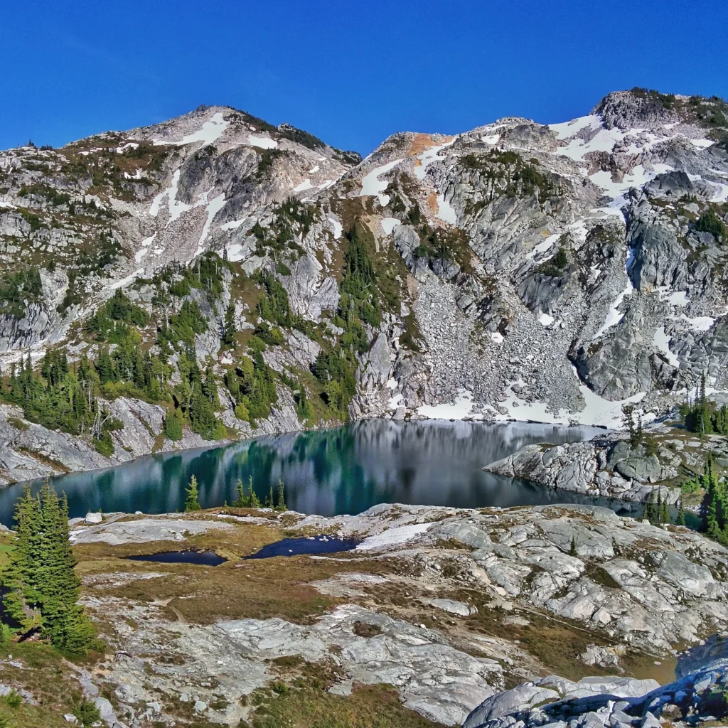
The round trip runs about 12 miles with about 3,350 feet of gain. Campfires are prohibited above 5,000 feet in the Alpine Lakes Wilderness, so the lakes are a stove-only camp. We came to Tuck and Robin Lakes by this same road system, on another trip. The same trailhead serves the Marmot and Jade Lakes country. Trip reports on WTA describe the lot as full on summer weekends, and an early start is the pattern.
Passes and rules. A Northwest Forest Pass covers parking at the Salmon La Sac and Tucquala Meadows trailheads, and at the Pete Lake lot at the far end of Cooper Lake. No pass is required to camp; at the campgrounds, the nightly fee is the charge. The trails enter the Alpine Lakes Wilderness as they climb, and wilderness rules follow. Campfires are prohibited above 5,000 feet, and food must be stored against bears anywhere in this forest.
Planning the hike from camp. The campgrounds sort themselves by trailhead. Salmon La Sac Campground puts the Cathedral Pass, Cooper River, and Waptus River trails at the door. Fish Lake Campground puts the Tucquala Meadows trails at the top of the same gravel road. Owhi Campground puts the Cooper River Trail at the lake’s edge, and the Pete Lake Trail just beyond it.
The Tucquala Meadows lot fills early on summer weekends, and an early start serves the road’s end trailheads too. Check WTA and the forest’s alerts page before the trip, and check again from town before driving up. In winter the road’s end works on snow. The Cooper River snowshoe follows the groomed road through the campground to the river trail, 8 miles round trip to Cooper Lake. A summer weekend booking at the anchor comes with a bonus. The trailheads sit at their quietest on the weekday mornings at either end of the stay.
Backpacking up the Salmon La Sac road
The trails at the top of this road run two kinds of trip. From the campgrounds they are day hikes, out to a lake or the pass and back by dinner. With a pack, the same hike in ends at a camp beside a lake, and the trail runs on past the camps into bigger country. A backpacking trip here starts at a trailhead, not at a campground. The car stays in the lot for the nights the party is out, and the hike does the rest.
The permit. An overnight stay in the Alpine Lakes Wilderness takes a wilderness permit, and on this side of the wilderness the permit is a form, not a reservation. From May 15 to October 31, backpackers fill out the free, self-issued permit at the trailhead before hiking in, and the same permit covers day hikes in the season. No lottery and no quota stand in the way. Groups cap at 12, counting people and stock together.
The lottery hikers hear about belongs to the Enchantments Permit Area near Leavenworth, and no trailhead on this road enters it. Permit rules are the forest’s to change, so check the current rules on the Forest Service’s Alpine Lakes Wilderness page before a trip.
The two trips share the road and little else. The campground trip sleeps at a site, and these trails fill its days. The backpacking trip sleeps out at the lakes, and the campgrounds play no part in it. What the overnight trip needs from the road is a trailhead lot that can hold a car for the length of the trip, and that need drives the parking rules below.
Parking for the hike in. A day pass covers a single day, running to midnight of the date written on it. A car left at a trailhead lot for the nights of a backpacking trip needs a day pass for each day it sits there, with the passes on the dashboard. The annual pass covers the same ground for a year, through the end of the month it was bought. Pete Lake’s lot takes the same pass, a third trailhead lot on this road. The tight lot is Tucquala Meadows, at the top of the gravel road. It fills early, and we once saw what a crowded day there can do, a car in the ditch by the lot after a poor parking choice.
First overnights. Four lakes carry the first overnights on this road: Waptus Lake, Pete Lake, Peggy’s Pond, and the Robin Lakes. Waptus Lake is the classic first night out on this road. The Waptus River Trail runs long and gentle, and its big lake is a visit on a day hike and a camp on an overnight. A night at the lake cuts the long walk into two level days, and the Pacific Crest Trail junction beyond the lake stays open to trips that keep going. Both this lake and Pete Lake take a single night well, and both stretch to two for a slower trip.
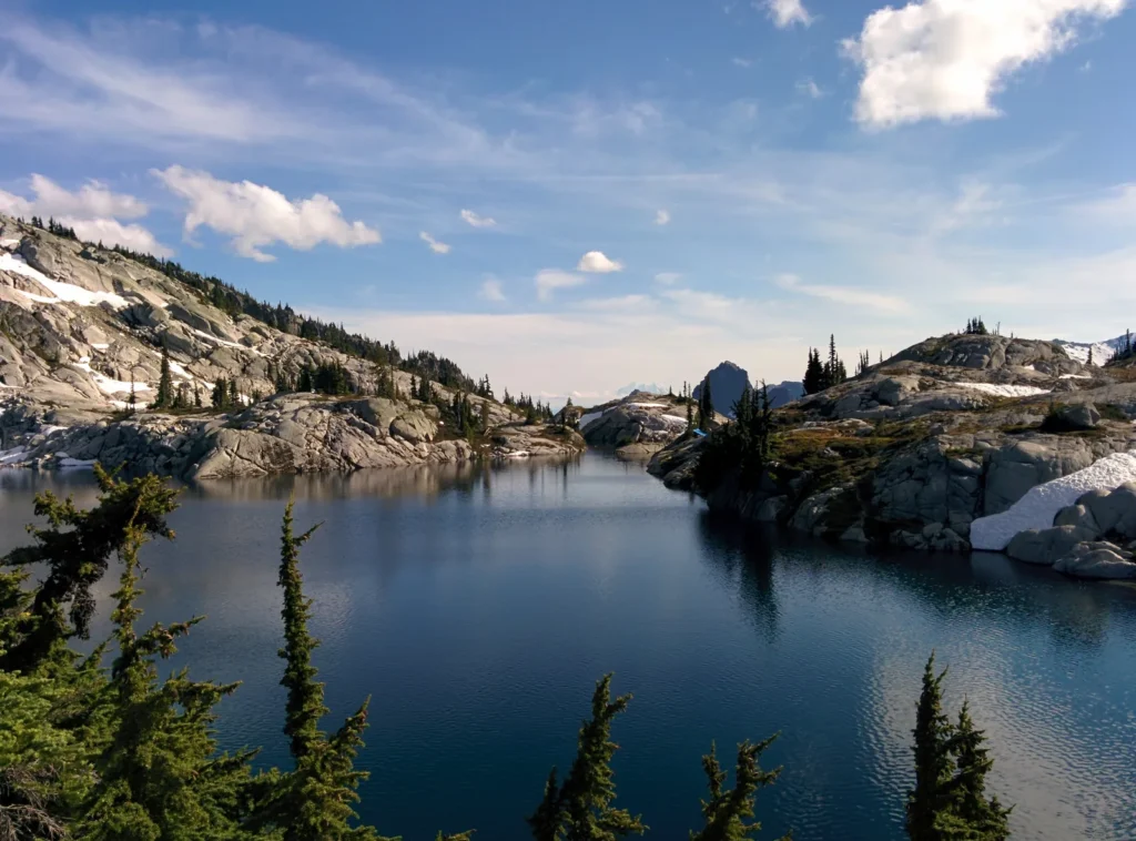
Pete Lake is the gentlest of the four. Its trail barely climbs, running through old growth to an alpine lake suited to a first backpack or a short trip with children. A first backpack at this scale is where the pattern starts, and its return is documented, in better focus, mood, and sleep in children, the measured effects of time outside, gathered in our research guide.
Peggy’s Pond is the climb of the four. Its trail crosses the pass, and the pond sits just beyond it, a small lake in a rock cirque under the spire. The pond is the camp for the Mount Daniel scramble above it, the climb we made in August 2016 from a camp at the pond.
Tuck and Robin Lakes ask the most. From Tucquala Meadows the trail climbs through Tuck Lake to the Robin Lakes in their granite basin, the steepest finish on this road, and one we know from another trip up it.
Longer trips. The first overnights are not the ceiling here. Three of these trails meet the Pacific Crest Trail. The Waptus River Trail ends at it, the Cathedral Pass Trail joins it just past the pass, and the Deception Pass Trail reaches it beyond Tuck and Robin. A backpacker can hike in from this road, join the PCT, and hike out somewhere else entirely, or keep going on the Pacific Crest Trail. These lakes are the first step into that bigger country.
Rules that carry over. The wilderness rules in the Trailheads section carry the most weight overnight. The campfire ban turns the high camps, Peggy’s Pond and the Robin Lakes, into stove camps. Food storage against bears matters most where a camp sleeps. Dogs can come along on this side of the wilderness.
The high country opens later than the campgrounds do. Snow holds the high trails into June, so the first trips of the year stay low. Waptus Lake and Pete Lake open the backpacking year on this road, and the pass and the high basins follow as the snow leaves.
Frequently asked questions
Do I need a reservation at Salmon La Sac Campground? No. About 40 of its 69 sites take reservations, and almost 30 are first come. One part is the exception. The Cooper River Side units 86 to 112 are reservation only, even when they stand empty. New dates release at 10 a.m. Eastern six months out, so for a summer weekend, reserve the morning yours opens or arrive in the middle of the week.
When does Salmon La Sac Campground open? Its season runs May through September, and it is closed to camping from October through April. The Forest Service publishes no exact opening date. In a normal year it opens in May as conditions allow. Check the campground’s Forest Service page in spring for the current year.
Is there a dump station or hookups anywhere on the road? Not at any public campground. The only hookups on the road are the water and sewer connections at The Last Resort’s nine RV sites in Ronald. A rig staying anywhere else should plan its dump for Cle Elum or beyond.
Can I camp at Speelyi Beach? No. Speelyi Beach, beside Wish Poosh Campground on Lake Cle Elum, is day use only. A forest order prohibits camping there. Wish Poosh is the overnight campground beside it.
Do I need a pass to camp on this road? No pass is required to camp. The nightly fee is the charge. A Northwest Forest Pass covers parking at the trailheads, including Salmon La Sac and Tucquala Meadows. A state Sno-Park permit covers the anchor campground’s winter season. The Discover Pass is a state lands pass, and it does not apply anywhere on this road.
Which campgrounds have drinking water? Salmon La Sac, Cayuse Horse Camp, and Cle Elum River have drinking water. At Cayuse it comes by handpump and spigot. At Salmon La Sac it comes from hand pumps, and reviewers warn the pumps do not take an RV hose fitting. Wish Poosh’s water system has been unreliable, so bring water there. Red Mountain, Owhi, and Fish Lake have no drinking water at all.
Can I bring my horse? Yes, at Cayuse Horse Camp, the one campground on this road built for stock. It has 14 sites with one corral each, room for 3 horses at a single site and 4 at a double, and no high-lining or hobbles. The other campgrounds are not set up for stock.
What do I do if the campgrounds are full? Work back down the road rather than driving home. Red Mountain and the Cle Elum River sites sit minutes below the top, and Owhi waits up the Cooper River road. The Last Resort in Ronald takes rigs and tents. Beyond the campgrounds, the dispersed pullouts described above are the road’s last answer. Next time, book the reservable share earlier, or come midweek.
Sources
Checked November 2026. Okanogan-Wenatchee National Forest campground pages for Salmon La Sac, Wish Poosh, Cayuse Horse Camp, Cle Elum River, Red Mountain, Owhi, and Fish Lake, fs.usda.gov. Their listings sit on recreation.gov for Salmon La Sac, Wish Poosh, Cayuse Horse Camp, and the Cle Elum River Group Site. Forest Service alerts and orders for the Cle Elum Ranger District, including Forest Orders 06-17-03-00-331 and 06-17-00-25-01, fs.usda.gov.
The Last Resort, thelastresort.us. Kittitas County Fire Marshal burn ban page and Kittitas County Sheriff’s Office alerts. Washington Trails Association, its Roslyn feature and the Cathedral Rock, Cooper River, Waptus River, Pete Lake, Robin Lakes, and Cooper River Snowshoe hike pages and trip reports, wta.org. The Mountaineers, its Pete Lake and Pete and Spectacle Lakes route pages, mountaineers.org. InciWeb for wildfire information, inciweb.wildfire.gov. The Forest Service’s Alpine Lakes Wilderness page and its Alpine Lakes Wilderness Regulations Booklet, fs.usda.gov.