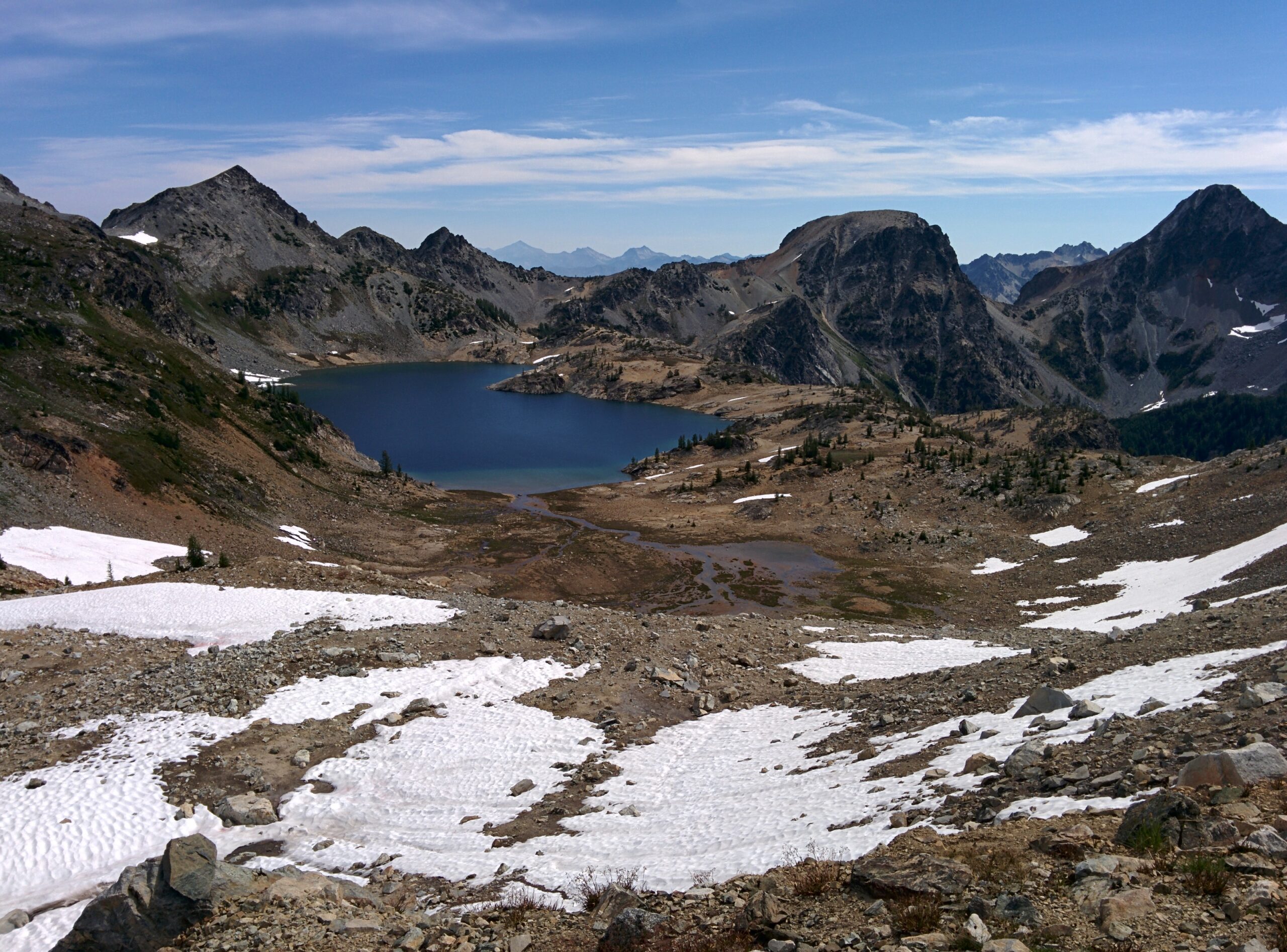
Entiat camping runs up one river valley on the dry east slope of the Cascades. The town of Entiat sits on the Columbia River where the Entiat River comes down out of the mountains. A single road follows the river about 38 miles to its end below the Glacier Peak Wilderness. Two managers run every campground in the valley, and the City of Entiat runs one full-service park on the Columbia shore at the mouth. The Forest Service runs a string of campgrounds up Entiat River Road, from Pine Flats at mile 14 to Cottonwood at the road’s end.
Fire sets the terms of a trip here right now. The 2026 Little Giant Fire burned across the head of the valley. Under the current Forest Service closure order, the upper road and the Forest Service campgrounds from Fox Creek to the road’s end stand closed, through April 30, 2027 unless rescinded sooner. Pine Flats, the lowest campground on the road, stands outside this closure, and the city park at the mouth is a separate city system. The Forest Service’s Okanogan-Wenatchee alerts page carries the order’s current state, and it is the check to make before any trip up the valley.
The entries follow the road itself, from the city park at the mouth to Cottonwood at the road’s end. The Entiat is one of the valleys gathered in the Central Cascades camping guide.
In this guide
Entiat camping at a glance
Every campground in this guide sits in the table below, in the order the entries in this guide treat them. The status column carries each campground’s state under the current forest order, so the table and the entries agree.
| Campground | Manager | Sites | Booking | Status |
|---|---|---|---|---|
| Entiat City Park | City of Entiat | 31 RV sites and 26 tent sites | Reservations through CampSpot | Runs on the city’s own season, March 16 to November 13 |
| Pine Flats Campground | Forest Service | 6 sites plus a group site | First come; the group site by reservation | Stands outside the current forest order closure |
| Fox Creek Campground | Forest Service | 16 sites | First come | Closed under the current forest order through April 30, 2027 |
| Lake Creek Campground | Forest Service | 18 sites | Half reservable, half first come | Closed under the current forest order through April 30, 2027 |
| Silver Falls Campground | Forest Service | 31 sites plus a group site | First come; the group site by reservation | Closed under the current forest order through April 30, 2027 |
| North Fork Campground | Forest Service | 8 sites | First come | Closed under the current forest order through April 30, 2027 |
| Spruce Grove Campground | Forest Service | Day use only | No camping | Closed to overnight camping; the day use site stands inside the current closure |
| Three Creek Campground | Forest Service | One group site | Reservations through Recreation.gov | Closed under the current forest order through April 30, 2027 |
| Halfway Springs Camping Area | Forest Service | 4 tent sites | No reservations | Closed under the current forest order through April 30, 2027 |
| Cottonwood Campground | Forest Service | 25 sites | First come | Closed under the current forest order through April 30, 2027 |
| Big Hill Campsite | Forest Service | 1 dispersed site | No reservations | Closed under the current forest order through April 30, 2027 |
The current closure order for the Little Giant Fire is in force. It closes Entiat River Road in its upper reach and every Forest Service campground from Fox Creek at mile 27 to Cottonwood at the road’s end, through April 30, 2027. The Shady Pass Road sites above the valley close under it too. It does not reach Pine Flats at mile 14, and it does not reach the city park, which the city runs on its own land at the mouth. Before any trip, check the order’s state on the Forest Service’s Okanogan-Wenatchee alerts page, because a rescinded or replaced order changes this picture at once.
Supplies follow a three-points-then-nothing pattern. Entiat, at the mouth, has groceries and fuel on US-97A. About 10 miles up the road at Ardenvoir, Cooper’s General Store and Cafe sells gasoline, groceries, and camping supplies; its listing shows limited hours and closed days midweek. Above Ardenvoir there is no purchasable supply of any kind for the remaining 28 miles, past all eight Forest Service campgrounds. Stock up in Entiat, treat Cooper’s as a thin second chance, and carry everything past mile 10.
Carry your drinking water. The Forest Service’s own pages conflict about water at Fox Creek, and the district has said in its season announcements that no drinking water is available at its campgrounds. The safe reading is the simple one. Fill containers in Entiat, treat any campground water as seasonal and check-first, and plan as if no tap on the river road will run. Water is certain only at the city park’s full-service RV sites, and they sit at the wrong end of the valley for a party already camped at mile 30.
Three absences shape every Forest Service plan on this road. No Forest Service campground in the valley has showers, hookups, or a dump station. Entiat City Park holds the valley’s only set of each. An RV trip up the road is dry camping, with tanks filled before arrival and a dump stop back at the mouth.
Three reservable rentals stand in the valley and take no entry here, because they are not campgrounds. Tyee Lookout and Steliko Lookout rent by the night through Recreation.gov, and Cottonwood Cabin rents beside Cottonwood Campground. Daroga State Park and Beebe Bridge Park sit on the reservoir shore outside the valley, and this guide names them only to close the map. The valley’s one named dispersed site, Big Hill Campsite, stands above the valley on Shady Pass Road and takes its own treatment below. No designated dispersed camping area stands on Entiat River Road itself.
Passes, fees, and booking
Forest Service campgrounds
Most camping on Entiat River Road takes no reservation at all. The individual campgrounds are first come, and a driver takes an open site on arrival. Lake Creek Campground splits its 18 sites in half, 9 reservable through Recreation.gov and 9 first come. The Pine Flats Group Site, the Silver Falls Group Site, and Three Creek Campground are reservable through Recreation.gov. Those three group sites run on a 12 month rolling booking window.
The settled fees are these. Pine Flats and Fox Creek each cost $15 a night. Lake Creek costs $15 a night, with its 2027 season running May 23 to September 8 and its availability releasing on November 23, 2026.
The Pine Flats Group Site costs $75 a night for its season of April 25 to October 27, 2027. The Silver Falls Group Site costs $125 a night for May 23 to October 27, 2027, and Three Creek costs $40 a night for May 30 to September 29, 2027. No current nightly fee for Silver Falls’ individual sites or for Cottonwood appears on the managers’ own pages. This guide gives none rather than borrow a figure from a roundup. Recreation.gov carries Pine Flats, Fox Creek, Silver Falls, and Cottonwood as Scan and Pay facilities.
One forestwide rule binds every camp in this valley, developed and dispersed alike. A forestwide food storage order, in effect through June 30, 2029, requires food, food containers, and related refuse to be stored to its standard. The storage forms are a certified bear-resistant container, the inside of a hard-sided vehicle, or behind an approved operating electric fence. Food stays attended while it is being prepared or eaten, and feeding wildlife is prohibited. The Entiat Ranger District office is closed for staffing, and the district directs visitors to the Chelan Ranger District at (509) 682-4900.
No pass pays a camping fee anywhere in the valley. Passes matter here only at trailheads, where the hiking section below carries the parking forms for the Silver Falls and Entiat River trailheads. The Discover Pass is a state pass and is not valid on national forest land.
Entiat City Park
The city park runs on a different system entirely. The City of Entiat takes reservations through CampSpot only, online, and accepts no cash for camping reservations. Reservations for the 2027 season open on January 1, 2027.
A cancellation made 7 days or more before arrival refunds everything except the $7 reservation fee. Inside 7 days, the refund also loses the first night, and a no-show gets no refund. Changing a reservation costs $15. Holiday weekends, Memorial Day, the Fourth of July, and Labor Day, carry a two night minimum, and the city suggests booking early for holiday weekends and for July and August. The park’s full 2026 rate schedule sits in its entry below.
Entiat City Park
Quick facts: closed under no forest order, a city park on its own land outside the forest closure; season, March 16 to November 13; sites, 31 RV sites and 26 tent sites on 40 acres of Columbia riverfront, 29 of the RV sites full-service and 2 without sewer; potable water, at the full-service RV sites; restrooms, restroom facilities; showers, coin-operated, the only showers in the valley; campfires, fire pits at the RV sites; check-in 3 p.m., check-out 1 p.m.; booking, reservations through CampSpot only; nightly cost, RV sites $65, the two sites without sewer $40 in the shoulder season and $55 in the main season, tent sites $25 in the shoulder season and $35 in the main season, with a $7 reservation fee and $10 for an extra vehicle; pets, dogs allowed under the city’s 2017 park operating policies, on a leash and under the owner’s control at all times, never left unattended, with owners picking up and disposing of their refuse; dump station, $5 a visit, the only dump station in the valley; boat launch, $5 for non-campers and free to campers; resupply, groceries, cafes, and fuel in Entiat within 2 miles; emergency readiness, the shortest leg in this guide, with Wenatchee the hospital town down US-97A.
Entiat City Park is the valley’s inversion, a full-service municipal campground on the Columbia at the mouth of a valley whose other campgrounds run on vault toilets and carried water. The park spreads across 40 acres of open riverfront where the Entiat River meets the Columbia. Its 29 full-service RV sites carry water, sewer, and 30 and 50 amp electric, and its 26 tent sites sit in the same open layout, open grass where a family can spread the big tent our family tents guide sizes for a serviced base. Campers who review the park name its tradeoff in the same terms again and again. The layout is open and grassy with limited shade and little privacy between sites, and in exchange it delivers every service the road above it lacks.
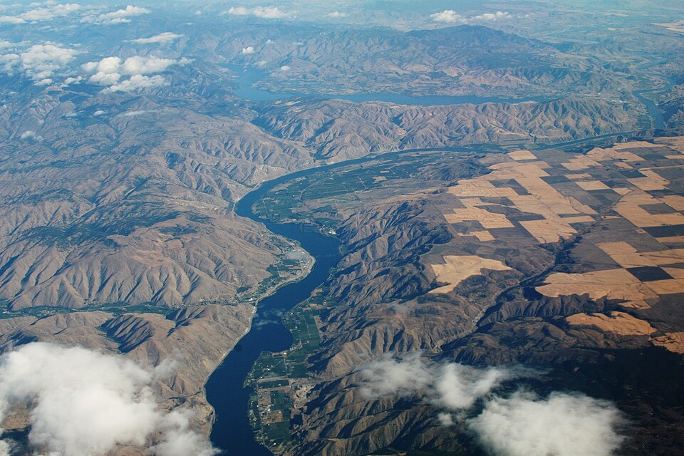
A boat launch and dock serve the reservoir, with swimming and beach use on the shore. An accessible waterfront trail, a playground, and a rentable picnic shelter fill out the day use side. Picnic tables and fire pits stand at the RV sites. Seniors and veterans take $10 a night off with proof, and an annual launch pass costs $10 for city residents and $30 for non-residents. The picnic shelter rents for $25 to city residents and $50 to $225 to non-residents, by group size.
The park’s season runs in two price blocks. The main season runs from May 1 through Labor Day, and the shoulder blocks flank it, April 1 to April 30 and the Tuesday after Labor Day to October 30. Tent sites and the two RV sites without sewer step down in the shoulder blocks, while the full-service RV sites hold at $65 in both. A camper with flexible dates buys the same riverfront for less in April or after Labor Day, with the town’s grocery store, cafes, and restaurants within 2 miles either way.
For an RV trip, this park is the valley’s answer. It holds the only hookups, the only showers, and the only dump station in the Entiat valley, and it doubles as the resupply-side base for the road above it. The park sits inside the incorporated city, and inside Chelan County’s emergency alert system with it. A party can sleep here with full services and day-trip the river road, or use the park as the service stop around dry camping on the road above. Either way, every serviced night in this valley happens at this park.
Campgrounds on Entiat River Road
Entiat River Road starts as Chelan County Road 19 at US-97A and becomes Forest Road 5100 at about mile 27, with the pavement ending at about mile 34. The eight Forest Service campgrounds on it share a form. The seven overnight campgrounds run on vault toilets, with no hookups, no showers, and no dump station, and each entry below carries its own trailer maximum where one is settled.
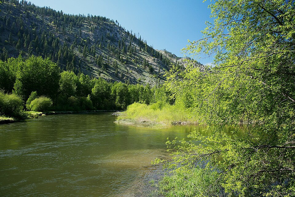
Two stops stand on the road itself. Box Canyon, the valley’s geology stop, sits at about mile 27.8, and Entiat Falls stands roadside a short distance above Silver Falls. The closure draws the road’s current line at Fox Creek. Every campground from Fox Creek to the end stands closed under the current forest order, and Pine Flats, below the closure’s reach, does not.
Pine Flats Campground
Quick facts: sites, 6 individual sites at 1,600 feet, at mile 14 on Entiat River Road near the Mad River, plus one group site; restrooms, vault toilets; showers, none; booking, individual sites first come, and the group site by reservation only through Recreation.gov; site character, forested sites under old ponderosa pine, with the Lower Mad River Trailhead inside the campground; maximum trailer length, 28 feet; resupply, about 4 miles above Cooper’s General Store and Cafe at Ardenvoir, with Entiat about 14 miles down the road; nightly fee, $15 for the individual sites, and $75 for the group site.
Pine Flats Campground anchors the lower valley. It sits at mile 14, where the Mad River comes down to meet the Entiat, and its six sites spread under old ponderosa pine at 1,600 feet. The Forest Service’s Mad River Trail page describes quiet campsites with native wildflowers. It is the closest Forest Service campground to town, and the only one with a trailhead inside the campground itself. A party sleeping here has already passed the last supply point, 4 miles back at Ardenvoir, so the lower valley’s convenience is relative.
The campground doubles as the front door to the Mad River trail system, because the Lower Mad River Trailhead stands inside it. It is also the one Forest Service campground on this road that the current fire closure does not reach. Pine Flats stood in earlier closure orders for the Little Giant Fire and stands outside the current closure order, so its normal seasonal form governs. That position can change with a new order, and the alerts page check in this guide’s opening applies here as much as anywhere.
The group site rides inside the same campground. It takes up to 40 people and 20 vehicles, with a 28 foot maximum trailer length, two vault toilets, and campfire rings. It is reservation only, at $75 a night, on a 12 month rolling window, with its 2027 season running April 25 to October 27. A group that wants the lower valley to itself books this site and gets the Mad River trailhead at its door.
Fox Creek Campground
Quick facts: closed under the current forest order through April 30, 2027, with the Forest Service alerts page as the check; sites, 16 sites at 2,000 feet, at mile 27 on the north bank of the Entiat River; restrooms, vault toilets, with garbage service; showers, none; booking, first come; site character, a single loop under grand cedar and ponderosa pine, with sites well spaced along the river; maximum trailer length, 28 feet; resupply, 17 road miles above Ardenvoir, so carry everything; cell service, reported unreliable; nightly fee, $15.
Fox Creek Campground is the valley’s shade campground, and the first campground the closure reaches. Its single loop hugs the north bank of the Entiat River at mile 27, just where the county road becomes Forest Road 5100. Its 16 sites sit under grand cedar and ponderosa at 2,000 feet. An older Forest Service survey called it the most RV-friendly campground on the Entiat River, and its 28 foot trailer maximum and spaced sites still suit that reading. Campers describe a peaceful, uncrowded campground, and the valley’s thin review record holds no report of Fox Creek full, or of a party turned away from it.
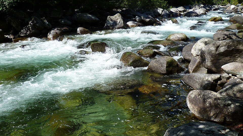
Two cautions ride with the campground in season. Riverside sites have closed early in a season for snowmelt high water, so a low site in a wet spring is a poor bet. And Fox Creek carries no water promise. The Forest Service’s own pages disagree about water here, which is exactly the conflict this guide’s valley-wide instruction exists to settle. Carry your water, and let the campground be what it is, a shaded loop on the river.
The river is also the campground’s soundtrack. The older Forest Service survey records the Entiat River audible throughout the campground, and no road or rail noise pattern competes with it in this valley. Box Canyon, the valley’s geology stop, stands at about mile 27.8, less than a mile up the road. That makes Fox Creek the natural base for the short side trip in an open season.
Lake Creek Campground
Quick facts: closed under the current forest order through April 30, 2027, with the Forest Service alerts page as the check; sites, 18 sites at 2,200 feet, at about mile 28 along the Entiat River; restrooms, vault toilets, with garbage service; showers, none; booking, 9 sites reservable through Recreation.gov and 9 first come, the valley’s only split campground; nightly fee, $15, with the 2027 season running May 23 to September 8 on a 6 month rolling window and availability releasing November 23, 2026 at 7:00 a.m. PST; maximum trailer length, 28 feet; site character, sites along the river with the Lake Creek Trailhead adjacent; resupply, about 18 road miles above Ardenvoir; cell service, reported absent.
Lake Creek Campground is the valley’s only split-booking campground, and the only individual campground where a planner can hold a site in advance. Half of its 18 sites take reservations through Recreation.gov and half stay first come, a shape no other individual campground on this road offers.
The sites sit above the river, with views down to it on the roundup accounts. The campground sits at about mile 28 at 2,200 feet, and the Forest Service’s page for it carries the fire closure banner while the current order runs. This Lake Creek is the Entiat River campground. A different Lake Creek Campground on the Little Wenatchee River belongs to the Lake Wenatchee guide, and the two share nothing but the name.
Its second asset is the trailhead beside it. The Lake Creek Trailhead opens Trails 1443, 1444, and 1448 to hikers, mountain bikes, and motorcycles. No other campground on the road pairs with a motorized and bike web directly. The Forest Service’s page for the campground sells exactly that pairing, scenery and access to hiking, dirt biking, and mountain biking, with the campsites strung along the river. A party that wants to ride or hike the side drainages and sleep at a reservable individual site has this one option on the road, in an open season.
What campers report from the campground itself is plainer. They describe no-frills camping, sites spaced at comfortable intervals, and an access road that turns rough before camp. That is the whole texture the record holds for Lake Creek, and this entry leaves it there.
Silver Falls Campground
Quick facts: closed under the current forest order through April 30, 2027, with the Forest Service alerts page as the check; sites, 31 sites in two loops at 2,400 feet, at mile 30 on the Entiat River, plus one group site; restrooms, vault toilets, with garbage service; showers, none; booking, individual sites first come, and the group site by reservation; maximum trailer length, 28 feet at the individual sites and 35 feet at the group site; site character, forested sites on the banks of the Entiat River, with the Silver Falls National Recreation Trail across the road and a shorter interpretive trail inside the campground; resupply, 20 road miles above Ardenvoir; cell service, none, settled on the Forest Service’s own host recruitment notice for this campground.
Silver Falls Campground is the largest Forest Service campground on the road and the valley’s frontcountry hiking anchor. Its two loops hold 31 sites at 2,400 feet. The Silver Falls National Recreation Trail starts across the road from its entrance, with a shorter interpretive trail inside the campground itself. The Forest Service’s 2026 notice recruits a campground host for Silver Falls, May 11 to September 16, the one host recruitment on the road in the record. Its individual nightly fee appears on no manager page, so this guide gives none.
The group site rides inside the same entry. It requires reservations and takes up to 60 people and 30 vehicles, with a 35 foot maximum trailer length. It carries a picnic shelter with a fireplace, accessible toilets, and no electricity or water. It costs $125 a night, with its 2027 season running May 23 to October 27 on a 12 month rolling window. A reunion or a club outing that wants the falls at its door books this site, in a season when the road is open.
Its loops stand in forested mountain terrain on the banks of the river. The interpretive trail inside the campground gives a party with children or a short evening a walk that stays home. A walk that stays home still counts toward the total, because the benefits of time outside accrue in short, close-to-camp hours as well as on long trails. Between the falls trail across the road, the interpretive trail inside, and the river at the sites, a party can fill two days here. Silver Falls is the one campground on this road where that works without starting a vehicle.
North Fork Campground
Quick facts: closed under the current forest order through April 30, 2027, with the Forest Service alerts page as the check; sites, 8 sites at the confluence of the North Fork Entiat River and the main river, at about mile 33, just past Entiat Falls; restrooms, one vault toilet; showers, none; booking, first come; resupply, 23 road miles above Ardenvoir.
North Fork Campground is the quiet upper-valley campground, and the least documented one in this guide. Its 8 sites sit where the North Fork comes down to the main Entiat River, just past Entiat Falls, the roadside falls stop a short distance below it. The elevation is about 2,500 feet. The Forest Service’s closure orders settle its existence and its developed form by name, and almost everything else about it is thinly documented, so this entry stays short and fact-led. It takes no reservation.
Roundup accounts describe a gate that can stand closed in the fall, with camping still permitted by parking outside and walking in, and some sites growing over between visits. Treat both details as reported rather than settled.
One firsthand account of a stay here after the fires describes winter and fire debris across the sites, and burned, fire-weakened trees standing over them. It also found the narrow road below the campground prone to flooding. That is a reported condition from one party’s stay, not a settled state of the campground. A party heading for North Fork in any open season checks current conditions first and picks its site with the trees above it in mind.
Spruce Grove Campground
Spruce Grove Campground stands in road order at mile 34, where the pavement ends, and it takes a short treatment because nobody sleeps here. The campground held 2 sites along the river at about 2,900 feet, with trailers not recommended. The Forest Service closed it to overnight camping because of wildfire impacts, a closure its district reports have carried since 2016, in the Wolverine Fire era. The Forest Service’s 2026 closure orders carry the place as Spruce Grove Day Use Site, which is its standing form. A decade on, the name still draws campers up the road looking for a site that is not one.
While the current forest order runs, the day use site stands inside the closure. Once the order lifts, Spruce Grove is a day stop, not a night one. Its service state is unsettled in the Forest Service’s own forms, which disagree about whether any toilet or service stands there. A day visitor checks conditions first and counts on nothing. In season, the nearest campgrounds that take campers are North Fork, about a mile back down the road, and Fox Creek, 7 miles down, both inside the current closure.
Three Creek Campground
Quick facts: closed under the current forest order through April 30, 2027, with the Forest Service alerts page as the check; sites, one group site at about mile 36 on the upper Entiat River, for 20 to 30 people with space for up to five trailers, in three separate tent or trailer areas; restrooms, accessible vault toilets, with a dumpster; campfires, campfire rings; booking, reservations through Recreation.gov on a 12 month rolling window; nightly fee, $40, with the 2027 season running May 30 to September 29; resupply, 26 road miles above Ardenvoir.
Three Creek Campground is the upper valley’s group campground, the last developed stop before Cottonwood. Some Forest Service reporting spells it Three Creeks, and the closure orders’ form, Three Creek, governs here. The campground takes a whole group on one reservation, with picnic tables and room to spread across its three areas.
The stretch of river at the campground sits above Entiat Falls, where the state’s fishing rules run on selective gear. Any fishing party checks the current state rules before it casts. In May 2026, when a landslide blocked the road’s end, the Forest Service directed visitors to use this campground as the turnaround. It is a dated piece of road history, and it tells a driver how the upper road behaves in a slide year.
Halfway Springs Camping Area
Quick facts: closed under the current forest order through April 30, 2027, with the Forest Service alerts page as the check; sites, 4 tent sites at 5,000 feet, 6 miles up Forest Road 5900 from about mile 28.5 on Entiat River Road; water, none; trash service, none, and all garbage packs out; trailers, not recommended.
Halfway Springs Camping Area is a rustic camping area on Shady Pass Road, above the valley floor on the way toward Shady Pass. The Forest Service lists it among the district’s camping areas. Its own page for the site carries the fire closure banner, and the current forest order names it among the closed campgrounds. A camper counts it as part of the road system above the valley, closed with the rest of that system while the order runs.
Cottonwood Campground
Quick facts: closed under the current forest order through April 30, 2027, with the Forest Service alerts page as the check; sites, 25 sites at 3,070 feet, at mile 38, the road’s end, beside the Entiat River Trailhead; restrooms, vault toilets, with garbage service on the campground’s standing form; showers, none; booking, first come; maximum trailer length, 28 feet; site character, the road-end campground in mature lodgepole pine and spruce country, at the door of the Glacier Peak Wilderness east side; resupply, 28 road miles above Cooper’s at Ardenvoir, the longest resupply leg in the valley; cell service, none on the Forest Service’s destinations form.
Cottonwood Campground is the road’s end campground. The road ends here, at 3,070 feet. The campground’s 25 sites stand beside the Entiat River Trailhead, the door to the Entiat River Trail, the Ice Creek Trail, and the east side of the Glacier Peak Wilderness. The Entiat River Trail backpacking in the hiking section below starts at this trailhead.
The pavement gives out at about mile 34, so the last miles in are unpaved Forest Road 5100. The campground’s settled character is remoteness and quiet at the end of a long, supply-free drive. In an open season it is the one a party reaches only after committing to the full 28 miles above Ardenvoir, with no purchasable supply on the way.
The valley’s headwall stands above it, Mount Maude, Seven Fingered Jack, and Mount Fernow, all in the 9,000 foot class.
The reservable Cottonwood Cabin stands adjacent to the campground. It is a rental, named here so nobody mistakes it for part of the campground, and it takes no entry in this guide.
The Forest Service’s page for Cottonwood describes walk-in only access over a road washout, with no water or trash service and no fee charged for the season. In May 2026 the Forest Service reported a major landslide about a quarter mile from the end of the road. A temporary route through the slide served high-clearance vehicles only, trailers were not permitted, and Three Creek Campground was the turnaround. Neither form is the campground’s standing shape. Both tell a driver what the road’s end has been through.
Dispersed camping in the Entiat valley
The valley’s one named dispersed site stands above it, not on the river road. Big Hill Campsite is a rustic dispersed camping area with 1 site and a shelter, no water, no toilets, and no fee, and it takes no reservation. Trailers are not recommended, its access road is really rough, and good clearance is advised.
To reach it from Entiat, a driver takes Entiat River Road about 28.5 miles and turns right on Forest Road 5900, Shady Pass Road, for about 8 miles. Then a left on Forest Spur Road 112 runs about 3 miles to the road’s end, at 6,800 feet. Forest Road 5900-112 stands named in the current forest order’s closed roads, and the site itself falls inside the closure area. Big Hill stands closed while the order runs, through April 30, 2027 unless rescinded sooner.
Beyond Big Hill, the dispersed form here is the standing national forest opportunity, not a designated area. Dispersed camping runs across the Entiat Ranger District’s lands under the forestwide food storage order. That order binds a dispersed camp exactly as it binds a developed one, and the fire restrictions in the section below bind both. No dispersed site in this valley provides water, toilets, or trash service unless its own page says so, so a dispersed camper here carries water and packs out everything. The statewide rules and forms for dispersed camping stand in the dispersed camping in Washington guide. Food stores to the order’s standard, in a certified bear-resistant container, inside a hard-sided vehicle, or behind an approved operating electric fence.
No designated dispersed camping area stands on Entiat River Road itself on any Forest Service page. A driver looking for a free pull-off on the river road is looking for something the valley does not formally offer. The Shady Pass Road system holds the valley’s named dispersed camping instead. Big Hill stands at the end of its spur road, and Halfway Springs Camping Area, in its own entry above, stands 6 miles up the same road. Both stand closed while the current order runs.
Hiking and backpacking from Entiat River Road
Entiat River Trail and the Ice Lakes
The Entiat River Trail 1400 leaves the road’s end beside Cottonwood Campground and follows the river into the Glacier Peak Wilderness. Sources measure it differently because they measure to different endpoints. The Mountaineers put it at 14.7 miles each way to the Entiat Meadows, and Visit Chelan County calls it about 18 miles.
Junctions branch along it to Myrtle Lake, the Larch Lakes, Pomas Creek, and, at about 8 miles, Ice Creek, and multi-day parties work the junctions as a system. Reports describe the wider network, Myrtle Lake, the Larch Lakes, and Cow Creek Meadows, as a working multi-day web. The Pomas Creek descent to Ice Creek still carries bushwhack and burn-section difficulty in the same reports. Entry into the Glacier Peak Wilderness on this forest takes a free permit, filled out at the trailhead, with no quota and no lottery attached. The forestwide food storage order binds backpackers on these trails exactly as it binds the campgrounds below.
The Ice Lakes are the valley’s destination, and they are a backpack, not a day hike. Washington Trails Association lists the Ice Creek and Ice Lakes route at 28.0 miles roundtrip with 4,200 feet of gain. From the Ice Creek junction, the route crosses the Entiat River on logs or by ford. It then follows Ice Creek Trail 1405 past two more crossings, on logs in low water and waded in other seasons, to Lower Ice Lake at about 13 miles out. A fainter side trail, 1405.1, climbs to Upper Ice Lake.
Trip reports across two decades agree on the shape. The crossings are the trip’s crux, they vary by season and year, and the lakes take two to three days. Recent reports describe the Ice Creek Trail in excellent, recently cleared condition, with fire recovery and returning wildlife along it. Camps belong on the pumice flats, not on the fragile meadows.
The lakes file in this guide because Ice Creek drains them to the Entiat River, and this is their river’s guide. The better known approach is the Leroy Creek High Route from the Chiwawa side. It belongs to the Lake Wenatchee guide, which tells it and a July 2015 trip over that route there. What this guide claims for the Entiat side is only the geography and the trail. While the current forest order runs, the trailhead itself stands at the end of a closed road, so the Entiat-side approach waits with the road.
The parking picture is thinner than the camping picture. Washington Trails Association reports that a valid national recreation pass covers parking at the Silver Falls trailhead. The county tourism source states the Northwest Forest Pass for the Entiat River and Silver Falls trailheads. No pass pays a camping fee anywhere in the valley.
Silver Falls National Recreation Trail
The valley’s frontcountry hike starts across the road from Silver Falls Campground. The Silver Falls National Recreation Trail, designated in 1979, runs 1.7 miles roundtrip with 600 feet of gain. It climbs stone staircases past four waterfall viewpoints to a bridge over the main falls. The descent runs through a former burn area, hotter and more exposed than the shaded ascent, with deadfall to watch for. It is the one hike in the valley a driver can do between camp chores.
The Mad River trails
The Mad River system starts at the valley’s lower end, at the Lower Mad River Trailhead inside Pine Flats Campground. The Mad River Trail 1409 runs 20 miles end to end, open to hikers, horses, mountain bikes, and motorcycles. The Tyee Ridge Trail 1415 and Billy Ridge run in the same system. The drainage burned in the 1994 Tyee Fire, and the Forest Service’s trail text still carries a snag caution for it. The whole trail stands named closed under the current forest order, so its length and form belong in this guide inside that closure, for the season when it reopens.
From the Lake Creek Trailhead, Trails 1443, 1444, and 1448 serve hikers, mountain bikes, and motorcycles. The North Fork Entiat River Trail 1437, the Duncan Hill Trail 1434, and the Anthem Creek Trail stand in the district list. The Anthem Creek Trail runs 3.3 miles and very steep between the river trail and Duncan Hill. The Pyramid Mountain Trail 1433 and Pyramid Creek 1439 stand there with them.
The Butte Creek Trail 1440 runs as an old sheep drive route, primitive and steep. The Cool Creek Trail 1431 branches from the Ice Creek Trail in the wilderness.
Fishing on the Entiat River runs under the state rules in WAC 220-312-050. Below Entiat Falls, the standing season is whitefish only, from December 1 through the last day of February, under whitefish gear rules. It runs in both reaches of the lower river, from the mouth to the boundary markers below the fish hatchery and from those markers up to the falls.
Above Entiat Falls, and in all the tributaries, selective gear rules apply. Salmon seasons on the lower river are set by emergency rule in season, as one was in July 2026. A fishing party checks the current state rules before it casts, every time.
Fire restrictions and emergencies
The valley’s fire record
Fire is this valley’s standing condition, not its interruption. The Tyee Fire burned the Mad River drainage in 1994, and its scar still stands in the Forest Service’s trail text. The Pyramid Fire burned the lower North Fork trail country in 2012. The Wolverine Fire burned 66,339 acres in 2015, and the upper valley stayed closed from 2015 to 2017 over landslide and falling-tree hazards.
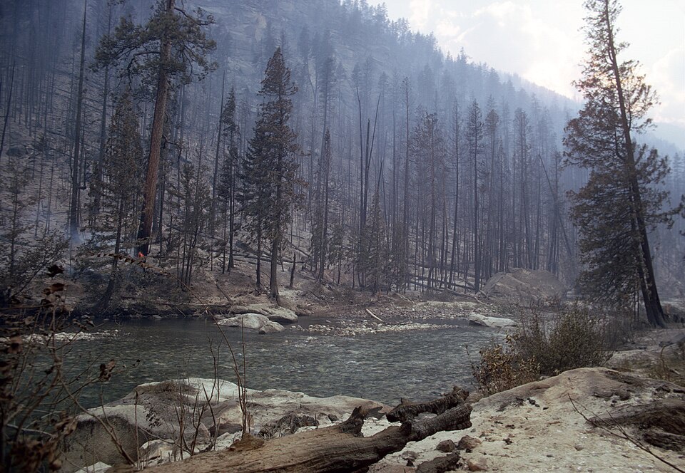
The Cougar Creek Fire, lightning-caused on July 28, 2018, burned 42,680 acres. It put both sides of the road from Mad River Road to the road’s end under Level 2 evacuation orders. The Little Giant Fire started by lightning on July 15, 2026, in the Chiwawa drainage and reached 172,906 acres on InciWeb’s October 9, 2026 update. No source records any campground in this valley as destroyed. The recorded losses are Spruce Grove’s overnight use, gone since the Wolverine era, and Cottonwood’s vehicle access and services, which the current conditions at the road’s end describe.
The fires also leave a condition layer behind them, and it outlasts the closures. Burned slopes shed debris, fire-weakened trees stand over upper-valley sites, and the riverside campgrounds carry flood risk in snowmelt and storm runoff. Landslide and falling tree hazards, not the flames, are what kept the upper valley closed for two full years after the Wolverine Fire.
Fire restrictions
Two layers of fire rules cover a camp here, and the stricter one controls. On the Forest Service campgrounds, the forest’s own orders govern, and the current order is the fire closure itself. Across unincorporated Chelan County, the county’s fire hazard rules in Chelan County Code Chapter 7.52 run on a calendar.
Restrictions begin June 1 in the Valley Zone, where open burning is prohibited, campfires stay allowed in designated campfire areas, and propane is always allowed. On July 1 the restrictions add the Mountain Zone and prohibit residential campfires and coal briquettes in both zones. Fireworks are prohibited in unincorporated Chelan County outside a narrow New Year window. The county removes its restrictions on October 1 unless its commissioners extend them, as they did through October 15 in 2025.
In fire season, check both layers before a trip, the county’s fire restrictions page and the Forest Service’s Okanogan-Wenatchee alerts page. Either one can shut a campfire down on its own.
Emergencies
Plan the upper valley as a no-service drive. Cell service is settled as absent at Silver Falls Campground and Cottonwood Campground. It is reported unreliable at Fox Creek and reported absent at Lake Creek. A party carries its navigation and its emergency plan on paper and in the vehicle, not on a phone.
Chelan County runs its emergency alerts through AlertSense, administered by the county’s emergency management and sheriff’s office. Signing up before a trip is the one notification step that works from the valley mouth. Emergencies go to 911 through Chelan County dispatch. Wenatchee, down US-97A south of Entiat, is the hospital town. During the Little Giant Fire, evacuation levels for the valley stood at Level 1, Be Ready, on the fire’s October 2026 updates.
Frequently asked questions
Are the Entiat campgrounds open?
Entiat River Road in its upper reach and the Forest Service campgrounds from Fox Creek to the road’s end stand closed under the current closure order through April 30, 2027. The Shady Pass Road sites above the valley stand closed with them, unless the order is rescinded sooner. Pine Flats Campground stands outside this closure, and Entiat City Park, at the mouth, is a separate city system outside the forest closure, running on the city’s own season. The Forest Service’s Okanogan-Wenatchee alerts page is the live check before any trip. See Entiat camping at a glance.
Can you camp at Spruce Grove Campground?
No. Spruce Grove has been closed to overnight camping since the Wolverine Fire era and stands as a day use site. While the current forest order runs, the site stands inside the closure as well. In season, the nearest campgrounds that take campers are North Fork, about a mile back down the road, and Fox Creek, 7 miles down, both inside the current closure. See Spruce Grove Campground.
Does Entiat City Park have hookups?
Yes. Twenty-nine of its 31 RV sites are full-service, with water, sewer, and 30 and 50 amp electric. The park also holds the valley’s only showers and its only dump station. Its 26 tent sites take campers who want the services without an RV, and reservations run through CampSpot only. See Entiat City Park.
Do you need a reservation to camp on Entiat River Road?
Mostly no, because the individual campgrounds are first come. Lake Creek splits its 18 sites, half reservable through Recreation.gov and half first come. The Pine Flats Group Site, the Silver Falls Group Site, and Three Creek Campground are reservable through Recreation.gov. The group sites book on a 12 month rolling window, and Lake Creek’s reservable half on a 6 month window. See Passes, fees, and booking.
Is there drinking water at the Entiat campgrounds?
Plan as if there is none. Carry all your drinking water. The Forest Service’s own pages conflict about water at Fox Creek, and district season announcements have said no drinking water is available at its campgrounds. Entiat City Park is the exception, with water at its full-service RV sites. See Entiat camping at a glance.
Where do you camp for the Ice Lakes?
At Cottonwood Campground, which sits beside the Entiat River Trailhead at the road’s end, in an open season. The lakes are a backpack of about 13 miles from that trailhead, up the Entiat River and Ice Creek trails. Camping at the lakes is backcountry camping on the pumice flats. The trip takes two to three days, and its river and creek crossings vary by season. Wilderness entry takes a free permit, filled out at the trailhead.
The approach is subject to the current closure, which shuts the road to the trailhead while it stands. See Entiat River Trail and the Ice Lakes.
How far is it to gas and groceries from the upper valley?
Far. Entiat, at the mouth, has groceries and fuel. Cooper’s General Store and Cafe at Ardenvoir, about 10 miles up the road, is the last supply point. Nothing purchasable exists for the remaining 28 miles to the road’s end.
Cooper’s listing shows limited hours and closed days midweek, so do not count on the stop. Stock up in Entiat as if Ardenvoir were not there. See Entiat camping at a glance.
Is there cell service in the Entiat valley?
Plan on none above the town of Entiat. Service is settled as absent at Silver Falls Campground and Cottonwood Campground, reported unreliable at Fox Creek, and reported absent at Lake Creek. Carry your navigation and emergency plan on paper, and sign up for Chelan County’s AlertSense alerts before the trip. See Fire restrictions and emergencies.
Sources
The Forest Service’s Okanogan-Wenatchee National Forest pages for the Entiat Ranger District and its campgrounds, Forest Order 06-17-07-2026-48 with the forest’s alerts page, the district’s 2025 season announcement, and the Pacific Northwest Research Station’s sustainable recreation case study for the district, fs.usda.gov. The Recreation.gov facility pages for Lake Creek Campground, the Pine Flats Group Campground, the Silver Falls Group Site, and the Three Creek Group Site, and the campground roundup and review records behind the North Fork entry and the valley’s trail texture.
The City of Entiat’s park page and its CampSpot listing, and the city’s park operating policies. Chelan County Code Chapter 7.52 and the county’s fire restrictions page, co.chelan.wa.us, and Chelan County AlertSense. Washington Trails Association hike pages for Ice Creek and the Ice Lakes, Silver Falls, and the Entiat River, wta.org. InciWeb’s Little Giant Fire page. The Washington Department of Fish and Wildlife’s rules as codified in WAC 220-312-050, app.leg.wa.gov.