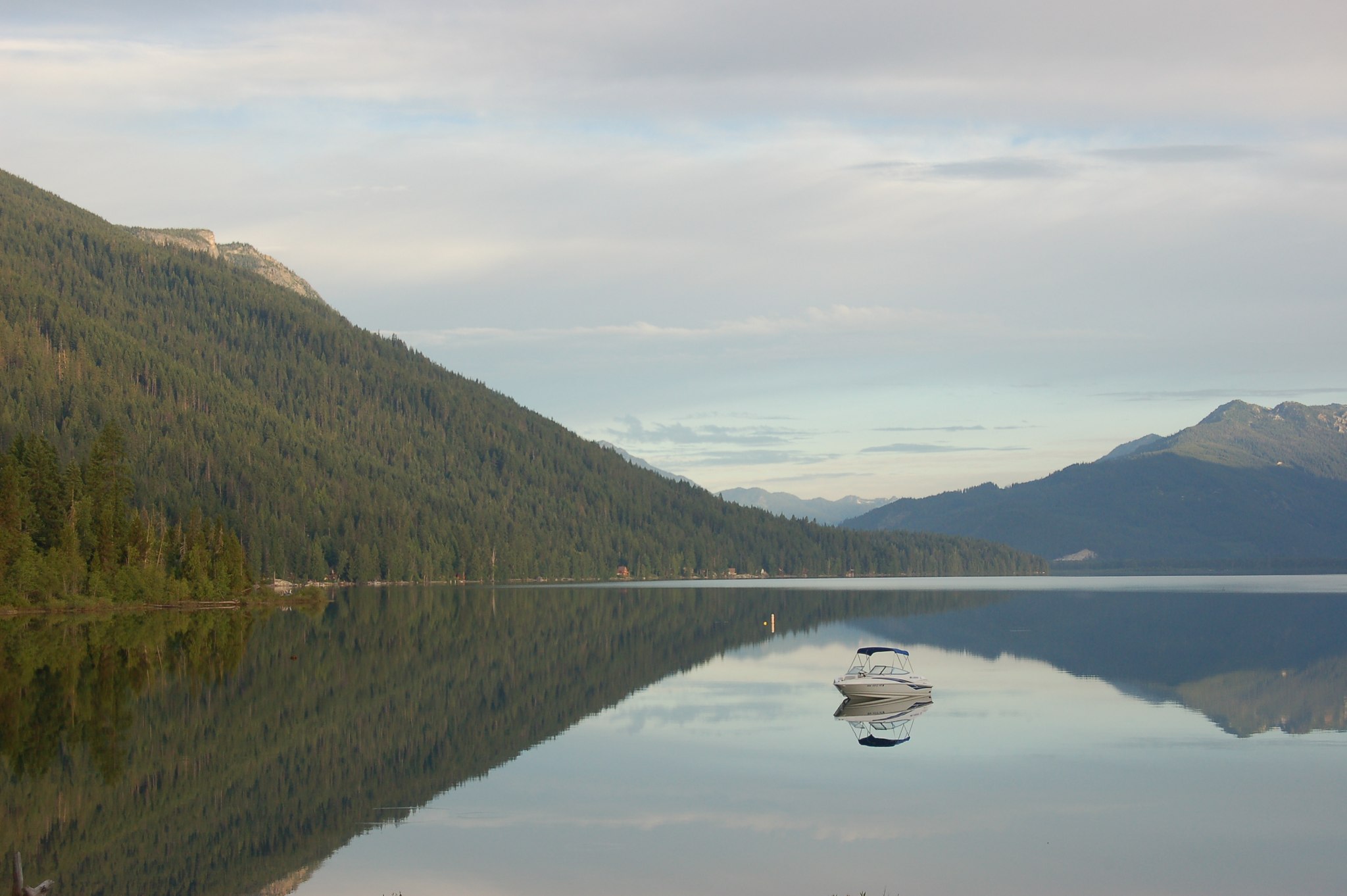
Lake Wenatchee is a big blue glacial lake, five miles long, held in a mountain valley under Dirtyface Mountain. A state park with a swim beach and 197 campsites stands at its east end. The walk-in campsites of Glacier View Campground line a stretch of its south shore. Three river roads climb out of the valley into the high country, each ending at a wilderness trailhead, and one of them ends at the trailhead for Spider Meadow, one of the best known backpacking meadows in the Cascades.
Twenty-one public campgrounds serve the lake and its river roads, and one private park stands at the valley’s foot. One booking system runs the state park, and its window opens nine months ahead. Most of the federal campgrounds up the rivers are first come, claimed by arriving. That split between a bookable park and a first come field runs through everything below.
We know this valley from its far end. We hiked in from the trailhead at the head of the Chiwawa River road, twice, up Leroy Creek toward Seven Fingered Jack. We camped at the Ice Lakes and in Spider Meadow on the first trip, and below the Seven Fingered Jack basin on the second. We have also spent a day at the lake itself. We have not stayed in any of these campgrounds. The campground guidance here rests on the land managers’ own pages, checked in November 2026, and the trail guidance on the Washington Trails Association’s reporting.
This valley sits inside the wider Central Cascades camping between Stevens Pass and Snoqualmie Pass. The Entiat River, one drainage north, gets its own guide in this series. Tumwater Canyon and Icicle Creek, below Leavenworth, belong to a neighboring guide.
In this guide
- Lake Wenatchee camping at a glance
- Choosing a campground at Lake Wenatchee
- Lake Wenatchee State Park
- Glacier View Campground
- Nason Creek Campground
- Campgrounds up the Chiwawa River
- Campgrounds up the White River
- Campgrounds on the Little Wenatchee River
- Private camping at Plain
- Booking the Lake Wenatchee campgrounds
- When the campgrounds are full
- Hiking around Lake Wenatchee
- Backpacking from Lake Wenatchee
- Seasons and winter
- Fire restrictions and emergencies
- Camping with an RV at Lake Wenatchee
- Dispersed camping around Lake Wenatchee
- Frequently asked questions
- Sources
Lake Wenatchee camping at a glance
The lake campgrounds carry the services and the crowds. The state park has the beach, the showers, and the only dump station at a public campground in this guide. Nason Creek has flush toilets, the only ones at a federal campground here. Glacier View has the walk-in lakefront. Up the three river roads the services thin out fast. Most of those campgrounds print no drinking water at all, and none lists showers. A camper who needs a hookup ends up at Plain, at the valley’s foot.
| Campground | Where on the road | The place in a phrase | How you get a site |
|---|---|---|---|
| Lake Wenatchee State Park | The lake’s east end, off SR 207 | The full service park, with a swim beach and 197 sites | Reservations up to nine months ahead |
| Nason Creek Campground | The lake’s southeast end, on Cedar Brae Road | Flush toilets and a split booking system | About 60 percent reservable, the rest first come |
| Glacier View Campground | The end of South Shore Road | Walk-in sites right on the south shore | First come only |
| Soda Springs Campground | Little Wenatchee River Road, the first camp up it | The road’s lowest camp | Check with the ranger district |
| Rainy Creek Campground | Little Wenatchee River Road, about 10 miles from the lake | The camp with the ADA-accessible trail | Check with the ranger district |
| Lake Creek Campground | Little Wenatchee River Road, the last camp up it | The staging camp for the road-end trailhead | Check with the ranger district |
| Napeequa Crossing Campground | White River Road, 7 miles from the lake | First up the road, with a trailhead across it | Check with the ranger district |
| Grasshopper Meadows Campground | White River Road, 10 miles from the lake | A meadow camp on the river | Check with the ranger district |
| White River Falls Campground | White River Road, 11 miles from the lake (9.3 miles from the SR 207 junction) | A camp beside a waterfall | Check with the ranger district |
| Grouse Creek Group Site | The junction of Chiwawa Loop Road and Chiwawa River Road | One reservable site for a group of 50 | Reservation required |
| Meadow Creek Campground | Meadow Creek Road (FS 6300), 2.4 miles up Chiwawa River Road and 2.4 miles in | A river camp near the road’s start | Check with the ranger district |
| Goose Creek Campground | Forest Roads 6208 and 6100, 3.2 miles up Chiwawa River Road and about a mile in | The motorcycle trail campground, with drinking water | First come only |
| Finner Creek Campground | Chiwawa River Road, 17 miles from the lake | About 3 sites, with drinking water and a trailhead | First come only |
| Riverbend Campground | Chiwawa River Road, 18 miles from the lake | A small camp on the river | First come only |
| Rock Creek Campground | Chiwawa River Road, about 20 miles from the lake | Trailheads for the Rock Creek and Estes Butte trails | First come only |
| Schaefer Creek Campground | Chiwawa River Road, 21 miles from the lake | A quiet river camp near the upper trailheads | First come only |
| Chiwawa Horse Camp | Chiwawa River Road, beside Rock Creek Campground | Long pull-through spurs built for stock | First come only |
| Atkinson Flat Campground | Chiwawa River Road, where the valley opens | Eleven large sites on the valley floor | First come only |
| Nineteenmile Campground | Chiwawa River Road, 22 miles from the lake | The quiet end of a rough road | First come only |
| Alpine Meadows Campground | Chiwawa River Road, the upper valley floor | Eight sites in an upper valley meadow | First come only |
| Phelps Creek Campground and Horse Camp | Trinity, the end of the road | The trailhead’s own campground | Check with the ranger district |
| Thousand Trails Leavenworth | Chiwawa Loop Road, at Plain | The valley’s full service membership park | Booked with the operator |
Choosing a campground at Lake Wenatchee
The choice here is not really about distance. Every campground in this guide stands on the lake or up one of its three river roads. The choice is about how a camper wants to claim a site, how much weather off the lake they want, and how many services they need standing near the tent.
The book or the field. The state park takes reservations up to nine months ahead, and summer weekends there book months in advance. A camper who needs certainty plans around that window. The federal campgrounds up the rivers are first come almost everywhere, and a camper who travels on a weekday or arrives early holds the advantage there. Nason Creek sits between the two systems. About 60 percent of its sites take reservations and the rest are first come, so it works as the valley’s hedge for a camper who missed the state park’s window.
North or south at the state park. The park runs two campgrounds. The South Campground stands beside the swim beach and the day use lawn, and it is the family side of the park. A family headed for that side is also choosing how much tent it needs, and our family tents guide works out the sizing. The North Campground is quieter and more sheltered, with its own small beach reached by trail. A camper choosing between them is choosing between the beach outside the tent flap and a calmer camp a short walk from it.
Wind and mosquitoes. These two come as a pair on this lake, and they trade against each other all summer. Wind comes off the water and builds during the day, strongest at exposed beach and lakefront sites. That wind is also what holds the mosquitoes down. When the air goes calm, the mosquitoes come out, and they are at their worst in June and worst on still days and evenings. A camper who wants the breeze picks an open lakefront site and accepts the wind in the tent fly. A camper who wants shelter picks a forested site away from the shore and accepts the bugs. Mornings are the calmer window on the water. The pattern eases later in the summer, and by August the mosquitoes have usually thinned.
Lake or river. The lake campgrounds offer swimming, boating, and company. The river campgrounds offer running water beside the tent, thin services, and space. Most campgrounds up the rivers have no drinking water at all, so a river trip starts with full water containers in the car whatever the season. A camper who wants a swim beach belongs at the lake. A camper who wants to fall asleep to a creek belongs up one of the river roads.
How far up the Chiwawa. The Chiwawa River road carries twelve campgrounds, and the campgrounds thin out as it climbs. The lower campgrounds are wooded. The upper ones stand in a wide glacial valley floor, and the road roughens to gravel and dirt well before them. One standing fact belongs in the choosing, not after it. The roads at this valley’s heads have closed for whole seasons at a time in fire and storm years. Checking the forest’s current road status is part of picking a campground up any of these rivers, and the sections below say where to check.
Hookups and full service. No public campground in this guide has full hookups. The state park’s North Campground has partial utility sites with water and electric at the site. The one full service campground of scale is private, Thousand Trails at Plain, with 279 sites at the foot of the Chiwawa valley. A rig that needs sewer and full power finds them there. Everything else in this guide asks a rig to run on its own tanks.
Groups. Groups have one reservable answer in this guide. The Grouse Creek Group Site, up the Chiwawa River road, takes a single group by reservation at $74 a night. A reunion or a club trip that needs one big site books there, and books through Recreation.gov like the other reservable sites in this guide.
Horses. Two campgrounds here are built for stock. Chiwawa Horse Camp, partway up the Chiwawa River road, has long pull-through spurs and horse facilities. The Phelps Creek Campground and Horse Camp at the end of the road pairs tent sites with equestrian sites. Stock campers plan around those two.
Towns and resupply. Leavenworth, about 15 miles from the lake, is the full service town, with groceries, fuel, and the valley’s hospital. Plain, at the foot of the Chiwawa valley, is closer to the river campgrounds. The store at Plain, Midway Gas and Grocery, sells fuel around the clock, groceries, ice, and firewood, and it is the resupply anchor for the Chiwawa side. The state park’s Camp Store sells firewood, ice, snacks, and camping supplies in season. Coles Corner, where SR 207 leaves US-2 for the lake, is the turnoff.
Lake Wenatchee State Park
Quick facts: 197 sites, with 100 standard sites in the South Campground and 55 standard, 2 ADA, and 42 partial utility sites in the North Campground; reservations up to nine months ahead and until 2 p.m. on the arrival date, with self-registration on site; open all year, and the campgrounds close when snow arrives, with winter camping first come in a designated area at the South Park day use lot; comfort stations; hot showers; partial utility hookups with water and electric in the North Campground, and a trailer dump there at $5 a use; check in at 2:30 p.m. and check out at 1 p.m., with entry until 10 p.m. and a gate that arriving campers may open and close behind them after hours; one vehicle per site included, extra vehicles $10 a night, two vehicles at most per site; pets on a leash of 8 feet or less and not on designated swimming beaches; quiet hours 10 p.m. to 6:30 a.m. and generators 8 a.m. to 9 p.m.; a 10-night stay limit; boat launch $7 a day.
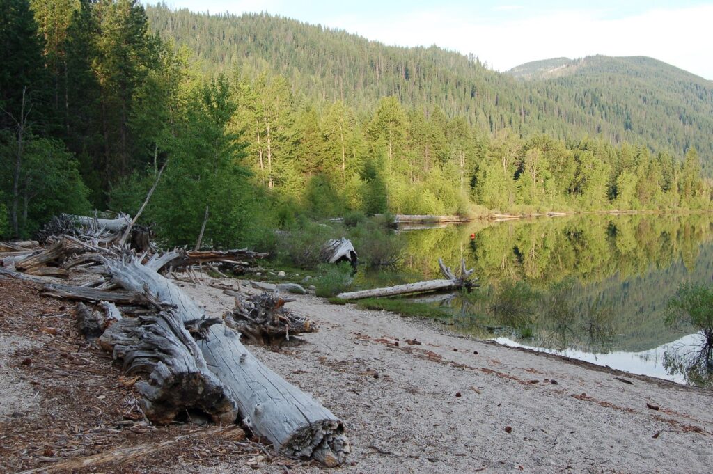
Lake Wenatchee State Park is the campground most people picture when they plan for this lake, and it earns the place. It stands at the lake’s east end where the Wenatchee River leaves the water, on both sides of the highway, with the lake in front of it and Dirtyface Mountain over it. A camper here gets the swim beach, the boat launch, hot showers, and a camp store inside one park gate. We have stood on this shore on a day trip and looked around the lake, and the first thing a visitor notices is the scale of the water. The second is the wind.
The park runs on the state reservation system, and that system shapes a stay here more than any site feature does. Reservations open up to nine months ahead of the first night and stay open until 2 p.m. on the arrival date itself. The booking fee is $8 online and $10 through the call center. A camper who arrives without a reservation self-registers on site for whatever stands open, by cash or check, with a credit card machine in the South Park. The park also runs a group camp for 20 to 80 guests, tent camping only, with fees that vary with the size of the group. Summer weekends here book months ahead. A camper who wants a July Saturday plans in winter, and a camper who cannot plan that far ahead reads the rest of this guide for the first come field up the rivers.
The South Campground
The South Campground is the beach side of the park. Its 100 standard sites serve tents, camper vans, and truck campers, and vehicle and trailer combinations under 20 feet. The designated swim beach and the day use lawn stand on this side, and the Camp Store sells prepared food, snacks, ice cream, espresso, camping supplies, firewood, and ice through the season. Families base here because the water is a short walk from the tent and the day runs on swims, the unstructured outdoor hours behind the development benefits of time outside for children. The trade is exposure. The south shore takes the lake’s wind full in the face, and campers describe the beach side as cold and windy even on a good day, while the woods behind it stay calm.
The North Campground
The North Campground is the sheltered side. Its 55 standard sites and 2 ADA sites sit in the woods, and its 42 partial utility sites add water and electric at the site, the only hookups at any public campground in this guide. The trailer dump stands on this side too, at $5 a use. The north side has its own small beach, reached by trail rather than by road, and campers who stay here describe a quieter park, more privacy in the outer loops, and trees that break the wind the south shore takes. In winter the north side woods are the sheltered walk, warmer than the beach in the cold months as well as the hot ones.
Both campgrounds share the park’s working rules. Check in begins at 2:30 p.m. and check out is 1 p.m. Campers may enter until 10 p.m., and the gates close at dusk. A camper arriving after hours may open the unlocked gate, drive through, and close it behind them, which the park prints as its own late arrival procedure. One vehicle comes with each site, a second costs $10 a night, and anything beyond two vehicles goes to overflow parking. Pets stay on a leash of no more than 8 feet and off the designated swimming beaches. Quiet hours run 10 p.m. to 6:30 a.m., and generators may run from 8 a.m. to 9 p.m. A stay caps at 10 nights in a 30-day period.
The park’s year has two full seasons, not one. In summer the campgrounds run on the reservation book and the lake runs the days, swimming at the beach, boats off the $7 launch, and the store open daily. When the snow arrives the campgrounds close, and the park does not. Winter camping moves to a designated area at the South Park day use lot, first come, with heated restrooms and showers, and the lots turn over to snowshoe and ski days under the Sno-Park system the seasons section describes. A camper who wants this lake in January camps in a parking lot in the snow, and campers do, because the valley in winter is a different and quieter place.
The day use side of the park carries its own weight. The swim beach and the lawn above it fill on summer days with families who are not camping at all, and the Camp Store runs daily in season, 9 a.m. to 6 p.m., selling prepared food, snacks, ice cream, espresso, camping supplies, firewood, and ice. The park has one watercraft launch, with 16 feet of handling dock beside it, at $7 a day. A camper based anywhere in this valley can use the park as its beach on a Discover Pass and its boat ramp at the $7 launch fee. That is why the when-full section below treats a full campground here as a smaller problem than it first looks.
One honest limit belongs in this entry. The wind that makes the beach cold also makes the park’s summer bearable, because it is the same wind that holds the mosquitoes down on cool, breezy stays. On calm June days the mosquitoes here can be as bad as anywhere on the lake. Food needs care either way. Campers report chipmunks raiding unattended food, and the park flags bear country rules. Store food the way the fire and emergencies section describes, and the park is an easy place to stay.
Glacier View Campground
Quick facts: 16 walk-in sites on the lakeshore; first come only, claimed by arriving in person and paid by Scan and Pay in the Recreation.gov app; drinking water; vault toilets; no hookups; $24 a night, extra vehicles $11, and day use $11 per vehicle or boat, with recreation passes not accepted for the day use fee because a concessionaire runs the day use side; elevation 1,900 feet; cedar shade on the lake’s south shore, at the end of South Shore Road, with views of Glacier Peak.
Glacier View Campground is the walk-in campground on the lake’s south shore, and it is the first come answer to the state park’s reservation book. Sixteen sites stand right along the water under cedar shade, close enough to the lake that the tent hears it. There is no reservation for any of them. A camper arrives, finds a site standing open, and pays by scanning a code in the Recreation.gov app, which the Forest Service advises downloading before the trip, since a camper cannot count on cell service to fetch it later.
The arrival pattern here is the best documented in this valley, and it is consistent. The campground fills on summer weekends and empties considerably on weekdays. Campers who stay here describe arriving early as the working rule, with Sunday afternoon and early weekday arrivals as the working strategy. A camper who rolls in on a Friday evening in July is gambling. A camper who arrives on a Sunday afternoon as the weekend crowd leaves is playing the pattern the campground actually runs on. Rangers swing through checking receipts, and the vault toilets draw better reports than most.
What a camper gets for the gamble is the lakefront. The sites sit on the south shore with Glacier Peak in the view up the lake, and the day use side takes boats as well as vehicles, at the same $11. The wind and mosquito trade that the choosing section describes runs sharpest here. On a breezy day this is one of the most pleasant campgrounds on the lake. Campers also describe the wind dying in mid-June and mosquito swarms bad enough to cut trips short. The breeze is the condition that makes this campground work in early summer, and a camper coming in June packs for both versions of the place.
Two trails leave from the campground’s door. Dirtyface Peak rises straight above it, one of the earliest high trails in the valley to clear of snow. By midsummer it is one of the hottest climbs in it, up a south facing burn slope where early starts and carried water are the pattern from July into September. The Hidden Lake loop runs from the campground side as a short walk, the kind families use from camp with small children. The hiking section carries both. Parking at the campground is tight, and campers warn against trailers and large rigs. This is a tent campground with walk-in sites, and it works best for campers who travel that way.
Nason Creek Campground
Quick facts: 73 sites, 70 single and 3 double, sized for 2 tents, or 1 RV plus 1 tent, with 2 vehicles at most; about 60 percent of sites reservable at least 3 days ahead and the rest first come, paid by Scan and Pay on site; drinking water in common areas; flush toilets; no electric hookups; $27 a night, extra vehicles $11, day use $11, with half off the single site fee on senior and access passes; check in at 2 p.m. and check out at noon; elevation 1,900 feet; at the lake’s southeast end, on both sides of Nason Creek.
Nason Creek Campground stands where Nason Creek meets the lake, on Cedar Brae Road at the lake’s southeast end, and it holds a position no other campground in this guide holds. It is a federal campground with a published booking split. About 60 percent of its sites take reservations through Recreation.gov, made at least 3 days ahead. The rest are first come. A camper who missed the state park’s nine-month window can still book here, and a camper who books nothing can still try here. That is why it reads as the valley’s hedge.
It is also the federal campground with flush toilets, six of them, with electrical outlets in the restrooms, a thing no other federal campground in this guide offers. Every site carries a picnic table and a fire ring with a grill, and firewood sells at the host site at $10 a bundle. Campers praise the hosts here, described as kind and actively maintaining the place, and the spigots near the sites. The feel of the campground runs laid back against the state park’s busier one. The park itself is walkable from here, which puts its store, its beach, and its showers within reach of a camper sleeping in a federal site.
Site choice inside the campground matters more than at most. The creek-side sites are the prize, and they fill first. The sites nearer the road hear Highway 207 traffic, mostly in the daytime and fading at night. A camper who arrives for the first come share works the morning. Check out is noon, and the practice campers describe is to arrive in the morning, watch which sites open as campers leave, move in when one empties, and pay by Scan and Pay on site. It is a practice, not a promise, and it works best on the same weekday and Sunday pattern the whole valley runs on.
A single site is $27 a night, an extra vehicle $11, and day use $11, with half off the single site fee for senior and access pass holders. Mosquitoes bite on arrival in June accounts and ease with the weather, the same lake pattern as everywhere here. What this campground does not have is hookups, and it has no dump station. A rig camps here on its own tanks and plans its dump at the state park or in Leavenworth, the pattern the RV section works out for the whole valley.
Campgrounds up the Chiwawa River
Twelve campgrounds stand along the Chiwawa River road and its side roads, and they run a full valley in one drive. The road leaves the lake road at Fish Lake and follows the river northeast into a wide glacial valley. It starts paved and gives that up to gravel and dirt as it climbs. The lower campgrounds sit wooded along the river. The upper ones stand where the valley opens into its glacial floor, and the road ends at Trinity, the old townsite below the Phelps Creek Trailhead. Plain, with its store and fuel, is the last resupply before the road. One standing instruction belongs at the head of this whole road. The upper stretch has closed for whole seasons at a time in fire and storm years, and a closure gate can stand anywhere along it. Check the Wenatchee River Ranger District’s current road status before planning on any campground up here, and treat a closed gate as the answer wherever it stands.
Grouse Creek Group Site
Quick facts: one group site for up to 50 guests and 30 vehicles; reservation required, through Recreation.gov; accessible vault toilets; no drinking water; no electric hookups; no trash collection; campfire rings and picnic tables; $74 a night; check in at 2 p.m. and check out at noon; at the junction of Chiwawa Loop Road and Chiwawa River Road.
Grouse Creek Group Site is the one campground in this valley built for a crowd. A single group takes the whole site, up to 50 people, and the reservation is not optional. A family reunion, a scout troop, or a club weekend that wants one big site in the national forest books here, through the same Recreation.gov system as the valley’s other reservable sites. Its Recreation.gov listing carries its current booking terms. The site stands at the valley’s entrance, where Chiwawa Loop Road meets Chiwawa River Road.
The facilities match the group purpose and stop there. Accessible vault toilets serve the site. There is no drinking water, no electricity, and no trash collection, so a group hauls its water in and its garbage out. Campfire rings and picnic tables carry the cooking and gathering. The campground sells no firewood on site, so a group brings its own or buys it at Plain on the way in. Check in runs at 2 p.m. and check out at noon. At $74 a night for the whole site, a full group camps here for less per tent than any single site in this guide.
Meadow Creek Campground
Quick facts: on the Chiwawa River, 6 miles from Fish Lake, reached by Meadow Creek Road (Forest Road 6300) off Chiwawa River Road; river access; elevation 2,250 feet.
Meadow Creek Campground stands up a side road of its own. Meadow Creek Road leaves Chiwawa River Road 2.4 miles up, with 2.4 more miles to the campground. It stands on the river at 2,250 feet. The Forest Service publishes little about this campground beyond its setting on the river, and its listing carries no site count or fee. A camper headed here plans the way the dispersed section describes, self-sufficient, and treats anything standing on site as a bonus. Its position is its virtue. It is river camping on the low end of a road whose far end asks much more of a vehicle.
Goose Creek Campground
Quick facts: 29 sites, 26 single and 3 double; first come only, claimed by arriving, paid by Scan and Pay in the Recreation.gov app; potable water; vault toilets; firewood for sale at the host site, $10 a bundle; no hookups; $22 a night, extra vehicles $11; elevation 2,200 feet; on Goose Creek near the Chiwawa River, reached by Forest Roads 6208 and 6100 off Chiwawa River Road.
Goose Creek Campground is the Chiwawa River road’s motorcycle camp. It stands on Goose Creek near the Chiwawa River, about a mile up Forest Road 6100 from a turnoff 3.2 miles up the river road, low on the valley, with the motorcycle trail system as its reason to exist. Its 29 sites carry services most of this road’s campgrounds lack. Potable water runs here, on a road where most campgrounds offer none, and vault toilets and a host site selling firewood at $10 a bundle stand with it.
The trade is the company. Riders base here for the trails, and their machines are the campground’s soundscape, a pattern campers report at its heaviest on holiday weekends. A camper who came up this road for quiet has better choices higher up it. A rider gets the opposite bargain, a serviced base at the low end of the road with the riding at the door. The claim runs the road’s standard way, arrive in person and scan to pay, and the app download before arrival matters here as much as anywhere on this road.
Finner Creek Campground
Quick facts: about 3 sites, on both sides of the road; first come only, claimed by arriving, paid by Scan and Pay in the Recreation.gov app; drinking water from a solar powered system; vault toilets; no hookups; $22 a night, extra vehicles $11, with half off the single site fee on senior and access passes; elevation 2,450 feet; 17 miles from Lake Wenatchee, where the Basalt Ridge Trail begins.
Finner Creek Campground is a tiny campground, about 3 sites split by the road itself, and it holds a distinction most of this road’s campgrounds lack. It has drinking water, run through a solar powered system, on a road where most campgrounds offer none. That makes Finner Creek a practical stop as well as a camp. A camper claims a site by arriving, there being no reservation for any of them, and pays by scanning the code on site.
The campground doubles as a trailhead. The Basalt Ridge Trail begins here, climbing to the ridge between the Chiwawa and Nason Creek drainages. A camper can sleep at the trailhead the night before a climb and walk out of camp in the morning. With about 3 sites, it does not take many arrivals to fill it. The road offers eleven more campgrounds above and below it, which is the road’s own answer to a full one.
Riverbend Campground
Quick facts: first come only, claimed by arriving, paid by Scan and Pay; no drinking water; vault toilets; no hookups; $22 a night, extra vehicles $11, with half off the single site fee on senior and access passes; elevation 2,500 feet; 18 miles from Lake Wenatchee, on the Chiwawa River.
Riverbend Campground stands on the river 18 miles from the lake, and its name is its description. Campers come here for the water beside the site and for a quieter version of the Chiwawa than the campgrounds near Fish Lake offer. There is no drinking water, so the river is for looking at and listening to, and a camper arrives with full containers. The vault toilets and the $22 fee match the rest of the road’s middle campgrounds.
Riverbend is the kind of campground this road does best. It is small, it is simple, and a camper’s whole plan here is the river and the trees. A camper who wants more than that from a campground belongs lower down the road or back at the lake. A camper who wants exactly that is in the right reach of the valley.
Rock Creek Campground
Quick facts: first come only, claimed by arriving, paid by Scan and Pay; no drinking water; vault toilets; no hookups; $22 a night, extra vehicles $11, with half off the single site fee on senior and access passes; elevation 2,500 feet; about 20 miles from Lake Wenatchee, with easy access to the Rock Creek and Estes Butte trails; the road roughens from about the 11-mile point.
Rock Creek Campground stands about 20 miles from the lake, and it is a trailhead campground in everything but name. It offers easy access to two trails. The Rock Creek Trail climbs the creek of the same name, and the Estes Butte Trail climbs to Estes Butte above the valley. A camper sleeps at the foot of either and walks out at first light.
The road sets the terms of a stay. It roughens from about the 11-mile point, well below this campground, so the drive in runs on gravel and dirt at the speed the surface allows. There is no drinking water. The Forest Service also runs a horse camp beside this campground, listed separately below, and the two share the trailheads. A camper with stock reads that entry. A camper without stock gets the same trails from a smaller, simpler camp.
Schaefer Creek Campground
Quick facts: first come only, claimed by arriving, paid by Scan and Pay; no drinking water; vault toilets; no hookups; $22 a night, extra vehicles $11, with half off the single site fee on senior and access passes; elevation 2,500 feet; 21 miles from Lake Wenatchee, on the Chiwawa River.
Schaefer Creek Campground stands on the river 21 miles up, in the road’s upper reach. It is a simple river campground, vault toilets and no water, at the same $22 the road charges everywhere. What it holds beyond its sites is position. The Schaefer Lake Trail climbs from this reach of the road, and the road’s end and its trailheads stand above it.
That position gives Schaefer Creek a second use. The Washington Trails Association’s Spider Meadow write-up mentions this campground as a Friday-night staging camp before the hike, and it stands close enough to the end of the road to serve exactly that night. A camper here should still arrive with water aboard and no expectation of services. The upper valley provides the scenery. The campground provides a flat place beside the river to sleep in it.
Chiwawa Horse Camp
Quick facts: 7 long pull-through spurs built for horses and trailers; first come only, claimed by arriving in person, paid by Scan and Pay; wheelchair accessible; $22 a night, extra vehicles $11, with half off the single site fee on senior and access passes; check in at 2 p.m. and check out at noon; beside the Rock Creek Campground, with the Basalt Ridge Trail 1527 and Rock Creek Trail 1509 at its door.
Chiwawa Horse Camp is the stock camp for the Chiwawa valley, built in a form no other campground in this guide uses. Its sites are long pull-through spurs, made to take a truck and a horse trailer without unhitching gymnastics, with horse facilities at the sites. It stands beside the Rock Creek Campground and shares its trailheads, so a rider has direct access from camp to the Basalt Ridge and Rock Creek trails. Its listing gives a May through October season.
The camp runs first come, like the rest of the road. A rider arrives, occupies a spur in person, and pays by scanning the code on site. At $22 a night it charges the road’s standard rate for a specialized facility. Riders should read its current listing before a trip for the working stock rules, since water and stock handling at horse camps change with the season’s conditions. For a camper without horses, the campground next door offers the Rock Creek Trail as well. For a camper with them, this is the valley’s purpose-built answer.
Atkinson Flat Campground
Quick facts: 11 large sites; first come only, claimed by physically occupying a site, paid by Scan and Pay; no drinking water; vault toilets; no hookups; $22 a night, extra vehicles $11, with half off the single site fee on senior and access passes; elevation 2,500 feet; the final 5 miles of road are very rough and may not suit low-clearance vehicles.
Atkinson Flat Campground stands on the wide valley floor where the Chiwawa valley opens into its glacial upper reach, and its 11 sites are large ones. The Forest Service’s own wording for claiming a site here is to physically occupy it. A camper drives in, sets up, and scans to pay. The campground has vault toilets and no drinking water, and the valley around it does the rest, with the high country rising around the flat.
Atkinson Flat is also where this road’s terms change. The Forest Service warns that the final 5 miles of road are very rough and may not suit low-clearance vehicles. The road above this campground has been closed by fire and storm orders for whole seasons at a time. A camper planning on the campgrounds above Atkinson Flat checks the district’s current road status before leaving, every time, and treats this campground as the fallback that makes the check painless. If the upper road is closed when you come, the trip still has a camp, on the valley floor, at the foot of the high country.
Nineteenmile Campground
Quick facts: first come only, claimed by arriving, paid by Scan and Pay; no drinking water; vault toilets; no hookups; $22 a night, extra vehicles $11, with half off the single site fee on senior and access passes; elevation 2,570 feet; 22 miles from Lake Wenatchee, with the final 10 miles of road very rough.
Nineteenmile Campground stands deep in the upper valley at 2,570 feet. The drive in is the price of the place. The Forest Service describes the final 10 miles of road as very rough, which on this road means a slow, deliberate drive in a vehicle with clearance. What waits at the end of it is a river campground in a quiet reach of the upper valley.
The campground itself keeps the road’s standard form, vault toilets, no water, and the $22 fee with the pass discount. The point of the place is the absence of everything the lake campgrounds have, crowds included. A camper whose vehicle cannot take the upper road has Atkinson Flat and the lower campgrounds. A camper who can, and who wants the valley to themselves, drives the rough miles and earns it.
Alpine Meadows Campground
Quick facts: 8 sites; first come only; on the valley floor beside the Chiwawa River; elevation 2,600 feet; 21 miles from Fish Lake.
Alpine Meadows Campground is a small meadow campground on the valley floor, 8 sites at 2,600 feet, in the upper valley’s open country. Its name describes its setting rather than an alpine climb. The sites stand in meadow at the valley’s wide part, with the river beside them and the ridges of the Glacier Peak Wilderness around. It is first come, claimed by arriving, on the road’s standard pattern.
The Forest Service publishes less about this campground than about any other on the road, so plan to arrive self-sufficient, with water aboard and no services assumed. What the campground offers is the setting itself, a small and quiet camp in the big valley, a few miles below the end of the road and its trailheads.
Phelps Creek Campground and Horse Camp
Quick facts: 7 tent sites and 6 equestrian sites at Trinity, where Phelps Creek meets the Chiwawa River; about 23 miles from Fish Lake, at the end of the Chiwawa River road.
Phelps Creek Campground and Horse Camp stands at Trinity, the old townsite at the end of the road, and it exists because the trailhead does. Backpackers hiking into Spider Meadow, up Leroy Creek, and over the passes of the Glacier Peak Wilderness start here, and this campground is where a driver who wants a camp at the road’s end sleeps. Its tent sites serve the hikers. Its equestrian sites serve the stock parties heading for the same country. We have hiked through Trinity on both of our trips into this valley, going straight from the trailhead into the backcountry each time. We have never camped here, and this entry rests on the Forest Service’s own pages rather than on a stay.
The end of the road is the most conditional camping in this guide. The road above Atkinson Flat has been closed by fire and storm orders for whole seasons at a time, and Trinity is the last place it reaches. The backpacking section below describes the trailhead, the parking, and the check-before-you-drive instruction in full, and it applies to this campground with the same force. A camper who finds the road open and a site standing empty at Trinity holds a rare thing, a developed camp at the door of one of the Cascades’ great wilderness trailheads.
Campgrounds up the White River
The White River road leaves the lake’s north side and follows its river toward Glacier Peak. Three small campgrounds stand along it, and the road ends at a trailhead for the Glacier Peak Wilderness. This is the road where the campgrounds publish the least about themselves. A camper headed up here packs for the lake campgrounds’ opposite, full water aboard, everything needed in the car, and the river and the falls as the whole program. The road has flooded in big storm years, so the check with the ranger district that the fire and emergencies section describes belongs to this road as much as to the Chiwawa.
Napeequa Crossing Campground
Quick facts: on the White River, 7 miles from Lake Wenatchee; river access; elevation 1,950 feet; the Twin Lakes Trail trailhead stands across the road.
Napeequa Crossing Campground is the first campground up the White River road, 7 miles from the lake, and it takes its name from the river’s older name, the Napeequa. It is the easiest camp on this road to reach and the one with a trailhead at its door. The Twin Lakes Trail begins across the road from the campground, climbing toward the lakes in the Glacier Peak Wilderness. A camper can sleep here, cross the road in the morning, and be hiking into the wilderness before breakfast.
Like the other campgrounds on this road, it publishes little beyond its setting on the river, so the self-sufficient rule holds. Its position is its argument. It is the White River’s low camp, the shortest drive on the road, with a trailhead across the road and the falls up the road above it. A camper sampling this road for the first time starts here. A camper who wants the falls out the tent door drives on to White River Falls Campground.
Grasshopper Meadows Campground
Quick facts: on the White River, 10 miles from Lake Wenatchee; river access; elevation 2,000 feet.
Grasshopper Meadows Campground stands in meadow on the White River, 10 miles from the lake, and it is the middle campground on this road in every sense. It sits between the crossing below and the falls above, on the river, in open grass under the valley walls. The meadow setting gives it a different feel from the forested campgrounds on the other roads, brighter and more exposed, with the river running beside the sites.
Its Forest Service page is the sparsest on this road, carrying the setting and little else. A camper here arrives self-sufficient in the full sense, water, food, and a plan to pack out trash. What the campground returns for that self-sufficiency is space and quiet. Campers who want listed facilities before they commit belong at the lake. Campers who want a meadow, a river, and nobody’s itinerary but their own have found their campground.
White River Falls Campground
Quick facts: on the White River, 11 miles from the lake up White River Road; beside a waterfall; elevation 2,200 feet; no trailer turnaround; no garbage service, so pack out all trash.
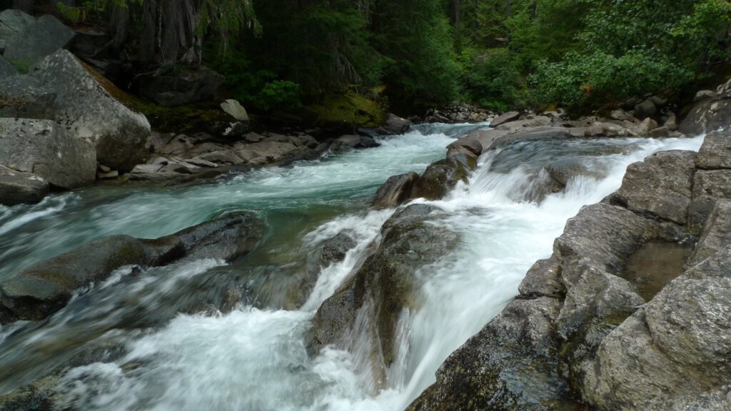
White River Falls Campground stands beside the falls its name promises, where the White River comes down through rock in the upper valley. The waterfall is the campground’s reason to exist, and the Forest Service warns that the rocks around the falls are slippery. There is no trailer turnaround, which settles the RV question for this campground before it starts. A rig that cannot turn around in its own length does not belong up this road’s end.
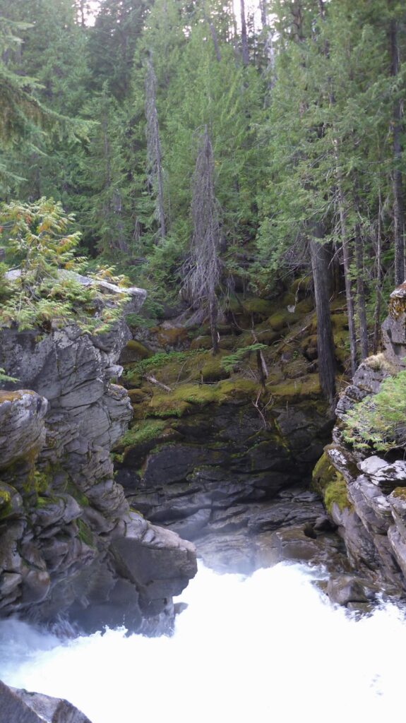
The Forest Service publishes little about this campground beyond its setting, so arrive self-sufficient, with water and everything else aboard, and plan to pack out every scrap of trash, since the campground provides no garbage service. One trail note belongs here because campers get it wrong. There is no footbridge at this campground. The river crossing for the trails sits at the trailhead at the end of the road, above this campground, where the White River and Indian Creek trails begin. A camper sleeping here for the falls has the falls. A hiker sleeping here for the wilderness walks up the road in the morning.
Campgrounds on the Little Wenatchee River
The Little Wenatchee River feeds the lake’s west end, and its road climbs toward the crest of the Cascades and the Pacific Crest Trail. Three campgrounds stand along it, the valley’s westernmost camps, and the trailhead at the end of the road is a door onto the Pacific Crest Trail. The road washes and floods in big storm years, as the river roads in this valley do. The campgrounds here are the least documented in this guide, and the entries below carry what the Forest Service publishes for them, and say where that runs out. The backpacking section takes the road’s head, where its real importance lies.
Soda Springs Campground
Quick facts: on the Little Wenatchee River, up the Little Wenatchee River Road from the lake’s west end; the lowest of the road’s three campgrounds.
Soda Springs Campground is the first campground up the Little Wenatchee River road, the lowest of its three camps. The campground’s current public listings are thin enough that this guide prints its position and little more, and a camper counting on it should confirm its status with the Wenatchee River Ranger District before the trip. That caution is this road’s general condition rather than a mark against this campground. The Little Wenatchee’s camps ask a camper to arrive prepared for whatever stands there.
Rainy Creek Campground
Quick facts: on Rainy Creek, with creek access; an ADA-accessible trail at the campground; elevation 2,100 feet; reached by SR 207, 6.1 miles of the Little Wenatchee River Road, and about a mile of Forest Road 6701, about 10 miles from the lake in all.
Rainy Creek Campground stands on Rainy Creek, beside the Little Wenatchee River, and it holds a distinction none of the valley’s other small campgrounds claims. An ADA-accessible trail runs at the campground, putting the creekside forest within reach of campers who cannot take the valley’s rougher trails. In a guide full of walk-in lakeshores and rough upper roads, that trail is worth naming in full. Accessibility in these mountains is rare enough to be a reason to choose a campground.
The campground sits 10 miles from the lake by its access route, in the middle of the road’s three camps. Its Forest Service page carries its setting and its trail and little in the way of listed facilities, so a camper arrives self-sufficient here as on the White River. What it offers is the creek, the accessible trail, and a camp on the way to the road’s real destination, the trailhead at its end.
Lake Creek Campground
Quick facts: on the Little Wenatchee River, up the Little Wenatchee River Road; the highest of the road’s three campgrounds.
Lake Creek Campground is the uppermost campground on the Little Wenatchee River road, the last developed camp before the road ends at the Little Wenatchee Ford trailhead. Campers should not confuse it with the Lake Creek Campground on the Entiat River, a different campground in the next drainage north, whose listings crowd out this one’s in search results. That confusion is part of why this campground’s own current listings are hard to pin down, and a camper planning on it should confirm its status with the Wenatchee River Ranger District, (509) 548-2550, before driving up.
It stands closest to the Ford, where the Cady Creek, Cady Ridge, and Little Wenatchee River trails begin and the PCT runs within reach. The backpacking section describes that trailhead in full. Treat this campground as its staging camp, confirm it before the trip, and let Rainy Creek below it be the fallback if the answer comes back closed.
Private camping at Plain
Plain is the small community at the foot of the Chiwawa valley, where the river road meets the lake road. It holds the valley’s one full service campground of scale, a private park run on a membership model, and the closest store and fuel to the river campgrounds. Campers who need hookups, a laundry, or a bookable site in a valley of first come campgrounds end up here.
Thousand Trails Leavenworth
Quick facts: 279 sites; open year round; at 20752 Chiwawa Loop Road in Plain, about 4 miles from Fish Lake and 17 miles from Leavenworth; full hookups among its listed amenities, along with a market, laundry, a pool, a clubhouse, propane, and WiFi; a membership campground, with member and camping pass access on the operator’s terms.
Thousand Trails Leavenworth is the largest campground in this guide and the only one run as a full service park. Its 279 sites stand in Plain at the foot of the Chiwawa valley, close enough to serve the river roads and far enough down to keep full services. The operator lists full hookups, restrooms and showers, a laundry, a market, a pool and hot tub, a clubhouse, propane, and WiFi, the full amenity set no public campground in this guide approaches. It is a membership campground in the Thousand Trails network. Members camp under their membership terms, and the operator also sells access by a camping pass, so a non-member reads the operator’s current terms before planning on a stay.
Its role in this valley is the bookable site. Every public campground up the rivers is first come or thin on reservations, and a camper who cannot gamble, or whose rig needs full hookups and a dump, books here and day trips to the lake and the trailheads. A second private name, Lake Wenatchee RV Resort, appears in campground listings for this valley. We could not confirm its operator from a page of its own, so it stands in this guide as a name to check rather than a camp to plan on. The services note for the valley stands in the choosing section above. Midway Gas and Grocery, also in Plain, is the store and fuel stop the Chiwawa campgrounds run on.
Booking the Lake Wenatchee campgrounds
Two booking systems run this valley, and they reward opposite habits. The state park rewards planning far ahead. The federal campgrounds mostly reward showing up well. Nason Creek and Grouse Creek are where the planners who missed the park’s window should look. One splits its sites between the federal book and first come, and the other is reservation only.
The state park book. Lake Wenatchee State Park takes reservations up to nine months ahead of the first night and until 2 p.m. on the day of arrival, through washington.goingtocamp.com. The booking fee is $8 online and $10 by phone. A reservation names its site. A camper without one self-registers on site for whatever stands open. The park’s stay limit is 10 nights in one park in a 30-day period. Summer weekends here go first, months out, and the rest of the park fills behind them.
The federal book. Two federal campgrounds here take reservations, both through Recreation.gov. Nason Creek reserves about 60 percent of its sites, with reservations made at least 3 days ahead, and holds the rest first come. Grouse Creek Group Site is reservation only. Federal sites release on a rolling window six months ahead at 10 a.m. Eastern for individual sites, and group sites book on the window their own listings carry, up to twelve months. The federal stay limit in this forest is 14 consecutive days in one place, then 30 days away, with a cap of 28 days in a calendar year.
Claimed by arriving. Most of the rest of the federal campgrounds in this guide are claimed by arriving. At Atkinson Flat the Forest Service’s own wording is to physically occupy the site. At the campgrounds that use it, payment runs through Scan and Pay, a code at the campground scanned in the Recreation.gov app. The Forest Service advises downloading the app before the trip, since a camper cannot count on cell service to fetch it later. A camper who arrives, sets up, and pays holds the site. At Nason Creek, the morning practice around the noon check out is described in its entry above. The state park’s own late arrival procedure is the mirror image of the federal campgrounds. Its gates close at dusk, and an arriving camper may open the unlocked gate, drive in, and close it behind them.
Passes and fees. No pass pays a camping fee anywhere in this valley. The fees themselves are the nightly rates in the entries above. What passes do here is narrower. Senior and access passes halve the single site fee at Nason Creek and at the Chiwawa River campgrounds whose pages print the discount. A Discover Pass covers day use vehicle access at the state park, $45 for a year or $10 for a day, and no federal recreation pass substitutes for it there. In winter the pass stack changes entirely, and the seasons section below carries that swap.
When the campgrounds are full
A full state park is not a full valley. The park books out first because it is the only campground here that everyone can reserve, and its full weekends say more about its booking window than about the valley’s capacity. The first come campgrounds turn over on a pattern. Sunday afternoon and early weekday arrivals work best, at Glacier View most reliably of all. A camper who can shift a trip by two days usually finds the valley a different place.
Depth is the other answer. Twelve campgrounds stand up the Chiwawa River road alone. A camper turned away at the lake drives up a river road and keeps driving. Nason Creek is the standing hedge, part reserved and part first come, next door to the park. Thousand Trails at Plain is the private fallback, a site booked on the operator’s terms. And a full campground is not a closed lake. The state park’s beach and trails take day use on a Discover Pass, its boat launch costs $7 a day, and a camper sleeping up a river road can still spend the day on the water.
Hiking around Lake Wenatchee
The campgrounds here double as trailheads all over the valley, and the day hikes sort by which camp a hiker sleeps in. The two best known trails leave the lake itself. Dirtyface Peak rises straight above Glacier View Campground, the big climb of the lake’s south shore. It is one of the earliest high trails in the valley to clear of snow, and by midsummer it is one of the hottest, up a south facing burn slope with little shade. The pattern campers and hikers run there is an early start and more water than the distance suggests. The Hidden Lake loop runs from the same campground’s side of the lake, a short walk to a small lake in the woods, the hike families take from camp with children.
Nason Ridge stands across the lake from Dirtyface, reached from the state park’s side. The ridge route runs toward Merritt Lake and the Alpine Lookout. Carry water on it. The ridge east of Merritt Lake runs dry. In winter the same ridge is a snowshoe route from the park, in the groomed trails country the seasons section describes.
Up the river roads the hikes live in the campground entries, and they are worth gathering in one place. The Twin Lakes Trail trailhead stands across the road from Napeequa Crossing Campground. Rock Creek Campground gives access to the Rock Creek and Estes Butte trails, and Finner Creek and the Chiwawa Horse Camp both give access to the Basalt Ridge Trail. The upper Chiwawa also gives access to the Schaefer Lake Trail. The falls at White River Falls Campground are their own short destination, with the warning from that entry standing. The rocks are slippery. Rainy Creek’s ADA-accessible trail, described in its entry, is the valley’s one graded trail at a campground, and the state park’s shoreline paths are the gentlest walking of all. The trails that run past a night in a tent belong to the next section.
Backpacking from Lake Wenatchee
Backpacking trips in this valley start at trailheads, not at campgrounds, and the two systems should not be confused. The car stays in a trailhead lot under a parking pass where one applies. The campgrounds serve a different trip, drivers sleeping near their cars. Three trailheads in this valley open the Glacier Peak Wilderness, and a fourth, at Stevens Pass, opens the Pacific Crest Trail at the crest. Between them they cover some of the most loved backpacking country in Washington.
West of the crest, the Skykomish River camping guide covers the US-2 corridor from Gold Bar to the pass.
The parking pass mechanics are shared, and they are worth stating once. At the trailheads that take the Northwest Forest Pass, a day pass costs $5 and stays valid until 11:59 p.m. on its date. An overnight trip needs one day pass for each day of the trip, each one displayed on the dashboard, or the annual pass at $30, which runs one year through the end of the month it was bought in. Interagency passes, including America the Beautiful, are accepted at those lots. A pass never guarantees a parking space. Two of the four lots below carry conflicting published pass rules, and those lots carry a check instruction instead of a claim.
Phelps Creek Trailhead stands at Trinity, at the end of the Chiwawa River road, at 3,500 feet, and it is the valley’s great door. The wilderness permit here is a free self-issue form at the trailhead, with no quota and no lottery. One caution stands on the parking. Published sources conflict on whether this lot requires a recreation pass, so check the Wenatchee River Ranger District’s current fee information, or the sign at the lot, before leaving a car for days. There is no toilet at this trailhead. Campers stopping at a campground on the way up the road, or at Trinity’s campground beside it, solve that problem in the natural place.
The lot fills on peak-season weekends and overflows onto the roadside, and in October, when the larches turn on Carne Mountain, it fills again with cars lining the road, even though the summit above stays comparatively uncrowded. The drive in is long, rough, and slow in any vehicle, which is part of the lot’s rhythm. It rewards an early start and punishes a Friday evening arrival.
The Phelps Creek Trail itself walks an easy, slow grade up the creek. The wilderness boundary comes at 2.6 miles and the Leroy Creek crossing at about 3.4 miles. Spider Meadow lies about 3 miles beyond the crossing, a mile-long wildflower meadow under craggy peaks, with designated campsites in and around it. The Phelps Basin Trail continues through the meadow for about another half mile, and stock is not allowed on that final half mile. We camped in Spider Meadow on our first trip into this country, in July 2015, coming back down from the Ice Lakes above, and the meadow earns its reputation. Onward from the basin toward Spider Gap, the way is unmarked and unmaintained.
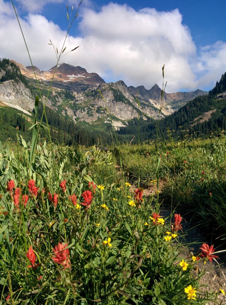
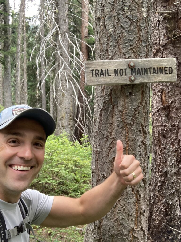
Leroy Creek branches off the Phelps Creek Trail just past the crossing, and it is a different kind of hiking. The Leroy Creek Trail is an unmaintained climbers’ path, posted by the Forest Service as not maintained, climbing about 1 mile and 2,000 feet to Leroy Basin at about 6,000 feet, under Seven Fingered Jack and Mount Maude. Washouts cross the creek route in places. From the basin, the Leroy Creek High Route climbs over a saddle on Mount Maude’s shoulder and drops about 500 feet to the upper Ice Lake, about 8 miles from the trailhead in all.
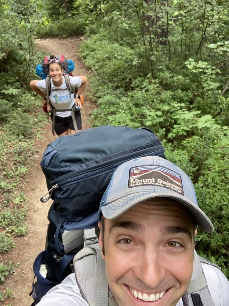
We have hiked this route twice. In 2015 we went up Leroy Creek, left the maintained tread, and worked off trail to the Ice Lakes and camped there, then came back down and camped in Spider Meadow on the way out. In August 2021 we went up Leroy Creek again and camped below the basin of Seven Fingered Jack. One boundary belongs with the route. The Ice Lakes drain north to the Entiat River, and their own trail system comes up the Entiat side. Their full coverage belongs to the Entiat guide in this series. This valley’s claim on them is the high route over the saddle, and it is claim enough.
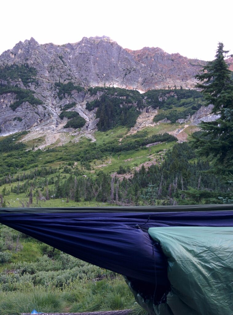
Carne Mountain branches off the Phelps Creek Trail a quarter mile from the trailhead, before any of the routes above, and switchbacks steeply up its own ridge. Its season is autumn. Golden western larches cover its slopes in October, which is why its parking pattern belongs to that month as much as to summer. A party that wants one hard climb from this lot, with the larch color and a summit that stays quieter than its parking lot, takes Carne.
Little Wenatchee Ford Trailhead ends the Little Wenatchee River road at 3,025 feet, and it is the valley’s west door. This lot takes the Northwest Forest Pass or an interagency pass, and a Discover Pass does not work here. The wilderness permit is a free self-issue form, no quota. Four trails leave the Ford. The Cady Creek and Cady Ridge trails climb to the Pacific Crest Trail, the lake’s west-end access to it. The Little Wenatchee River Trail walks the river toward Meander Meadow. The Poe Mountain Trail climbs its own peak. The Ford enters the Henry M. Jackson Wilderness first, and the Glacier Peak Wilderness through the PCT connection. Its lot can fill on a summer day.
White River Trailhead, also signed as the Indian Creek Trailhead, ends the White River road at 2,300 feet. Its permit is the same free self-issue form, no quota. Its pass rule is the second conflicting one in this valley, so the check instruction from the Phelps Creek lot applies here too. Four trails leave this one lot. The Indian Creek and White River trails both reach the Pacific Crest Trail, by different valleys. The Mount David Trail climbs the big peak above the lake’s north shore, and the Boulder Creek Trail walks its creek. Older reports describe room for 15 to 20 cars here, which fits its pattern.
Stevens Pass is the fourth door, on US-2 at the crest, and it works on highway rules rather than forest road rules. PCT parking stands in Lot E, on the Pacific Crest Trail Association’s direction, and vehicles parked in the ski area’s other lots may be towed. The lot takes an annual pass or a $5 day pass, paid on site through the Recreation.gov app, and an overnight trip needs a pass for each day, displayed. A free trailhead permit covers the hiking, for groups of 12 at most. There is a vault toilet and no drinking water. The trailhead is heavily used in summer. Its winter parking rules belong to the ski season and are not stated here, so check them before a winter trip.
Southbound from the pass, the PCT enters the Alpine Lakes Wilderness, the only door into that wilderness in this guide’s country. The Enchantments permit lottery does not apply here. That lottery belongs to the Icicle Creek trailheads below Leavenworth, in a neighboring guide’s country.
Seasons and winter
This valley runs on snow and elevation more than on calendar dates. The lake sits at about 1,900 feet and its campgrounds come out of winter first. The river roads climb from there, and their campgrounds open as their stretches of road clear, the highest ones last. No federal campground in this guide publishes a firm season, so the district’s current status is the settling source in spring, every year. Mosquitoes set the early summer’s terms, worst in June, easing as the summer dries. The lake’s wind builds through summer afternoons. Autumn is the larch season in the high country. Then the snow comes back and the valley changes systems.
Winter belongs to the state park. When snow arrives, its campgrounds close and winter camping moves to a designated area at the South Park day use lot, first come, with heated restrooms and showers. The park becomes a Sno-Park, and the pass stack swaps. From November 1 through March 31 a Sno-Park permit replaces the Discover Pass, which is not valid at Sno-Parks. Lake Wenatchee is one of the state’s eight special groomed trails Sno-Parks. Its winter users need the seasonal permit at $50 plus the special groomed trails sticker at $70, or the one-day permit at $25, which covers groomed sites for its day. A combined seasonal and groomed permit sells at $120. Permits sell November 1 through April 30.
The park’s groomed ski and snowshoe trails are the winter draw, and the Nason Ridge route from the hiking section runs from the park side in a winter snowshoe form. A camper who sleeps in the day use lot in January is base camping for that trail system, in a valley that feels entirely different from the one the summer crowds know.
Fire restrictions and emergencies
Fire rules in this valley stack, and the strictest layer in force governs. The layers are worth knowing separately, because four different authorities set them and each changes on its own schedule: the Forest Service and the state park set the campground rules, Chelan County sets its burn restrictions in county code, the Department of Natural Resources rates fire danger, and the Department of Ecology can ban burning for air quality.
The base layer is the forest and park rule. In developed campgrounds, fires belong in the fire rings, stoves, and grills provided, and pets stay restrained or on a leash. Food storage is a standing federal order in this forest, not a suggestion. In bear country here, food and scented items are stored in a bear resistant container, a hard-sided vehicle or boat, or a hard-sided building, at all times. The state park flags the same bear country rules.
The county layer is Chelan County’s code, and every campground in this guide stands in unincorporated Chelan County’s Mountain Zone. The county’s restrictions begin June 1 in its Valley Zone and expand July 1 to the Mountain Zone, where residential campfires are prohibited in designated areas and coal briquettes are prohibited from July 1. Propane appliances stay allowed. Fireworks are banned year round in the unincorporated county, outside one New Year’s Eve window. The county removes its restrictions October 1 unless it extends them.
The state adds two more layers. The Department of Natural Resources rates fire danger by rating area, and this valley spans the Chelan and Valley areas on its burn restrictions page. The Department of Ecology can ban burning on air quality grounds, on its own authority and its own page. The standing practice follows from the stack. Build fires only where the rules in force on the day allow them, and check the current state before a trip, at the Chelan County fire restrictions page, the DNR burn restrictions page, and the Ecology burn bans page. Lake Wenatchee Fire and Rescue, Fire District 9, is the valley’s own fire district, and the county’s Emergency Incidents Map and Everbridge alerts carry its active incidents.
Emergency readiness has a short form here. The hospital town is Leavenworth. Cascade Medical, at 817 Commercial Street in Leavenworth, is the district hospital, and its district covers Plain and Lake Wenatchee expressly. County 911 calls route through RiverCom, the Chelan and Douglas dispatch. The Wenatchee River Ranger District office, in Leavenworth at (509) 548-2550, answers for the roads and campgrounds in this guide. Cell service cannot be counted on up the river roads, which the FAQ below takes up. A camper registers for the county’s Everbridge alerts before a trip in fire season and finishes any downloads before leaving the lake.
Camping with an RV at Lake Wenatchee
The RV form of this valley is a study in one full service park, one partial utility campground, and a long field of dry sites. Thousand Trails at Plain carries the full hookups, 279 sites of them, on the operator’s membership terms. The state park’s North Campground carries 42 partial utility sites with water and electric. No federal campground in this guide lists hookups of any kind, and the entries above carry each one’s limits. Nason Creek takes an RV plus a tent on a site and warns its own way about water. Its water stands in common areas, from a handpump or a spigot, and there is no RV hose hookup to its system. Fill the tank before arriving.
Size rules run by campground. The state park’s South Campground takes vehicle and trailer combinations under 20 feet. Where a Chiwawa campground’s page prints a trailer maximum, it prints 30 feet. Glacier View is walk-in camping, full stop. White River Falls has no trailer turnaround, which is a harder limit than any number. On the Little Wenatchee road and at Meadow Creek, plan as a self-contained rig and confirm with the district, since their listings settle little. The roads themselves vote too. The upper Chiwawa’s final miles are very rough, and the White River and Little Wenatchee roads flood in storm years.
The dump station count for the whole valley is one. The state park’s trailer dump, in its North Campground, charges $5 a use, and it is the only dump station at a public campground in this guide. No federal campground here has one, and there are no showers at any federal campground either. A rig running the river roads plans on the park’s dump on the way out, or on Leavenworth. Generators follow the same split as everything else in this valley. The state park prints its hours, 8 a.m. to 9 p.m., with quiet hours from 10 p.m. to 6:30 a.m. No federal campground here publishes quiet or generator hours.
Dispersed camping around Lake Wenatchee
Dispersed camping exists all around this valley’s developed campgrounds, along the river roads’ spurs, around Fish Lake, and up the side roads where the national forest allows it. The rules that govern it are the district’s, and they change with fire and road conditions, so the working instruction is the standing one. Check the Wenatchee River Ranger District’s current dispersed camping rules before relying on any particular pullout, and camp in places that show prior use rather than cutting new ones. This guide’s full treatment of dispersed camping in the Central Cascades belongs to the Dispersed guide in this series, which takes the whole cluster’s undeveloped camping as its subject.
One named place belongs in this pointer. Alder Creek Horse Camp, on the Chiwawa Loop side of the valley’s south end, was a developed equestrian campground in an earlier era. Firsthand accounts from recent years describe it as unmanaged dispersed camping now, one large defined site with a fire ring and smaller sites on a spur above it, its vault toilet a remnant and its corrals and signage gone. Treat it as dispersed camping land, not as a campground. Nothing there is maintained, reserved, or serviced, and a camper who goes takes the place entirely as found.
Frequently asked questions
Can I camp at Lake Wenatchee without a reservation? Yes. The state park self-registers campers for open sites, about 40 percent of Nason Creek is first come, and every other federal campground in this guide is first come entirely. The gamble is real on summer weekends. Weekday and Sunday afternoon arrivals run the pattern in a camper’s favor.
How far ahead can I book a campsite at Lake Wenatchee? The state park opens its window up to nine months ahead, through washington.goingtocamp.com, and takes reservations until 2 p.m. on the arrival day. Federal sites on Recreation.gov release six months ahead on a rolling window at 10 a.m. Eastern, and group sites can book up to twelve months ahead.
Do I need a Discover Pass to camp at Lake Wenatchee State Park? A Discover Pass covers vehicle access to the park for day use, at $45 for a year or $10 for a day, and campers pay the park’s nightly camping fee through its reservation system. No pass pays a camping fee anywhere in this valley. From November 1 through March 31 the park is a Sno-Park, and a Sno-Park permit replaces the Discover Pass there.
Are there any hookups at Lake Wenatchee? Two places have them. The state park’s North Campground has 42 partial utility sites with water and electric, and Thousand Trails at Plain has full hookups at a private membership campground. No federal campground in this guide has hookups of any kind.
Is there a dump station near Lake Wenatchee? One at a public campground. The state park’s trailer dump stands in its North Campground and charges $5 a use. No federal campground here has a dump station, so rigs plan on the park or on Leavenworth.
When do the Lake Wenatchee campgrounds open? The state park stays open all year, and its campgrounds close when the snow arrives, with winter camping in its South Park day use lot after that. The federal campgrounds publish no firm season dates. They open as their roads clear in spring, the lowest first, and the Wenatchee River Ranger District’s current status is the source to check.
Can I bring my dog camping at Lake Wenatchee? Yes, on a leash. At the state park the leash runs no more than 8 feet, and dogs stay off the designated swimming beaches. At the federal campgrounds, pets stay restrained or on a leash in the developed sites. The standard bear country food storage rules apply to pet food as well.
How bad are the mosquitoes at Lake Wenatchee? June is the worst of it, and the pattern runs on wind. Wind off the lake holds them down, which is why exposed lakefront sites can be nearly free of them on a breezy day. Calm air releases them, worst when the air is still, and in the sheltered woods. They ease as the summer dries, and by August they have usually thinned.
Is there cell service at Lake Wenatchee? Plan as if there is none up the river roads. Download the Recreation.gov app for Scan and Pay, and your maps, before the trip, the way the Forest Service itself advises. Campers who need to stay reachable name a check-in plan at the lake rather than counting on a signal at camp.
Can I have a campfire at Lake Wenatchee? In a campground’s provided fire rings, when the rules in force allow it. Chelan County’s restrictions expand into the Mountain Zone each July 1, the state rates fire danger and can ban burning for air quality, and the strictest layer in force governs. Check the current state before a trip at the county, DNR, and Ecology pages named in the fire section above. Propane appliances stay allowed under the county rules.
What do I do if every campground at Lake Wenatchee is full? Drive up a river road. Twelve campgrounds stand up the Chiwawa alone. Nason Creek’s first come share turns over around its noon check out. Thousand Trails at Plain sells the guaranteed site. And the lake itself takes day use even when every site is taken, the beach and trails on a Discover Pass and the launch at $7 a day.
Where do backpackers park for Spider Meadow? At the Phelps Creek Trailhead, in Trinity at the end of the Chiwawa River road. The wilderness permit is a free self-issue form with no quota. Published sources conflict on whether the lot requires a recreation pass, so check the ranger district’s current fee information or the sign at the lot. The road to it has closed for whole seasons in fire and storm years, so check its current status before any trip that depends on it.
Sources
Checked November 2026. Wenatchee River Ranger District and Okanogan-Wenatchee National Forest campground and trailhead pages for Lake Wenatchee’s federal campgrounds and the Phelps Creek, Little Wenatchee Ford, White River, and Stevens Pass trailheads, fs.usda.gov. Their Recreation.gov facility listings for Nason Creek, the Grouse Creek Group Site, and Goose Creek, and Recreation.gov’s pass pages for the Northwest Forest Pass terms, recreation.gov. Washington State Parks pages and the park brochure for Lake Wenatchee State Park, its reservation system at washington.goingtocamp.com, and the Sno-Park permit pages, parks.wa.gov.
Forest orders for the Okanogan-Wenatchee National Forest, including the forest-wide stay limit and food storage orders, and the district’s alerts for road and fire closures, fs.usda.gov. Chelan County Code 7.52 and the county’s fire district and emergency management pages, co.chelan.wa.us. Washington Department of Natural Resources burn restrictions, dnr.wa.gov, and Department of Ecology burn bans, ecology.wa.gov. Washington Trails Association hike pages and trip reports for Phelps Creek and Spider Meadow, Leroy Creek and the Ice Lakes High Route, Carne Mountain, Dirtyface Peak, and the White River and Little Wenatchee trails, wta.org. Thousand Trails Leavenworth and Midway Gas and Grocery, the businesses’ own pages. Cascade Medical, Leavenworth, for the hospital district’s coverage of Plain and Lake Wenatchee.