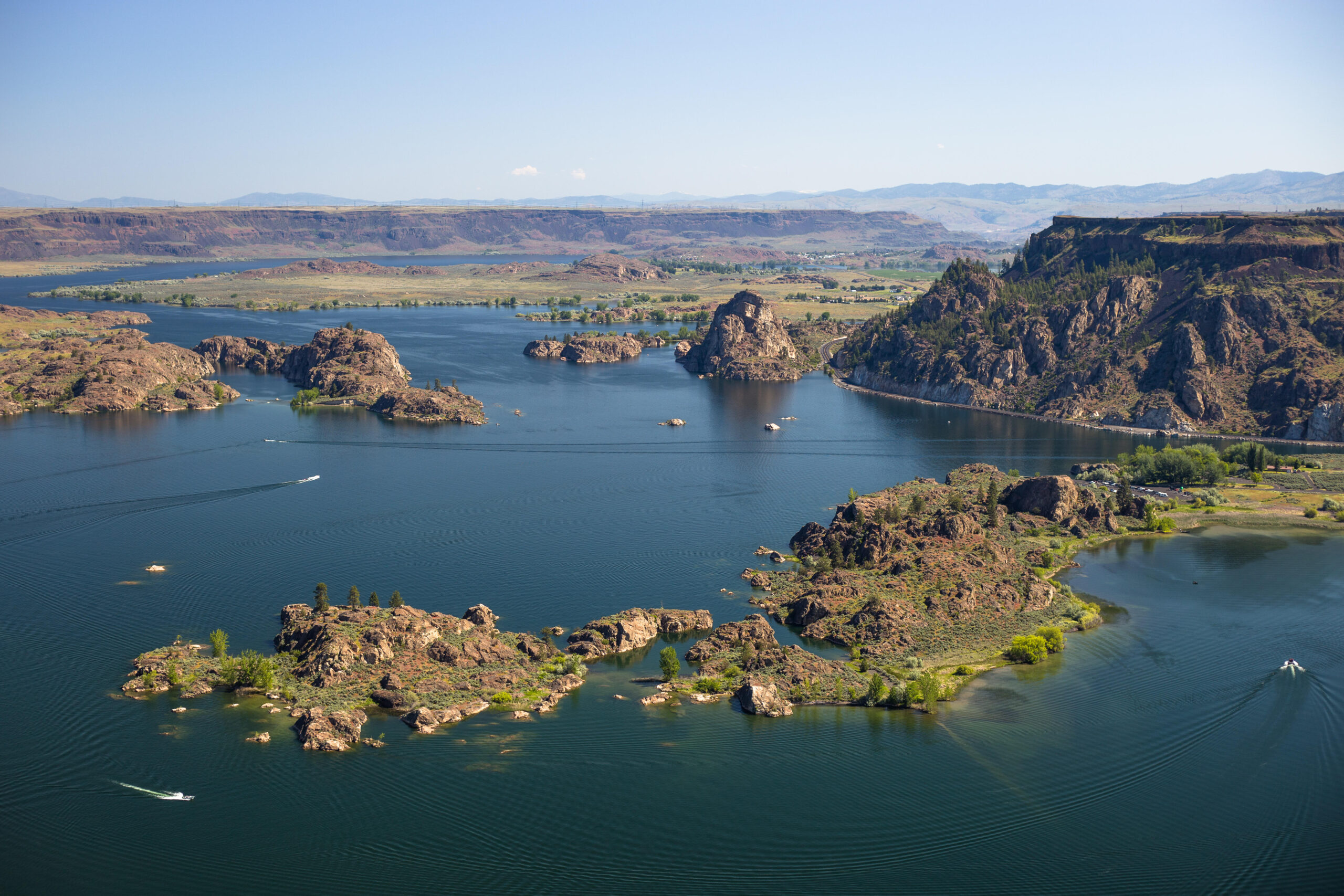
Eastern Washington camping is reservoir and river camping east of the Cascade crest, spread across eight camping countries that share a dry climate and almost nothing else. A camper can sleep on the Columbia at Wenatchee, on a coulee lake under a basalt butte, or on the 151 mile reservoir behind Grand Coulee Dam. The same camper can sleep in a Spokane city park, in the Colville National Forest, or on the Snake River. Those nights are run by different agencies and operators, each with its own booking system, and at some of those campgrounds there is no drinking water at all.
This guide carries the whole region in one place, campground by campground. Dispersed camping on the region’s national forest and state lands runs on its own rules, which the dispersed camping in Washington guide lays out statewide. The rest of the state’s camping regions stand in the Washington campgrounds by region guide. Each campground’s fees and booking rules are stated from its manager’s own record wherever that record settles them, and named as open where it does not.
Two corrections come first, because they answer searches that arrive every month. There is no camping at Palouse Falls, and there is no camping at Lyons Ferry State Park. Both are day use parks. The campgrounds that serve their country are Lewis and Clark Trail State Park, Fields Spring State Park, and the marina campground at Lyons Ferry itself. Both corrections stand as entries in the southeast section below, so a reader who came for either name leaves with a campground that exists.
The governing fact of the region is dryness. Summer highs run into the upper 90s and past 100 degrees, the reservoir parks carry essentially no shade, and annual precipitation across the Columbia Basin is under 10 inches. Carry all of your drinking water, because the lakes are not a supply. Check the fire restrictions for your county and your campground’s manager before any trip, because three layers of rules stack over every campfire here and the strictest one governs.
In this guide
- Eastern Washington camping at a glance
- Passes, fees, and booking
- Leavenworth and Wenatchee
- Naches and White Pass
- Columbia Basin
- Lake Roosevelt
- Spokane and the northeast
- The Okanogan
- The southeast and the Snake River
- Yakima River Canyon
- Hiking in eastern Washington
- Fire restrictions and emergencies
- Frequently asked questions
- Sources
Eastern Washington camping at a glance
The table below carries the guide’s full and short entries in the order the sections treat them. Campgrounds carried at roster depth stand in their sections’ roster passages and tables. The two day use corrections stand in the southeast section, because neither has a campground to tabulate.
| Campground | Manager | Sites | Booking | Water |
|---|---|---|---|---|
| Leavenworth/Pine Village KOA Holiday | Private | About 135 sites | Reservations through the operator | At hookup sites |
| Alpine View RV Park and Campground | Private | About 33 sites | Reservations through the operator | At sites |
| Blu-Shastin RV Park | Private | About 85 to 86 sites | Reservations through the operator | At hookup sites |
| Wenatchee River County Park | Chelan County | 49 sites, no tents | Reservations through the operator | At hookup sites |
| Wenatchee Confluence State Park | Washington State Parks | 60 sites | Reservable; first come in winter | Drinking water; winter supply by the dump station and at sites 34 and 36 |
| Lincoln Rock State Park | Washington State Parks | Three loops plus a group camp | First come until May 15 | Frost-free spigots in winter |
| Bumping Lake Campground | Forest Service, concessionaire operated | Lake campground on the Bumping River | Reservable | Carry water |
| Leech Lake Campground | Forest Service | 16 sites | Recreation.gov information listing | Carry water |
| Dog Lake Campground | Forest Service | Small lake campground | First come | None; carry water |
| Steamboat Rock State Park | Washington State Parks | Main campground plus primitive bay campgrounds | Reservable April 1 to October 31 | At the main campground; none at the primitive forms |
| Sun Lakes-Dry Falls State Park | Washington State Parks | 96 standard and 41 full hookup sites | Reservable in season; first come September 16 to April 14 | Drinking water; winter supply near the welcome station |
| Potholes State Park | Washington State Parks | Reservoir campground, open year-round | Reservable in season; first come November 1 to the end of February | Winter supply at the dump area |
| Wanapum Recreation Area | Washington State Parks | 49 sites | Reservable April 16 to October 15 | Drinking water |
| Spring Canyon Campground | National Park Service | Hillside loops above the reservoir | Reservation required, $30 a night | Water spigots in the loops |
| Kettle Falls Campground | National Park Service | North end campground plus the Locust Grove group site | Reservation required, $30 a night | See the Lake Roosevelt system passage |
| Riverside State Park | Washington State Parks | Three camping areas | System reservations | Seasonal by area; see the entry |
| East Sullivan Campground | Forest Service | 46 sites | Reservable | Drinking water |
| Mount Spokane State Park | Washington State Parks | 8 sites at Bald Knob | Reservations for all open dates | Carry water |
| Curlew Lake State Park | Washington State Parks | Sites numbered to 80 | Most sites reservable | Off November 1 to April 5; winter supply near the welcome station |
| Conconully State Park | Washington State Parks | Two-unit park on the Conconully lakes | Reservable in season; first come April 6 to May 15 | Winter supply near the dump station |
| Alta Lake State Park | Washington State Parks | Three loops on Alta Lake | First come October 1 to 31 and April 3 to 14 | Winter supply near the park office |
| Bridgeport State Park | Washington State Parks | 34 sites | First come September 15 to April 30 | Winter supply near the trailer dump |
| Fields Spring State Park | Washington State Parks | 20 sites | First come September 15 to May 15 | Carry water |
| Lewis and Clark Trail State Park | Washington State Parks | 24 to 25 standard sites | First come at both shoulders | Carry water |
| Chief Timothy Park | Corps of Engineers, privately operated | Full service island campground | Season, May 1 to October 31 | Full service |
| Roza Campground | Bureau of Land Management | The canyon’s downriver campground | $15 a night; reservable May 1 to September 30 | None; carry water |
| Big Pines Campground | Bureau of Land Management | 42 sites | $15 a night; reservable May 1 to September 30 | None; carry water |
| Lmuma Creek Campground | Bureau of Land Management | 7 sites | $15 a night; reservable May 1 to September 30 | None; carry water |
| Umtanum Campground | Bureau of Land Management | At the Umtanum Creek trailhead | $15 a night; reservable May 1 to September 30 | None; carry water |
| Yakima Sportsman State Park | Washington State Parks | Standard and full hookup sites plus a group camp | System reservations | Drinking water |
The dry east frame governs every section that follows. Afternoon wind in the coulees takes unstaked canopies, rattlesnakes work the shrub steppe and the talus, ticks run spring through autumn, and basalt holds the day’s heat into the evening. A party that packs for shade, water, and wind at home will not have to improvise any of the three at the campground.
Resupply follows the towns, and the distances are eastern Washington distances. Wenatchee serves the Wenatchee and Leavenworth country, Yakima serves the White Pass and Naches strings, Spokane serves the northeast, and Moses Lake serves the Columbia Basin at town level. Inside the Colville National Forest the resupply towns are Colville and Newport, and Republic serves Curlew Lake. Colfax and Dayton serve the southeast, and Lewiston, across the Snake River in Idaho, is the Snake River’s full service town. The same towns are the hospital towns, and the fire section below carries the emergency form in full.
Booking rhythm is the region’s other governing fact, and it runs on the calendar each manager prints. The reservable campgrounds book through their systems inside their stated windows, and the first come campgrounds carry the parties who plan around them. A party’s real choice is usually made weeks before the trip: reserve an anchor, or plan around a first come shoulder.
The shoulders are this region’s reward. September and October open the state parks’ long first come windows, on the dates the entries below state. A fall party camps on a first come basis at campgrounds that took reservations all summer.
The entries in this guide rest on the managers’ own pages, schedules, and booking records. No firsthand campground stay in this region stands behind them. The guide carries two firsthand facts: that he looked at Leavenworth area camping and never stayed because it was always too crowded, and a hotel night in Grand Coulee. Both stand in their sections.
Three boundary lines close the map. Hells Gate State Park stands in Lewiston, Idaho, and takes no part in this guide beyond this naming. The lookout and rental forms that appear on the forest lists are rentals, not campgrounds, and take no entries. Lake Chelan and Lake Wenatchee belong to their own guides and are named only where a section’s road reaches their boundary.
Passes, fees, and booking
Washington State Parks
Washington State Parks runs the anchor campgrounds in five of this guide’s sections, and every one of them runs on the same system. Nightly site fees run by site type and season. In peak season, May 15 to September 15, a standard site runs $31 to $43, a partial utility site $41 to $51, and a full utility site $46 to $56. In the shoulder seasons, April 1 to May 14 and September 16 to October 31, the same three site types run $23 to $35, $35 to $46, and $41 to $51. In winter, November through March, they run $23, $35, and $41, and a primitive site runs $12 in every season.
Reservations run through washington.goingtocamp.com. Check-in is 2:30 p.m. and check-out is 1 p.m. Quiet hours run 10 p.m. to 6:30 a.m. An extra vehicle costs $10 a night, and showers cost 50 cents for three minutes.
The stay rule that took effect August 19, 2024 binds every state park stay in this guide. A party may stay 10 nights in one park within a 30 day period. Across the system the cap is 90 days per calendar year, with one party and eight people maximum per site. A Discover Pass covers day use parking at the state parks, and the day use corrections below turn on it. A visit to Palouse Falls or Lyons Ferry is a day use visit and nothing more.
Each park’s own page and winter schedule carry its season form, and the entries below take their seasons from those rows. Several parks in this region run a split year, reservable in season and first come at the shoulders. Two of them, Wenatchee Confluence and Riverside, keep part of their camping open all year. The winter water pattern repeats across the system: water turns off in autumn, and a winter supply stands at a named point, which each entry names.
Lake Roosevelt
Lake Roosevelt runs as one system under the National Park Service, and its rule is the simplest in the region to state and the easiest to get wrong. Every vehicle-accessible site in the recreation area is reservation required, booked through Recreation.gov. Boat-in sites are first come. No interagency pass pays a camping fee here.
Two fee tiers cover the Park Service’s standard campgrounds. The $30 tier runs at Evans, Kettle Falls, Gifford, Hunters, Fort Spokane, Porcupine Bay, and Spring Canyon, and the concessionaire campground at Keller Ferry also stands at $30. The $23 tier runs at North Gorge, Snag Cove, Kettle River, Kamloops Island, Marcus Island, Haag Cove, Cloverleaf, Hawk Creek, and Jones Bay. Group sites stand at Evans, at Locust Grove at Kettle Falls, at Gifford, at Hunters, at Keller Ferry, and at Spring Canyon.
Dump stations stand at Evans, Kettle Falls, Gifford, Hunters, Porcupine Bay, Fort Spokane, Keller Ferry, and Spring Canyon. A dump and water fee has been in force since March 15, 2025. The reservable season runs April 1 to November 30 at every campground. From December 1 to March 31 only single loops at Spring Canyon, Fort Spokane, and Kettle Falls stay reservable, and Cloverleaf runs May 1 to September 30 only. The Lake Roosevelt section below carries the full roster and the drawdown rule that governs its boat ramps.
Forest Service campgrounds
The Forest Service runs the pass strings and the northeast roster, through the Okanogan-Wenatchee and Colville National Forests. Its developed campgrounds share a baseline everywhere in this guide. Dogs stay on leash, campfires burn in developed rings only, fireworks are prohibited, and the stay limit on developed campgrounds is 14 days.
Booking splits by campground. Reservable campgrounds book through Recreation.gov, and the rest are first come, and each entry below states its campground’s form where the record settles it. For the Naches and White Pass strings, the fees and reservable seasons in the entries come from the campgrounds’ own Recreation.gov Seasons and Fees panels, read for the 2027 season. No figure for those strings is borrowed from a roundup or a mirror site. Two limits ride with the panels.
Dog Lake stands on Recreation.gov as an information listing with no fee panel at all, so its entry prints no fee and rests on the forest’s district record. And a campground whose panel lists no rates, as South Fork Tieton’s does, prints without a fee in the same way.
Yakima River Canyon
The Bureau of Land Management runs the Yakima River Canyon’s four campgrounds as one small system, and its prices are the region’s most legible. Camping costs $15 a night at Roza, Big Pines, Lmuma Creek, and Umtanum, and day use at the canyon’s sites, including the Bighorn day use area, costs $5. Reservations run May 1 to September 30 through Recreation.gov, and the campgrounds are first come from October 1 to April 30. The canyon is open year-round, and no canyon campground has drinking water or hookups at any site.
County and private campgrounds
County and private campgrounds book through their own operators, on their own systems, and no shared rule covers them. Chelan County’s one campground, Wenatchee River County Park at Monitor, carries its operator’s fee schedule in its entry below, effective August 1, 2026. The Corps of Engineers owns Chief Timothy Park on the Snake River and a private operator runs it, and its entry states its season and form.
The private resorts that carry the Leavenworth bucket and the reservoir shores book directly. The membership form in the region, Thousand Trails Leavenworth, is named at awareness weight in its section and takes no entry. A membership campground is not a booking option for a reader without the membership.
Leavenworth and Wenatchee
Leavenworth camping searches land on RV resorts. A tent camper who books the town bucket without reading it will arrive at a hookup site, the one tent exception standing down US-97 at Peshastin. The town has no state or federal campground. Its supply is a KOA, an RV park in town and one at Peshastin on US-97, and a membership campground. Down the Wenatchee River at Monitor stands Chelan County’s campground, which takes no tents at all.
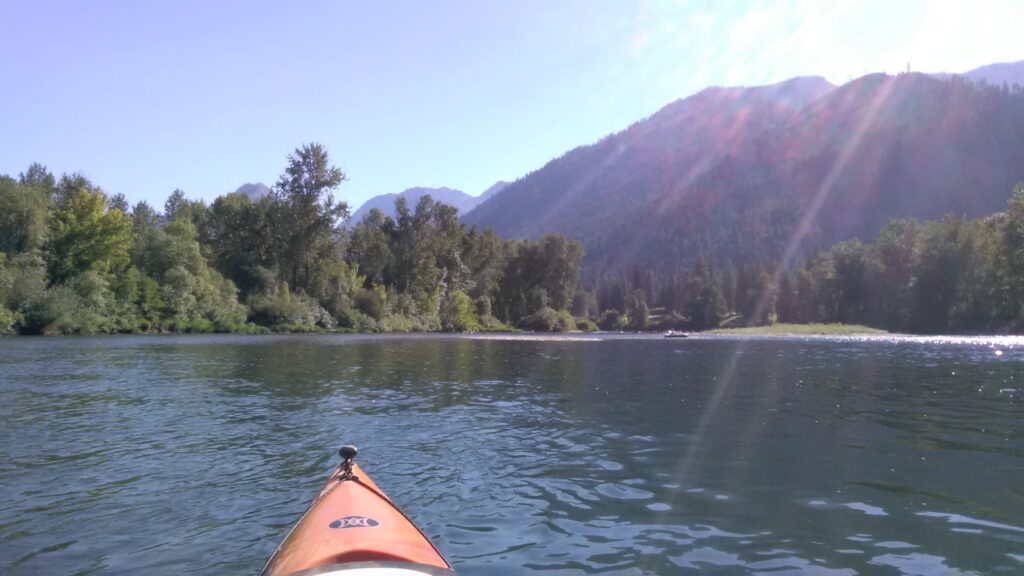
The tent camping that serves Leavenworth stands up Icicle Road, in the Forest Service campgrounds the Icicle Creek guide covers, a short drive from town. This section carries the town bucket as it is. It then follows the Columbia River string north from Wenatchee Confluence State Park to Lincoln Rock State Park on the Rocky Reach Trail.
The author’s own Leavenworth record belongs in this passage. He looked at camping in the Leavenworth area on his trips there and never stayed, because the campgrounds were always too crowded. No campground is named in that record and no stay is claimed. The backpacking and day trips he has made in the Icicle Creek and Enchantments country stand in their own guides and do not change it.
Two seam campgrounds take naming rather than entries. Icicle River RV Resort stands on Icicle Road and belongs to the Icicle Creek guide’s country. Thousand Trails Leavenworth is a membership campground, named here so a reader holding the name knows its form.
Daroga Point State Park stands further north on Lake Entiat beyond Lincoln Rock. It is reservable for all its open dates, with its campground closed October 1 to April 1. It rides at roster depth at the end of the river string below.
Leavenworth/Pine Village KOA Holiday
Quick facts: sites, about 135 sites on the Wenatchee River, with full hookups taking rigs to 65 feet and cabins in the mix; booking, reservations through the operator; site character, the town bucket’s anchor resort form, with a shuttle into Leavenworth; resupply, Leavenworth’s groceries and fuel in town.
Leavenworth/Pine Village KOA Holiday is the form most Leavenworth camping searches are actually asking for, a full resort campground on the Wenatchee River at the edge of town. Its sites run to full hookups long enough for 65 foot rigs, and its cabins give a party without camping gear a bookable Leavenworth base. The shuttle into town is the feature that shapes a stay here, because it separates the campground from the town’s parking problem.
It is a private resort, priced and run as one, and it is the bucket’s RV answer rather than a substitute for Icicle Creek’s Forest Service tent campgrounds. A family that wants hookups, a cabin option, and a ride into town is served here. A tent camper who wants a forest site should read the seam passage above and book up Icicle Road instead.
Alpine View RV Park and Campground
Quick facts: sites, about 33 sites; season, open year-round on the operator’s own form; position, 9825 Duncan Road, three quarters of a mile from downtown Leavenworth; dump, a dump station available on the operator’s record; resupply, downtown Leavenworth on foot.
Alpine View RV Park and Campground is the bucket’s walk to town form. Its roughly 33 sites stand three quarters of a mile from downtown, close enough that a party can leave the rig parked and walk in for dinner. Its season stands as year-round on the operator’s own form, which makes it the town’s winter RV option as well.
The park’s trade is size for position. It is the smallest of the town’s private forms, and what it sells is the shortest walk. A camper choosing between Alpine View and the KOA is choosing between walking into town and riding a shuttle to it. The resort’s facilities stand on the KOA side of the ledger.
Blu-Shastin RV Park
Quick facts: sites, about 85 to 86 sites, full hookups plus tent sites; position, on Peshastin Creek at Peshastin on US-97, southeast of Leavenworth; site character, a creek side park outside the town’s immediate orbit; resupply, Leavenworth a short drive north, Peshastin at hand.
Blu-Shastin RV Park stands apart from the town bucket in the way that matters most to a tent camper. Alongside its full hookup sites it carries tent sites, one of the few tent welcoming forms in the Leavenworth supply. Its creek side position at Peshastin also puts it outside the town’s weekend compression, on US-97 between Leavenworth and the Wenatchee River.
For a party driving US-97, Blu-Shastin works as the Leavenworth stay that does not require entering Leavenworth. For a tent party set on sleeping near town without driving up Icicle Road, it is the bucket’s honest answer. Its creek is Peshastin Creek, which the park’s name shortens and its position confirms.
Wenatchee River County Park
Quick facts: sites, 49 sites at 2924 State Highway 2, Monitor, of which 43 are full hookup, 4 are water and electric, and 2 are dry, with 3 of the sites pull-through; tents, no tent camping anywhere in the park, and every camper sleeps inside an RV or a vehicle; season, April 1 to October 31; nightly fee, on the operator’s schedule effective August 1, 2026, full hookup $55 a night and $330 a week plus tax, and a dry site $35 a night plus tax; site character, 17 developed acres on the Wenatchee River between Cashmere and Wenatchee; resupply, Cashmere and Wenatchee on State Highway 2.
Wenatchee River County Park is Chelan County’s only campground, and its first fact is the one its entry must not bury. This is an RV campground. Tents are not allowed anywhere in the park, and the operator states the rule and its reason directly. A tent party that books here has booked the wrong campground. No other public campground in the Leavenworth and Wenatchee country carries that restriction, which is why it leads this entry.
For the rig it is built for, the park is a strong riverfront form. Forty-three of its 49 sites are full hookup, the highest hookup share of any public campground in this section. The park spreads across 17 developed acres beside the Wenatchee River at Monitor. Its position does quiet work as well. Monitor sits between Cashmere and Wenatchee, close enough to serve either town and outside both towns’ summer crowds.
The fee schedule in the Quick facts is the operator’s own, effective August 1, 2026. It is the only county campground fee in the region published by its operator. A party comparing the county park against the town’s private resorts should compare like with like: full hookup against full hookup. The county park’s river frontage and its smaller scale stand on its side of the ledger.
Wenatchee Confluence State Park
Quick facts: sites, 60 sites on 194 acres at 333 Olds Station Road, Wenatchee, 8 standard and 52 full hookup, with a maximum length of 65 feet; potable water, drinking water, with water turned off around November 1 and a winter supply near the dump station and at sites 34 and 36; restrooms, yes; showers, yes, at the system rate; campfires and firewood, firewood available, with fires under the park’s posted restriction level; check-in 2:30 p.m., check-out 1 p.m.; booking, reservable in season, and first come from October 16 to March 31; pets, on the system leash rule; dump station, yes; quiet hours, 10 p.m. to 6:30 a.m.; group camp, reservable, for 50 to 250 people; site character, an urban riverfront park where the Wenatchee River meets the Columbia, with the Apple Capital Loop Trail through the park; season, camping all year, with Loop 2 open all year and Loop 1 closed from October 16 for a construction project until the project completes; resupply, Wenatchee’s full services at the park’s edge; emergency readiness, Wenatchee is the hospital town for this country.
Wenatchee Confluence State Park stands where its name says, at the meeting of the Wenatchee and Columbia Rivers inside the city of Wenatchee. It is the most hookup heavy state park form in the region. Fifty-two of its 60 sites are full hookup. A party that wants a serviced site on the Columbia, inside a city, with a paved trail system running through the park, is describing this park. No other park in this guide matches that description.
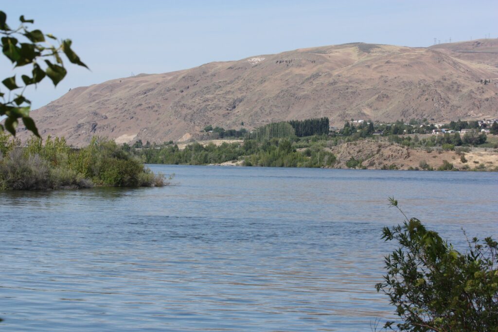
Its winter form is the fact its season turns on. Loop 2 stays open all year, and camping runs first come from October 16 to March 31. A winter water supply stands near the dump station and at sites 34 and 36, after the park’s water turns off around November 1. Loop 1 stands closed from October 16, and its reopening depends on completion of a construction project. A winter party plans on Loop 2 and treats any Loop 1 opening as a change to verify on the park’s page before driving.
The trails are the park’s second identity. The Apple Capital Loop Trail, a paved 10 mile loop, runs through the park, and the Rocky Reach Trail leaves it northward along the Columbia toward Lincoln Rock State Park. A party can ride or hike from its site to the next campground in this section without starting a vehicle. No other pair of entries in this guide can claim that. The park’s group camp, reservable for groups from 50 to 250 people, is also the largest group form in the region’s state parks.
Lincoln Rock State Park
Quick facts: position, on Lake Entiat, the Columbia River reservoir, in Douglas County north of Wenatchee; sites, standard, partial hookup, and full hookup sites across three loops, with Loop 3, sites 28 to 58, full hookup and Loop 2, sites 60 to 94, partial hookup at a settled count of 35, plus 12 cabins; booking, first come until May 15, and first come again from October 16 to 31 and March 1 to May 14; maximum length, 65 feet, limited availability; restrooms, accessible restrooms and showers near the loops; dump station, one; group camp, for up to 50 people, with two partial hookup sites, one full hookup site, a shelter, a fire pit, and a barbecue brazier; check-in 2:30 p.m., check-out 1 p.m.; quiet hours, 10 p.m. to 6:30 a.m.; potable water, frost-free spigots near the park entrance by the dump station and across from site 34 in Loop 2 during the closed season; season, the campground closes November 1 to March 13; site character, a reservoir shore park on the river string north of Wenatchee, with the Rocky Reach Trail running south toward Wenatchee Confluence; resupply, Wenatchee down the river road.
Lincoln Rock State Park is the north anchor of the Wenatchee river string and the eastern Washington park the most people look up by name. It stands on the east shore of Lake Entiat in Douglas County, on the Columbia above Rocky Reach Dam. Its camping runs in three loops, and the hookup split is the entry’s working fact. Loop 3 is the full hookup loop, Loop 2 is the partial hookup loop at 35 sites, and the standard sites fill out the form.
This guide prints that loop structure rather than a grand total, because the park’s own forms leave a one site difference in the full hookup count unsettled. The loop a camper books matters more than the arithmetic.
Its booking form is the string’s surprise. The loops are first come until May 15, a late first come season for a park of this demand. The shoulders run first come again, from October 16 to 31 and March 1 to May 14.
The campground then closes outright from November 1 to March 13, with frost-free spigots at the entrance and in Loop 2 serving the open shoulder days at either end. A spring party that arrives before May 15 drives in and takes an open site. A party planning a winter stay should plan on the Confluence instead, which keeps Loop 2 open all year.
The park’s group camp holds up to 50 people with its own hookup sites, shelter, fire pit, and brazier, the Wenatchee country’s bookable group form at this scale. Between the cabins, the group camp, and three loops of sites, Lincoln Rock carries more distinct sleeping forms than any other park on the river string. That range is part of why its name outpulls every other Washington place term in the region.
The bucket’s split by vehicle is the practical summary of the whole section. A rig party books by position: Alpine View to walk into town, the KOA for the resort form and the shuttle. Blu-Shastin answers for the creek and the quieter highway, and the county park for full hookups on the river at a county schedule. A tent party books by exclusion: not the county park, which bars tents outright, and not the town’s hookup sites at full fee unless the town itself is the point. Icicle Creek’s campgrounds or Blu-Shastin’s tent sites are the tent party’s campground instead.
Daroga Point State Park closes the string at roster depth. It stands further north on Lake Entiat and takes reservations for all its open dates. Its campground closes from October 1 to April 1, with day use and the launch closing November 1 to April 1 and water turned off in mid-October. A river party extending north from Lincoln Rock finds Daroga as the string’s third state park, at the depth its record supports here.
Naches and White Pass
The Naches and White Pass country is a Forest Service string, and it reads as one. Two highway arms carry more than twenty developed campgrounds between them: SR 410 along the Naches and Bumping Rivers, and US-12 over White Pass along the Tieton River. Almost all of them are small, and set on the rivers and lakes the highways follow. The reservation anchor is Bumping Lake at the head of the Bumping River arm. The Pacific Crest Trail crosses both highways, at Chinook Pass and at White Pass, and Leech Lake at the summit is its trailhead campground.
One correction opens the section, because the name draws campers every season. Wild Rose is a picnic area on US-12 at 2,400 feet, with no camping and no fee, and it takes no entry here beyond this line.
Bumping Lake Campground
Quick facts: position, on Bumping Lake at the head of the Bumping River, on the SR 410 arm west of Naches; manager, Forest Service, concessionaire operated; booking, reservable through Recreation.gov; season, May 14 to September 18; nightly fee, standard nonelectric sites at $24, $27, and $48 across the panel’s site classes, tent only sites at $27; site character, the arm’s reservation anchor and its only lake campground, the base for the Bumping River campgrounds below it; resupply, Naches at the foot of the arm, with Yakima beyond it.
Bumping Lake Campground is the campground this string is organized around. It is the reservation anchor of the Bumping River arm, and the natural base for the day use and trailheads up the Bumping River Road. Its lake setting separates it from the Bumping River campgrounds below it, which are river campgrounds on moving water.
The Forest Service’s baseline from the passes section governs here: dogs on leash, campfires in the developed rings, fireworks prohibited, and a 14 day stay limit. The arm’s second traffic is the Pacific Crest Trail, which crosses SR 410 at Chinook Pass above the lake. Bumping Lake is the developed base nearest that crossing on the east side. A party meeting a section hiker, or hiking the pass country itself, stages from this campground. The trailhead parking rule in the hiking section applies at the pass in full.
Bumping Lake’s fee and season stand in its Quick facts, taken from the campground’s own Recreation.gov panel. Its site count and maximum length stand unsettled on the primary record, and this guide prints neither rather than carry either figure from a secondary source. The Bumping River campgrounds below it, from Lodgepole down to Bumping Crossing, run smaller and simpler the further up the road a party drives.
The Bumping River and SR 410 campgrounds
Quick facts: booking, the roster campgrounds split between Recreation.gov reservations and first come forms on their facility pages; water, most carry drinking water in season, with Bumping Crossing the named exception; site character, small shaded river campgrounds under the Forest Service baseline; resupply, Naches for the whole string.
The Bumping River and SR 410 campgrounds run as a roster, because no single one of them carries the demand its string does. Their facts stay intact at this depth. Lodgepole Campground carries 33 sites at $24 a night, and Hells Crossing carries 18 at $22 for its standard and tent only sites. Cedar Springs carries 15 sites plus 2 multiple-family sites at $22. Each is a developed river campground reservable from May 14 to September 18 on its Recreation.gov panel.
American Forks carries 12 sites at $15, on the string’s shorter reservable season, May 27 to September 8. Sawmill Flats carries 24 sites further along the highway string, at $24 across its standard, tent only, and walk to sites. Cougar Flat carries standard and walk to sites at $22. Both stand on the May 14 to September 18 season.
Bumping Crossing is the roster’s honest exception, and its facts print in full because they are the point of the campground. It carries 12 sites, no fee, no water, and a first come form, the free primitive end of a string whose anchor is reservable. A party that drives past Bumping Lake’s formality to Bumping Crossing is choosing exactly that trade, and the campground delivers it without a booking system in between.
Soda Springs carries 22 to 23 sites at $24 a night on the string’s record, and one naming line belongs with it. This Soda Springs is the Okanogan-Wenatchee National Forest campground on the SR 410 string. It is not the Gifford Pinchot National Forest campground of the same name on the west side of the crest.
Pleasant Valley stands on the American River with standard sites at $22 a night, reservable from May 14 to September 18. The Forest Service’s own forms give it two site counts, so this guide prints neither. Its fee and season carry its roster line.
Halfway Flat and Kaner Flat complete the string’s reservable roster. Halfway Flat, on the Naches River, runs two standard nonelectric site classes at $10 and $18 a night, reservable from May 20 to September 8 on its panel’s rates table. Kaner Flat, on the Little Naches River, carries 25 reservable sites at $20 and $40, reservable between Memorial Day weekend and Labor Day weekend. Every site runs first come after mid-September. Its group site books at $50, with $10 more on weekend and holiday nights, from May 20 to September 30 on a twelve month booking window.
Little Naches and Cottonwood close the roster on the Naches River itself. Little Naches carries standard sites at $22 and $44 on the May 14 to September 18 season. Cottonwood is a real Forest Service campground on the river off SR 410 at Forest Road 414. It carries standard nonelectric and tent only sites at $22 a night, with vault toilets, drinking water, no hookups, and no dump station. The correction is worth stating because thin listings drop it.
Its reservable season runs May 14 to September 18 on a six month rolling booking window. Its facility notices set check in at 2 p.m. and check out at noon. Its site count stands on its Recreation.gov page, where a booking party reads it.
Elk Ridge Campground stands as the string’s private form, with 9 cabins, 20 RV sites, and tent sites on its operator’s record. A party that wants a cabin on the Naches string books there. The string’s public campgrounds otherwise run without cabins entirely, which is part of the string’s character. It is also part of why its camps fill with tents and small trailers rather than resort rigs.
Leech Lake Campground
Quick facts: sites, 16 sites; position, at White Pass summit on US-12, also signed White Pass Lake; site character, the Pacific Crest Trail’s trailhead campground at the pass, a small full entry whose use is set by the trail rather than the highway; resupply, the White Pass services at the summit, with Yakima down the east side.
Leech Lake Campground is a trailhead campground that happens to take campers, and reading it that way explains its whole form. Sixteen sites stand at the summit lake where the Pacific Crest Trail crosses US-12, and the campground serves section hikers, pass travelers, and lake parties in that order. It is the most searched small campground in this section, which is what a PCT crossing does to a 16 site campground.
The lake is also signed White Pass Lake, and both names stand on the campground’s signs, so a party searching either name is looking at this campground. A PCT party uses Leech Lake as the section’s natural zero point: resupply and a vehicle at the summit, and a legal developed site at the crossing itself. The trail runs north toward Chinook Pass and south into the Goat Rocks from there. The trailhead parking rule from the hiking section applies here in full, because the lot serves the trail first.
Dog Lake Campground
Quick facts: potable water, none, and every party carries its water in; booking, first come; restrooms, vault toilets; length limits, trailers to 20 feet and motorhomes to 24 feet; site character, a small dry lake campground on the US-12 string below the pass; resupply, White Pass summit services and Yakima.
Dog Lake Campground is a dry campground on the Tieton string, and its Quick facts carry the two facts a party needs before choosing it. There is no water, and the length limits are short: trailers to 20 feet, motorhomes to 24 feet. A rig over those lengths does not fit this campground whatever the map suggests, and a party without water aboard cannot fix the problem at the lake.
Within those limits the campground is a simple first come lake camp under the Forest Service baseline, dogs on leash and fires in the rings. The Forest Service’s own pages give the campground two different site counts, so this guide prints none and lets the campground’s form carry the entry. A party driving the string with a small trailer and its water aboard will find Dog Lake the quiet end of the Tieton roster. It stands below the reservable campgrounds at Indian Creek and Hause Creek.
The Tieton and Rimrock campgrounds
Quick facts: booking, Indian Creek and Hause Creek are reservable with piped water, at $27 a night for a standard site at Indian Creek and $27 and $54 across Hause Creek’s standard classes, and Clear Lake South is first come with well water; site character, the US-12 string’s reservoir and river campgrounds between White Pass and Naches; resupply, Naches at the foot of the string and Yakima beyond it.
The Tieton and Rimrock campgrounds spread along the Tieton River and Rimrock Lake below White Pass, and their forms split cleanly. Clear Lake North carries 33 to 34 sites and Clear Lake South 22 to 23 sites with well water and a first come form.
Indian Creek carries 39 sites with piped water and reservations at $27 a night, on a reservable season from May 14 to September 18. Hause Creek carries 42 to 43 sites on the same piped and reservable form, at $27 and $54 across its standard site classes and $27 for its tent only sites. Its season runs a week longer, to September 25. The two campgrounds are the pair a booking party on this string chooses between.
The smaller forms complete the string. White Pass Horse Camp carries 6 sites for stock parties. Peninsula Campground stands first come on Rimrock Lake at $10 a night, paid on site through the Scan and Pay system, on a season from May 20 to September 30.
Tieton Pond and South Fork Tieton stand as the string’s other named smaller campgrounds on the Forest Service record, and neither carries a fee here. South Fork Tieton’s panel states no rates, and Tieton Pond’s fee stands unsettled on the record. Rimrock Lake Resort stands at 37590 US-12 as the string’s private resort form.
One correction closes the string, on the pattern the section opened with. The correction is Dog Lake’s, in the entry above: a small dry campground with vault toilets on the US-12 string, first come, with short length limits. The roster’s reservable pair on this string, Indian Creek and Hause Creek, carry the string’s booking traffic, and its first come campgrounds carry everyone the pair turns away.
Columbia Basin
The Columbia Basin is coulee country: basalt canyons cut by Ice Age floods and filled with irrigation reservoirs. It is hot enough in July that shade is a planning item rather than a preference. Its three full entries are the region’s best-known reservoir state parks, at Steamboat Rock, at Sun Lakes below Dry Falls, and on Potholes Reservoir. Its shore forms run wider than any other section’s, from a city park at Coulee City to private resorts on Banks Lake and Moses Lake. Its western gateway is Wanapum on the Columbia at Vantage.
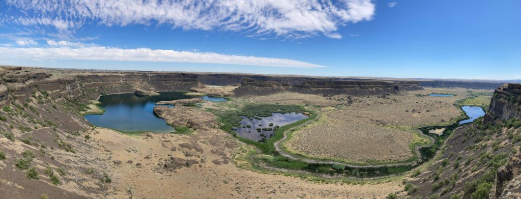
Mosquitoes belong in this section’s planning as well. The Grant County Mosquito District sprays at Steamboat Rock on its published schedule, and the bay campgrounds carry the basin’s standing mosquito reputation in season.
Steamboat Rock State Park
Quick facts: position, a 5,043 acre park with 50,000 feet of shoreline on Banks Lake, under the basalt butte that gives the park its name; season, open year-round; booking, the main campground is reservable April 1 to October 31; maximum length, 50 feet, limited availability; restrooms, accessible restrooms and showers near the main campground; site character, the main campground below the butte, with primitive forms at Jones Bay, at Osborn Bay and the Lake Dune Loop, at the equestrian camp, and at the boat-in sites; primitive counts, on the park brochure’s form, Jones Bay 44 sites, Osborn Bay and Lake Dune Loop 26, the equestrian camp 5, and 12 boat-in sites, with cabins in the park’s mix; winter form, the Sage, Dune, and Cove loops of the main campground close November 1 to March 31, Jones Bay closes October 1 to April 1, the Bay loops run first come in winter, and a winter water supply stands at the Bay loop restroom across from the cabins; resupply, Grand Coulee and Electric City at the head of Banks Lake, Coulee City at its foot; emergency readiness, Grand Coulee is the section’s service town.
Steamboat Rock State Park is the basin’s signature campground, and its setting does the work. The main campground spreads on the Banks Lake shore in the Grand Coulee, in the open below the butte, with 50,000 feet of park shoreline around it. There is essentially no shade. The park’s summer is the dry east frame at full strength: heat past 100 degrees, wind off the water, and a sky that stays light late.
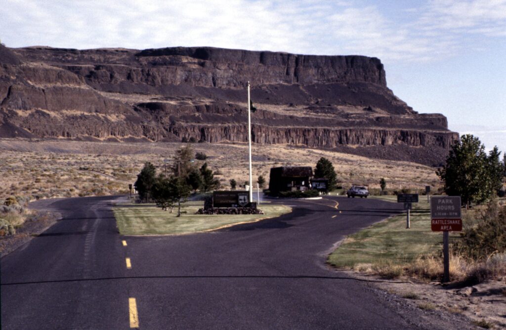
A party that plans its shade at home, with a canopy staked hard against the coulee wind, camps comfortably here. A party that plans to improvise shade does not.
The park’s winter form is its least understood fact, and it prints in full because the campground does not simply close. The main campground stays reservable through October 31. In winter the Sage, Dune, and Cove loops close from November 1 to March 31 while the Bay loops run first come. Water stands at the Bay loop restroom across from the cabins.
Jones Bay, the largest of the primitive forms, closes October 1 to April 1. A winter party therefore aims at the Bay loops and carries the closure dates as the trip’s frame.
Banks Lake itself is an irrigation reservoir, pumped up from the Columbia and drawn down on the project’s schedule, and its level moves on operations rather than on weather. The drawdown rule from the Lake Roosevelt section applies here in its general form. The shoreline a party camps in May is not the shoreline of September, and launches change with the level. The current figure is an operations posting to check before the trip, never a number to carry in a guide.
The primitive forms are how a boat party camps the park and how the park takes its summer overflow. Jones Bay carries 44 primitive sites, Osborn Bay and the Lake Dune Loop 26, the equestrian camp 5, and the boat-in sites 12. None of them has water at the sites.
The main campground’s own count stands unsettled between the record’s brochure form and the booking inventory copies, and this guide prints neither. It carries the settled structure instead: a reservable main campground under the butte, open all year in the forms above, at a 50 foot maximum. The summit trail and Northrup Canyon, the park’s two hikes, stand in the hiking section below.
Sun Lakes-Dry Falls State Park
Quick facts: sites, 96 standard sites and 41 full hookup sites; maximum length, 65 feet, limited availability; booking, first come from September 16 to April 14, on the Winter Schedule’s form; winter form, sites 1 to 31 may close from October 31 to March 16, and a winter water supply stands near the welcome station; restrooms, restrooms with showers; dump station, yes; day use, the Dry Falls Lake gate closes December 1; site character, a string of coulee lakes below the Dry Falls cataract, with the campground on the lakes chain south of the visitor center; resupply, Coulee City at hand, Grand Coulee and Electric City up the coulee.
Sun Lakes-Dry Falls State Park camps a party inside the flood story the whole basin is built on. The campground spreads along the chain of lakes that pools in the Grand Coulee below Dry Falls, the great dry cataract at the coulee’s head. Its 96 standard and 41 full hookup sites make it the largest settled campground count in the basin. Its form is a lakes campground rather than a reservoir one: smaller water, closer shores, and the coulee walls for a backdrop on every site.
Its season form rewards a shoulder season party. The park runs first come from September 16 to April 14. It is a long first come window, and it covers the coulee’s cooler season, when the heat breaks and the summer crowds thin out. Two winter details ride with it: sites 1 to 31 may close from October 31 to March 16, and the winter water supply stands near the welcome station. The Dry Falls Lake gate closes December 1, which bounds the day use end of the park without closing the campground.
Sun Lakes pairs with Steamboat Rock as the basin’s two anchor stays, and the choice between them is a real one. Steamboat Rock is the bigger water and the bigger sky, with the butte over the campground and Banks Lake’s drawdown to plan around. Sun Lakes is the quieter chain of small lakes under the coulee walls, with the larger settled site count and the longer first come season.
Potholes State Park
Quick facts: season, open year-round; maximum length, 50 feet, limited availability; booking, first come from November 1 to the end of February; dump, a dump station at $5; boat launch, $7; unattended vehicle fee, $10; water, water is off from October 24 to April 1, with a winter supply at the dump area; cabins, on weekends only from December to February, with a two night minimum; site character, a campground on Potholes Reservoir in the seep lakes country west of Moses Lake, where the reservoir’s level drops significantly by late summer; resupply, Moses Lake is the section’s town for this campground.
Potholes State Park is the basin’s fishing and birding campground, on the west shore of Potholes Reservoir where the seep lakes country begins. Its open all year form and its winter first come window, November 1 to the end of February, make it one of the basin’s most available winter campgrounds. Its fee facts are the section’s most concrete: the dump station costs $5, the boat launch $7, and an unattended vehicle $10.
The reservoir governs the stay here more than the campground does. Potholes is an irrigation reservoir, and its level drops significantly by late summer, which changes its shoreline, its launches, and its fishing as the season turns. The durable rule is the one the Lake Roosevelt section states for its own water. The level is an operations fact, and it moves every year. A party towing a boat checks the current level before the trip rather than trusting any figure, this guide’s included.
Its winter water form is the entry’s second working fact. Water turns off from October 24 to April 1, and the winter supply stands at the dump area, so a winter party fills there and camps dry at the site. The cabins narrow in winter to weekends only, December to February, with a two night minimum. The park’s site count stands unsettled on the current record, its last brochure form dating to 2016. This guide prints the park’s structure and fees instead, which are the facts a booking party acts on.
Wanapum Recreation Area
Quick facts: position, 4511 Huntzinger Road, Vantage, the camping unit of Ginkgo Petrified Forest State Park, on the Columbia River at the Interstate 90 crossing; sites, 49 sites on the Winter Schedule’s form, full hookup sites plus hiker and biker sites; maximum length, 60 feet, limited availability; booking, all sites reservable April 16 to October 15; season, the campground closes November 1 to March 1; potable water, drinking water; restrooms, restrooms with showers; site character, a river shore campground in open wind country, with a boat ramp and dock and a swim beach with no lifeguard; resupply, Vantage at hand, Ellensburg west on Interstate 90 and George east.
Wanapum Recreation Area is the basin’s western gateway and the Columbia River campground of the Interstate 90 crossing at Vantage. It is the camping unit of Ginkgo Petrified Forest State Park, and it serves two traffics at once. River parties are bound for its ramp and swim beach, and highway parties crossing the state need a serviced site at the river. Its full hookup sites take rigs to 60 feet, and tent campers may use them at the full fee. For a family crossing the state, the swim beach is what turns a serviced stop into a day outside, and days like that carry the documented benefits of time outside for children, in mood, focus, and sleep.
The wind is the campground’s standing warning, and the park states it directly. High winds are frequent, especially in the evening, and tents are strongly not recommended, with light articles to be secured. A tent party that reads that warning as scenery will spend its first evening chasing its gear across the campground.
The campground’s second rhythm is the Gorge Amphitheatre’s concert season, when the park fills early on weekends. A party without a reservation in the April 16 to October 15 window is gambling. Its closed season, November 1 to March 1, bounds the year cleanly at both ends.
The basin’s shore forms close the section at awareness depth. Coulee City Campground carries 55 first come sites at the foot of Banks Lake, as the coulee’s city park form. Coulee Playland and Sunbanks Resort stand as the Banks Lake private forms.
On Moses Lake, the city’s forms and Cascade Park carry the town’s camping. None of these takes a full entry here, and a party choosing among them is choosing on position. Coulee City answers for the Grand Coulee’s foot, the resorts for Banks Lake’s shore, and Moses Lake for the interstate town itself.
Lake Roosevelt
Lake Roosevelt is the reservoir behind Grand Coulee Dam, 151 miles of Columbia River water reaching north almost to Canada, and it camps as a single National Park Service system. The passes section above carries its rules in full. Every vehicle-accessible site takes a required reservation, boat-in sites run first come, and the fee tiers are $30 and $23. Group sites stand at six campgrounds, dump stations at eight, and winter single loops at only three campgrounds. This section carries the system’s two anchor entries, its full roster, and the drawdown rule that governs every launch on the lake.
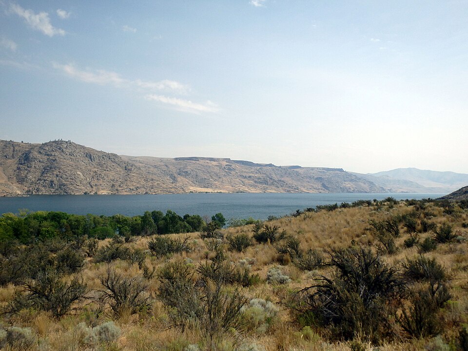
The drawdown rule comes before the entries, because it shapes more Roosevelt trips than any campground fact. The reservoir operates between 1,290 feet at full pool and 1,208 feet at its minimum flood pool, an 82 foot band. A spring drawdown and a summer refill mark a normal year. No figure in that band is the level on any given trip.
The durable form is the rule plus the instruction: check the current lake level before towing a boat to any Roosevelt ramp. A ramp that floats a boat in July can stand dry in April. The Park Service and Reclamation post the operating level as it moves.
Spring Canyon Campground
Quick facts: position, on the reservoir’s south shore minutes from the town of Grand Coulee and the dam; nightly fee, $30, in the system’s upper tier; booking, reservation required, reservable April 1 to November 30, and one of the system’s three winter single loop campgrounds from December 1 to March 31; dump station, yes; group site, yes, in the system roster; site character, hillside loops above the water with essentially no shade; day use, the adjoining day use area carries cold showers, flush toilets, and potable water in summer, facilities that belong to the day use area and not to the campground loops; resupply, Grand Coulee at the campground’s shoulder; emergency readiness, Grand Coulee is the reservoir’s south end service town.
Spring Canyon Campground is the reservoir’s south anchor and the campground a Grand Coulee Dam trip camps at. Its loops climb the hillside above the water, which gives its sites the reservoir’s long views and its full sun. The day use area below the loops carries the swimming beach and, in summer, cold showers and flush toilets. The distinction in the Quick facts matters: those showers serve the day use area, and no shower claim stands for the campground loops themselves.
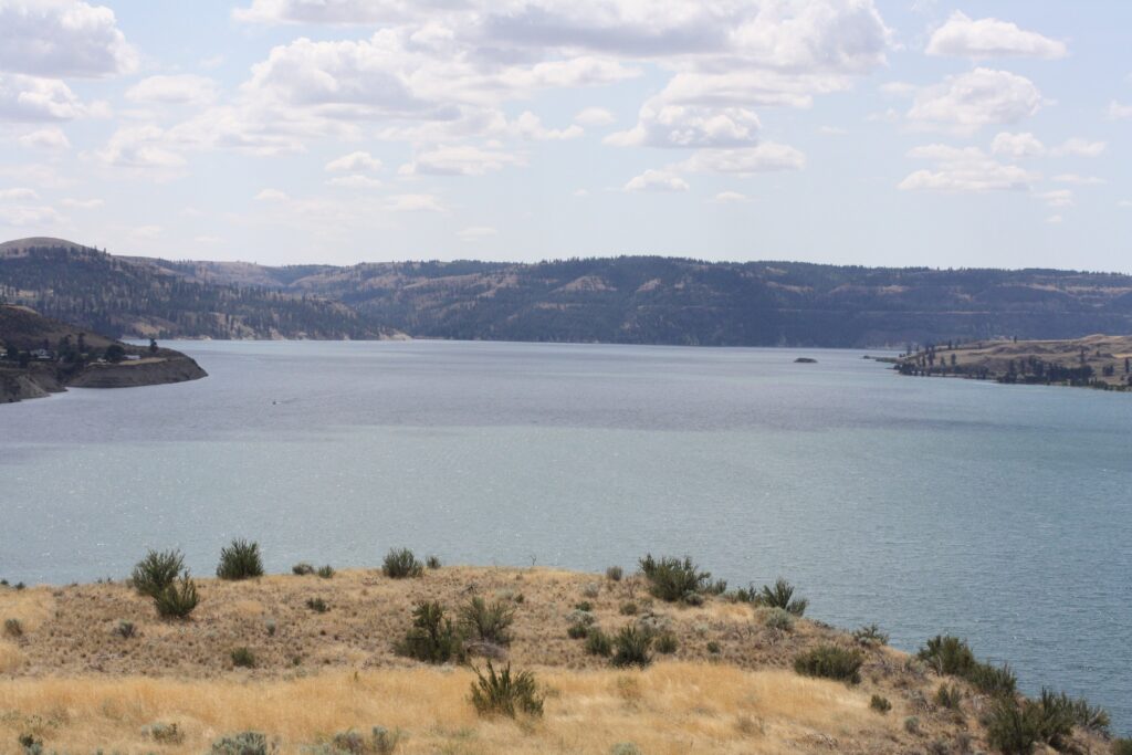
He has stayed overnight in Grand Coulee, in a hotel at the base of the dam. It was a town stay, not a campground stay, and no Roosevelt campground night stands behind this section. A reader planning the dam trip he made will find Spring Canyon the campground form of it. The dam and its visitor traffic stand in town, the reservoir at the campground, and the drawdown check comes before any boat leaves the trailer.
Spring Canyon is also one of only three Roosevelt campgrounds with a winter single loop, alongside Fort Spokane and Kettle Falls, which makes it the reservoir’s south end winter option. Its group site puts it in the system’s group roster as well. A party that camps one Roosevelt campground in a year usually camps this one, because the dam is the trip and Spring Canyon is where the trip sleeps.
Kettle Falls Campground
Quick facts: position, at the reservoir’s north end near the town of Kettle Falls, where the Colville River meets the lake; nightly fee, $30, in the system’s upper tier; booking, reservation required, reservable April 1 to November 30, and one of the system’s three winter single loop campgrounds from December 1 to March 31; dump station, yes; group site, the Locust Grove group site stands in the system roster at this campground; site character, the north end’s anchor campground, the base for the upper reservoir and the Kettle Falls town services; resupply, Kettle Falls at hand, Colville up the Colville River road.
Kettle Falls Campground anchors the reservoir’s north end the way Spring Canyon anchors its south, and the pairing is the system’s geography in two entries. The campground stands near where the Colville River comes down to the lake, below the town of Kettle Falls. Its Locust Grove group site is the north end’s group form. Its winter single loop makes it, with Spring Canyon and Fort Spokane, one of three campgrounds that carry Roosevelt camping through the winter.
The upper reservoir reads differently from the dam end. The lake narrows toward the river it came from, the country turns from shrub steppe to the Colville forest’s edge, and the resupply towns change to Kettle Falls and Colville. A party running the whole reservoir in one trip camps Spring Canyon for the dam, works north through the roster below, and camps Kettle Falls for the upper lake. The two anchors share a form, reservation required at $30 with a dump station and a winter loop. That shared form is what makes the trip bookable as one plan.
The remaining campgrounds stand as the system’s roster, each at its settled tier. In the $30 tier with the anchors stand Evans, Gifford, Hunters, Fort Spokane, and Porcupine Bay, with the Keller Ferry concessionaire campground also at $30. In the $23 tier stand North Gorge, Snag Cove, Kettle River, Kamloops Island, Marcus Island, Haag Cove, Cloverleaf, Hawk Creek, and Jones Bay. Cloverleaf runs May 1 to September 30 only.
Group sites stand at Evans, Gifford, Hunters, and Keller Ferry beyond the two anchors’ campgrounds. Camp Na-Bor-Lee stands named in the roster as the system’s educational group camp, priced per person or per family outside the tiers. A standalone Lake Roosevelt guide is this guide’s named future piece, and it will carry these campgrounds at entry depth.
Two roster campgrounds deserve a sentence each beyond their tier. Keller Ferry is the system’s concessionaire campground, at $30, standing where the ferry crossing and the marina serve the reservoir’s middle reach. It is the natural mid-lake night on a full reservoir run. Fort Spokane stands where the Spokane River arm meets the lake, and its winter single loop makes it the mid-reservoir winter option between Spring Canyon and Kettle Falls.
Spokane and the northeast
Spokane’s camping runs on a scale no other eastern Washington city matches. Riverside State Park alone spreads along the river at the city’s edge with three separate camping areas. Beyond it the northeast opens into the Colville National Forest, a full forest of small lake campgrounds. This guide carries that forest at roster depth, under one full entry at Sullivan Lake.
Mount Spokane and Curlew Lake carry the section’s other full entries, and the Colville National Forest roster closes the section. The resupply and hospital town for the whole section is Spokane, with Colville and Newport serving the forest’s interior.
Riverside State Park
Quick facts: position, a state park along the Spokane River at Spokane’s edge, camping in three areas; the Bowl and Pitcher area, sites 15 to 33 and the cabins open year-round, with the group camp and sites 1 to 14 open April 1 to October 15, a maximum length of 45 feet, 1 pull-through site, 2 restrooms both with showers, 2 group tent sites, and 2 cabins; water and dump, the Bowl and Pitcher’s water and dump station close October 15 to mid-April; the Equestrian Area campground, open April 1 to October 31; the Lake Spokane Campground, open April 1 to October 31, with 10 standard sites, 1 companion site, 1 group site for 25 people, 9 boat-in sites, and 1 hike-in or bike-in site; booking, on the State Parks system; check-in 2:30 p.m., check-out 1 p.m.; quiet hours, 10 p.m. to 6:30 a.m.; site character, a river park inside a city’s orbit, the largest urban camping form in the region; resupply, Spokane in full; emergency readiness, Spokane is the hospital town.
Riverside State Park is three campgrounds wearing one park name, and its entry’s first job is to keep them separate. The Bowl and Pitcher area, named for its river rock formations, is the year-round core. Sites 15 to 33 and the cabins stay open through the winter, while the group camp and sites 1 to 14 run April 1 to October 15. Its water and dump station close from October 15 to mid-April, so a winter party at the Bowl and Pitcher camps dry and plans its dump elsewhere.
The Equestrian Area campground serves stock parties inside the park’s trail system, open April 1 to October 31. The Lake Spokane Campground, on the park’s Long Lake water, carries the most varied site mix in the section. Its 10 standard sites, a companion site, a group site for 25, 9 boat-in sites, and a hike-in or bike-in site all run April 1 to October 31. A party choosing inside Riverside is really choosing among a year-round river campground, a horse camp, and a small lake campground. The park’s size means the three feel like separate parks sharing a boundary.
No other campground in this guide puts this much camping this close to a city’s services. A Riverside party can camp on the river, ride the park’s trails, and eat in Spokane the same evening. The trade is the one its position implies: this is an urban park, and its campgrounds carry a city’s background rather than a forest’s quiet.
East Sullivan Campground
Quick facts: sites, 46 sites in total, 38 standard sites, 1 group site for up to 40 people, and 7 walk-in sites; potable water, drinking water; restrooms, vault toilets; hookups, none; booking, reservable; manager, the Forest Service, in the Colville National Forest’s Sullivan Lake country; site character, the lake anchor of the forest’s northeast corner, the fullest campground in the Sullivan Lake cluster; resupply, Metaline Falls and Ione on the Pend Oreille River, with Newport the section’s larger town.
East Sullivan Campground is the Colville National Forest’s anchor entry in this guide, the largest settled campground in the Sullivan Lake cluster at the forest’s northeast corner. Its 46 sites split into 38 standard sites, a group site for up to 40 people, and 7 walk-in sites. The mix lets one campground serve drive-in parties, a scout or reunion group, and walk-in tent campers on the same lake. It runs without hookups, with drinking water and vault toilets, and it is reservable, where most of the forest’s campgrounds run first come.
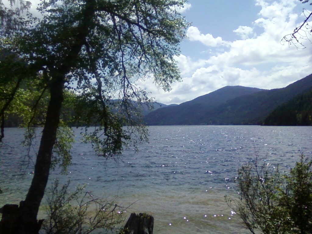
The cluster around it rides at the depth the record settles. West Sullivan carries 10 sites across the lake, Noisy Creek carries 20, and Mill Pond stands in the cluster on the claims record. A party that finds East Sullivan full on a summer weekend works that cluster in order, and a party planning ahead books East Sullivan itself. The lake country here, hard against the Canadian border in the Selkirk Mountains’ foothills, is the far corner of the region this guide covers. It carries the forest’s most complete campground form.
Mount Spokane State Park
Quick facts: sites, the Bald Knob Campground, 8 sites; booking, reservations for all open dates; season, the campground closes September 16 to June 30, and Summit Road closes October 16 to June 30; site character, a summit campground above Spokane; resupply, Spokane below the mountain.
Mount Spokane State Park camps at altitude, and its season is the fact that follows from it. The Bald Knob Campground’s open window is the short summit summer between its September 16 closing and its June 30 reopening. Summit Road itself is closed October 16 to June 30. A party that wants to camp on the mountain books inside that window, through the State Parks system, for all its open dates.
The campground’s count stands at 8 sites, and the mountain’s own forms do not settle it further. What is settled is the form: a small summit campground in the park that carries Spokane’s ski mountain and its summit road, above the city it overlooks. In a guide of reservoir shores and river valleys, Bald Knob is the one campground where the camping problem is snow rather than heat.
Curlew Lake State Park
Quick facts: sites, numbered to 80, with six pull-through sites and a maximum length of 45 feet; booking, most sites reservable, with sites 17 to 19 first come from December 1 to March 15 and no utilities in that window; season, the park closes November 1 to April 6, with the winter sites above as its exception; water, off from November 1 to April 5, with a winter supply near the welcome station; dump station, one; day use, the boat ramp stays open for ice fishing through the closed season; position, on Curlew Lake in Ferry County, south of Republic; site character, a long narrow lake campground in the Okanogan highlands’ east slope country; resupply, Republic is the campground’s town.
Curlew Lake State Park is the far northeast tier’s lake campground, on a long glacial lake in Ferry County, and its entry carries the section’s most complete winter form. The park closes November 1 to April 6, and inside that closure three sites, 17 to 19, run first come from December 1 to March 15 without utilities. The boat ramp stays open for the ice fishing the lake is known for. Water is off November 1 to April 5, with the winter supply near the welcome station.
In season the campground is a full lake campground: sites numbered to 80, six of them pull-through, a 45 foot maximum, one dump station, and most sites reservable. Its position serves two countries at once: the Republic and Curlew valley behind it, and the Colville National Forest’s western edge around it. Swan Lake and Ferry Lake from the Colville roster stand in the same driving country. A party that camps Curlew Lake in July and returns for the December ice season is using the same campground in its two settled forms. That is more range than most parks in this guide can claim.
The Colville National Forest roster
Quick facts: manager, the Forest Service; booking, the roster campgrounds run first come apart from the reservable anchors the forest’s own list marks; site character, small lake and creek campgrounds across a working forest, under the Forest Service baseline of leash, ring fires, no fireworks, and a 14 day stay limit; resupply, Colville and Newport.
The Colville National Forest roster carries the rest of the forest’s campgrounds at the depth their records support here, named from the forest’s own list. The roster names Big Meadow Lake, Browns Lake, Davis Lake, Deer Creek, Edgewater, Panhandle, and Pioneer Park. With them stand Gillette, Lake Gillette, Lake Thomas, South Skookum, Swan Lake, Ferry Lake, and Canyon Creek.
These campgrounds share a form: small, first come in the main, and set on lakes and creeks in timber. A standalone northeast guide is this roster’s named future, and it will carry the campgrounds at entry depth. The forest is campable across its whole width. Its settled anchor is East Sullivan, and its resupply towns are Colville and Newport, with Republic serving its western edge.
The forest’s geography explains the roster’s spread. The Colville runs from the Kettle River country in the west to the Pend Oreille River in the east, with the Selkirk foothills at its northeast corner around Sullivan Lake. Its campgrounds sit where its lakes and creeks sit, which is to say everywhere. A party crossing the region on SR 20 passes within reach of campgrounds at both ends of that width, and the roster above is the checklist for that drive.
The Okanogan
The Okanogan is lake country along US-97 and the Okanogan River. Its camping is a run of small state parks on valley lakes, each with its own season form and its own winter water point. This section carries the three parks as short entries inside one section, because their shared form is the section’s real subject. Resupply runs on Omak and Okanogan for the valley parks and Tonasket for Conconully.
Conconully State Park
Quick facts: season, the campground closes October 31 to April 6; booking, first come from April 6 to May 15; water, a winter water supply stands near the dump station; site character, a two-unit park on the Conconully lakes at the town of Conconully; resupply, Conconully in town, Tonasket and Omak on US-97.
Conconully State Park stands at the town of the same name, on the lakes the town was built between. Its settled facts are its season and its water. It is closed October 31 to April 6 and first come through the spring shoulder to May 15, and a winter water supply stands near the dump station. Its site count stands on the park’s own current forms rather than here. It is the lakes stay beyond the US-97 string, and its town, a former county seat kept as a resort village, is half the reason to go.
Alta Lake State Park
Quick facts: position, at the north end of Alta Lake, southwest of Pateros; season by loop, Loop 1 closes September 30 to April 15, Loop 2 closes October 31 to April 15, and Loop 3 closes September 10 to April 15; booking, first come from October 1 to 31 and April 3 to 14; water, a winter water supply stands near the park office; site character, a campground on a 2 mile lake where mountainous pine forests meet the desert; resupply, Pateros at the highway, Brewster and Chelan beyond it.
Alta Lake State Park stands southwest of Pateros at the north end of its lake. The lake runs 2 miles, and the park’s own page describes it as the place where mountainous pine forests meet the desert. The campground’s loops close on three different schedules, which the Quick facts state loop by loop because a party’s arrival date decides which loops exist for it. Loop 3 goes first, on September 10, then Loop 1 on September 30, then Loop 2 on October 31. The spring shoulder runs first come from April 3 to 14, with winter water near the park office.
The park page lists trout fishing, water skiing, and windsurfing on the lake. Its site count stands on the park’s own forms rather than in this guide, on the same pattern as Conconully. What the record settles, and what a trip actually turns on, is the loop calendar above, and it is stated in full for that reason.
Bridgeport State Park
Quick facts: sites, 34 sites; season, open year-round; booking, first come after September 15 through April 30; water, a winter water supply stands near the trailer dump; position, on Rufus Woods Lake, the Columbia reservoir behind Chief Joseph Dam, at Bridgeport; site character, the Columbia shore park of the Okanogan run, with the river’s width in front of the campground; resupply, Bridgeport in town, Brewster down the river.
Bridgeport State Park is the Okanogan section’s Columbia River campground, on Rufus Woods Lake above Chief Joseph Dam, and it is the run’s year-round stay. Its 34 sites take first come campers from after September 15 through April 30, the longest first come window of the section’s parks. Its winter water stands near the trailer dump. A winter party on the middle Columbia has Bridgeport and Wenatchee Confluence as its two state park options, one at each end of the reach.
The park’s river is the point. Rufus Woods Lake runs wide and slow in front of the campground, a different water from the valley lakes behind it in this section. Fishing stands among the park’s listed activities, with a boat ramp and dock on the lake. Its position at Bridgeport makes it the natural last night of a US-97 run, before the road turns west toward the Methow or east toward Grand Coulee.
Pearrygin Lake State Park, on its lake outside Winthrop at the Methow Valley’s east end, takes no entry in this guide. It is the Methow Valley’s lake park, and its full treatment stands in the published North Cascades guide, which carries the valley’s camping in full.
The three parks’ season forms, read together, are the section’s planning table. Alta Lake closes loop by loop through the fall, and Conconully closes outright on October 31. Bridgeport never closes at all, running first come through the winter with its water at the trailer dump.
A party touring the valley in October can still camp each of the three parks by choosing its dates against those forms. Alta stands on its surviving loops, and Conconully stands ahead of its October 31 closing. A winter party has Bridgeport alone among the three, which is why its 34 sites carry the section’s cold season.
The southeast and the Snake River
The southeast is the region’s correction country. Two of the most searched camping names in eastern Washington, Palouse Falls and Lyons Ferry, are day use parks with no camping at all. This section answers those searches with the campgrounds that actually serve the country. Fields Spring stands in the Blue Mountains foothills, Lewis and Clark Trail on the Touchet River, and Chief Timothy Park on an island in the Snake River. Resupply runs on Colfax, Dayton, and Pomeroy, with Lewiston across the river as the Snake’s full service town.
Palouse Falls, day use only
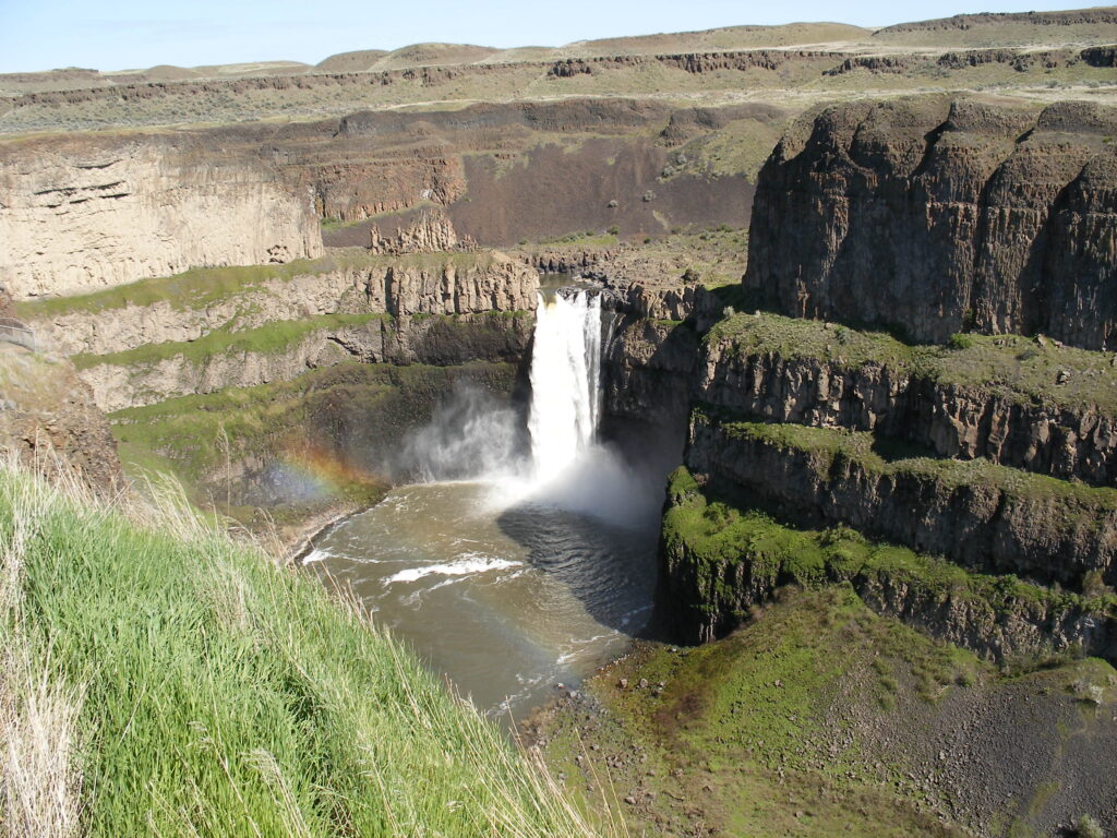
Palouse Falls is worth the drive and impossible to camp at, and this passage exists so that both halves of that sentence arrive together. The falls drop into a basalt canyon on the Palouse River, and the overlook stands open. The canyon and base trails are permanently closed, a closure that has held since 2022 and that no season reopens. A party that builds a Palouse Falls trip camps at Lewis and Clark Trail State Park or at Fields Spring. It day trips to the overlook, which is the only form the visit takes.
Lyons Ferry, day use only
Lyons Ferry State Park carries the same correction in a softer form. The park itself is day use, at the meeting of the Snake and Palouse Rivers. The Corps of Engineers campground at Lyons Ferry is closed. The camping its searchers want stands beside it at Lyons Ferry Marina, whose campground form serves the confluence directly.
Lewis and Clark Trail State Park, in the next entry, is the public campground of the same country. Both parks’ day use only status stands corroborated on the State Parks Winter Schedule, the agency’s own season document. A Discover Pass covers day use parking at both parks.
Fields Spring State Park
Quick facts: sites, 20 sites; booking, first come from September 15 to May 15; winter access, a Sno-Park permit covers day use from November to March; rental form, the Tamarack Cabin is reservable all year; position, in the Blue Mountains foothills south of Anatone, with Puffer Butte at 4,500 feet carrying the park’s viewpoint; site character, a small timbered mountain park, the cool altitude end of the southeast’s camping; resupply, Anatone at hand, Clarkston and Lewiston down the grade.
Fields Spring State Park is the southeast’s mountain campground, a small timbered park in the Blue Mountains foothills where the region’s heat finally breaks. Its 20 sites run first come from September 15 to May 15. Its year carries a winter identity the other southeast campgrounds do not share: the park is a Sno-Park from November to March, with the permit covering day use. The Tamarack Cabin stays reservable all year as the park’s four season form.
Puffer Butte, at 4,500 feet, gives the park its viewpoint over the Grande Ronde country toward Oregon. A party camps Fields Spring for the combination no other southeast campground offers: altitude, timber, and a cabin that books in January. A falls day trip to Palouse Falls stands within the same weekend’s driving. Its first come shoulder is the longest in this section, and its winter form makes it the one southeast campground a party can plan a snow trip around.
Lewis and Clark Trail State Park
Quick facts: sites, 24 to 25 standard non-hookup sites, plus teepee rentals and a group camp form; season, the campground closes November 1 to March 31; booking, first come from September 15 to October 31 and from April 1 to May 15; day use note, the day use area’s opening stands delayed to mid to late April by a restroom update project, printed as a dated note; position, on the Touchet River between Waitsburg and Dayton; site character, a shaded river bottom campground in cottonwood country, the Palouse Falls trip’s natural base; resupply, Dayton and Waitsburg on US-12.
Lewis and Clark Trail State Park is the campground the Palouse Falls correction points to, a shaded Touchet River campground between Waitsburg and Dayton. Its sites are standard and non-hookup, and its count stands at 24 to 25. Its teepees and group camp widen its forms beyond the site count. Its shoulders run first come, September 15 to October 31 and April 1 to May 15, around a campground closure from November 1 to March 31.
The park’s river bottom setting is its character: cottonwoods, shade, and moving water, in a region where the other campgrounds are reservoir shores and coulee lakes. The dated construction note in its Quick facts belongs to the day use area, whose opening the restroom update project delays, and the note is dated because it expires. A party traveling after mid to late April should find the day use area open on its delayed schedule. The party can verify the current form on the park’s page. For the falls trip, this is the base: camp on the Touchet, drive to the overlook, and return to shade, which is the southeast itinerary in one sentence.
Chief Timothy Park
Quick facts: position, on Silcott Island in the Snake River, eight miles west of Clarkston; manager, owned by the Corps of Engineers and operated by Northwest Land Management (CLM Services); season, May 1 to October 31; site character, a full service island campground with day use and a boat ramp; resupply, Clarkston and Lewiston across the river, the river’s full service towns.
Chief Timothy Park is the Snake River’s island campground, a park in the river below the Clarkston and Lewiston valley. The Corps of Engineers owns it and a private operator, Northwest Land Management (CLM Services), runs it.
The split is worth stating because it explains the park’s form: federal campground, concessionaire operation, and full service camping. Day use and a boat ramp stand on an island a bridge reaches. Its season runs May 1 to October 31.
The island setting does what no mainland shore can. The park is surrounded by the Snake, with the river’s current, its barges, and its canyon walls as the campground’s whole environment.
A river party running the Snake camps here rather than in town. For a Palouse or Blue Mountains party it is the low altitude, full service counterweight to Fields Spring’s timber. One further Snake form stands named at this entry’s close: Boyer Park and Marina, the Snake River KOA. It is a Port of Whitman County campground downriver, carrying 45 full hookup sites, 16 partial sites, 3 tent sites, and 4 cabins on its operator’s record.
Yakima River Canyon
The Yakima River Canyon is the scenic route between Ellensburg and Yakima, a basalt canyon the river cut and the old highway follows. Its camping is a single Bureau of Land Management system of four campgrounds and a day use area.
The system’s facts are stated once in the passes section and govern every entry here. The rate is $15 a night and $5 for day use, with reservations May 1 to September 30 and first come October 1 to April 30. The system is open year-round, with no drinking water or hookups at any site. This section carries the campgrounds in canyon order and closes at the canyon’s city end, Yakima Sportsman State Park in Yakima.
Roza Campground
Quick facts: manager, the Bureau of Land Management; nightly fee, $15, with $5 day use across the canyon system; booking, reservable May 1 to September 30 and first come October 1 to April 30; potable water, none; hookups, none; site character, the canyon’s downriver campground by the Roza recreation area, the float trip’s take-out end of the system; resupply, Yakima at the canyon’s mouth.
Roza Campground stands at the canyon’s Yakima end, by the recreation area that serves as the lower river’s boating hub. Its role in the system is the take-out. A float party that puts in upriver camps its last night at Roza or drives out to Yakima, and a fishing party works the lower canyon from it. It carries the system form without variation, dry sites at the system price under the canyon walls.
Big Pines Campground
Quick facts: sites, 42 sites on the Bureau of Land Management’s record; nightly fee, $15; booking, reservable May 1 to September 30 and first come October 1 to April 30; potable water, none; hookups, none; site character, the canyon’s largest campground, under the ponderosa pines that name it, on the river’s bank mid-canyon; resupply, Ellensburg and Yakima at the canyon’s two ends.
Big Pines Campground is the canyon’s main campground, 42 sites under big ponderosas on the riverbank, and its shade is a feature rather than an accident. In a region where the dry east frame makes shade a planning item, Big Pines is the exception. It is a Bureau of Land Management campground where the trees were there first and the sites were fitted under them. Its size makes it the system’s default, the campground a first canyon trip books.
Lmuma Creek Campground
Quick facts: sites, 7 sites on the Bureau of Land Management’s record; nightly fee, $15; booking, the canyon system’s split, reservable in season and first come from October 1 to April 30; potable water, none; hookups, none; site character, the system’s small campground at the creek mouth, the quiet end of the canyon’s camping; resupply, Ellensburg upriver, Yakima downriver.
Lmuma Creek Campground is the canyon’s small campground, 7 sites where its creek meets the river. It carries the same system form as Big Pines at a sixth of the size, which is its whole appeal. A party that wants the canyon without the main campground’s company camps Lmuma Creek. It accepts the same dry sites and the same price, and gets the river nearly to itself. Its name is the creek’s, spelled as the Bureau of Land Management spells it, and a party searching the canyon’s campgrounds should search it in that form.
Umtanum Campground
Quick facts: manager, the Bureau of Land Management; nightly fee, $15; booking, the canyon system’s split, reservable May 1 to September 30 and first come October 1 to April 30; potable water, none; hookups, none; site character, the canyon’s upriver campground at the Umtanum Creek trailhead, the hiking end of the system; resupply, Ellensburg at the canyon’s head.
Umtanum Campground stands at the canyon’s Ellensburg end, where Umtanum Creek comes down to the river under its footbridge. The campground doubles as the trailhead for the creek’s canyon, one of the region’s known spring wildflower and birding hikes. That makes Umtanum the system’s hiking campground, as Big Pines is its shade campground and Roza its boating campground. Its site count stands unsettled across the Bureau’s own forms, so this guide prints its form and position instead. Those are what a trip turns on: a dry system-price campground at the canyon’s creek trailhead.
The Bighorn day use area completes the system at $5, the canyon’s picnic and river access form, and it takes no camping entry because it takes no campers. Together the four campgrounds are the whole public camping supply of the canyon, with Bighorn as its day use form. Their shared system is the section’s lesson: one manager, one price, one booking split, no water anywhere. A party that packs for that form can camp any of the four campgrounds without relearning anything.
Choosing inside the system is a matter of matching the campground to the trip’s purpose, because the price and the facilities do not change. Big Pines for shade and size, Umtanum for the creek hike, Roza for the lower river and the take-out, Lmuma Creek for quiet. A party that cannot get its first choice in the reservation window loses nothing but position by taking its second. It is a freedom no other section in this guide offers at a single price.
Yakima Sportsman State Park
Quick facts: position, 904 University Parkway, Yakima, a 266 acre park created by the Yakima Sportsman’s Association; sites, standard and full hookup sites, with some sites taking rigs to 60 feet; group camp, one tent only group camp for up to 100 people, with fire pits, water, restrooms, and parking, its fee varying by group size; dump station, one; restrooms, accessible restrooms and showers; potable water, drinking water; season, closed October 1 to April 16 on the Winter Schedule’s form; site character, an irrigated green park with deciduous shade trees in the camping and picnic areas, more than 130 bird species on its record, and a juvenile fishing pond; construction note, the Levy Trail ecosystem restoration runs to late 2027, with extra noise near campsites 17 to 36; resupply, Yakima in full at the park’s edge.
Yakima Sportsman State Park is the canyon’s city end campground, the state park answer at the bottom of the canyon drive. It inverts the canyon system’s form point by point. It carries hookups where the canyon has none, and drinking water where the canyon has none. Showers, a dump station, and irrigated shade trees over the sites complete the inversion. A party that floats or fishes the canyon and wants a serviced night at the end of it camps here, and a Yakima based party camps here without leaving town.
The park’s scale is its other distinction. At 266 acres it carries a group camp for 100 people, a fishing pond, and a bird list past 130 species. It is a city park that happens to take campers at state park standard.
Its season closes October 1 to April 16 on the Winter Schedule’s form. The dated trail construction note in its Quick facts matters to a party booking sites 17 to 36. That party should know it before it books, not after it arrives, because the work runs into late 2027.
Hiking in eastern Washington
Eastern Washington hiking runs on the same dry frame as its camping, with one addition. Trailhead parking is part of every hike’s plan, because the region’s known trailheads fill and its passes carry their own parking rules. This section carries the hikes that belong to this guide’s campgrounds, stated from the Washington Trails Association and the managers’ own listings. The Enchantments and the Icicle Creek country belong to their own guides and stand outside this section entirely.
Steamboat Rock summit is the basin’s signature hike, at 6.0 miles roundtrip with 650 feet of gain on the Washington Trails Association’s listing. It climbs the butte that stands over the state park campground. The route is exposed for its whole length, and the dry frame applies at full strength: no water on the route, no shade, and heat radiating off the basalt. A party camps below the butte and climbs it in the morning, which is the order the campground and the trail were made for.
Northrup Canyon, in the same park, runs 3.0 miles roundtrip with 384 feet of gain into the coulee’s back country. The park’s own event copy calls it Grant County’s only true forest. It is a stand of pine and fir in a side canyon that reads as a different county from the shrub steppe at its mouth. Between the summit and Northrup Canyon, Steamboat Rock carries the two hikes a basin trip is most likely to remember, and both start from the campground’s own park.
Palouse Falls stands in the hiking record as a limit rather than a route. The overlook walk is 1.0 mile on the listing, and it is the whole of the park’s open hiking. Every trail into the canyon and to the base of the falls has been permanently closed since 2022. A party that reads older trip reports describing the canyon floor should treat them as history. The falls are an overlook visit, and the southeast section’s campgrounds are where its hikers sleep.
The Wenatchee river string carries the region’s two paved trail systems. The Apple Capital Loop Trail runs 10 miles through Wenatchee Confluence State Park. The Rocky Reach Trail runs 5.5 miles from the Confluence toward Lincoln Rock State Park along the Columbia. A party can hike or ride between the two campgrounds on pavement, which makes the pair this guide’s only campground to campground trail connection.
The Pacific Crest Trail crossings close the section. The trail crosses SR 410 at Chinook Pass and US-12 at White Pass, where Leech Lake Campground stands as its trailhead campground, also signed White Pass Lake. Section hikers resupply and vehicles meet the trail at those crossings, and the pass parking rules govern both. Umtanum Creek, from its campground in the Yakima River Canyon, is the canyon’s own hike, a creek canyon walk known for spring wildflowers. It needs no separate listing beyond its campground entry above.
Trailhead parking is the standing element that ties this section to the campgrounds. The pass crossings and the state park trailheads fill on summer weekends, and a parked party is committed for the day. Overnight trailhead parking follows each manager’s own rule. A backpacking party reads that rule on the trailhead board or the manager’s page before leaving the vehicle. Camping at the trailhead campground, where one stands, as Leech Lake stands at White Pass, is the form that avoids the question entirely.
Fire restrictions and emergencies
Three layers of fire rule stack over every campfire in eastern Washington, and the strictest layer governs. The first layer is the campground’s manager: a state park’s posted restriction level, the Forest Service’s ring and fireworks rules, the Bureau of Land Management’s canyon rules. The second layer is the county, which sets burn bans and fire danger restrictions across its unincorporated land. The third is the city, for any campground inside a city’s limits or its fire district’s rules. A campfire is legal only when all three layers allow it, and a restriction at any layer closes the fire whatever the others say.
The state instruments are the standing checks. The Department of Natural Resources publishes current burn restrictions by its Fire Danger Rating Areas.
In this region those areas include the Chelan, Valley, Lower Basin, Upper Basin, Lower Yakima, and Upper Yakima areas, and the northeast areas over the Colville country. The Department of Ecology publishes air quality burn bans. Ecology is the air quality authority for every county in this region without its own clean air agency. Those counties include Chelan, Grant, Douglas, Ferry, Okanogan, Pend Oreille, Stevens, Whitman, Asotin, and Franklin.
Yakima County’s air quality bans run through the Yakima Regional Clean Air Agency. Spokane County’s run through the Spokane Regional Clean Air Agency, which reports the county’s combined fire danger and air quality position. Washington State Parks posts its own alerts page for park level closures and restriction changes.
The county layer has names and forms worth knowing before a trip. Chelan County’s fire restrictions run on the county code’s standing calendar, beginning June 1 in the Valley Zone and widening July 1. Residential campfires are prohibited from July 1, and restrictions lift October 1 unless extended. Grant County bans most outdoor burning in its unincorporated areas every year from June 1 to September 30.
Yakima County’s fire marshal issues an annual burn restriction. Kittitas County’s fire marshal publishes the county’s fire safety and air quality bans on one page. Pend Oreille County’s burning ordinance ties its recreational fire controls to the state Department of Natural Resources position. In the counties where no county burn page stands, including Douglas, Ferry, Whitman, Franklin, Asotin, and Lincoln, the fire districts and the two state instruments above carry the layer. A party checks those rather than assuming a county page exists.
Emergency alerts run county by county as well, and a party driving the region crosses systems as it crosses county lines. Chelan, Douglas, Kittitas, and Okanogan Counties alert through Everbridge, Okanogan adding a county text signup.
Spokane County’s system is ALERT Spokane, and Stevens and Asotin Counties alert through Hyper-Reach. Pend Oreille and Grant Counties alert through Nixle, Franklin County through CodeRED, and Columbia County through Alert Columbia. Lincoln County alerts through Lincoln County ALERT, and Ferry County through its own county alert system. Yakima County’s Alert Yakima and Whitman County’s emergency management signup complete the region.
The state’s alerts registry, published by the Washington Emergency Management Division, is the one page that lists every county’s system. Enrolling in the system for the county a party sleeps in is the region’s standing emergency advice.
The hospital towns stand as the front of this guide states them. Wenatchee serves the Wenatchee and Leavenworth country, Yakima serves the White Pass and Naches strings, and Spokane serves the northeast. Moses Lake serves the Columbia Basin at town level. Grand Coulee, Colville, Newport, Republic, Colfax, and Dayton stand as their countries’ nearer towns.
In rattlesnake country a party’s real emergency equipment is distance awareness. Watch the talus and the shrub steppe edge, and give any snake the trail. Treat the drive to the hospital town as part of the trip plan rather than an improvisation.
Frequently asked questions
Can you camp at Palouse Falls?
No. Palouse Falls State Park is day use only, and the southeast section’s correction passage carries the full record. The campgrounds that serve a falls trip are Lewis and Clark Trail State Park and Fields Spring State Park.
Can you camp at Lyons Ferry State Park?
Not in the state park. Lyons Ferry State Park is day use only, and the Corps campground there is closed. The camping at Lyons Ferry stands at the marina beside the park, and Lewis and Clark Trail State Park is the area’s public campground.
Where can you camp near Leavenworth with a tent?
The tent camping that serves Leavenworth stands up Icicle Road, in the Forest Service campgrounds the Icicle Creek guide covers. Blu-Shastin RV Park’s tent sites are the town bucket’s own tent form. Wenatchee River County Park takes no tents at all.
Do I need a reservation at Lake Roosevelt?
Yes, for every vehicle-accessible site, through Recreation.gov, at the $30 or $23 tier for your campground. Boat-in sites are first come, and no interagency pass pays a camping fee.
Where do you camp near Spokane?
Riverside State Park, at the city’s edge, with three camping areas, including year-round sites and cabins at the Bowl and Pitcher. Mount Spokane’s Bald Knob Campground is the short season mountain option, open roughly July 1 to mid-September.
Can you camp at Wenatchee Confluence State Park in winter?
Yes. Loop 2 stays open all year, and camping runs first come from October 16 to March 31. A winter water supply stands near the dump station and at sites 34 and 36. Loop 1 stands closed from October 16 for a construction project until the project completes.
How do you book Bumping Lake Campground?
Through Recreation.gov. It is a reservable, concessionaire-operated Forest Service campground, and its entry above carries its fee and season from its own panel. The string’s other campgrounds split between Recreation.gov reservations and first come, and the roster passages state each campground’s form.
Where is the camping on Banks Lake?
Steamboat Rock State Park anchors the lake’s north end, with its primitive bay campgrounds below the butte. At the south end, Coulee City Campground carries 55 first come sites, and Coulee Playland and Sunbanks Resort stand as the lake’s private forms. Banks Lake is an irrigation reservoir, and its level moves on the project’s schedule, so a party towing a boat checks the current level before the trip.
What is the camping at Sullivan Lake?
Four Forest Service campgrounds stand at the lake. East Sullivan is the largest, at 46 sites, and reservable. West Sullivan carries 10 sites and Noisy Creek 20, and Mill Pond completes the cluster.
Is there water at the campgrounds in eastern Washington?
Plan to carry it. The Yakima River Canyon’s campgrounds have no drinking water at all. The Forest Service campgrounds on the pass strings carry it in season or not at all by campground. The state parks turn water off in winter, with a winter supply at a named point, which each entry names. The region’s standing rule is to carry all drinking water, because the lakes are not a supply.
Sources
Washington State Parks park pages and the State Parks Winter Schedule, for Wenatchee Confluence, Lincoln Rock, Daroga Point, Steamboat Rock, Sun Lakes-Dry Falls, Potholes, Wanapum Recreation Area, Riverside, Mount Spokane, Conconully, Alta Lake, Bridgeport, Curlew Lake, Fields Spring, Lewis and Clark Trail, Palouse Falls, Lyons Ferry, and Yakima Sportsman, with the State Parks fees page and the washington.goingtocamp.com booking system for the system forms and the Apple Capital Loop Trail and Rocky Reach Trail figures. National Park Service, Lake Roosevelt National Recreation Area pages, for the reservation rule, the fee tiers, the group sites, the dump stations, the winter loops, and the reservoir’s operating levels. Recreation.gov facility pages and their Seasons and Fees panels, for the Forest Service campgrounds whose booking forms, fees, and seasons the entries state, including the Naches and White Pass strings’ panels read for the 2027 season.
United States Forest Service, Okanogan-Wenatchee and Colville National Forest pages and campground lists, for the Bumping River, SR 410, Tieton, Naches River, Sullivan Lake, and Colville roster records and the forestwide baseline rules. Bureau of Land Management, Yakima River Canyon recreation pages, for the four campgrounds, the Bighorn day use area, and the canyon system’s fees and seasons. Chelan County and the Wenatchee River County Park operator, for the county park’s sites, season, and fee schedule effective August 1, 2026. United States Army Corps of Engineers and Northwest Land Management (CLM Services), for Chief Timothy Park. The operators’ own pages, for the Leavenworth/Pine Village KOA Holiday, Alpine View RV Park and Campground, Blu-Shastin RV Park, Elk Ridge Campground, Rimrock Lake Resort, and the Snake River KOA.
Washington Trails Association listings, for the Steamboat Rock summit, Northrup Canyon, and Palouse Falls figures. Washington State Department of Natural Resources burn restrictions pages and Fire Danger Rating Areas, the Washington State Department of Ecology burn bans page, the Yakima Regional Clean Air Agency and the Spokane Regional Clean Air Agency, Chelan County Fire Prevention and Investigation and county code Chapter 7.52, the Grant County and Yakima County fire marshals, the Kittitas County Fire Marshal, Pend Oreille County Burning Control Ordinance 2011-3, and the Washington Emergency Management Division alerts registry with the county emergency management pages named in the fire section, for the restriction stack and the alert systems.