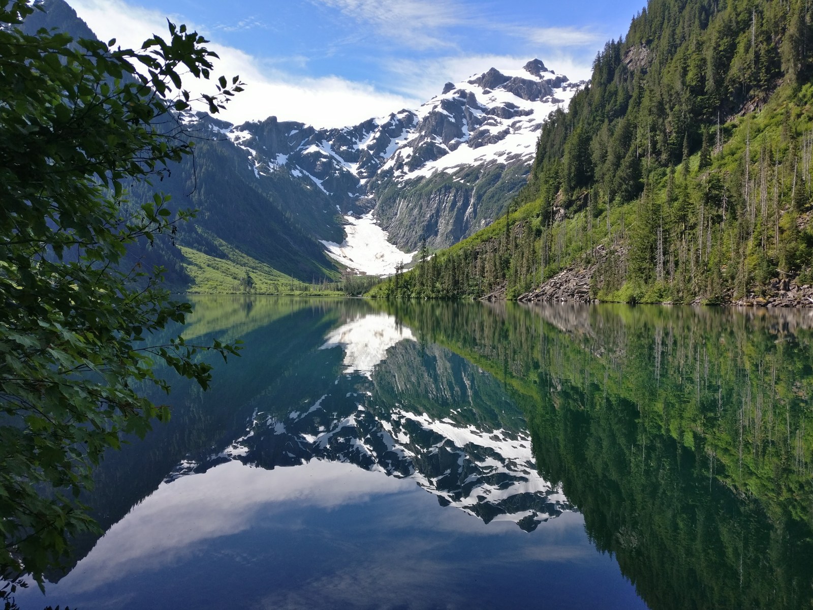
The Mountain Loop Highway runs about 54 to 55 miles between Granite Falls and Darrington. Pavement carries both ends. A single lane gravel middle climbs over Barlow Pass between them. Campgrounds line the South Fork Stillaguamish River on the west side and the South Fork Sauk River on the east side, under old growth and below steep peaks. The Loop is one of the valleys gathered in the Central Cascades camping guide, which covers the region valley by valley.
The hiking here is the reason many campers come. Two famous trailheads anchor the road, the Big Four Ice Caves and Goat Lake, and a ghost town trail leaves from Barlow Pass. I have done a lot of day hiking on this road, and this area is one of my favorite areas for hiking and backpacking. I have not stayed in these campgrounds, so the campground entries stick to what the Forest Service and Snohomish County Parks publish, and to what campers report from their own stays.
Old growth forest lines much of the drive, and the road follows the South Fork Stillaguamish on the west side and the South Fork Sauk on the east. A ghost town trail, an interpretive boardwalk at a mill pond, and river bars beside the campsites fill the hours between hikes.
Two agencies run the campgrounds on this road, and the gravel middle closes to vehicles every winter. The Forest Service runs six campgrounds and seven group camps on the highway. Snohomish County Parks runs two parks at the approaches, one near Arlington and one outside Darrington. Each agency sets its own booking system, fees, and stay limit.
This guide stops at Darrington. The Sauk and Suiattle roads north of town are a different drive with their own campgrounds and closures, and they belong to a different guide.
In this guide
- Mountain Loop Highway camping at a glance
- The Mountain Loop Highway
- Passes, fees, booking, and stay limits
- Verlot Campground
- Gold Basin Campground
- Turlo Campground
- Squire Creek Park and Campground
- Bedal Campground
- River Meadows Park
- Red Bridge Campground
- Clear Creek Campground
- Group camps on the Mountain Loop
- Dispersed camping on the Sauk River
- Hiking and trailheads
- Fire restrictions and emergencies
- Frequently asked questions
- Sources
Mountain Loop Highway camping at a glance
Eight campgrounds carry full entries in this guide. The table puts them in road order, west approach first and east approach last, so you can read it as you drive. The entries below run in a different order, the most searched campgrounds first.
Verlot, Gold Basin, Turlo, Squire Creek, Bedal, River Meadows, Red Bridge, and Clear Creek. Each entry carries its own full Quick facts, so a campground’s row and its entry always agree on the facts.
| Campground | Agency | Sites | Booking | Water | Nightly cost |
|---|---|---|---|---|---|
| River Meadows Park | Snohomish County Parks | 10 drive up campsites, 4 hike in campsites, and 6 yurts | County online reservations | Running water nearby, winterized in winter | $33 for a campsite; yurts $60 to $100 plus tax. County transaction and extra vehicle fees in the entry. |
| Verlot Campground | Forest Service | 23 | All sites reservable through Recreation.gov | Yes, at spigots | Check Recreation.gov for the current nightly rate. |
| Turlo Campground | Forest Service | 18 single | Reservable through Recreation.gov, with one first come site | Yes, at spigots | Check Recreation.gov for the current nightly rate. |
| Gold Basin Campground | Forest Service | No count published; the agency record conflicts. See the entry. | Reservations through Recreation.gov | None. Verlot, about 2.4 miles away, is the nearest water | Check Recreation.gov for the current nightly rate. |
| Red Bridge Campground | Forest Service | 15 | Reservations and first come sites through Recreation.gov | None, bring your own supply | Check Recreation.gov for the current nightly rate. |
| Bedal Campground | Forest Service | 22 standard | See the entry. | None, bring your own supply | Check Recreation.gov for the current nightly rate. |
| Clear Creek Campground | Forest Service | 12 single | Booking information through Recreation.gov | None, bring your own supply | Check Recreation.gov for the current nightly rate. |
| Squire Creek Park and Campground | Snohomish County Parks | No count published. See the entry. | County online reservations | Yes, at spigots, winterized mid October through mid April | $33 for a non utility site |
Nightly costs for the six Forest Service campgrounds are not printed in this guide because the booking pages do not state one settled rate for them. Recreation.gov shows the current rate for each campground.
Seven group camps sit between the entries in one coverage below, and dispersed camping on the Sauk River has its own section after them. See Group camps on the Mountain Loop and Dispersed camping on the Sauk River.
No campground here offers showers for tent and RV campers, and no campground in the entry list has a dump station. The nearest dump station named in this guide is at Whitehorse Campground in Darrington. The county charges $10 for users who are not camping there, and that station closes in the winterization window from November to March. The one exception on showers sits inside the River Meadows yurts, for yurt campers only, and that entry states it in full.
Granite Falls is the west gateway town. Groceries and fuel stand in town. The Verlot Public Service Center, about 11 miles east on the highway, is the Forest Service information point for the west side.
It is not a store. Plan on no store, fuel, or purchasable water on the highway between Verlot and Darrington. Everything rides in from Granite Falls or Darrington.
Darrington is the east gateway town. Groceries and fuel stand in town, and the Darrington Ranger District office stands in town as the Forest Service information point for the east side. Whitehorse Park sits near Darrington and belongs to a different guide, so this guide names it here and gives it no entry.
One private camp operates on the highway itself. Triangle Recreation Camp, at 47715 Mountain Loop Highway, covers 80 acres and dates to 1975, in its operator’s own description. It is a private membership camp for adults 21 and over, open from mid April to early October, and it takes no entry in this guide.
The Mountain Loop Highway
The Forest Service names this road the Mountain Loop Scenic Byway and the Mountain Loop Highway. The road is paved from Verlot to Barlow Pass and from Darrington to the junction with the White Chuck River Road, Forest Road 23. The middle portion, 14 miles, is a single lane gravel road over Barlow Pass and down the South Fork Sauk River.
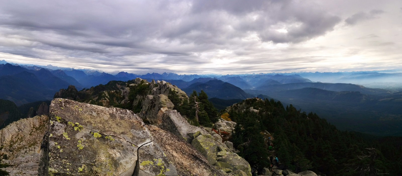
Some outside guides place the start of the gravel near Verlot, about eight miles east of Granite Falls. Pavement runs to Barlow Pass, and a driver who plans a turning decision near Verlot plans it about twenty miles too soon.
The gravel middle drives slowly. Trip reports across many seasons describe it as potholed and dusty in summer, sometimes in good condition and sometimes rough enough to slow a sedan to a crawl. Ordinary passenger cars complete it, and reports name small sedans and a Prius among the cars that have done so slowly. Dust settles on gear and food at roadside stops. Drivers move fast on the gravel in the dispersed camping reports, so roadside stops there need care with children and dogs.
Towing deserves caution on this middle section due to a single lane gravel road with potholes, washboarding, few turnarounds, and variable conditions, a combination that asks a lot of a trailer. No agency source settles a trailer recommendation for this section, so this guide claims none. The developed campgrounds state their own maximum vehicle lengths in their entries, and those figures govern what fits at camp.
Conditions on the gravel change with weather, maintenance, and traffic. Drive the middle at the speed the surface allows.
The winter closure
Every winter the gravel middle closes to motor vehicles between the Deer Creek gate on the west and the Bedal gate at Bedal Campground on the east. The closure normally runs from early November to the end of May, and reopening typically comes in mid May. In some years the Forest Service reopens the road in stages. The paved west section from Deer Creek to Barlow Pass opens first, while the section from Barlow Pass to Bedal stays closed for snow and maintenance.
The closed road stays open to hiking, snowshoeing, and cross country skiing. Skiers and snowshoers park at the Deer Creek gate in winter and travel the closed road toward the Big Four picnic area and the ice caves. That winter trip has its own form in the hiking section below.
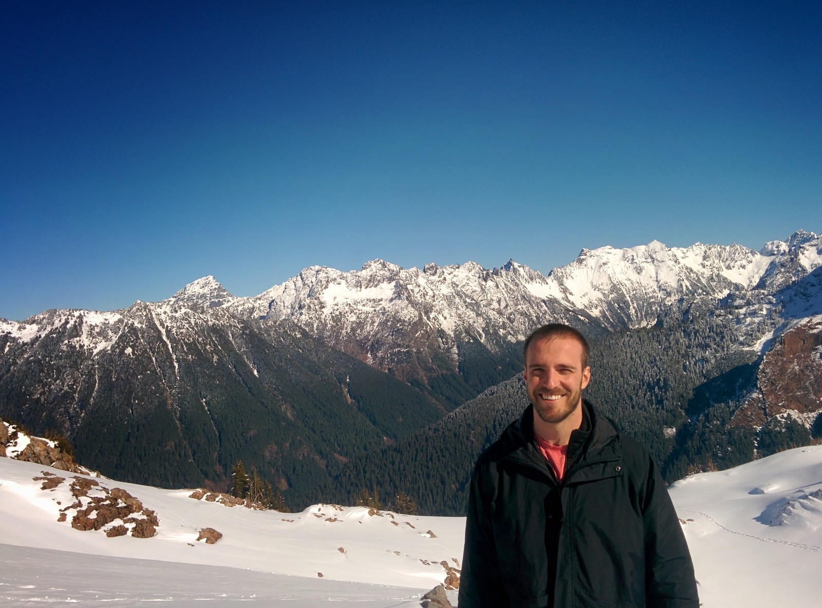
A sign reading Road Closed stands at Barlow Pass, while the west gate itself stands at Deer Creek. The Heather Lake and Lake Twentytwo trailheads sit below that gate and stay reachable when the road is open to Deer Creek. A driver who turns back at the trailheads gives up paved road that stays open to Deer Creek.
The closure does not close the whole highway. The Darrington side stays open to Bedal Campground. Squire Creek Park and Campground and Clear Creek Campground sit outside the gated segment entirely, on the State Route 530 side of the system. Winter camping questions at those parks are county and season questions, not gate questions.
Before any trip, check the Forest Service alerts page for the Mt. Baker-Snoqualmie National Forest and the Snohomish County road closures page. Those two sources govern the closure’s current form and the reopening.
Camp Silverton
Between Red Bridge and Barlow Pass, the highway passes the Silverton townsite. The site was the Silverton Ranger Station, a Forest Service unit established in 1908 and closed in 1936. Private groups and Everett Public Schools later ran an educational nature camp there named Camp Silverton, until 1997.
The camp closed in the early 2000s, and many remaining buildings were demolished in 2019. No camping operates there now. The Forest Service is exploring a future overnight use for the site. Nothing is bookable there now.
Passes, fees, booking, and stay limits
Two systems run the campgrounds on this road, and each system answers to its own rules. Read the part that matches your campground. No pass pays a camping fee at any campground in this guide.
Forest Service campgrounds
Forest Service campgrounds here book through Recreation.gov, in a mixed form. Most campgrounds hold reservable sites with first come remainders, as each campground’s own record states them. The standing federal booking form allows individual sites up to six months in advance and group sites up to twelve months in advance. Each campground’s Quick facts state its own booking form, and campers confirm the current window on Recreation.gov before counting on it.
The stay limit on Forest Service developed campgrounds is 14 days.
Storing food at Forest Service campgrounds
A food storage order covers the whole Mt. Baker-Snoqualmie National Forest. Store all food and refuse in a hard sided vehicle or trailer, in a food storage locker, or in a certified bear resistant container. Or keep food attended by a person who is physically present. That form applies at every Forest Service campground and group camp in this guide.
Dogs stay on leash. Campfires burn in developed rings only. Quiet hours run from 10 p.m. to 8 a.m. Fireworks are prohibited.
Do not move firewood. Buy it near the campground and burn it there.
Passes price parking and day use, not camping. Trailhead parking takes a Northwest Forest Pass or an interagency pass, at $5 per day or $30 a year. The Washington State Discover Pass is not valid at federal fee sites.
Verlot Campground’s own day use costs $8 or a pass, and that figure prices campground day use, a different thing from trailhead parking. Holders of interagency senior and access passes save 50 percent on single site camping fees at the campgrounds whose pages state that discount. Each entry names it where it applies.
Snohomish County Parks campgrounds
Snohomish County Parks runs its two campgrounds in this guide on its own online reservation system. Camping is limited to 14 nights in a 30 day period. A weekend reservation takes both Friday and Saturday nights.
The county Fee Schedule 2025 sets the forms that govern both county entries. A non utility site costs $33 a night, with an $8 transaction fee and a $10 extra vehicle fee on the same schedule. Quiet hours run from 10 p.m. to 7 a.m., and no generator runs during quiet hours.
Alcohol is not permitted in any county campground. Pets stay on an 8 foot leash and under control. The county fee schedule lists no vehicle access pass for either county campground in this guide. Day use at both parks carries no access fee on that schedule.
The Discover Pass pays nothing at any campground in this guide, federal or county. A federal pass pays no county fee, and a county reservation answers to county rules alone. Check the agency behind your campground first, and the rest of its rules follow.
Dispersed camping carries its own stay limit. Outside developed campgrounds, camping is limited to no more than 14 days in a row at the same spot. The limit is no more than 28 days total per calendar year, under Forest Order 06-05-24-02. That order ran through May 16, 2026 on its face, so check the forest alerts page for the current form before a dispersed trip. The dispersed camping section below covers where the sites are.
Verlot Campground
Quick facts: 23 campsites, 22 single and one double; all sites reservable through Recreation.gov; Nightly cost, check Recreation.gov for the current rate; season May to September; potable water at spigots; flush toilets; campfires in developed rings only; check in 2 p.m. and check out 12 p.m.; stay limit 14 days; dogs on leash; no hookups and no dump station; quiet hours 10 p.m. to 8 a.m.; maximum vehicle length 40 feet; day use $8 or a pass; interagency senior and access pass holders save 50 percent on single site fees.
Verlot Campground is the Forest Service anchor campground on the west side of the loop. It stands at 950 feet across the highway from the Verlot Public Service Center, on the South Fork Stillaguamish River. The service center is the west side’s information point in lived trips, and the campground beside it works as the base those trips start from. Day use here costs $8 or a pass. That price covers campground day use only, and it is separate from trailhead parking.
The Forest Service describes Verlot as much sunnier than its neighbor Turlo, with a more open canopy and easy fishing access to the river. Riverside sites read as peaceful in those reports, with river sound and direct water access. Highway side sites read as loud and busy through the day. Both halves belong to Verlot alone, and a camper choosing a site here chooses between them.
Verlot pairs with the Pilchuck side trailheads. Heather Lake and Lake Twentytwo sit above this part of the highway, and campers in the review record hike those trails and sleep here. The hiking section below covers both trails. Verlot also serves its neighbor in a practical way, because its spigots are the nearest water for Gold Basin Campground. That entry states the arrangement.
Winter trip reports describe its rangers redirecting parties toward Lake Twentytwo when deeper road travel failed, and hikers route their Monte Cristo questions through the same office. Fishing access to the South Fork Stillaguamish runs from the campsites themselves, on the Forest Service page.
Flush toilets make this the only flush toilet campground among the Forest Service single site campgrounds in this guide. That distinction matters to families choosing between the west side campgrounds. The tent is the family’s other choice on a trip like this, and our family tents guide works out how much tent a family actually needs. For those families the weekend’s real return is the time outside itself, and its effects on a child’s sleep, mood, and focus are documented benefits, gathered in our research guide. Book ahead for summer weekends, because camper reports describe the last site going on busy Saturdays and riverside sites going first. Every site here is reservable, so no first come fallback softens a full weekend at this campground.
Gold Basin Campground
Quick facts: reservations through Recreation.gov; Season, check Recreation.gov for the current open dates; Nightly cost, check Recreation.gov for the current rate; with reserved sites held until check out time, noon, on the day after the scheduled arrival date; no potable water, bring your own supply, with Verlot Campground about 2.4 miles away as the nearest water; vault toilets; campfire rings at sites; check in 2 p.m. and check out 12 p.m.; extra vehicle $12 a night, paid on arrival by cash or check only; No single maximum vehicle length is stated for Gold Basin, because site lengths vary by site, so check your site’s length on Recreation.gov before you book; no hookups and no dump station.
Gold Basin Campground stands about 13 miles east of Granite Falls. The Forest Service page calls it the largest campground on the Mountain Loop Highway and the most developed and accessible camping experience in the area. It is a large open field campground on the South Fork Stillaguamish River below the Big Four country.
This is a NO WATER facility, so campers need to bring their own supply. Signs at the campground direct campers to Verlot for water in camper reports, and Verlot sits about 2.4 miles away. A camper who arrives counting on spigots here has the wrong campground picture, whatever older guides say.
Gold Basin closed for years after the Oso period and reopened in 2019. A river washout in 2024 damaged its water system, and the campground partially reopened in 2025 without water.
Older reviews mention showers, flush toilets, drinking water, and first come sites. None of those describes the campground as it operates now.
The Gold Basin Mill Pond interpretive site sits across the road, with a half mile barrier free boardwalk trail. The Big Four Ice Caves trailhead stands across from the Gold Basin area, and the hiking section covers that trail. Camper reports also pair this campground with Lake Twentytwo drives and with Goat Lake backpacking trips that start the next morning.
A reserved site is held until noon on the day after the scheduled arrival date. An extra vehicle costs $12 a night, paid on arrival by cash or check only.
The Forest Service stay limit here is 14 days. Dogs stay on leash, campfires burn in rings only, and quiet hours run from 10 p.m. to 8 a.m. Before a trip, check the facility record and the forest alerts page for the current water and status position.
Turlo Campground
Quick facts: 18 single campsites, one of them first come and the rest reservable through Recreation.gov; Nightly cost, check Recreation.gov for the current rate; season May to September; potable water at spigots; vault toilets, with accessible vault toilets; campfires in developed rings only; check in 2 p.m. and check out 12 p.m.; stay limit 14 days; dogs on leash; no hookups and no dump station; quiet hours 10 p.m. to 8 a.m.; No maximum vehicle length is stated for Turlo, so check your site’s length on Recreation.gov before you book; accessible campsites; no day use at this campground.
Turlo Campground is Verlot’s pair, a Forest Service campground at 940 feet on the South Fork Stillaguamish River. Campers weigh them against each other on shade, privacy, and river access, and a camper who finds one full checks the other before driving on.
Tall firs, cedars, and hemlocks shade Turlo, and the campsites drop from the highway toward the South Fork Stillaguamish River. That canopy is the contrast with Verlot’s open sunniness. Camper reports name the trade off that comes with the position. Road noise carries into camp, partly masked by river sound at the riverside sites. The reports describe a clean camp that quiets at night under full occupancy.
Turlo shares Verlot’s Heather Lake pairing. Campers pair stays here with the Heather Lake hike by way of Mount Pilchuck Road, and with the short trip to Verlot’s river access. The hiking section carries Heather Lake beside Lake Twentytwo, where the pairing system sits. Fishing and river play at the campsites themselves round out the campground’s own activity, on the Forest Service page’s description.
The Forest Service page frames Turlo for both tents and RVs, and its accessible campsites and accessible vault toilets widen the set of campers this campground serves. Reviewers who have used both west side campgrounds compare their river access and their privacy directly, a quarter mile apart in one reviewer’s account. A camper who wants sun and flush toilets picks Verlot, and a camper who wants deep shade and a quieter night under full occupancy picks Turlo.
Seventeen of its eighteen sites run reservable in form, and one site stands first come. A camper counting on that single site on a summer weekend counts on very little.
Squire Creek Park and Campground
Quick facts: all sites non utility, with many sites taking RVs and each site’s pad length governing its maximum size; reservations through the county online system, with weekend reservations taking both Friday and Saturday nights; potable water at spigots spread through the campground, winterized mid October through mid April; restrooms Memorial Day weekend through Labor Day weekend, with Sanicans in place when the restrooms are closed; no hookups and no dump station; $33 a night for a non utility site on the county Fee Schedule 2025, plus an $8 transaction fee and a $10 extra vehicle fee on the same schedule, checked November 14, 2026; stay limit 14 nights in a 30 day period; check in 2 p.m. and check out noon; pets on an 8 foot leash and under control; quiet hours 10 p.m. to 7 a.m., with no generator running in quiet hours; alcohol not permitted; park hours 7 a.m. to dusk, with no day use access fee on the schedule.
Squire Creek Park and Campground is the county’s east bookend, a Snohomish County Parks campground on State Route 530 just outside Darrington under Whitehorse Mountain. Do not let the address mislead you. The park’s address is 41415 State Road 530, Arlington, and the park itself stands at the Darrington end of that highway.
The county page describes camping among moss laden trees in old growth, with creek access and two large picnic shelters near Squire Creek. Camper reports split on the sound of the place, and both halves stand. Several reviewers describe a clean and quiet camp.
One June stay reports truck and traffic noise through the night from State Route 530, despite a site chosen away from the road. Neither report covers the whole park, but both describe this campground.
Squire Creek works as the east end’s overflow in the camper record. Reviewers found a site here a week before the Fourth of July, after checking the county system when the larger systems looked full. Another found the camp not full on Labor Day weekend, which surprised that reviewer enough to record it.
Its own activity runs to Whitehorse Mountain above it and Sauk River access minutes away. Its trailhead pairing is the weakest on the road. Reviewers use it as a general base for the Darrington country and name no single trailhead with the consistency the Forest Service campgrounds show.
Water spigots close from mid October through mid April. Restrooms run from Memorial Day weekend through Labor Day weekend, with Sanicans in place outside that season. Squire Creek sits outside the gated segment entirely, on the State Route 530 side of the road system.
A burn ban may apply here when summer conditions are dry, on the county page’s own notice. The fire restrictions section below says how to check. Before a trip, check the county campgrounds page for the current season position.
Bedal Campground
Quick facts: 22 standard campsites; Booking form and season, check Recreation.gov and the Forest Service Bedal Campground page for the current form before you plan around either; no potable water, bring your own supply; vault toilets; picnic tables, food storage lockers, tent pads, and campfire rings; campfires allowed; check in 2 p.m. and check out 12 p.m.; pets allowed; extra vehicle $12 a night, paid on arrival by cash or check only; No single maximum vehicle length is stated for Bedal, because site lengths vary by site, so check your site’s length on Recreation.gov before you book; Nightly cost, check Recreation.gov for the current rate; no hookups and no dump station.
Bedal Campground is the Sauk River campground at milepost 37, 16 miles southeast of Darrington at 1,200 feet. The last 7.5 miles of road are graveled and single lane, and the facility record recommends access through Darrington.
The Forest Service page calls Bedal a more primitive, quiet camping experience in old growth, with every campsite hearing the rushing water of the Sauk River. An 18 by 18 foot Adirondack day use shelter, built of old growth timber, stands as the campground’s distinctive structure. Quiet is the review set’s consistent note, and reviewers who compare the road’s campgrounds prefer Bedal on exactly that point.
Whitewater paddlers use the basic back in boat ramp on the campground loop, with no fee for that access, and parking sits adjacent to the bridge and across the road. Hikers use Bedal as the east side base in the camper record. Goat Lake’s east approaches, Perry Creek, and Mount Dickerman pair with this campground, and the hiking section carries those trails. Fishing, rafting, hiking, and bicycle riding fill the area’s activity list on the Forest Service page.
The facility record recommends the Darrington approach, and the Forest Service page warns that conditions on the graveled single lane section vary with heavy use, weather, and periodic maintenance. A driver arriving from Granite Falls crosses the whole gravel middle to reach this campground.
A driver arriving from Darrington still drives 7.5 miles of that gravel. Ordinary passenger cars complete this road slowly, from either direction, and the road section above states the gravel form in full.
Bedal sits at the winter closure’s east end, at the Bedal gate. Every winter the gravel middle closes to motor vehicles between the Deer Creek gate and this gate, normally from early November to the end of May. The Darrington side stays open to Bedal in winter.
The Granite Falls side does not. Before a trip on the gravel, check the forest alerts page and the county road closures page, because this campground’s road is the first thing winter takes. Bedal’s season, booking form, and nightly cost change hands between the Forest Service page and Recreation.gov, so check both before a trip rather than counting on a form from an older guide.
River Meadows Park
Quick facts: 10 drive up campsites and 4 hike in campsites with fire pits, and a yurt village of six yurts, one ADA accessible; online reservations through the county system; campsites in the summer framing, with yurt rental year round; running water nearby for campsites, winterized in winter with the county page as the check; restrooms in summer, with portable toilets in the winterization window, and yurt restrooms open year round for yurt campers only; showers for yurt campers only; no hookups and no dump station; campsites $33 for a non utility site and yurts $60 to $100 by size and day, with taxes as the county Fee Schedule 2025 states them, plus an $8 transaction fee and a $10 extra vehicle fee on the same schedule, checked November 14, 2026; stay limit 14 nights in a 30 day period; campsite check in 2 p.m. and check out noon, and yurt check in 3 p.m. and check out noon; pets on an 8 foot leash and under control, with no pets in yurts or the yurt village; quiet hours 10 p.m. to 7 a.m., with no generator running in quiet hours; alcohol not permitted; a two night minimum for yurts.
River Meadows Park is the county’s west bookend. It is a Snohomish County Parks park of 150 acres of meadows and forest, with a mile of Stillaguamish River bank, off Jordan Road near Arlington. Its address is 20416 Jordan Road, Arlington. Trips starting on the Arlington side meet this park first, well before Granite Falls, and it serves campers who want the river country without the highway drive.
The campsites open onto a shared field, and camper reports describe the neighbor texture that follows. Sites share the field’s social life, children run through sites, and reviewers describe a community feel that some liked and one found intrusive. The yurt village is the park’s distinctive form. Each yurt carries heat, electricity, a firepit, and a private restroom with showers, and the village gives this guide its only roofed camping and its only showers.
A camper who needs a shower on this road sleeps in a River Meadows yurt or plans around the absence everywhere else. A camper who needs a non tent night in winter also lands here, because yurt rental runs year round while the campsites carry a summer framing. Three picnic shelters with water and electricity, reservable online, serve day groups at the same park.
The county page gives the winterization window two ways that differ by a month at each end, so this guide states the durable part only. Running water and restrooms winterize in winter, portable toilets stand in that window, and the county page is the check for the current dates. Yurt campers keep their own restrooms year round. The county campgrounds page also requires a two night yurt minimum, with a Sunday night required on Memorial Day and Labor Day weekends.
Red Bridge Campground
Quick facts: 15 campsites, 14 single and one double, two of them first come; reservations and first come availability through Recreation.gov; Nightly cost, check Recreation.gov for the current rate; season May to September; no potable water, bring your own supply; vault toilets; campfires in developed rings only; check in 2 p.m. and check out 12 p.m.; stay limit 14 days; dogs on leash; no hookups and no dump station; quiet hours 10 p.m. to 8 a.m.; maximum vehicle length 40 feet; no day use at this campground; interagency senior and access pass holders save 50 percent on single site fees.
Red Bridge Campground is a small Forest Service campground 7.1 miles east of the Verlot Public Service Center. It stands on the south side of the highway just past the bridge, on the South Fork Stillaguamish River. One outside venue places this campground on the Sauk River. That placement is wrong, and it matters, because it puts a west side campground on the east side of the divide. Red Bridge belongs to the Stillaguamish side, west of Barlow Pass.
The Forest Service page calls it a beautiful little campground with many private sites along the river, a river bar close by, on a salmon and steelhead river. Camper reports add lean noise texture in two parts. Highway noise reaches the outer sites where guardrails are visible, and river sound buffers the river sites. One late noise report in the review record traces to the free camping nearby rather than to this campground itself.
Red Bridge pairs with the Big Four Ice Caves as a drive pairing. Reviewers recommend the caves from camp, and the trip runs up the highway by car to the trailhead across from the Gold Basin area. No hike connects the campground to the caves, and no single review states a drive time. The hiking section covers the caves.
Picnic tables and campfire rings stand at the sites, on the Forest Service page. The river bar close by gives campers a second place to spend an afternoon beyond their own sites. The campground suits a small and self contained party best. Its fifteen sites absorb less overflow than the west side campgrounds, and its privacy comes from its size and its river position rather than from any facility.
No potable water exists, so every camper hauls water in. Two of the fifteen sites stand first come inside a reservable form, which gives a flexible driver a narrow chance and a planner a clear instruction to reserve.
Clear Creek Campground
Quick facts: 12 single campsites; Booking, check Recreation.gov for this campground’s current reservable and first come sites; Nightly cost, check Recreation.gov for the current rate; season May to September; no potable water; vault toilets; campfires in developed rings only; check in 2 p.m. and check out 12 p.m.; stay limit 14 days; dogs on leash; no hookups and no dump station; quiet hours 10 p.m. to 8 a.m.; maximum vehicle length 40 feet; no day use at this campground; interagency senior and access pass holders save 50 percent on single site fees.
Clear Creek Campground is the east end’s small Forest Service campground, 3.5 miles south of Darrington on pavement at 650 feet. The Forest Service page describes a small campground near the Sauk River under stately old firs. Darrington’s groceries, fuel, and ranger district office stand minutes away, which makes this the best supplied small campground on the road.
Sparse undergrowth gives Clear Creek a more open and communal character than the shaded west side campgrounds. The river’s roar covers road sound here, with little traffic at night. That report comes from the small set of camper reviews for this campground, and it is the only noise note they agree on.
Two trails beside the campground are its own activity. The Frog Lake Nature Trail, Trail 659, runs one mile, and the Old Sauk Trail, Trail 728, runs three miles, both on the Forest Service page for this campground. The hiking section covers the pair.
Clear Creek sits outside the gated segment entirely, on pavement south of Darrington. The winter closure that strands Bedal and the gravel middle campgrounds never reaches it.
Clear Creek closes seasonally, in step with its May to September season. Its Forest Service page gives the ordinary seasonal closure. Before a trip, check that page and the forest alerts page for the current season position.
Group camps on the Mountain Loop
Seven group camps sit on this road, and this section covers them together in road order. All seven are reservation camps booked through Recreation.gov, under the group booking form in the passes section above. No group camp in this set offers hookups or a dump station. Water exists only where a camp’s own passage below states it. Where a passage does not state water, the guide does not know, and the passage says so.
Wiley Creek Group Campground
Wiley Creek Group Campground is the first group camp on the road. It stands about five miles east of the Verlot Public Service Center on the river side of the highway, in old growth forest with giant Douglas fir. Two group campsites here reserve separately or together, and youth groups and organizations use the camp heavily in the Forest Service page’s description. Site A holds a riverside Adirondack shelter sleeping 8 on bunk beds, a cooking shelter with counter, a barbecue, and 4 picnic tables.
Site B holds a two level shelter of about 400 square feet per level, with wheelchair accessibility and 2 picnic tables. Vault toilets, picnic tables, tent pads, and fire rings stand at both sites. This guide does not state a group size, check in times, or whether Wiley Creek has drinking water, so check the camp’s Recreation.gov page for those three before you book.
Esswine Group Campground
Esswine Group Campground spreads through old growth cedar, fir, and hemlock on both sides of a short road, 5.2 miles east of the Verlot Public Service Center. Its maximum capacity is 25 people. Check in is 2 p.m. and check out is 12 p.m.
Vault toilets serve the camp, no potable water exists, and four picnic tables stand at the sites. The Forest Service page states the federal rules for this camp. The rules cover dogs on leash, fires in rings only, quiet hours from 10 p.m. to 8 a.m., fireworks prohibited, and a 14 day stay limit.
Boardman Creek Group Campground
Boardman Creek Group Campground sits between the highway and the South Fork Stillaguamish River, 5.9 miles east of the Verlot Public Service Center, at 1,250 feet. Use is by reservation, in the Forest Service page’s own words. Two campsites suit tents or trailers, and six tent only sites run long and narrow beside them. Garbage service is available.
The page describes a remote feel at the sites closest to the river, with traffic noise masked in part by the river. This guide does not state whether Boardman Creek has drinking water or toilets, or how many people it holds. So check the camp’s Recreation.gov page for water, toilets, group size, and check in times before you book.
Tulalip Mill Site Group Campground
Tulalip Mill Site Group Campground is a flat area 8.2 miles east of the Verlot Public Service Center, at 1,350 feet. A short trail runs from it to the South Fork Stillaguamish River. The Forest Service page calls it ideal for small group camping excursions, in its own words. Confirm its facility details on Recreation.gov before booking.
Marten Creek Group Campground
Marten Creek Group Campground holds one group tent only site, nonelectric, for up to 25 people and at most 6 vehicles. The site sits on a forested bench above the meeting of the Stillaguamish River and Marten Creek. Check in is 4 p.m. and check out is 2 p.m. Later on both ends than any other group camp in this set, so do not plan this camp’s arrival around another camp’s times.
Campers pick up the key to the group site at Gold Basin Campground. Campfires are allowed, and a two night minimum stay applies on weekdays and on weekends. This guide does not state whether Marten Creek has drinking water or toilets, so check the camp’s Recreation.gov page for both before your group packs.
Coal Creek Group Campground
Coal Creek Group Campground is one large group campsite along the South Fork Stillaguamish River, 12 miles east of the Verlot Public Service Center, at 1,600 feet. Its maximum capacity is 25 people, and the Forest Service page describes privacy for families or groups, with tents mixed with RVs. The tents in that mix run large for a group this size, and our multi-room tents guide scores the ones with separate rooms. Vault toilets serve the camp, no potable water exists, so groups bring their own supply, and picnic tables stand at the site. The federal rules from the passes section apply here in full.
Beaver Creek Group Campground
Beaver Creek Group Campground stands about 12 to 13 miles east of the Verlot Public Service Center, just past Silverton. Listing sites report this camp as closed to reservations indefinitely due to extensive erosion. No Forest Service page confirms that report, and a group counting on this camp checks its status with the Darrington Ranger District before planning around it. Do not book travel around this camp until that check comes back.
Dispersed camping on the Sauk River
Dispersed camping outside designated campgrounds is a standing opportunity on this national forest. Two rules govern it. You can camp no more than 14 days in a row at the same spot and no more than 28 days total per calendar year, under Forest Order 06-05-24-02. That order ran through May 16, 2026 on its face, so check the forest alerts page for its current form before a dispersed trip.
Store all food and refuse in a hard sided vehicle or trailer, in a food storage locker, or in a certified bear resistant container. Or keep food attended by a person who is physically present. The passes section above states both rules in full.
The working sites sit on the gravel segment, along the South Fork Sauk River between Barlow Pass and the White Chuck River Road junction. Pullouts with existing fire rings line that stretch. Firsthand dispersed reports describe sites that range from road edge pull ins to larger set back sites, with the better sites needing high clearance. Dust and fast drivers are the standing complaints in those reports, and every report agrees on one point. Campers carry water in.
Discover Darrington, the gateway town’s own source, names the concrete sites. Its dispersed campsites page places the Chockwich Dispersed Campsites along the South Fork Sauk River and the Mountain Loop Highway. The site holds three pull in campsites and an adjacent vault toilet, reached about 25 miles south of Darrington, after Bedal Creek and before Chockwich Creek. The same page places the Sloan Creek Dispersed Horse Campsites off Sloan Creek Road, Forest Road 49, 6.6 miles from the highway junction.
The site allows a maximum occupancy of 12 counting saddle animals, and holds a holding corral, a hitching post, and vault toilets. Discover Darrington, the gateway town’s own visitor source, names both sites. No Forest Service source names either one, so treat both as town reported sites and check conditions when you arrive.
Roundup listings send readers to coordinates on the paved section, where reviewers found loud and exposed pull offs, most now blocked off. A reader who stops at the first coordinates a listing gives gets the worst version of dispersed camping on this road. The working sites sit past the gravel, on the Sauk River stretch above. Drive on to the gravel segment before you judge dispersed camping here by those listings.
Roundup copy presents the developed campgrounds here as the hookup alternative to dispersed camping. No developed campground on this road offers hookups at all. A camper who needs hookups needs a private park off the highway, in Arlington, Granite Falls, or Darrington, and no campground entry in this guide fills that need.
Hiking and trailheads
I have done a lot of day hiking on this road, and I have probably done most of the hikes on the Mountain Loop. This area has been one of my favorite areas for hiking and backpacking since my August 2017 backpacking trip to Goat Lake. Five trails below are ones I have hiked, the Big Four Ice Caves as a summer day hike, Gothic Basin, Goat Lake, Lake Twentytwo, and Mount Dickerman, and they are written from my own trips. The remaining trails are written from the Forest Service and Washington Trails Association pages, and from camper reports where those reports are named.
Trailhead parking takes a Northwest Forest Pass or an interagency pass, at $5 per day or $30 a year, as the passes section states. A trip that leaves a car at a trailhead across several days takes one pass per day of the trip. A three day backpacking trip needs three day passes or an annual pass. Lots at the famous trailheads fill in summer, and trip reports describe overflow parking at Barlow Pass and at the Big Four trailhead on busy weekends. Arrive early on summer weekends, and download maps before leaving Granite Falls or Darrington.
Naming a trail below does not mean it is open. It means the route exists. Check current status on the Forest Service alerts page and the trail’s own page before any hike.
Heather Lake and Lake Twentytwo
Heather Lake and Lake Twentytwo are the two lake hikes above the Verlot and Turlo campgrounds, reached by way of Mount Pilchuck Road. Campers pair both trails with those two campgrounds, and the pair works as one choice. Take the sun and flush toilets at Verlot or the deep shade at Turlo, and hike either lake from either camp.
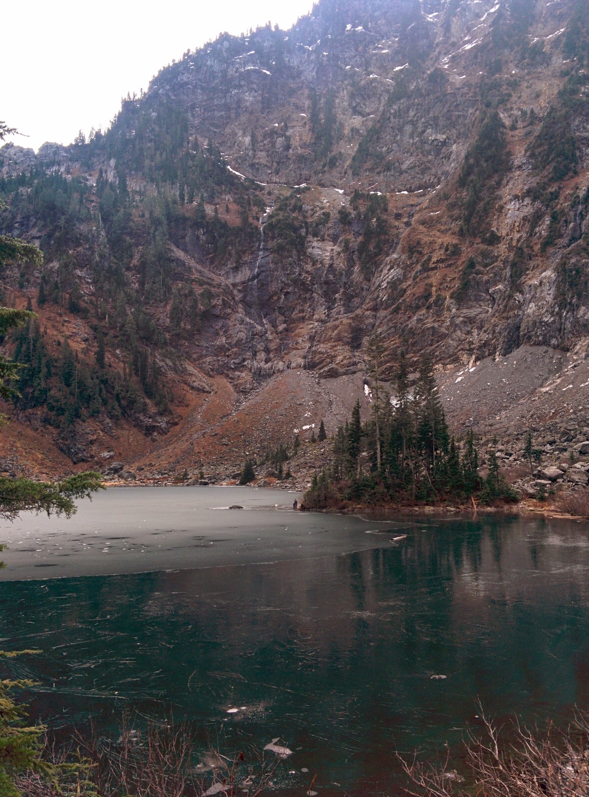
I have hiked Lake Twentytwo. Check the Washington Trails Association hike pages for each trail’s distance, elevation gain, and current conditions before you go. Conditions on Mount Pilchuck Road and on both trails change with the season.
Both trailheads sit below the Deer Creek gate. When the gravel middle closes, these trailheads stay reachable on the paved road to Deer Creek. Winter trip reports treat Lake Twentytwo as the alternative when deeper road travel fails. Parking for both trails follows the section introduction above.
Big Four Ice Caves
I have hiked the Big Four Ice Caves trail as a summer day hike. The Big Four Ice Caves Trail, Trail 723, leaves from the trailhead across from the Gold Basin area. The Forest Service page for the trail puts total elevation gain at only 200 feet from the trailhead. The caves are usually exposed from late July or August through October.
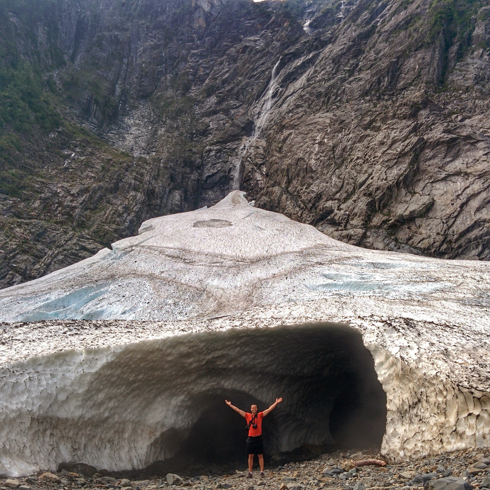
The Forest Service warns, in its own wording, that the caves and the area below the cliffs are extremely dangerous, and rock and ice fall is a hazard year round. It is never safe to leave the designated trail, and the ice caves should only be viewed from the designated trail.
The caves are exceptionally dangerous to enter or climb on, because tons of ice from the cave ceilings come crashing down every year. Hikers should not proceed beyond the footbridge during avalanche activity. Viewed from the trail, never entered, is the whole rule here.
The winter form is a different trip, and my experience does not extend to it. Skiers and snowshoers travel the closed road from the Deer Creek gate, adding roughly 2 to 2.5 miles of road travel each way. Trip reports disagree inside that range. Gold Basin and Red Bridge are this trail’s campground pairings, stated in their entries.
Goat Lake
I backpacked to Goat Lake in August 2017 and camped at the lake, and I have also hiked Goat Lake as a day hike. The Elliott Creek Trail, Trail 647, climbs from the Barlow Pass junction country to the lake. The Washington Trails Association lists Goat Lake at 10.4 miles roundtrip with 1,400 feet of gain.
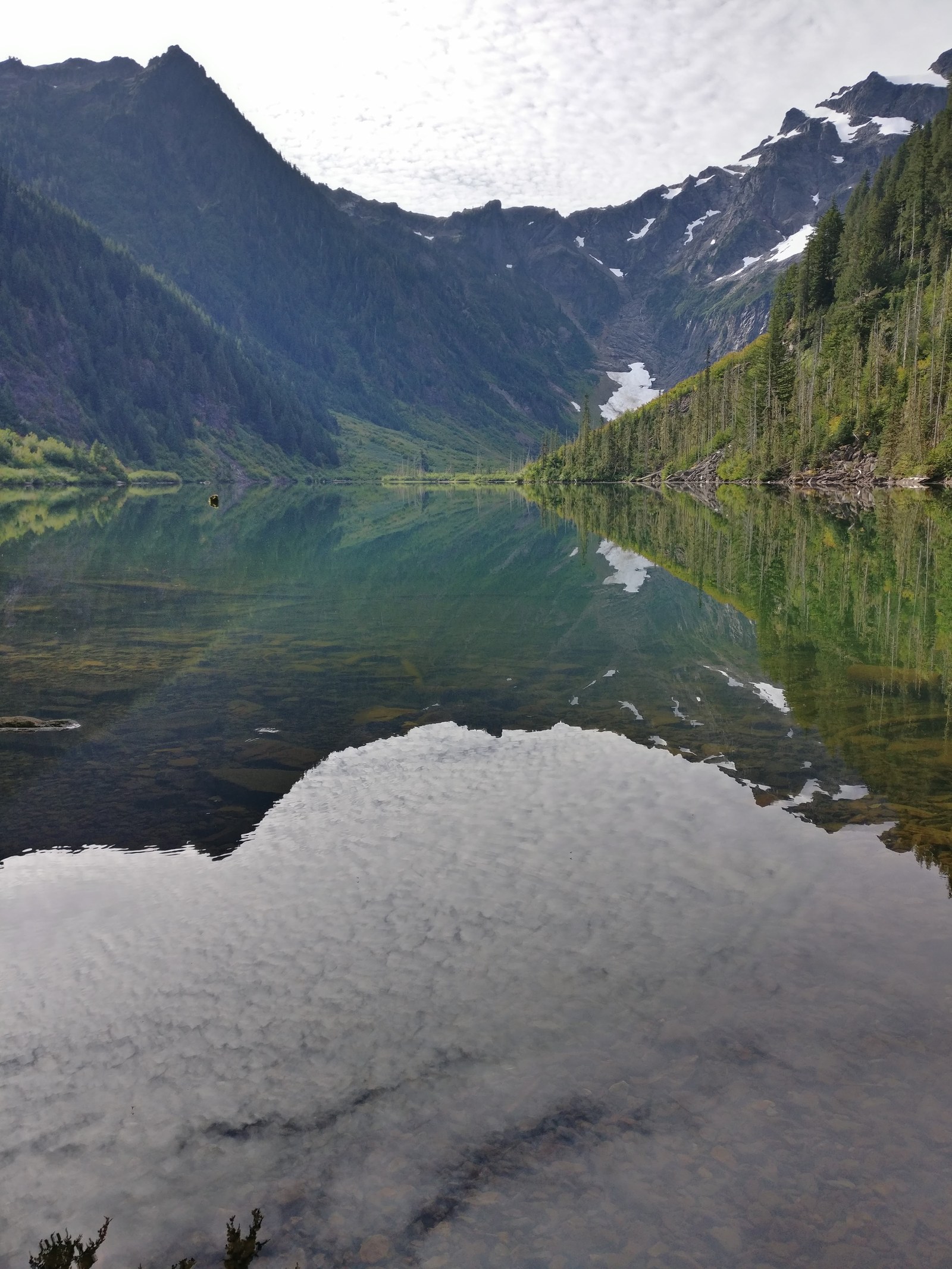
The 2017 trip approached on the Elliott Creek route and camped at the lake, and my frames from that trip sit in this section.
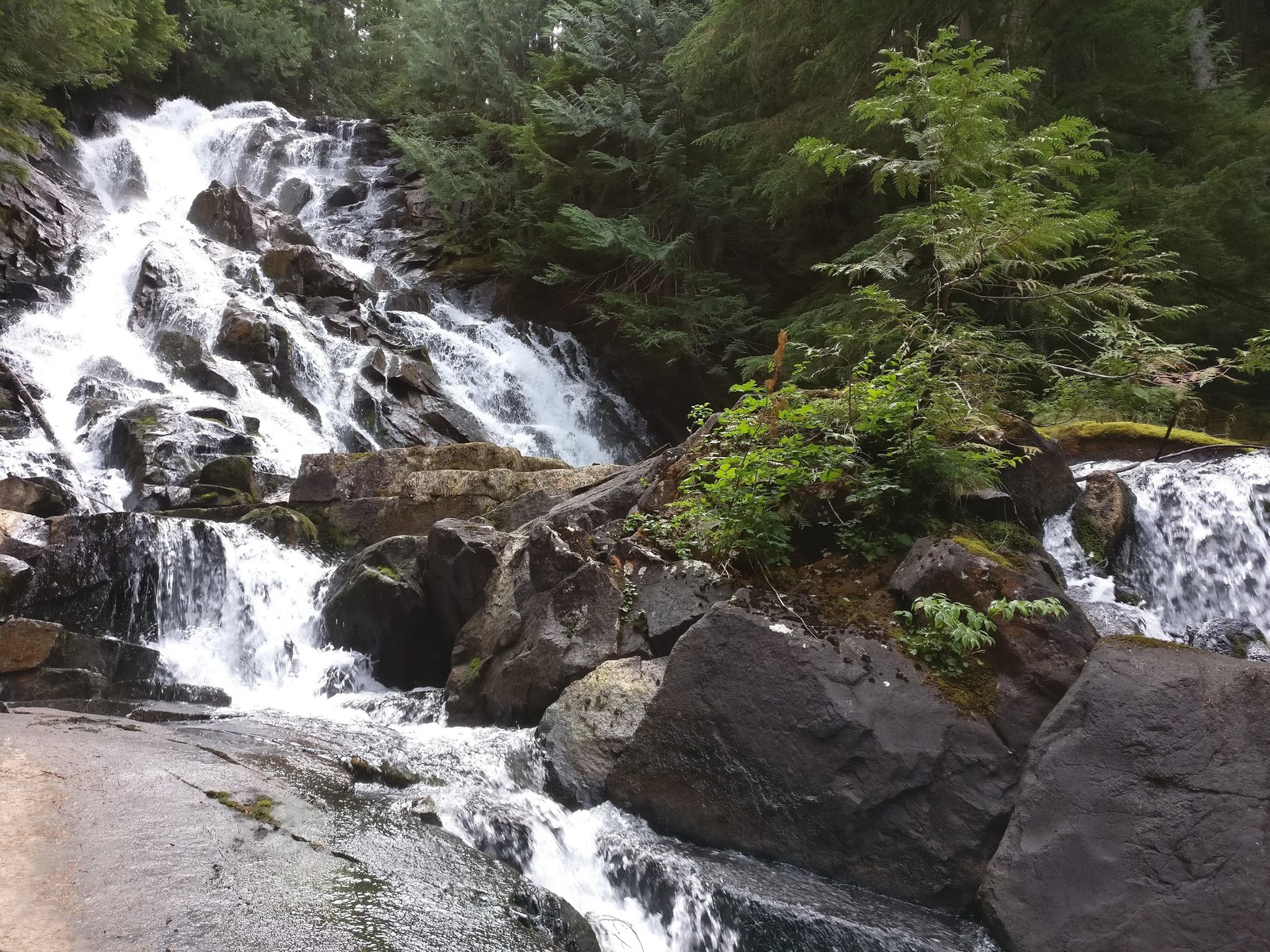
Bedal Campground pairs with Goat Lake’s east approaches, and Gold Basin pairs with the trip from the west in camper reports. In those reports, one reviewer camped at Gold Basin and backpacked Goat Lake the next night. Parking follows the section introduction, one pass per day across a multi day trip included. A backpacker who camps at the lake camps in the backcountry, under the food storage order in the passes section.
Gothic Basin and Monte Cristo
I have hiked Gothic Basin probably three times. The Weden Creek route leaves Barlow Pass in two branches, one climbing to Gothic Basin and one running to the old Monte Cristo townsite. The two branches share a trailhead and a road position.
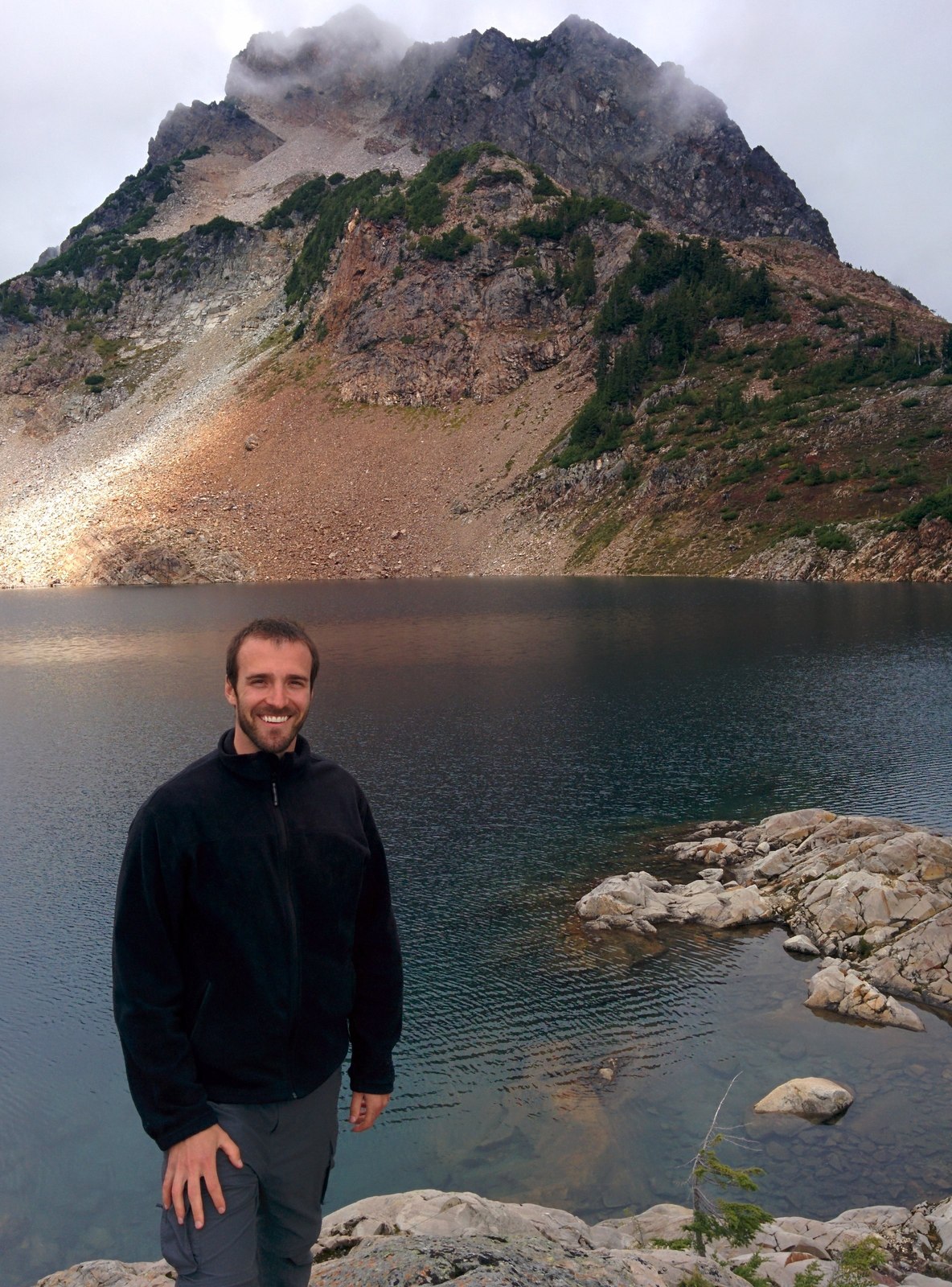
The Forest Service page for Weden Creek (Gothic Basin) Trail 724 describes the basin branch. The trail begins at about 2,300 feet elevation and climbs steeply to about 5,000 feet in 3.3 miles. It crosses potentially dangerous snow gullies, the upper section and the basin can remain snow covered into early September, and the trail becomes a rock scramble before the basin.
Camping is allowed on that page’s form, and campfires are prohibited. The trailhead sits at Barlow Pass, 19.5 miles east of the Verlot Public Service Center. Reach it with one mile on foot past the Monte Cristo Road gate, with the trailhead on the right just before the Sauk River crossing.
The Old Monte Cristo Townsite Trail runs from Barlow Pass to the ghost town, and trip reports describe a long road hike of about eight miles roundtrip. Camping for that trip is the backcountry townsite camp itself. No developed campground on this road pairs with a Monte Cristo trip.
Perry Creek and Mount Dickerman
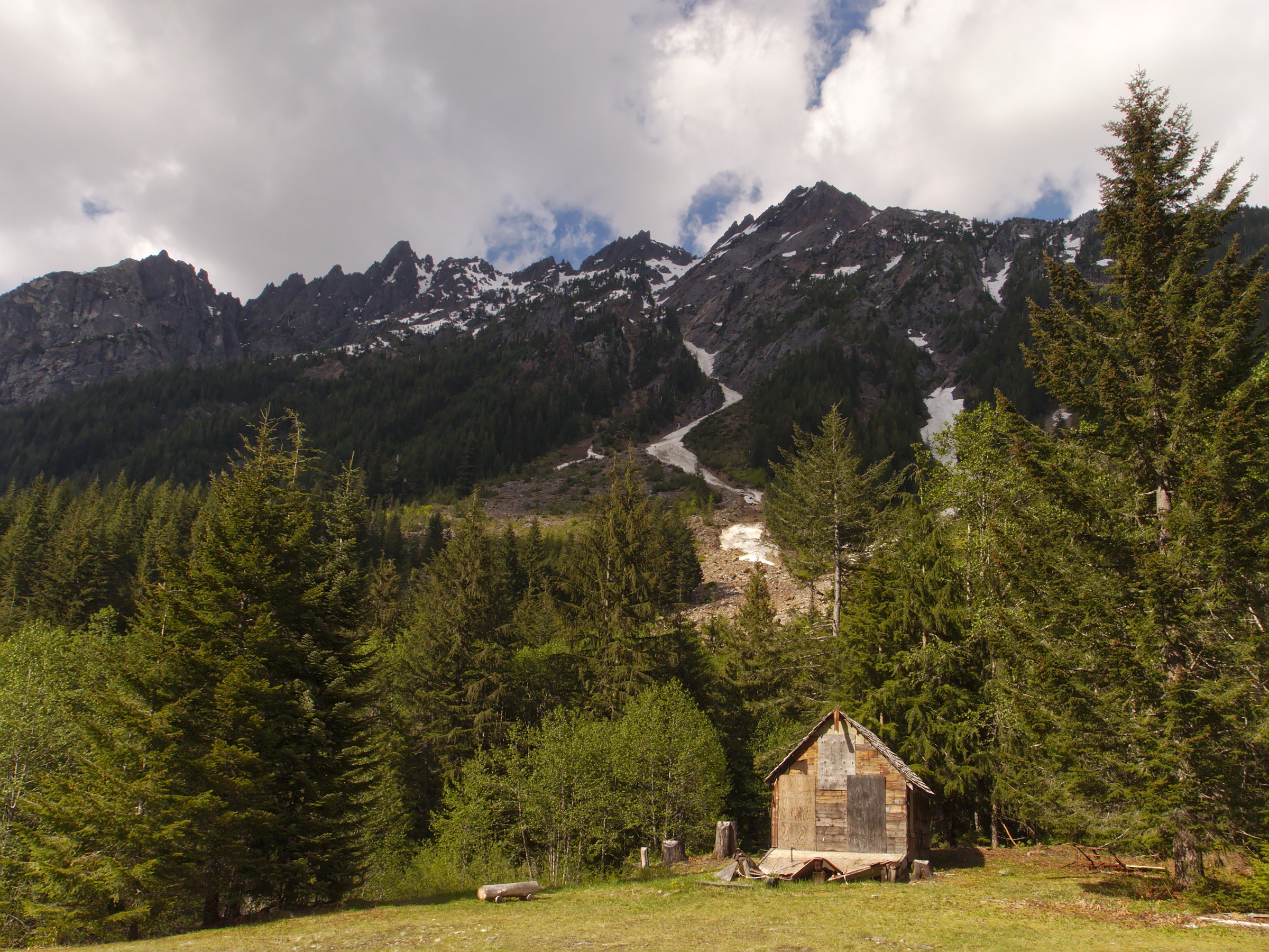
I hiked Mount Dickerman in June 2015. Perry Creek and Mount Dickerman are the east side trailheads that Bedal Campground pairs with, alongside Goat Lake. Campers staying at Bedal name both trails as the hikes they base there. Check each trail’s Forest Service page and its Washington Trails Association hike page for distance, elevation gain, and current status before leaving Darrington. Parking at both trailheads follows the pass form in this section’s introduction.
Old Sauk Trail and Frog Lake
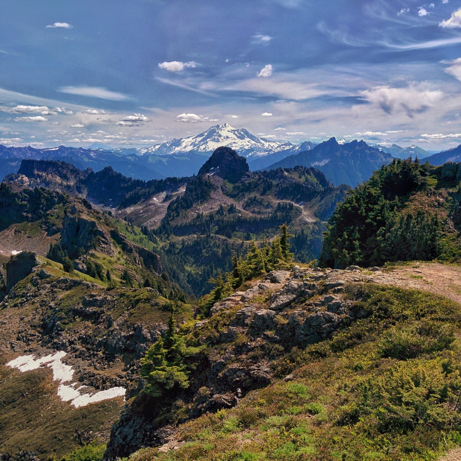
The Frog Lake Nature Trail, Trail 659, runs one mile, and the Old Sauk Trail, Trail 728, runs three miles, both on the Forest Service page for Clear Creek Campground. Reviewers staying at Clear Creek name the Old Sauk Trail, about a mile from camp in their accounts, as the campground’s paired hike. I have not hiked either trail, and no firsthand claim is made for them.
Short, river side hiking beside an east end campground serves campers who want a morning hike without a trailhead drive. Parking and status follow the section introduction and the campground’s own page, checked before the trip.
Fire restrictions and emergencies
Fire restrictions
Fire rules on this road stack, and the strictest applicable rule governs. Check the rules in this order. The land agency comes first, because its order governs the campground itself. At Forest Service campgrounds, campfires burn in developed rings only under the standing baseline. Any forest fire order in force also applies, checked on the Forest Service alerts page before any fire.
The county rule comes next. The Snohomish County Fire Marshal sets burn bans in unincorporated Snohomish County, and its Outdoor Burning Information Hotline at 425-388-3508 is the checking instrument. That county rule binds the land around the campgrounds and is often the stricter one.
The Washington Department of Natural Resources fire danger rule applies at the road’s edges, on the land DNR protects.
Inside the county parks themselves, county parks burn bans can close campfires in dry conditions, on top of every layer above.
The Puget Sound Clean Air Agency can issue air quality burn bans that bind when no fire danger ban does. Bans change with conditions, so check the current position before every fire.
Emergencies
Call 911 first in any emergency. Arlington is the hospital town for this road. Cascade Valley Hospital there runs a Level IV emergency department, and the same hospital system operates clinics in Darrington and Granite Falls. Everett is the larger center beyond Arlington, down the State Route 530 and Interstate 5 drive.
Snohomish County sends wider incident alerts through SnoCoAlerts, its early warning and notification system, powered by Smart911. A camper cannot count on hearing about a flood, a fire, or a road closure from camp. Signing up for SnoCoAlerts before the trip, with the Darrington or Granite Falls area as the place to watch, is the closest thing to a warning system this road has. Call 911 first in any emergency, whether or not an alert has arrived.
Download maps and the Recreation.gov app before leaving Granite Falls or Darrington, and do not count on a phone signal beyond the gateway towns.
Frequently asked questions
Can you drive the whole Mountain Loop Highway?
Yes in season, and no in winter. Pavement carries both ends, 14 miles of single lane gravel cross Barlow Pass in the middle, and that gravel middle closes to vehicles every winter. See The Mountain Loop Highway.
When does the Mountain Loop Highway close for winter?
Every winter, normally from early November to the end of May, with reopening typically in mid May. The closure runs between the Deer Creek gate and the Bedal gate. Check the Forest Service alerts page and the Snohomish County road closures page before any winter trip. See The winter closure.
Do you need a pass to camp on the Mountain Loop?
No pass pays a camping fee anywhere on the loop. Trailhead parking takes a Northwest Forest Pass or an interagency pass at $5 per day or $30 a year. The Discover Pass pays nothing at any campground in this guide. Verlot’s own day use is $8 or a pass, a different price from trailhead parking. See Passes, fees, booking, and stay limits.
Can you reserve a campsite on the Mountain Loop?
Yes at most campgrounds. Verlot, Turlo, Gold Basin, and Red Bridge book through Recreation.gov, and the two county parks, Squire Creek and River Meadows, book through the county online system. Every Verlot site is reservable, so a full weekend there has no first come fallback.
Turlo holds one first come site in eighteen, and Red Bridge holds two in fifteen. Bedal and Clear Creek booking forms are best checked on Recreation.gov before you count on either. See Passes, fees, booking, and stay limits.
Can a regular car drive the gravel section?
Yes, slowly. Ordinary passenger cars complete the 14 mile gravel middle, and trip reports name small sedans and a Prius among the cars that have done so. The surface is potholed and dusty in summer, so the drive takes the time the surface allows. See The Mountain Loop Highway.
Can you take a trailer over the gravel section?
Yes, with caution. The gravel middle is a slow single lane road that ordinary cars complete, and no agency source settles a trailer recommendation for it. The developed campgrounds state their own maximum lengths, 40 feet at Verlot, Red Bridge, and Clear Creek, and those figures govern what fits at camp. See The Mountain Loop Highway.
Is there dispersed camping on the Mountain Loop?
Yes, on national forest land in the standing form. The working sites sit on the gravel segment along the South Fork Sauk River, in pullouts with existing fire rings. The pull offs on the paved section that roundup listings point to are not the working sites. See Dispersed camping on the Sauk River.
Where can a group camp on the Mountain Loop?
Seven group camps sit on this road, in road order from the west. Wiley Creek, Esswine, Boardman Creek, Tulalip Mill Site, Marten Creek, Coal Creek, and Beaver Creek. All seven are reservation camps booked through Recreation.gov, and Beaver Creek is reported closed to reservations, so check its status before planning around it. See Group camps on the Mountain Loop.
Is there drinking water at the campgrounds?
At some campgrounds, yes, and at others, no. Verlot and Turlo carry potable water at spigots. Gold Basin carries none, with Verlot as its fallback about 2.4 miles away.
Red Bridge, Bedal, and Clear Creek carry none, so campers there bring their own supply. Squire Creek carries potable water at spigots spread through the campground, winterized from mid October through mid April. River Meadows carries running water nearby for its campsites, winterized in winter, and its yurt campers keep their own restrooms year round. See Squire Creek Park and Campground and River Meadows Park.
Are there showers or a dump station?
No showers serve tent and RV campers anywhere in this guide, and no campground in the entry list has a dump station. Showers exist inside the River Meadows yurts, for yurt campers only. A camper who needs a dump station uses the dump station at Whitehorse Campground in Darrington.
The county charges $10 for users who are not camping there. That station closes in the winterization window from November to March, on the county facility page. See Mountain Loop Highway camping at a glance and River Meadows Park.
How long can you stay?
Fourteen days on Forest Service developed campgrounds, and 14 nights in a 30 day period at the county parks. Dispersed camping allows no more than 14 days in a row at the same spot and up to 28 days total per calendar year. The limit sits under Forest Order 06-05-24-02, with the forest alerts page as the check for its current form. See Passes, fees, booking, and stay limits.
Where do you camp for Goat Lake or the Big Four Ice Caves?
By road position. Gold Basin stands below the Big Four Ice Caves, with the trailhead across from the Gold Basin area. Red Bridge pairs with the caves as a drive up the highway. Bedal serves Goat Lake’s east approaches, and Gold Basin pairs with a Goat Lake backpacking trip from the west.
Verlot and Turlo serve Heather Lake and Lake Twentytwo on the west side. No developed campground pairs with Monte Cristo, which is a trailhead trip with a backcountry camp at the townsite. See Gold Basin Campground, Bedal Campground, and Verlot Campground.
Sources
- United States Forest Service, Mt. Baker-Snoqualmie National Forest, the campground pages for the six Forest Service campgrounds in this guide, including the Verlot Campground page and the Clear Creek Campground page, the Camping and Cabins list, the Mountain Loop Scenic Byway page, and the forest alerts page, used for campground counts, seasons, water, restrooms, stay limits, the food storage order, the road’s form, and the winter closure pattern.
- Recreation.gov, the facility records for Verlot, Turlo, Gold Basin, Red Bridge, Bedal, and Clear Creek, used for booking forms, the Gold Basin and Bedal holds and extra vehicle fees, and check in and check out times; and the Marten Creek group site record, used for that camp’s capacity, times, and key pickup.
- United States Forest Service, the trail pages for Big Four Ice Caves Trail 723 and Weden Creek (Gothic Basin) Trail 724, used for the ice caves hazard form, the Gothic Basin elevation form and hazards, and the Barlow Pass trailhead form.
- Snohomish County Parks, the county campgrounds page, the Squire Creek and River Meadows park pages, the Yurt Camping page, the county rules and reservation pages, and the Snohomish County Parks Fee Schedule 2025, used for the county campgrounds, their fees, stay limits, quiet hours, and yurt facts.
- Snohomish County, the Public Alert Resources page, the county road closures page, the Fire Marshal outdoor burning information, and the Whitehorse Campground facility page, used for SnoCoAlerts, the closure check, the fire rule, and the dump station answer in the questions above.
- Washington Trails Association, the hike pages and trip reports for Goat Lake, the Big Four Ice Caves, Heather Lake, Lake Twentytwo, Gothic Basin, and Monte Cristo, at wta.org, used for trail facts and for the winter and gravel road patterns in trip reports.
- Discover Darrington, the dispersed campsites page, used for the Chockwich and Sloan Creek dispersed sites, named as that source in the dispersed camping section.
- Skagit Regional Health, the Cascade Valley Hospital location page, used for the hospital town and the clinics in Darrington and Granite Falls.
- Triangle Recreation Camp, the operator’s own site, used for the private camp passage in the at a glance section.