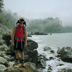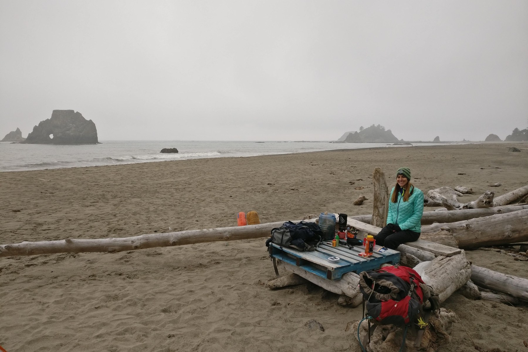
The Olympic Peninsula holds some of the wildest backpacking on the West Coast, and most of mine has happened on its wilderness ocean beaches. My family has camped overnight at six of them, Second Beach, Third Beach, Scott Creek, Strawberry Point, Toleak Point, and Mosquito Creek, and Toleak Point has become our favorite backpacking spot in Washington. I have also backpacked the Hoh River Trail up to the Blue Glacier.
Backpacking here runs on a wilderness permit, not a campground reservation. The park requires a permit for every overnight wilderness trip, releases summer permit reservations on April 15 for the May 15 to October 15 season, and requires a bear canister for all food and scented items in every wilderness area. The national forest that wraps the park runs lighter, with no quotas and a trailhead pass.
This guide covers the park's wilderness coast, its rainforest trails, its alpine interior, and the national forest backpacking at the park's edge. The park's drive in campgrounds have their own guide, Olympic Peninsula camping, and the Washington coast guide covers the state parks on the coast south of the park.
In this guide
At a glance
Inside the park, every overnight trip needs a wilderness permit from Recreation.gov, with quotas on the popular areas. In the national forest, a free self issued permit and a parking pass cover most trips.
The names in the Read more column are the sections of this guide where each row is treated in full, and each name jumps to that section.
| Trip type | Place | The catch | Read more |
|---|---|---|---|
| First wilderness beach camp with small children | Second Beach | The trailhead end crowds into a tent city on summer weekends | Second Beach |
| My favorite beach camps | Toleak Point and Strawberry Point | Reached on foot past Third Beach, with tides governing the walk | Toleak Point |
| The rainforest backpack | Hoh River Trail | 17.4 miles up the valley to the Blue Glacier viewpoint | Rainforest backpacking |
| The hard logistics trip | Shi Shi Beach | A park permit, a tribal pass bought in Neah Bay, and private overnight parking | Shi Shi Beach |
| The boardwalk and beach loop | Ozette Triangle | Permits are limited year round, and the ranger station lends out no canisters | The Ozette Triangle |
| The first forest lake | Lower Lena Lake | No permit quota, and its upper lake crosses into the park's permit system | Backpacking in Olympic National Forest |
| The interior valley | Enchanted Valley | A quota permit, capped at 208 users or 30 permits a night, and 13 miles each way | Rainforest backpacking |
| The alpine loop | Seven Lakes Basin and the High Divide | Designated camps only, permits limited year round, and a season that starts when the snow leaves | Backpacking the alpine interior |
| The forest high country loop | The Buckhorn loop | 20 to 21 miles in all, and neither pass holds water | The Buckhorn loop |
Choosing where to backpack on the peninsula
The wilderness coast's camps are beaches, its clock is the tide chart, and its permit areas between Point of the Arches and Yellow Banks are limited and reservation only in season. Start at the La Push beaches on a first trip, and hike south past Third Beach for quiet.
The rainforest valleys trade tides for distance. The Hoh River Trail runs 17.4 miles up its valley to the Blue Glacier, and the interior valleys beyond it hold the park's quota country, Enchanted Valley above all. The Enchanted Valley entry below walks that valley camp by camp.
The national forest has no quotas, a free self issued permit where one is asked for, and lakes like Lower Lena that make an easy first trip.
The alpine interior is the park's high country, lake basins and a ridge line above the valleys, where the season is set by snow and permits are limited year round. It is the one part of this guide I have not walked, and its section says so.
Trips by number of nights
Most parties start from the time they have rather than the place. This table sorts the trips in this guide by nights, from the shortest walk in to the longest route, with the catch that governs each band.
The names in the Read more column are the sections of this guide where each trip is treated in full, and each name jumps to that section.
| Time you have | Trips that fit | The catch | Read more |
|---|---|---|---|
| One night | Second Beach, Lower Lena Lake, and Rialto Beach out to Ellen Creek | Short walks in, and the park trips still need their wilderness permits | Second Beach, Backpacking in Olympic National Forest, Rialto Beach to Hole in the Wall |
| Two nights | The Ozette Triangle with a Wedding Rocks night, Enchanted Valley in its standard three day shape, and Seven Lakes Basin in its two night loop | All three run on limited or quota permits, booked ahead in season | The Ozette Triangle, Enchanted Valley, Backpacking the alpine interior |
| Three to four nights | The Hoh basecamp glacier trip, the South Coast from Third Beach to Mosquito Creek and back, and the Buckhorn loop | The coast days run on the tide chart, and the Buckhorn loop closes with a road walk or a shuttle | Rainforest backpacking, The South Coast route in segments, The Buckhorn loop |
| Five days or more | The north coast as one route, the Buckhorn country stacked toward 40 miles with Home Lake and a Royal Basin night, and the Hoh full push to Glacier Meadows | River fords and tide gates govern the north coast, and the stacked country crosses the park line, so park permits cover those nights | The north coast as one route, Backpacking in Olympic National Forest, Rainforest backpacking |
Wilderness permits
The wilderness system is separate from the campground system in every particular. Backpackers need permits year round. Obtain a permit in advance through Recreation.gov, by calling a Wilderness Information Center, or in person at one; all permits are created through Recreation.gov. Trailheads no longer offer paper self-registration permits, and the park holds no sites for same-day walk-ups.
The park releases permit reservations for the summer season, May 15 through October 15, on April 15 at 7 a.m. Pacific Time. For reservations made over a week in advance, staff issue permits around three days before the trip. For reservations made less than a week in advance, staff typically issue permits during business hours the same day or the following morning. Campers then log in and print their permits.
A wilderness permit allows camping only in the camp area designated on the permit itinerary, with maximum group size running from six to twelve depending on camp area. Campers can obtain permits in person at Wilderness Information Centers. The Port Angeles center is year round, and the Quinault Rainforest Ranger Station is seasonal, from Memorial Day weekend through the end of September, with a bear canister return bin available year round.
Some areas have quotas. The reservations page names the Sol Duc and Seven Lakes Basin ground, Grand Valley, Royal Lake, and the Cape Alava and Sand Point area among them. On the coast, the park limits permits and requires reservations for all areas between Point of the Arches and Yellow Banks. Plan for a permit at the popular coast trailheads when reservations open in April, not at the trailhead.
Backpacking the wilderness coast
The six beaches in this section are the beaches my family has camped overnight, on the coast we return to more than any other in Washington. Starting from Second Beach at La Push, a hiker meets these beaches in north-to-south order; my family has camped overnight at each one on many trips to this coast. My dated stays include Second Beach, Toleak Point across three trips, and Mosquito Creek.
The section closes with brief entries for beaches I have not camped. I think the La Push to Oil City traverse may be the most logistically difficult trip on this coast because it requires a car shuttle, river crossings, and careful tide timing. I have not hiked it end to end.
Second Beach
Quick facts. Hike in 0.7 miles with a 200 foot descent; camp on the sand or in the trees at the high tide line; the beach has a water source, the one we have used repeatedly; a Quileute Tribal parking permit for the lot, plus the park wilderness permit for the camp.
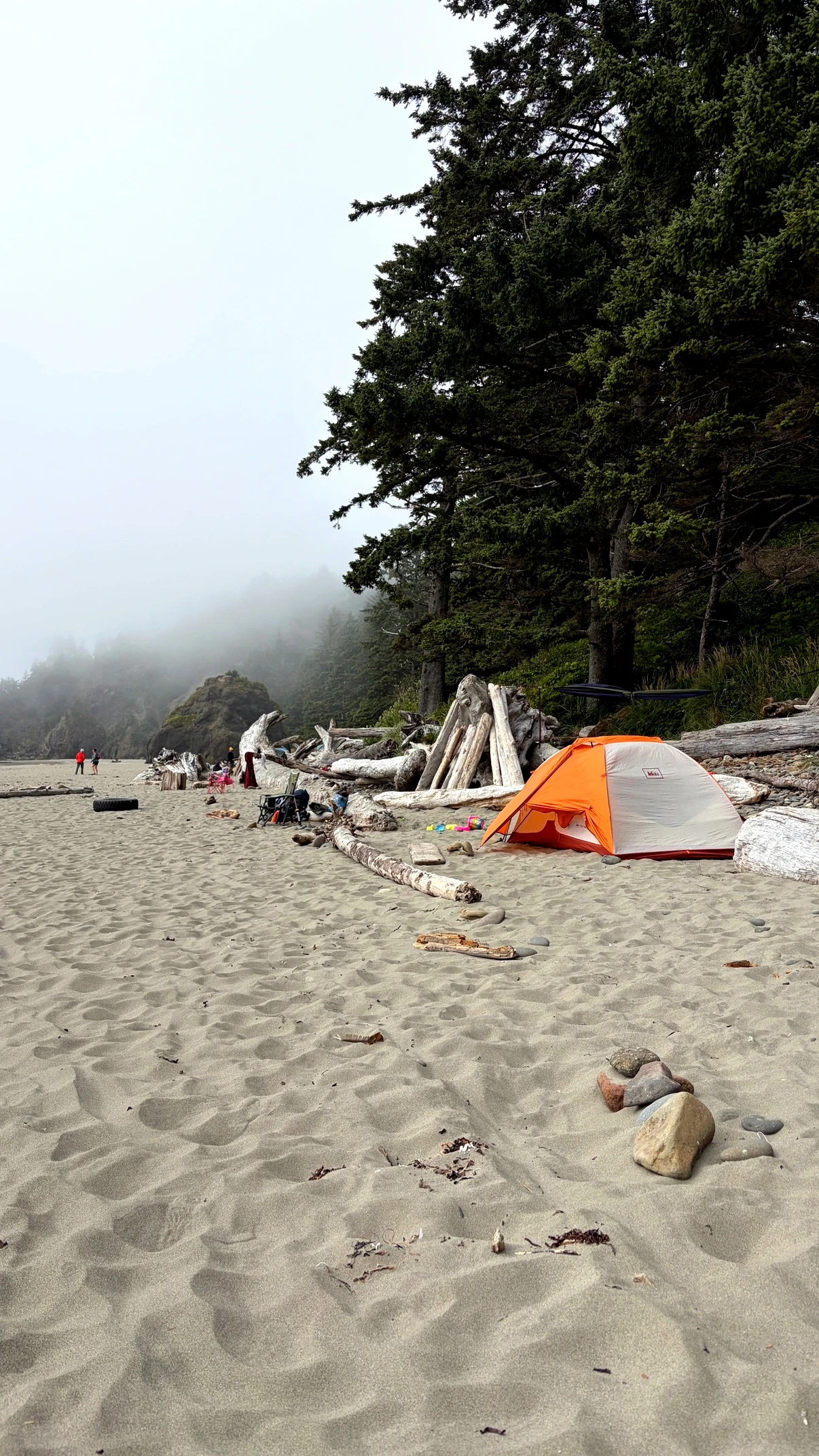
The trailhead sits fourteen miles west of Highway 101 on La Push Road, on the Quileute Indian Reservation. The trail runs 0.7 miles through forest before descending 200 feet to a sandy beach with seastacks and tidepools; the trailhead has a restroom.
The trailhead sits on Quileute Tribal land, and parking there takes a Quileute Tribal parking permit, on top of the park's wilderness permit for the camp itself. The permit can be paid by app at the lot, and the Lonesome Creek Store in La Push also sells it. Cell coverage at the lot depends on the carrier. Our T-Mobile phones had no service there on our August 2026 trip, so we bought our permits at the Lonesome Creek Store, along with a jar of peanut butter we had forgotten to pack.
I camped at Second Beach in the rain in August 2026, on a coast where my family has camped on many trips. Second Beach is one of the two beaches I identify as best for families with little legs, and it is also the most crowded Washington camping I have personally seen, in the summer of 2026.
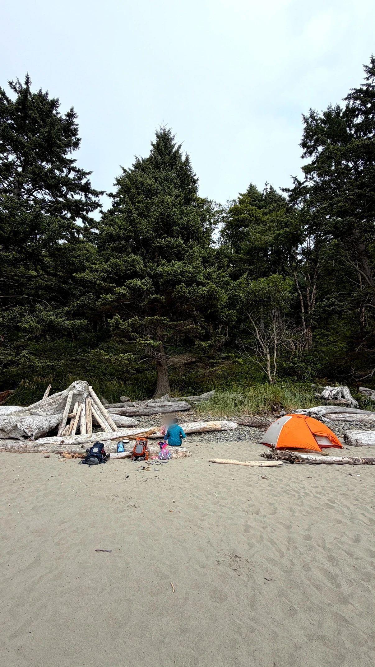
Campers describe the trailhead end crowding into a tent city on summer weekends, with counts of dozens of tents, while the far south end stays quiet. A 2023 report describes arriving to tent after tent already set up, then finding a spot that was not too close once the party hiked farther down the beach.
The trail is short and easy. The trailhead end crowds as described above, there is a single privy at the trail end, dogs appear despite the prohibition, and some groups camp without canisters.
The park does not state whether water is available at Second Beach, and many campers pack their water in. There is a water source at the beach, though. We have used it on multiple trips, and the water was good. A family planning this beach can hike past the trailhead cluster to the far end for a quieter camp.
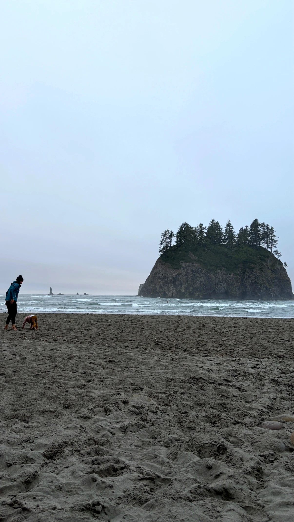
Washington Trails Association trip reports add a family pattern worth knowing here. At high tide the water reaches the top of the beach, the camps sit back in the trees, and the driftwood line between the tree sites and the sand is its own obstacle to cross with the smallest children.
Third Beach
Quick facts. WTA lists the hike at 3.6 miles round trip with 280 feet of gain; camp along the sand, our usual spot a little way north; the creek where the trail comes down is decent and reliable, and tannin colored; Taylor Point and its ladders guard the way south.
Third Beach is a huge, long stretch of sand in a shallow crescent, and one of the two beaches I consider best for families with little legs. We usually camp a little way north along the beach, somewhat close to the water source that comes out where the trail comes down to the sand. That source is decent and reliable, and its water runs brown with tannins from the forest, like the creeks all down this coast.
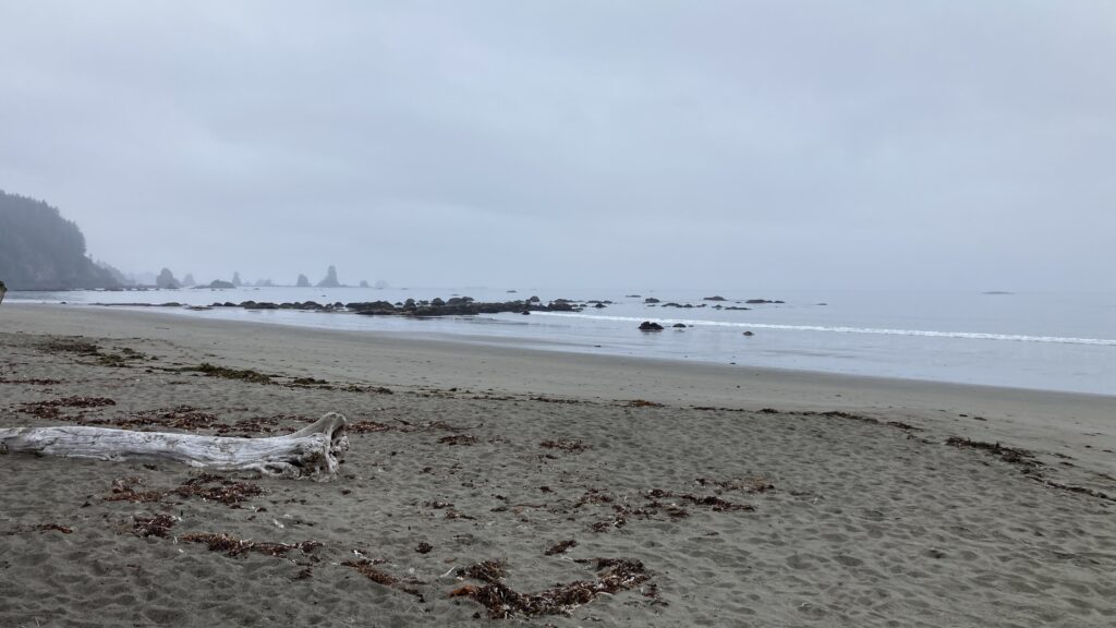
There is a lot of driftwood here, a strip of forest behind the sand, and a huge hill of coastal rainforest behind the forest. Families camp at Third Beach, and through hikers pass on their way south. The headland crossing at the beach's south end is Taylor Point, where I have climbed the wooden ladders using rope handlines.
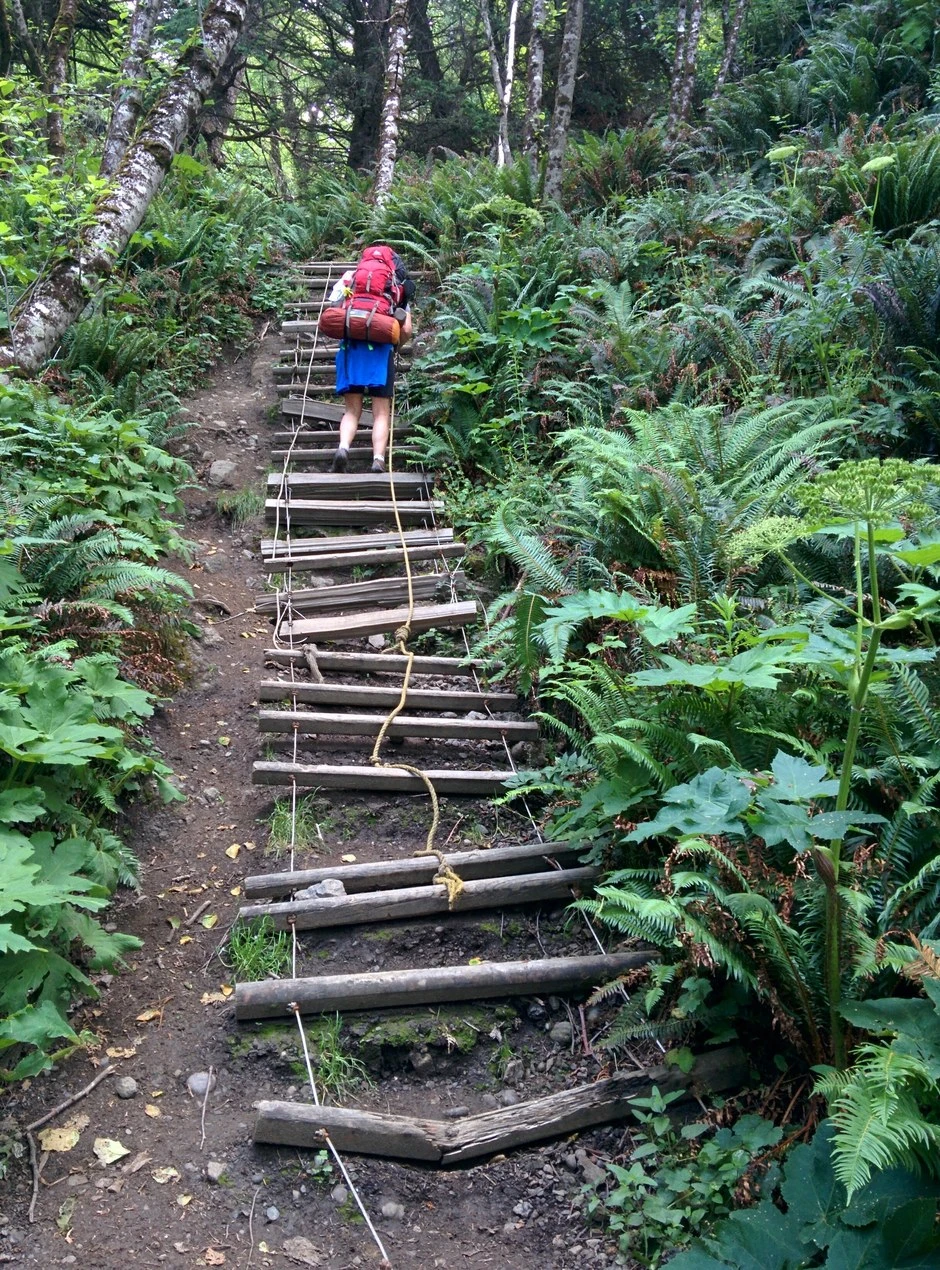
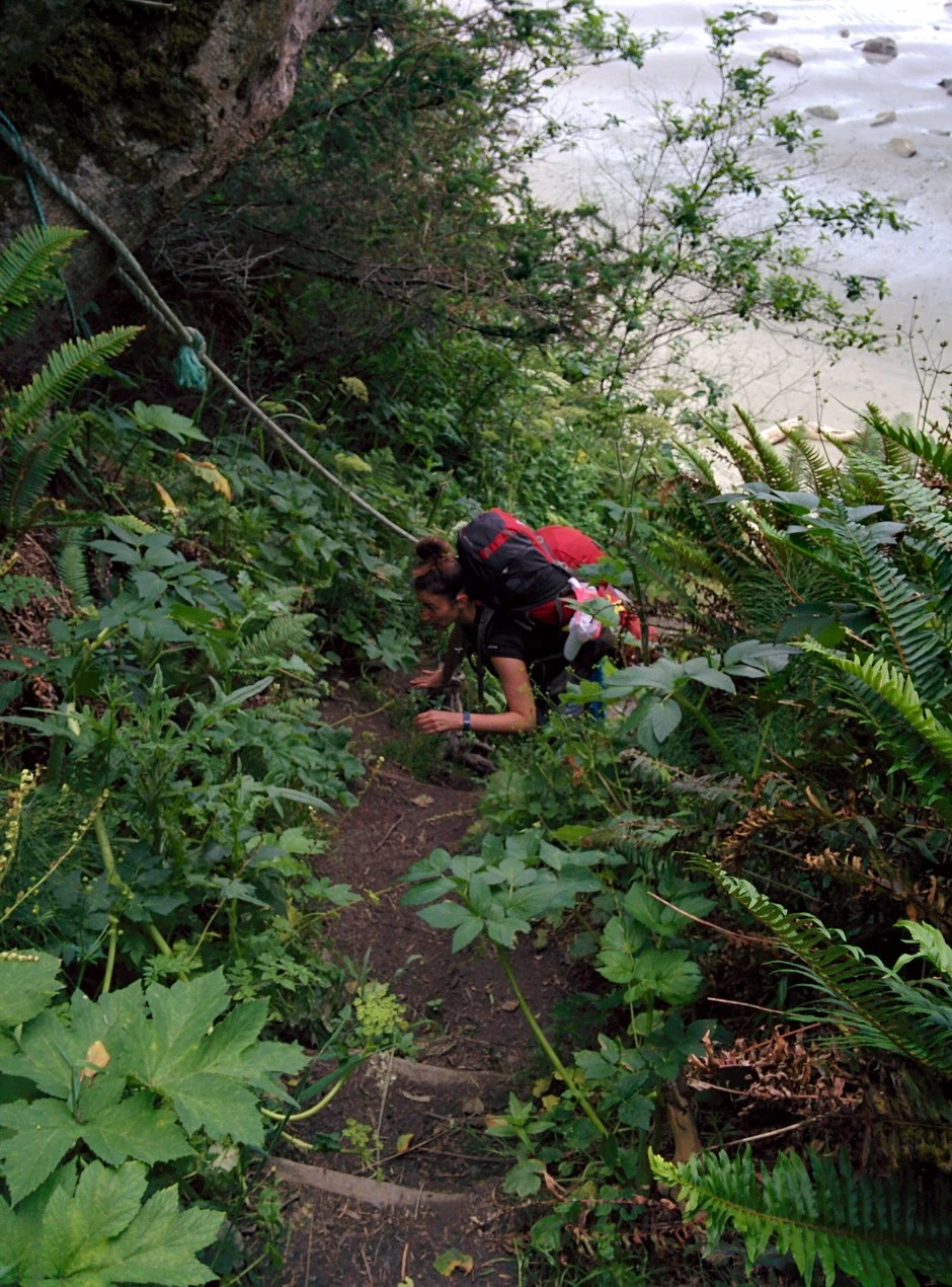
The trail in ends in a steep, muddy chute and a climb over the driftwood pile at the creek mouth. WTA lists the hike at 3.6 miles round trip with 280 feet of gain, and its trip reports put the trailhead lot full by about 10 a.m. on busy weekends.
Scott Creek
Quick facts. Reached over the rope assisted pass north of the creek; three small campsites above the beach, and no privy, on the park route page figures; Scott Creek itself is barely a creek, and its water is treated.
Scott Creek lies just south of an overland pass, and a hiker coming from the Third Beach area climbs a rope up the pass's very steep, cliff like north side and crosses over before reaching it. We camped along the beach here.
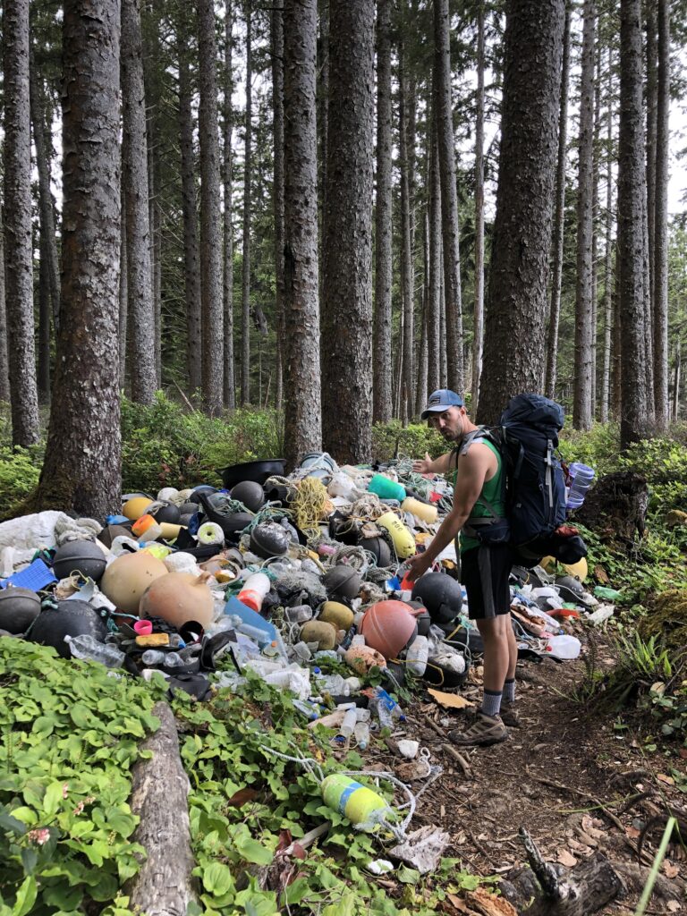
Scott Creek itself is barely a creek at all, nothing like the small river at Mosquito Creek. Just inside the woods stands a huge pile of beach trash that people have collected over time, buoys and other debris gathered into one place in the Scott Creek area.
Strawberry Point
Quick facts. Camp on the south side along the crescent bay, sandy, with plenty of driftwood and the roomiest ground on this part of the coast; water is the weak point, with no good source I remember at the point itself.
We camped on the south side of Strawberry Point, along its crescent bay. The point is a nice sandy area with a bunch of driftwood and a large area to camp, roomier than the camping at Scott Creek or Mosquito Creek. I love the crescent bay and the rock formations here, and Strawberry Point is one of my two favorite beaches on this coast.
Water is its weak point. I do not remember a good water source at Strawberry Point itself, and I believe we hiked down to Toleak Point for water. Toleak's water is one reason I rank it just ahead of Strawberry Point.
Toleak Point
Quick facts. Camp on the sand among the driftwood; the park route page lists a privy in the forest on the north side of the point; Jackson Creek, just south, is the area's closest reliable water source; my favorite beach on this coast, camped in 2016, 2018, and 2020.
Toleak Point is my favorite beach on this coast. I camped here in June 2016, August 2018, and September 2020, and with limited time to camp, we see little reason to go somewhere else. Our camps stood on the sand among the driftwood, with the arched sea stack offshore.
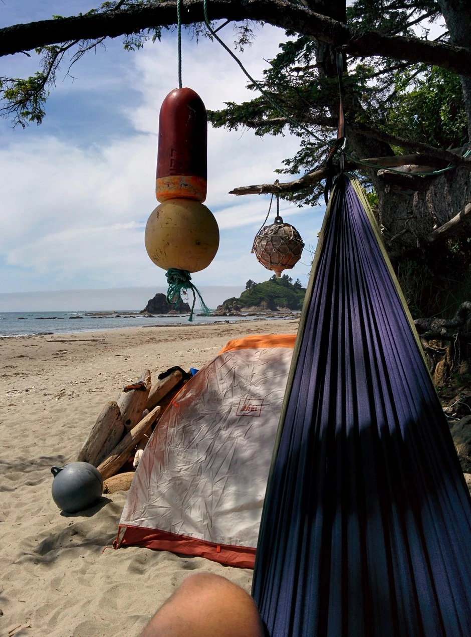
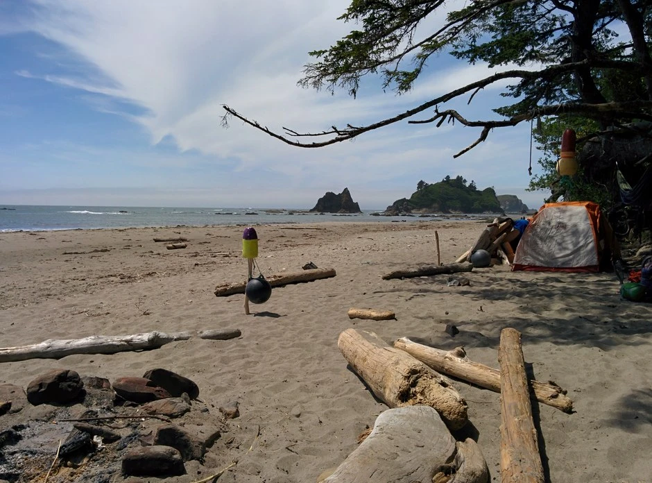
Water comes from Jackson Creek, the small creek just south of the point. The park calls it the area's closest reliable water source, and it is not big, but it is big enough. Use the tide chart to plan the hike in and the hike out, camp above the high tide line, and store everything scented in a canister against the raccoon pressure campers document on this coast.
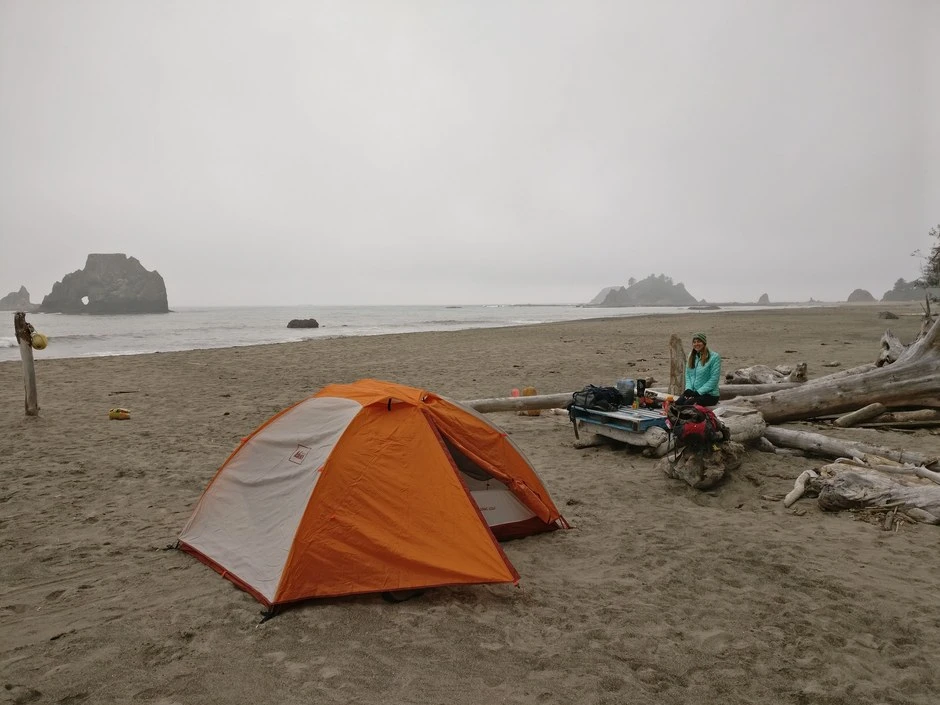
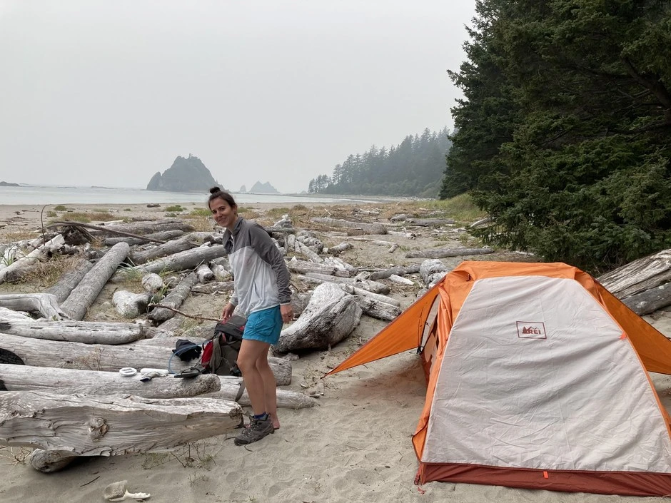
The wildlife here is a large part of the draw. We have seen orcas swimming out in the water, bald eagles flying, and deer coming down the beach, and I have seen bioluminescence in the water at night. It is a magical place.
Mosquito Creek
Quick facts. Camp on the north side of the creek among the driftwood; the creek is large and deep for a beach creek, more a small river, and it is forded at mid to low tide; the most remote feeling of the six beaches I have camped.
Mosquito Creek is the southernmost of the six beaches where I have camped overnight, and it feels quite a bit more remote than Toleak Point. We camped on the north side of the creek, the side we hiked in from, among the driftwood right at the edge of the creek where it runs into the ocean.
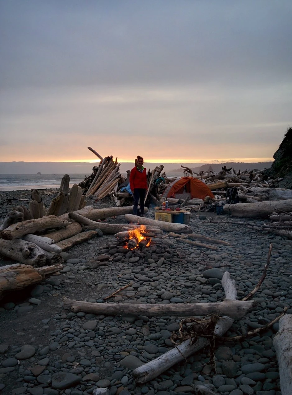
The creek is the feature here. It is a large creek, very deep in spots, more a small river than a creek, and its water runs brown with tannins. The camping area is smaller than the camping at the northern beaches, and rocky. Across the creek a huge hill rises, the start of the next overland pass. I believe there is a pit toilet on the other side of the creek, up on the side of that hill in the woods.
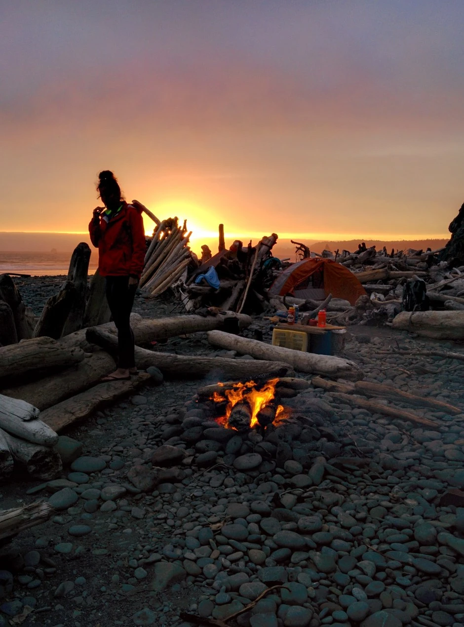
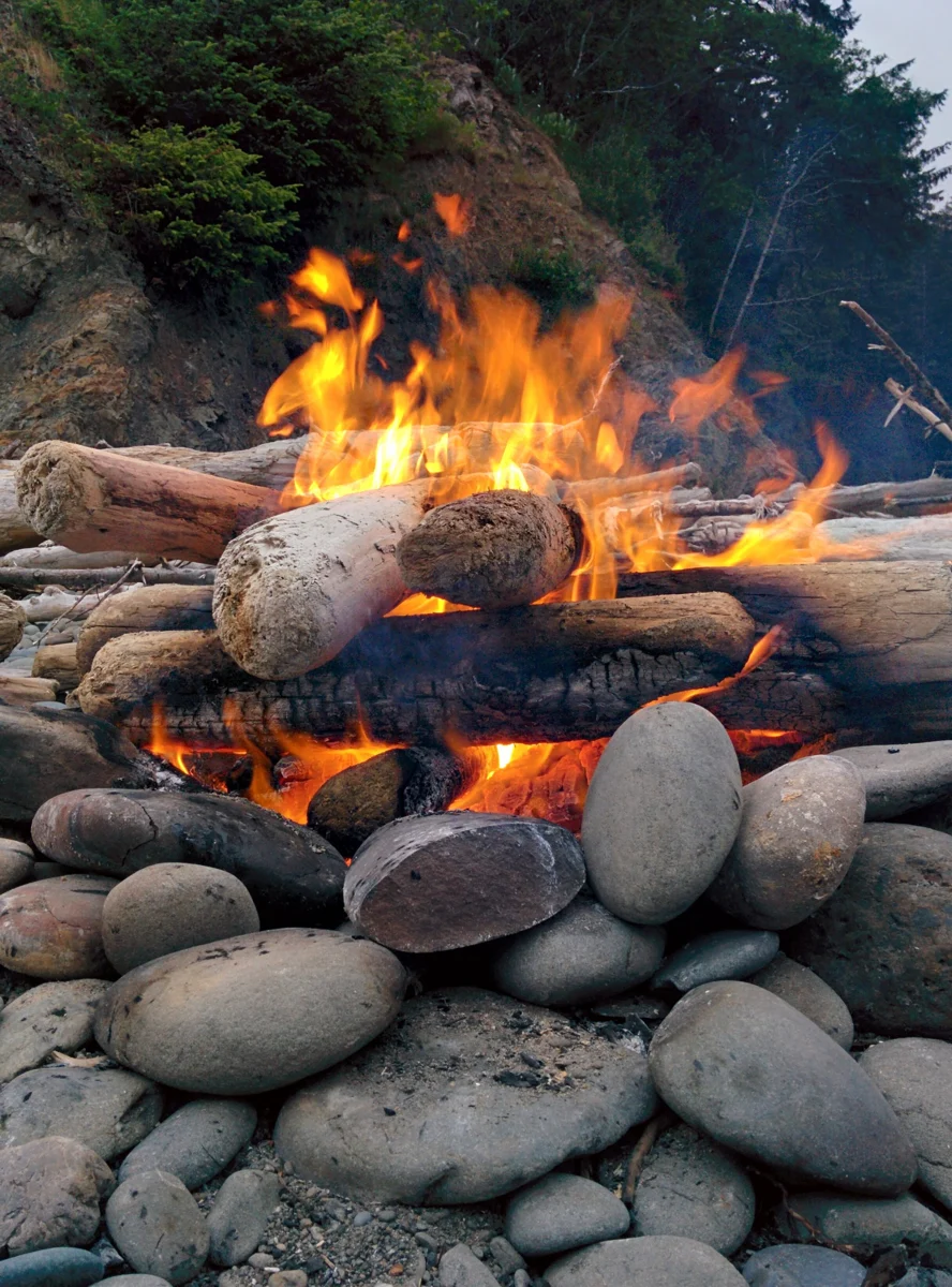
The South Coast route in segments
The camps above also form a route. Read from the Third Beach trailhead, the South Coast route runs about 17 miles south to the Oil City trailhead, and the table lays it out segment by segment. Distances and tide figures are the park's, from its South Coast Route page. We have camped at every camp from Third Beach to Mosquito Creek, and the entries above carry those nights. We have not hiked the last leg from Mosquito Creek to Oil City, and that row stands on the park's account alone.
| Segment | Distance | Tide and ground | Camp at the end of the segment |
|---|---|---|---|
| Third Beach trailhead to Third Beach | 1.4 miles | Forest trail, then a 200 foot descent down to the sand. Neither headland at the beach can be rounded at shore level. | Third Beach. A privy stands by the creek on the south side of the beach. |
| Third Beach to Scott Creek | 2.6 miles | Taylor Point is crossed on an overland trail with ladders and ropes, about 1.25 miles of it in the forest. The cove below that trail goes under at tides above 4.5 feet. A short rope assisted overland trail crosses the bluff above Scott Creek. | Scott Creek. Three small sites above the beach among the driftwood, and no privy. |
| Scott Creek to Toleak Point | 2.4 miles | All of it at sea level. The one tide gate on this segment, south of Scott Creek on the way to Strawberry Point, passes at a tide of 4 feet or lower. | Strawberry Point on the way, then Toleak Point, with a privy in the forest on its north side. |
| Toleak Point to Mosquito Creek | 4.6 miles | A mile of sand, then a 1.5 mile overland trail above the cliffs. Falls Creek and Goodman Creek are forded in succession, Goodman usually ankle to knee deep, and about 2.2 miles of open beach follow. Mosquito Creek is itself a ford, best crossed at mid to low tide. | Mosquito Creek. Sites and a privy sit a short way up the bluff trail, and shoreline camping is limited at higher tides. |
| Mosquito Creek to Oil City trailhead | 6.1 miles | The longest overland trail on the coast, 3.5 miles through the forest to Jefferson Cove, then a ladder and stairs down to the beach. Diamond Rock, just south of Jefferson Cove, passes only at a tide of 2 feet or lower and can stay shut for days at a time. The Hoh River cannot be forded. | Driftwood camps above the beach south of Jefferson Cove. The trailhead sits about 0.6 miles up the river trail from the beach. |
The segments add up to the park's 17 mile total for the route. On any given week the tide figures matter more than the distances, and the craft section that follows works through how to plan around them. The park puts the route's total climb at 1,900 feet of gain, between sea level and 320 feet. The Oil City trailhead at the route's end is a small lot with a pit toilet, at the end of a road that alternates paved and gravel. Most parties in the trip reports hike out and back from Third Beach rather than traversing, and the shuttle the reports name is Olympic Hiking Co.
On the beach, tides, canisters, and camp craft
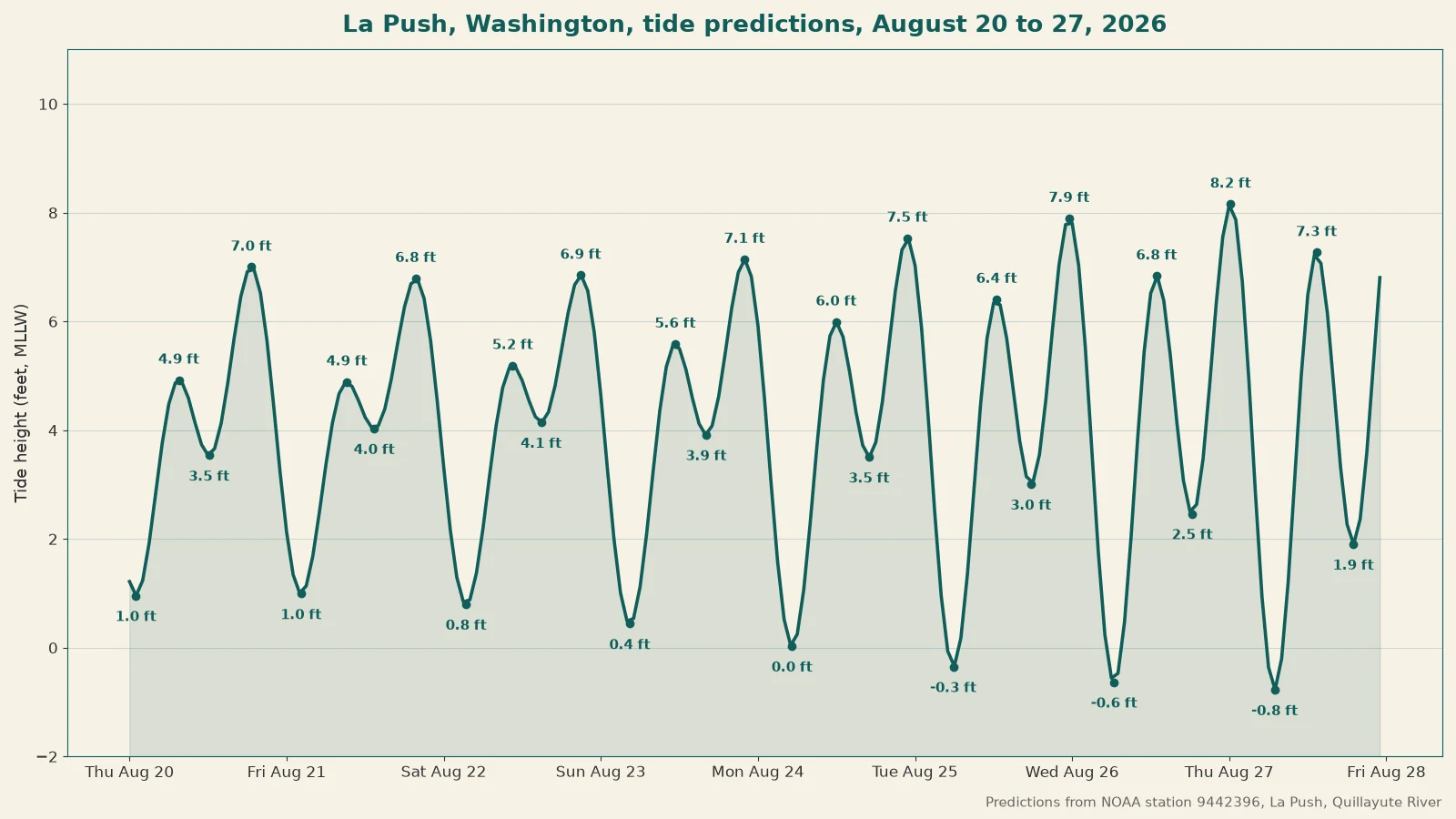
Tides are the safety fact campers learn by error. The Washington Trails Association record across 2014 to 2025 describes tents soaked overnight when camped too close to the water, and a rogue wave reaching a camp in one 2014 account. Hike farther down the beach for privacy, but camp above the high tide line and behind the drift logs, not merely away from people; treat those as one decision, not two.
Carry a tide chart, obtain a detailed topographic map showing the tidal heights at which headlands become hazardous, refer to tide charts before setting out, and never guess. The park directs campers to tide charts from the national ocean service's tides and currents site, and states tide charts are available at the Wilderness Information Centers and some ranger stations. When camping on the beach, camp above the high tide water line, know the tides, and carry a map and tide chart. Waves on this coast can move beach logs, which can crush and kill people. Strong currents, cold water, and hidden rocks make swimming hazardous.
Bear canisters are required in all wilderness areas of the park, not only on the coast. Store all food, trash, toiletries, and scented items in a hard-sided vehicle, a park-provided food locker, or a park-approved canister. On the wilderness coast, store all food, garbage, and scented items in approved canisters. The park does not consider bear wires or self-constructed hangs appropriate storage.
Canisters may be available for loan from Wilderness Information Centers during business hours, free to permit holders, on a first come, first served basis. WTA's Shi Shi page notes one more source, canister rentals at the Port Angeles Visitor Center. The park holds a large supply but occasionally runs out over exceptionally busy weekends. It does not reserve canisters in advance and encourages visitors to provide their own. Campers describe a summer queue at the Port Angeles center, where they arrive before the morning opening and plan about half an hour for permit, canister, and ranger talk combined.
Campers describe rangers checking permits and food storage, a fifty dollar ticket for missing canisters in one 2014 account, and repeated raccoon pressure even where bears are not seen. Campers also describe groups camping without canisters and groups starting fires despite burn bans. Those accounts explain why the rules exist and never justify relaxing them; raccoons, more than bears, are the everyday enforcement animal on this coast.
Gather wood only from the beach, and build fires on the beach only, small driftwood fires at least ten feet from beach logs and below the high tide line. Remove any evidence before leaving, and gather no wood from the forest floor.
Campfires are not permitted on the Sand Point stretch, north of Yellow Banks to Wedding Rocks. The park has imposed park-wide campfire bans in dry summers, covering anything that produces ash and expressly including the coastal areas. Beach fires are prohibited when a ban is in effect, so check the current fire status before any trip.
Treat all drinking water. Boiling for one full minute at a rolling boil or proper filtering are the only reliably effective treatments, because iodine and chlorine are ineffective against cryptosporidium, found in some coastal water sources. Use a filter rather than chemical treatment on this coast; the supported advice and the community record agree on that.
Water, camp by camp, works out like this. The south coast rows come from our own trips. The Ozette row is the park's account, because those camps are research ground for us rather than camps we have slept at.
| Camp | Water source | What to know |
|---|---|---|
| Second Beach | The creek at the beach | We have drawn from it on multiple trips and the water was good. The park does not promise water here and many campers pack water in, so arrive able to carry if the creek disappoints. |
| Third Beach | The creek where the trail comes down to the beach | Decent and reliable on our trips, and tannin colored, like most water on this coast. |
| Scott Creek | Scott Creek itself | Barely a creek at all when we camped there. Do not plan a fill up at this camp. Carry in what you need, or top up at Third Beach before it and Toleak Point after it. |
| Strawberry Point | No dependable source | The weak point of this part of the coast. We do not remember a good source at the point, and our memory is that we hiked down to Toleak Point for water. Trip reports name Scott Creek, about a mile north when the tide is out, as the closest fill up. |
| Toleak Point | Jackson Creek, just south of the point | The park calls Jackson Creek the closest reliable water source in this area, and it was our source on our trips here. Tannin colored. The crossing at the creek is a wade or a log, and the better watering hole sits a short way upriver past the driftwood pile. |
| Mosquito Creek | Mosquito Creek | A large creek, deep in spots, closer to a small river. Tannin colored. On the route it is also a ford, crossed at mid to low tide. |
| The Ozette Triangle camps | The camp creeks at Sand Point, Wedding Rocks, and Cape Alava | On the park's account, the water sources at Sand Point and Wedding Rocks typically dry up later in the summer. Trip reports found South Sand Point's creek running in early August. Wedding Rocks is a dry camp. Carry water on this loop late in the season. |
Every source in the table needs treatment before drinking, and a creek that runs strong in June can thin out by September, so carry enough capacity to haul water onward from the next reliable source.
Three more pieces of coast craft come out of the trip reports. Work gloves earn their place for the ropes, the ladders, and the barnacled rock. Water shoes stay on between close fords, Falls Creek and Goodman Creek on the south coast, where the crossings come in quick succession. Trip dates themselves are a tide tool, and parties in the reports choose their dates months ahead so the low tides fall in the morning, when the day's hiking wants them.
The planning tools have names. The Custom Correct coastal maps are the maps that print the tide restriction heights this guide quotes. The park's Interactive Wilderness Trip Planner Map is where the park plots privy locations, which makes it the place to check a privy's state before a trip.
North coast
Rialto Beach to Hole in the Wall
Quick facts. Camping is allowed north of Ellen Creek at about 1 mile; Hole in the Wall stands at about 1.5 miles, its arch passable at lower tides; there is no dependable fresh water on this stretch; mine is a visit here, in August 2020, not a camp.
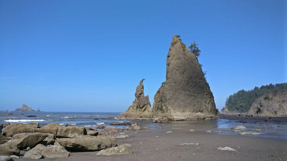
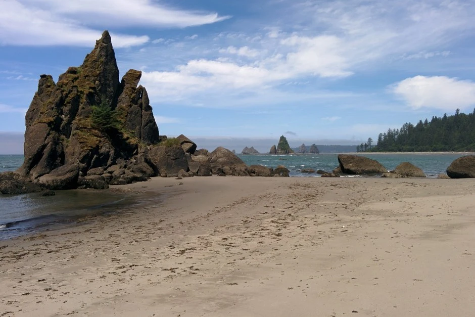
Rialto Beach is a popular day-use beach a short drive from Mora Campground; its wilderness camping area sits at the hike's end, between Ellen Creek and Hole in the Wall. I have been there once, on a visit in August 2020, and the photograph above is mine from that day. I have not camped at Rialto Beach. Campers describe numerous campsites along that stretch, with the hike in timed to the tides, the headlands governing the return, and driftwood covering the upper beach, with camps tucked behind it for wind protection. One winter report describes a camp just barely out of reach of the waves.
Mora Road is Rialto's only road. The road closed beyond Mora Campground from July 8 to October 15, 2026, for riverbank construction, blocking road access to Rialto Beach during that period. The road has reopened.
Rialto Beach is popular for day use, the parking lot is small, and campers report waits for parking. Dogs are allowed only on the half-mile stretch from the parking lot to Ellen Creek.
The hike in numbers, from the trail references. Ellen Creek sits about a mile up the beach, and wilderness camping is allowed north of it. Hole in the Wall is about 1.5 miles from the trailhead. Its arch passes at lower tides, and an overland trail crosses the headland above it when the tide is in.
Chilean Memorial is about 4 miles up the beach, past three more headlands that round only at mid to low tide, so the return is a tide calculation as much as a hike. There is no dependable fresh water near Chilean Memorial, and parties carry in what they need. The standard trip is one night at Chilean Memorial and out the next day, about 8 miles in total. A first night near Ellen Creek is the shorter version.
The Ozette Triangle
Quick facts. The loop runs a little over 9 miles in all; the bookable camps are Cape Alava, Wedding Rocks, South Sand Point, and Sand Point; permits are limited year round; canisters are required, and the Ozette Ranger Station lends none; the Sand Point and Wedding Rocks water sources run dry by late summer.
The Ozette Triangle is the park's loop backpack, 9.2 miles in all. Boardwalks run from the Ozette trailhead, behind Ozette Campground at the north end of Lake Ozette, out to Cape Alava and to Sand Point, and the beach between the two points closes the loop, past the petroglyphs at Wedding Rocks. The bookable camp areas are Cape Alava, Wedding Rocks, South Sand Point, and Sand Point.
Permits for this coast are limited year round, and the park advises booking early for trips from May through September. Bear canisters are required, and the Ozette Ranger Station does not lend or rent them, so the canister travels in with the party. Late in the summer the water sources at Sand Point and Wedding Rocks dry up, and parties carry in the water they need. The campground behind the trailhead is first come and cannot be reserved, and one camper found five of its fourteen sites taken on a Memorial Day weekend.
The Ozette triangle's beach camps at Sand Point and Cape Alava are accessible from the Ozette trailhead behind Ozette Campground; the permit system sets a quota for the area. Washington Trails Association reports describe Sand Point's sites as spacious. Many hold two or three two-person tents with good spacing and privacy; Cape Alava's sites have private beach views, with a single trail running past them. Campers reported bear sign in all three accounts, and one family reported a black bear walking through Sand Point's campsites. Campers who stage a night at the campground first warn that its low sites flood in heavy rain, and that the sites beside the lake can go under water in a downpour.
The park prohibits campfires from north of Yellow Banks to the headland at Wedding Rocks, including the Sand Point area, because campers have damaged trees and vegetation.
One family completed a two-night loop with children aged twelve and eight, rated it highly recommended, and found the boardwalk approaches easy for children. That family’s account describes a trip with older children; my judgment about beaches for preschoolers applies only to Second Beach and Third Beach.
The loop in numbers, from the trail references. From the Ozette trailhead, the Cape Alava trail runs about 3.1 miles on boardwalk and trail to the beach at Cape Alava, the westernmost point in the contiguous United States. The beach leg south to Sand Point is about 3 miles, past the petroglyphs at Wedding Rocks near its midpoint, and parts of it are low tide walks. The Sand Point trail returns about 3 miles on boardwalk to the trailhead, a little over 9 miles for the whole loop.
The boardwalks are slippery when wet. As a backpack, one night splits the loop unevenly, a 3 mile day and a 6 mile day, camping at Cape Alava or Sand Point. Two nights adds Wedding Rocks and slows the beach leg down.
The loop's toilet facts come from the park's Ozette page. Pit toilets stand at Sand Point and Cape Alava. Wedding Rocks has no privy, and South Sand Point has a newer one, with bluff sites reached by a rope assisted climb marked with buoys. Trip reports put South Sand Point full by about 4 p.m. on a summer Saturday. Cape Alava can run short of driftwood in the summer season, so a fire there is a smaller affair than at the beach camps farther south.
Two things on the Cape Alava leg deserve a line of their own. Ahlstrom's Prairie, a 160 acre former homestead meadow, crosses the trail at about 2.25 miles. The petroglyphs at Wedding Rocks were carved by ancestors of the Makah Tribe. They are legally protected, scattered across the rocks near the tree line, and worth finding slowly and leaving exactly as found.
Cannonball Island, also called Tskawahyah Island, sits off Cape Alava and is part of the Ozette Indian Reservation. It is always closed to the public.
The north coast as one route
Read as one route, the north coast runs about 35 miles from Rialto Beach to the Shi Shi Beach trailhead, and WTA treats it that way. The park gives the two halves as 20 miles from the Ozette trailhead to Rialto Beach, three to four days, and 15 miles from the Shi Shi trailhead to the Ozette trailhead, two days. The route breaks at La Push. The Quillayute River's mouth sits between Rialto Beach and the La Push beaches, and no foot route crosses it, so a through hike is two hikes joined by the road around the river.
This section is research. I have visited Rialto Beach, and I have not hiked this route.
| The camp ladder, south to north | What is there | The gate |
|---|---|---|
| Ellen Creek | The first camp north of Rialto Beach, about a mile up the beach | Wilderness camping is allowed north of here |
| Chilean Memorial | The memorial camp about 4 miles from Rialto, covered in its own entry above | The headlands between here and Rialto round at mid to low tide. No dependable water at the camp |
| Cedar Creek | The next camp north, in the boulder and cobble middle of the route | Slow rocky travel on both sides |
| Norwegian Memorial | The second shipwreck memorial camp | Boulder sections slow the miles around it |
| Yellow Banks | The camp at the south end of the permit limited zone | The limited zone runs from here north to Point of the Arches. Permits are limited year round inside it |
| South Sand Point and Sand Point | The Ozette loop camps, covered in the loop entry above | The Custom Correct map figure quoted in trip reports is 5 feet or lower for the beach leg between Cape Alava and Sand Point |
| Wedding Rocks and Cape Alava | The loop’s west side, covered in the loop entry above | Boardwalk trails run inland to the Ozette trailhead from both ends of the beach leg |
| The Ozette River camps | Camp areas on both banks of the river, just north of Cape Alava | The ford runs two to three hours around low tide, knee deep at low water, and can be impassable in winter and heavy rain. Filter upriver, against the salt. A headland half a mile north of the river carries a 6 feet or less figure in the reports |
| Seafield Creek | A small camp between the river and Shi Shi Beach | The park caps groups here at six, against twelve on the rest of the coast |
| Shi Shi Beach | The route’s north end, covered in its own entry below | Point of the Arches, at the beach’s south end, rounds at 4 feet or lower on the map figure the reports quote |
Parties walk the route in halves as often as whole, on the park's own allowances, and the trip reports show the camps chosen around the morning low tides. The camps I have not covered in their own entries, Cedar Creek, Norwegian Memorial, Yellow Banks, and Seafield Creek, stand on the park's camp list and the route reports, and they are named here so the sequence of camps along the route is complete.
Shi Shi Beach
Quick facts. About 4 miles from the trailhead to Point of the Arches, about 8 miles round trip; a park wilderness permit plus a $20 Makah Recreation Pass; overnight parking sits in private lots about 0.6 miles before the trailhead, priced at $20 a night in recent trip reports; Petroleum Creek is the usual water source, treated.
Shi Shi Beach is the north coast's hard logistics trip, with three frictions: a park wilderness permit, a Makah Recreation Pass, and overnight parking. Overnight stays require a park wilderness permit, and permits on this stretch of coast are limited. Buy a Makah Recreation Pass in Neah Bay before arriving at trailheads on the Makah Indian Reservation; it costs $20 per vehicle and is valid for the calendar year.
Overnight parking is permitted only at designated private parking lots. Overnight parking is not allowed at the trailhead, and campers advise carrying cash for the private lots. Recent trip reports price the lots at $20 a night, up from $10 a day in older reports.
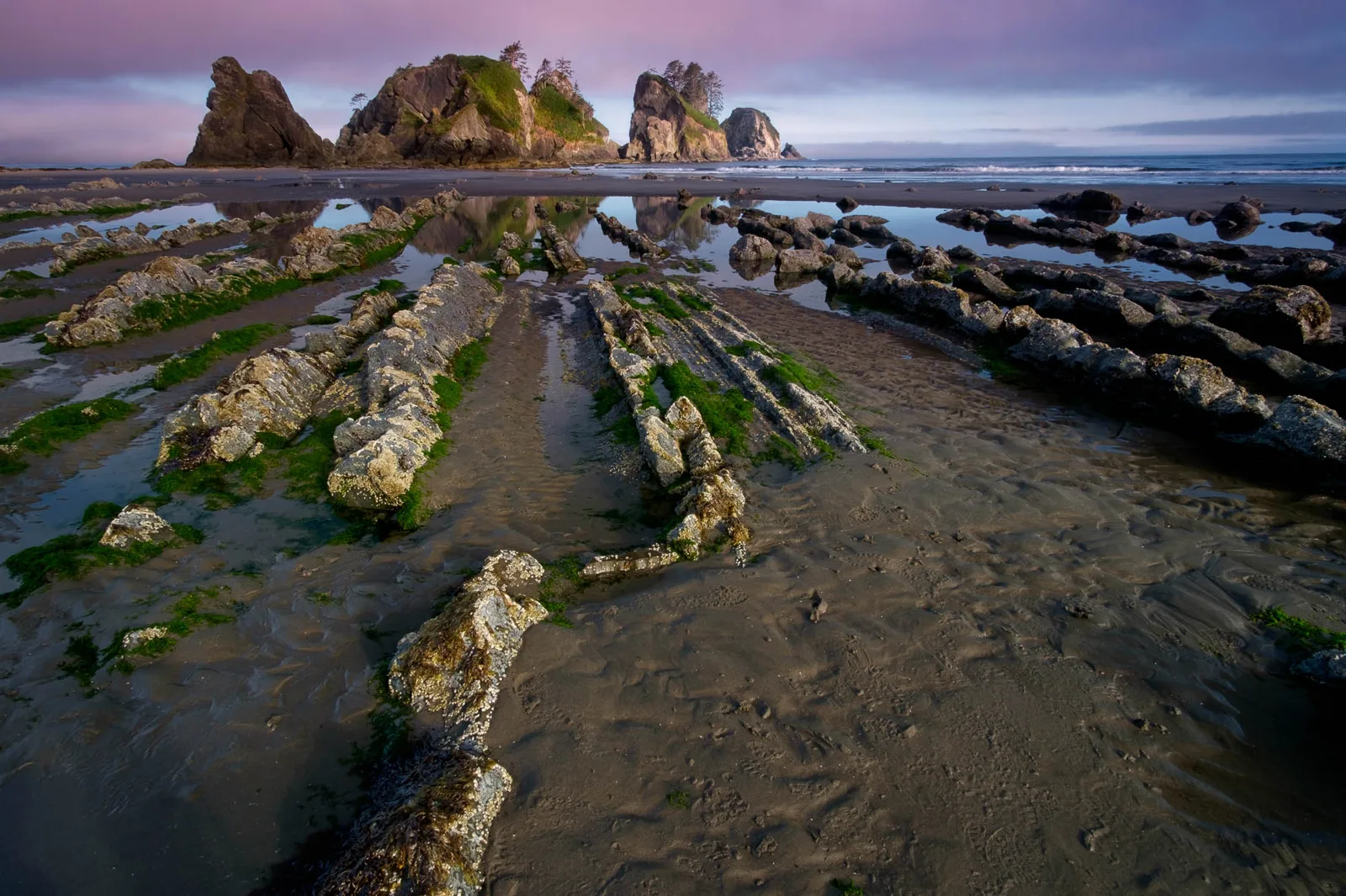
The hike to the beach is two to four and a half miles, with an elevation change of 200 feet to sea level; the best season is April through October. The park prohibits pets on the beaches and trails and expects large crowds in summer, with as many as 250 campers along the beach on busy weekends. I have not been to Shi Shi Beach.
The hike itself, from the trail references. Overnight parking sits in the private lots about 0.6 miles before the trailhead. From the trailhead, about 2 miles of forest trail, muddy for long stretches with boardwalk and planks across the wettest parts, ends in a steep descent to the beach. The beach runs south from there.
Petroleum Creek, about 1.3 miles south of the descent, is the usual water source, treated like every coast source. Point of the Arches is about 2 miles farther south, roughly 4 miles from the trailhead and about 8 miles round trip, and the arches themselves open up at low tide. Camps sit in the driftwood and the tree line along the beach, thickest toward the arches. The standard trip is one night on the beach with the low tide hike to the arches, and two nights when the tides or the light argue for staying.
The 2026 trip reports sharpen the hike's present shape. The bluff descent now has stairs and a railing. The mud is the forest trail's defining condition in those reports, with mudholes roughly 10 by 10 feet at the halfway point and braided side trails around the worst of it. The beach has named camping areas, the first of three near the descent, with a privy, and parties report filterable stream water along the beach beyond Petroleum Creek. Rangers camped at the descent in one account, checking permits and asking about canisters.
Rain and wind setup for this coast
We plan around rain when we can, and we have still camped in a lot of it. Many of our nights in the backpacking tent have been wet and windy, and the coast trips have rained on us more than once, including at Second Beach in August 2026. The tent has taken those nights with condensation only. The habits below are the ones those nights argue for.
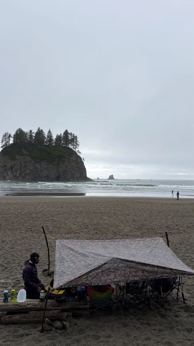
Drainage comes before the fly. Choose a flat or rounded spot, never the lowest ground or a divot, because a beach camp can soak from below as well as above, and a rainforest site stays wet after the rain ends. A footprint can trap water against the floor, so keep it inside the fly's drip line.
Wind is the other half of the setup. Stake the backpacking tent out fully and run its guy lines, with stakes that hold in loose sand at beach camps. Bluff and beach camps face weather that forested sites do not, and a pitch that feels solid in the forest can work loose on an open beach.
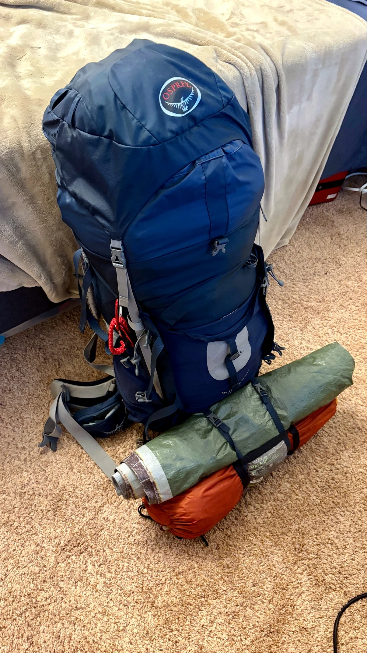
A separate living roof is the standard rig for a rainy camp, and the tarp in the photograph above is ours. A tarp strung as a separate living room and kitchen keeps a dry space outside a small backpacking tent. Pitch the tarp first and keep dry gear bagged until it is under cover.
Unload and dry the tent the same day at home, pitched or hung, rather than leaving it closed and wet.
Rainforest backpacking
I have backpacked in the Hoh Rainforest. In September 2014 I backpacked the Hoh River Trail up to the Blue Glacier, at the trail's end above Glacier Meadows. I camped at several of the first come, first served campsites along the trail. Some of the upper campsites required permits I did not have, so I stayed at the ones that did not require extra permits and day hiked up to the glacier at the end.
I slept in a hammock on that trip, which kept me off the forest floor and let me stay somewhat apart from the main camping areas. A huge rainstorm caught me on the way back.
I have backpacked along the coast and up the Hoh, and I want to explore the park's interior next. I would love to traverse the park from Quinault, by way of Enchanted Valley, to Staircase.
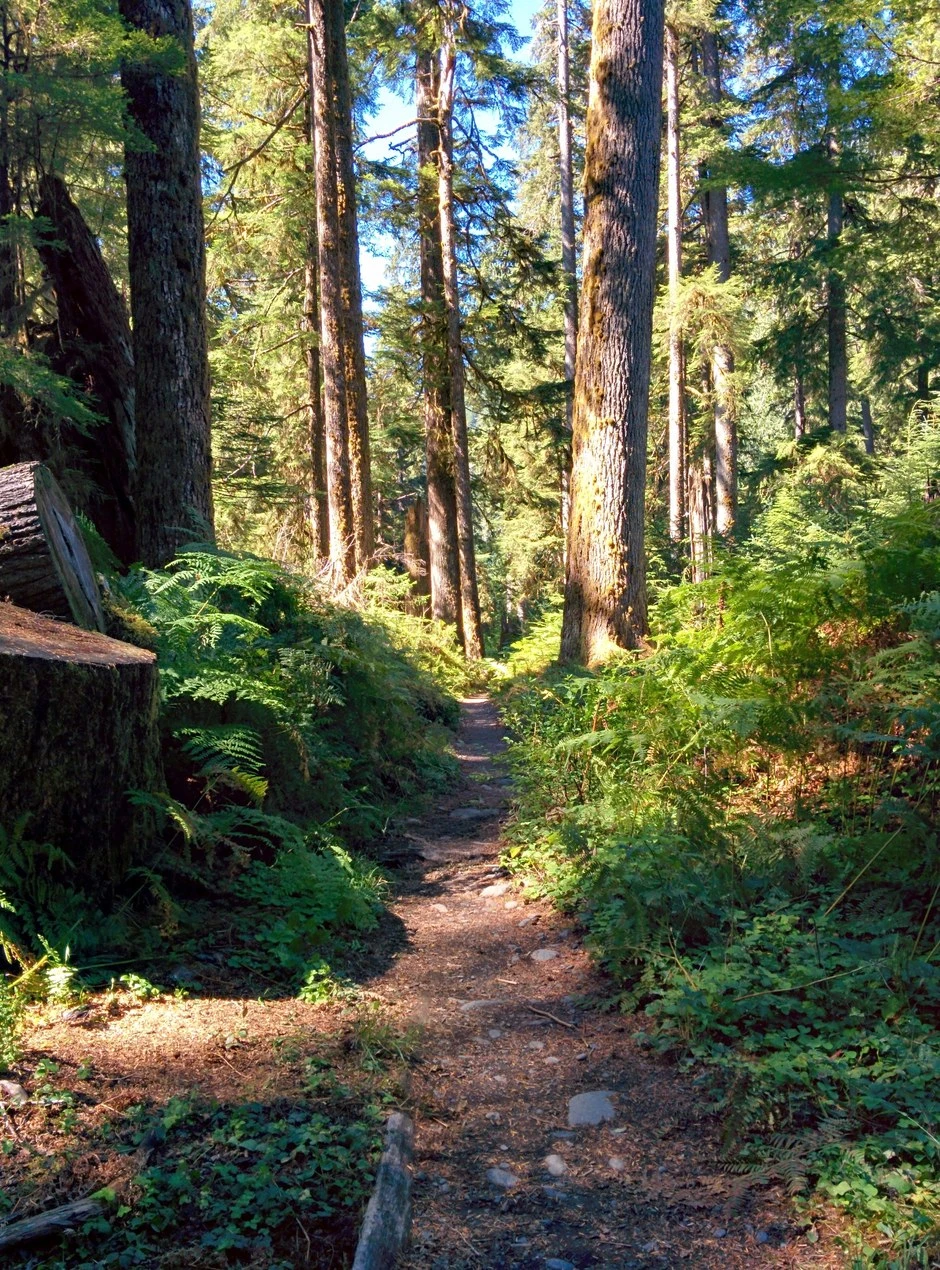
Getting in has its own gate. Trip reports describe the Hoh entrance station metering cars in season, one car in as one car out, with waits running to about an hour even on a weekday morning. The reported strategy is an early arrival, and the permit prints in advance, so the queue is the only line.
The trail runs 17.4 miles from the trailhead to Glacier Meadows. The park describes it as generally flat for the first 13 miles and steep after that, climbing from about 600 feet to 4,300 feet, with the best season late June through September. The camps sit in preexisting sites along the corridor, and a permit names the camp area for each night, so the corridor is planned rather than wandered. The table lays the camps out in walking order.
Site counts and toilets are the park's figures, from its Hoh River Trail page. Mileages are approximate, drawn from the trail organizations that maintain this corridor.
| Camp | Miles in | Sites | Pit toilet |
|---|---|---|---|
| Tom Creek | About 3 miles | 3 individual sites and 1 group site | No |
| Five Mile Island | About 5 miles | 3 individual sites, 2 group sites, and 1 stock site | Yes |
| Happy Four | About 5.8 miles | 2 individual sites, with the shelter beside them | No |
| Olympus Guard Station | About 9.3 miles | 7 individual sites and 2 group sites | Yes |
| Lewis Meadow | About 10.3 miles | 2 individual sites, 1 group site, and 1 stock site | Yes |
| Elk Lake | About 14.8 miles | 7 individual sites and 1 group site, the sites about half a mile below the lake, plus 1 stock site | Yes |
| Glacier Meadows | 17.4 miles | 11 individual sites and 1 group site | Yes |
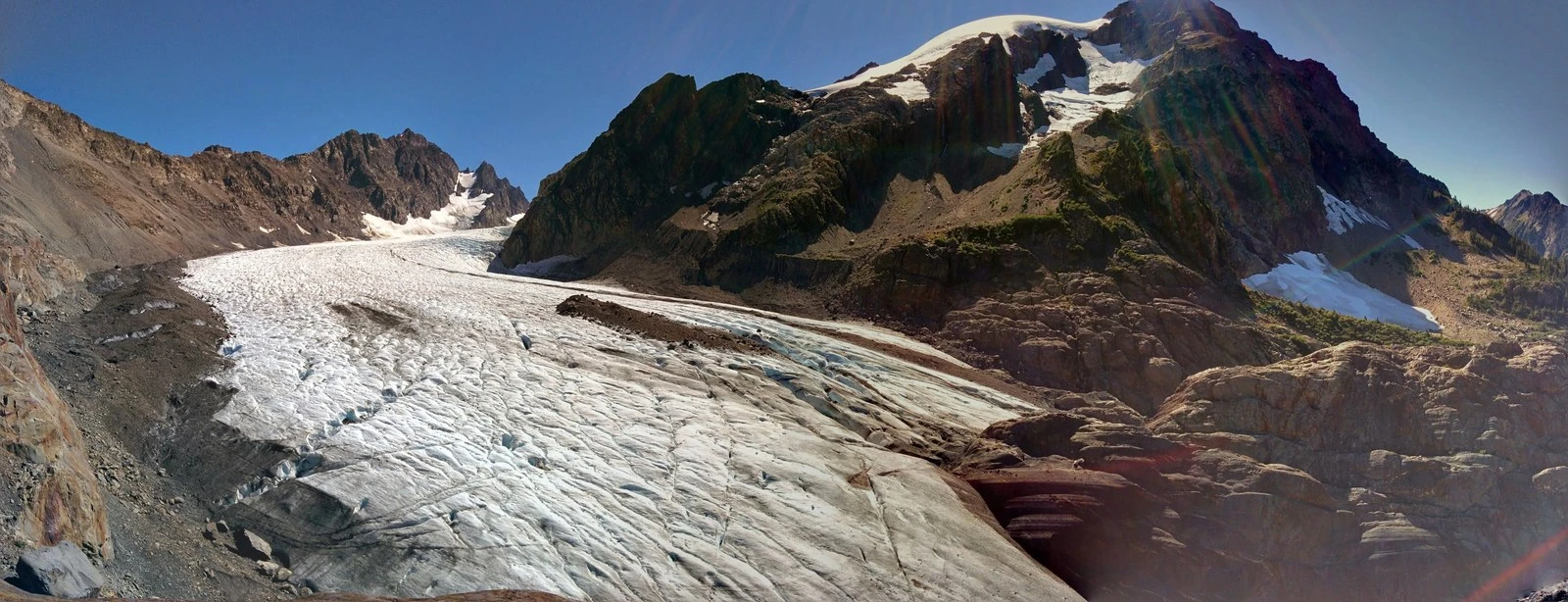
One obstacle stands between Elk Lake and Glacier Meadows, and the trail references are blunt about it. About half a mile before Glacier Meadows, a washout has taken the trail out, and the crossing descends about 100 feet on a ladder and rope rig. The technique, from WTA's hike page, is to pull the rope tight, face the hillside, and back down to the ladder, keeping three limbs in contact and one person on the ladder at a time. Trip reports put peak season waits at the ladder as high as about 90 minutes, and WTA's own advice is to consider camping before the washout rather than crossing it with a large pack.
Glacier Meadows camp sits about 10 to 15 minutes past it. The crossing is a standing feature, and its state is a trail conditions question, so check the park's current conditions before counting on it.
WTA's hike page also lists four small sites the park's camp list does not name, at miles 12.6, 13.1, 13.2, and 13.3, holding one or two tents each, with no toilets and no guaranteed water. A ranger check in confirms whether one is already spoken for.
Camp only in the preexisting sites, or on the gravel bars on the river, which the park calls good low impact campsites. Bear canisters are required in the corridor, as in all park wilderness. Campfires end at Martin Creek, with no fires above it. The first river access comes less than a mile from the trailhead, and the named landmarks on the way up are Mineral Creek Falls and the Cedar Grove. The Happy Four shelter, beside its two sites at about 5.8 miles, stands beside them, and in a rainforest a roof to cook under matters more than it sounds.
The first rainforest overnight. Walk the flat five miles to Five Mile Island, camp there, and use the second day to wander on to the Happy Four shelter and back before walking out. One or two nights, no climbing to speak of, and a real taste of the valley.
The basecamp glacier trip. Walk the flat valley to a low camp at Olympus Guard Station or Lewis Meadow, then day hike with a light pack up the steep last miles to the Blue Glacier viewpoint and back to the same camp, and walk out the next day. A WTA reporter who runs this same shape puts the Lewis Meadow to the moraine and back day at about 14 miles with 5,700 feet of elevation gain, and warns that slower parties came back after dark without headlamps. Three or four days. This is the shape my 2014 trip took, camping low along the trail and day hiking up to the glacier at the end, and it suits this corridor better than hauling a full pack up the climb.
The full push to Glacier Meadows. Break the climb with a night at Elk Lake, camp at Glacier Meadows, and take the viewpoint above the meadows before walking out over two days. WTA puts the first glimpse of the glacier at 17.5 miles and the best viewpoint, the Lateral Moraine, about another mile beyond Glacier Meadows, reached by following the ranger station sign and then a broken wooden sign that marks the lateral moraine where it meets the terminal moraine. Four days is comfortable. Everything hard about this trail is packed into its last five miles, so the shapes above exist to keep a heavy pack off most of it.
The trailhead can be crowded, and the main sites near it see the most traffic. The backcountry becomes less crowded beyond the first miles, and my backpacking was in the backcountry.
Sites stay wet in the rainforest. On one February trip, a camper reported moisture seeping through a footprint and tent floor. In the Hoh, avoid pitching your tent in the lowest available spot, and expect moisture.
Enchanted Valley
Quick facts. 13 miles each way from the Graves Creek trailhead; camps at Pony Bridge, O'Neil Creek, Pyrites Creek, and in the valley; the quota caps the valley at 208 users or 30 permits a night in season; canisters are required, and food hanging is prohibited at the valley.
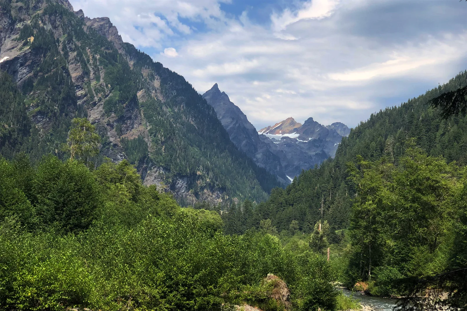
The East Fork Quinault River Trail runs 13 miles from the Graves Creek trailhead into Enchanted Valley, the park's great interior meadow, called the valley of 10,000 waterfalls for the falls that pour off its walls in wet weather, with Mount Anderson standing above it. This is the valley I name in my hopes for the park's interior at the head of this section, the Quinault side start of the traverse I want to walk to Staircase. I have not hiked it yet, so this entry is research, built from the park's trail page and WTA.
The trail follows an old road grade out of the trailhead, climbs about 500 feet to a low saddle, and drops steeply to Pony Bridge, the descent trip reports call the day's biggest single change. After that it rolls along the river the whole way, climbing and dropping in small pieces. The park gives the elevation change as 1,700 feet net. WTA's listing counts the rolling ground at 3,700 feet of gain, and its trip reports warn that the net figure understates the day. The park rates the trail moderate, with the best season May through September.
Water is the river and its tributaries the whole way, treated like every source in this guide. A washout closure on the South Shore Road has routed access via the North Shore Road in current route references, so check the park's road conditions before driving in.
| Camp | Miles in | Sites | Pit toilet |
|---|---|---|---|
| Pony Bridge | 2.5 | 3 small sites on the north side of the bridge | Yes |
| O'Neil Creek | About 6.9 | 6 sites in brush along the river, down a short side trail | Yes |
| Pyrites Creek | About 9.9 | 12 sites in total, 6 on each side of the creek | No |
| Enchanted Valley | About 13.1 | Established sites spread through the valley meadow | Yes, two privies |
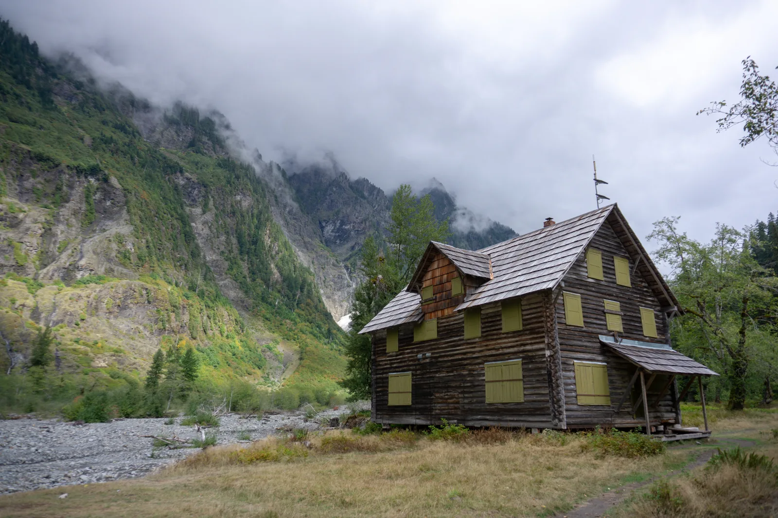
The building at the valley's heart is the Enchanted Valley Chalet, raised in the early 1930s as a lodge for hikers and horse parties, its brick, window frames, and lumber packed in 13 miles by horse. It served as an Aircraft Warning Station in the Second World War, stands on the National Register of Historic Places, and was moved back from the eroding riverbank in 2014. It is closed to entry today, and the camps spread through the meadow past it.
The valley is an active bear area. Canisters are required, and the park prohibits hanging food there. Fires go in the pre-existing rings, and the park prohibits campfires above 3,500 feet, which binds only the trail's upper reaches.
The standard valley trip. Break the walk at O'Neil Creek on the first night, camp in the valley on the second, and walk out on the third day, or take a second valley night and make it four days. This is the split the trip accounts settle on, and it keeps every day under seven miles.
The straight push. Walk the 13 miles to the valley in one long day, spend a night or two there, and walk out. The park calls this trail a popular two to three day out and back, and the push is the hard version of it.
The Anderson Pass day. From a valley camp, the trail continues about 5.2 miles to Anderson Pass at 4,465 feet, a 2,500 foot climb, with Anderson Lake another mile and a quarter and 1,000 feet above the pass. The White Creek ford on that stretch can be hazardous in heavy rain or snowmelt, and the trail above 3,500 feet is snow covered from November to June and crosses avalanche terrain. It is a fair weather summer day, and it is also the onward route, the way a through hike leaves the valley toward the Dosewallips side of the park.
Beginning in 2024, the park manages the East Fork Quinault River Trail and Enchanted Valley as a quota area on a trial basis for up to three years, capped at 208 users or 30 permits per night, whichever is reached first. The valley's permits release with the rest of the park's on April 15 for the May 15 to October 15 season, and the popular dates go at the release. Graves Creek Campground, covered in the Olympic Peninsula camping guide, sits at the trailhead as the base for the night before. It takes no reservations at any time of year, so the night before cannot be booked ahead.
The trailhead for the Hoh River Trail sits beside the Hoh Rain Forest Campground. The campground runs on its own drive in system, separate from the wilderness permits on the trail. Campers report no dependable cell service on any carrier at the campground, so arrange any pickup or check in before the walk in. It is covered in the Olympic Peninsula camping guide.
Backpacking the alpine interior
The coast runs on tides and the rainforest valleys on distance. The park's third country runs on snow. Above the valleys the trails climb to lake basins and ridge lines that hold snow into July in most years, and the park protects the fragile ground with quotas. The quota areas named in the park's wilderness trip planner include the Sol Duc and Seven Lakes Basin area, Royal Basin, and Grand Valley, on top of the coast and valley quotas this guide has already covered. I have not backpacked the park's alpine interior, so this whole section is research, built from WTA and the park's material, and it is here because the guide should name the whole of the park's backpacking, not only the parts I have walked.
Seven Lakes Basin and the High Divide
Quick facts. The loop runs 18.2 miles on the park figures and 19 miles on WTA's; designated camps at Deer Lake, Lunch Lake, Round Lake, Heart Lake, and Sol Duc Park; permits are limited year round; no fires above 3,500 feet; the season runs late July to early October in most years.
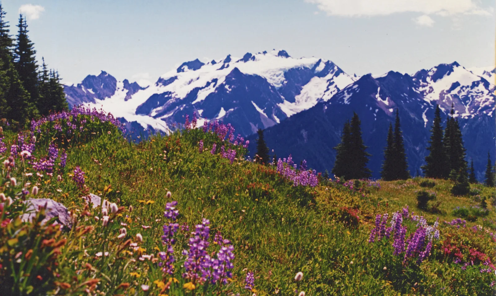
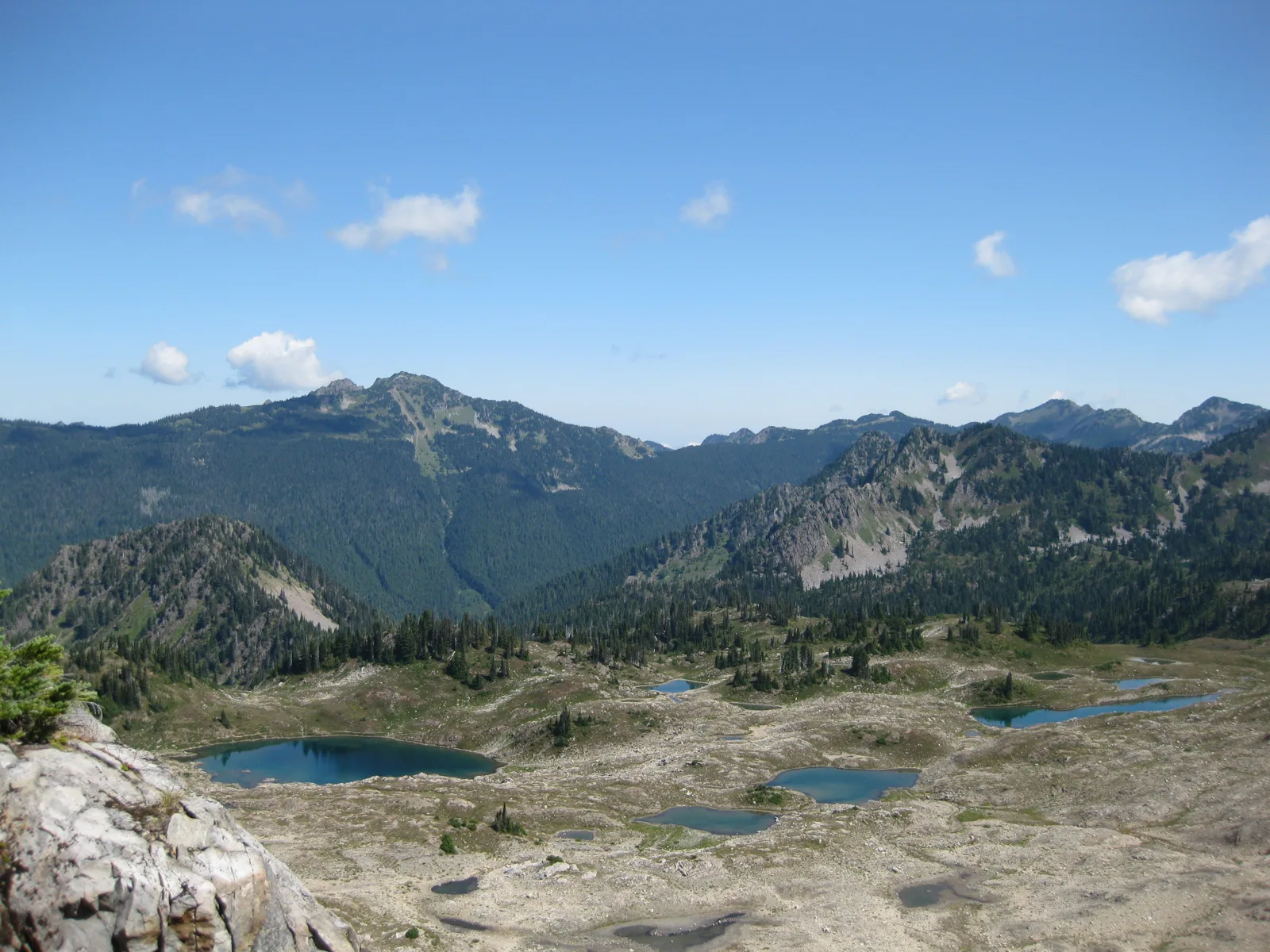
The High Divide loop is the park's classic alpine backpack, an 18 to 19 mile circuit from the Sol Duc trailhead at the end of the Sol Duc Road. The park gives the loop as 18.2 miles with 3,050 feet of gain and rates it moderate. WTA gives 19 miles and 4,000 feet and rates it hard, and the truth a pack feels is closer to WTA's, because the ridge walking rolls. The route climbs 0.8 miles to Sol Duc Falls, turns up the Deer Lake Trail to Deer Lake at about 3.7 miles, then climbs another 3.3 miles to the Seven Lakes Basin junction. From the junction a side trail drops 0.8 miles to Lunch Lake in the basin, and the main line runs the High Divide ridge itself, with a side trip up Bogachiel Peak, before descending past Heart Lake and walking out along the Sol Duc River.
Mount Olympus fills the view south from the ridge. Hoh Lake sits on the divide's far side, booked in the Hoh permit zone rather than the Sol Duc zone.
| Camp | Where it sits | Notes |
|---|---|---|
| Deer Lake | The first lake camp, about 3.7 miles in by way of the falls | The climb’s foothold camp. Vault toilet |
| Lunch Lake | In the basin, 0.8 miles down a side trail at the junction about 7.2 miles in | The basin’s prized camp. Vault toilet |
| Round Lake | In the basin, near Lunch Lake | The basin’s second camp, on the same side of the divide |
| Heart Lake | On the return leg, in meadows below the divide | Vault toilet. Water and camps grow scarce between here and Deer Lake |
| Sol Duc Park | On the Sol Duc River return, below the high country | The low last night out. Vault toilet |
The rules up here are the strictest in the park. Camping is allowed only in designated sites, permits are limited year round and booked through Recreation.gov, and groups of seven to twelve must use the designated group sites. Bear canisters are required throughout the area, and campfires are prohibited above 3,500 feet, which takes in nearly every camp on the loop. The season is short. Snow decides the start of it, and in most years the loop is a late July to early October trip.
The two night loop. Climb to a basin camp at Lunch Lake or Round Lake on the first night, cross the divide to Heart Lake on the second, and walk out along the river on the third day. This is the shape most parties walk, and it puts the ridge day in the middle with a lighter pack.
The three night loop. Add a night at Deer Lake on the way in or at Sol Duc Park on the way out, and take the Bogachiel Peak side trip on the ridge day. The extra night is also the weather hedge, because the divide in cloud gives back very little of what the climb cost.
Royal Basin
Quick facts. Royal Lake stands at about 7.2 miles and roughly 2,650 feet; designated sites in a quota area, on Recreation.gov permits; Royal Creek Camp at about 4.3 miles is the last camp where fires are allowed; canisters are required; the season runs about July to mid October.
The park's northeast alpine door is Royal Basin, reached from the Upper Dungeness trailhead, the same trailhead the national forest section below names for Marmot Pass, where parking takes a Northwest Forest Pass or an interagency pass. The Royal Creek Trail climbs about 7.2 miles and roughly 2,650 feet to Royal Lake, a blue green lake ringed by steep peaks, with the upper basin another 0.8 miles beyond on rougher trail. Camps step up the creek on the way: Royal Creek Camp at about 4.3 miles, the last camp where fires are allowed, then the Lower Royal Basin sites at about 6.35 miles, then the lake. Royal Basin is a quota area with designated sites, permits through Recreation.gov, and canisters required. Its season runs from about July to mid October, and its accounts promise more solitude than the valley trips, at the price of a long forest road drive to the trailhead.
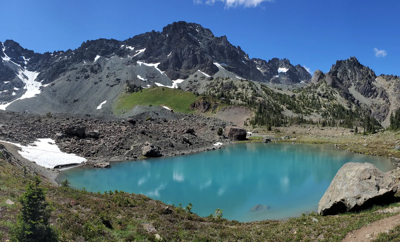
Grand Valley, in the park's northeast off the Obstruction Point Road, is the third quota alpine area, and the park's trip planner map is the place to see how the quota ground fits together. Between the High Divide, Royal Basin, and the Enchanted Valley traverse country, the interior is a full second backpacking park above the one this guide knows firsthand, and it opens latest in the year.
Backpacking in Olympic National Forest
The national forest wraps the park on the east and south, and its wilderness backpacking runs on lighter rules, with no permit quotas, a free self issued wilderness permit at the trailhead where one is asked for, and a Northwest Forest Pass for parking. Its named wilderness areas ring the park, the Buckhorn Wilderness on the northeast, The Brothers Wilderness above the Hood Canal rivers, and the Colonel Bob Wilderness above Lake Quinault in the south.
The trips below work around the park's east side, from the Buckhorn Wilderness high country in the northeast down the Hood Canal drainages to the Hamma Hamma and the Skokomish in the southeast. One of them I have walked myself, and it says so where it stands.
Marmot Pass and the Upper Big Quilcene
Quick facts. 11.5 miles round trip and 3,489 feet of gain; Shelter Rock Camp at 2.5 miles; Camp Mystery at about 4.5 miles is the last water; there is no water at the pass; a Northwest Forest Pass covers parking.
The Upper Big Quilcene Trail is the direct line to the Buckhorn high country, 11.5 miles round trip and 3,489 feet of gain to Marmot Pass, which WTA's Tubal Cain page puts at 5,900 feet. Shelter Rock Camp stands at 2.5 miles, and Camp Mystery, at about 4.5 miles, is the last water before the pass, roughly 0.7 miles below the pass, and the camp can crowd on summer weekends. There is no water at the pass itself. Buckhorn Mountain's summit is a further mile and 900 feet from the pass.
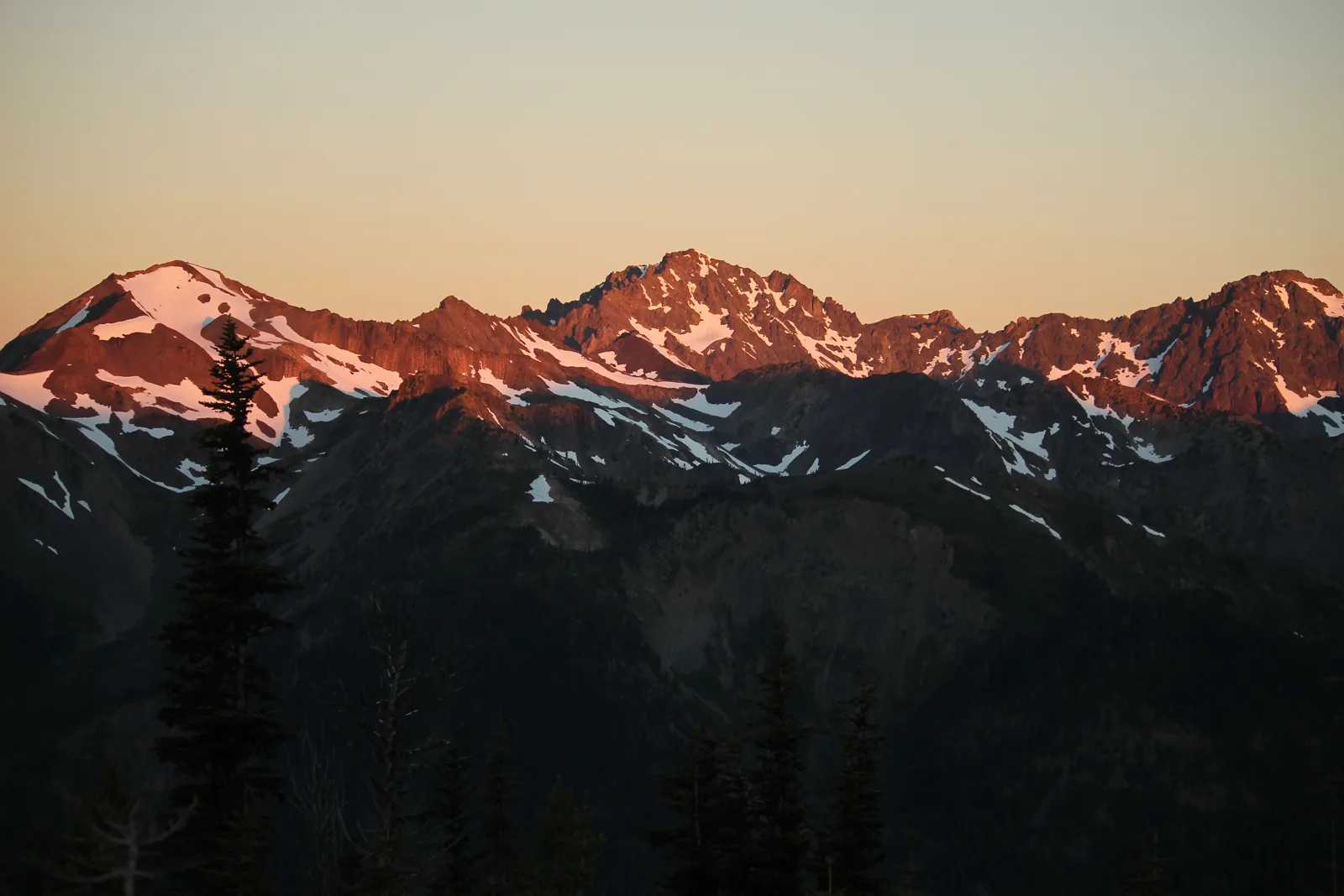
Trip reports describe a steady, well graded climb whose steepest stretch is only about three quarters of a mile, and goats and marmots are routine sightings in the meadows below the pass. The pass is a four way junction, with the Tubal Cain Trail to one side, the Dungeness line straight ahead, and a scramble ridge where campers pitch for the view. The gravel of Forest Road 2750 to the trailhead runs to deep potholes in patches, a standing warning in the reports.
Tubal Cain, the mine, and Buckhorn Lake
Quick facts. 12.0 miles round trip and 2,000 feet of gain to Buckhorn Lake; the mine shows at 3.0 miles; the B-17 spur climbs 450 feet in 0.6 miles; the lake sits at 6.1 miles and 5,100 feet; never drink the water pouring from the main shaft.
The Tubal Cain Trail reaches the same pass the gentle way, 12.0 miles round trip and 2,000 feet of gain to Buckhorn Lake, through rhododendron tunnels that are a draw in late spring. At 3.0 miles a mine shaft shows on the hillside, and just past it the Tull Canyon Trail climbs 450 feet in 0.6 miles to the wreck of a B-17 that crashed there in 1952. Its engines and wing fragments spread over a boggy plateau where parties camp. WTA's page gives the working rule for that ground: filter above the debris, and leave what you see where it lies.
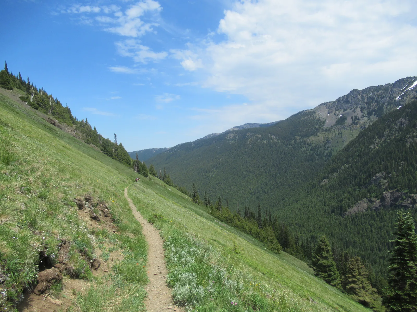
The main mine site follows, camps among the tailings, and a stream that pours straight out of the main shaft, which WTA's page warns may carry unsavory concentrations and no one should drink. The Buckhorn Lake side trail is signed at 5.7 miles, and the small lake sits at 6.1 miles and 5,100 feet, with camps at its shore. From the lake junction the trail climbs over Buckhorn Pass and along the ridge to Marmot Pass, about 8.6 miles one way from this trailhead, and neither pass holds water.
The Upper Dungeness
Quick facts. Camp Handy stands at about 3.3 miles, with its shelter; Boulder Shelter at about 6.5 miles holds two or three good campsites; Home Lake, 3.8 miles beyond, sits inside the park on a park permit; the Royal Basin junction leaves this same trailhead.
The Upper Dungeness trailhead is the busiest door in this country, because the Royal Basin junction leaves it less than a mile up the same trail the alpine section above describes. The river trail itself crosses the Dungeness at 2.6 miles and reaches Camp Handy at about 3.3 miles, a large meadow on the river with a shelter, which trip reports repeatedly call perfect for families and first backpacks. The old growth along the way runs to Douglas-firs more than 200 feet tall.
About 6.5 miles up stands Boulder Shelter, a substantial wooden shelter in a small meadow with only two or three good campsites before tents go onto the grass. Home Lake lies 3.8 miles beyond it, and that leg crosses into the park, so a night at Home Lake takes a park wilderness permit, with Constance Pass as the day trip above the lake.
The Duckabush River
Quick facts. 10.6 miles round trip and 2,300 feet of gain; Fivemile Camp at about 5 miles, right on the river; there are no toilets past the trailhead; the park boundary at about 6.7 miles puts camping beyond it on a park permit.
The Duckabush River Trail runs 10.6 miles round trip and 2,300 feet of gain to Fivemile Camp at about 5 miles, a big camp among enormous cedars right on the river. The climb over Big Hump crosses a large section of the 2011 Duckabush Fire, where standing dead trees fall routinely and WTA crews log out hundreds of trees a year. Trip reports name a Two Mile Camp on the river as the short version of the trip.
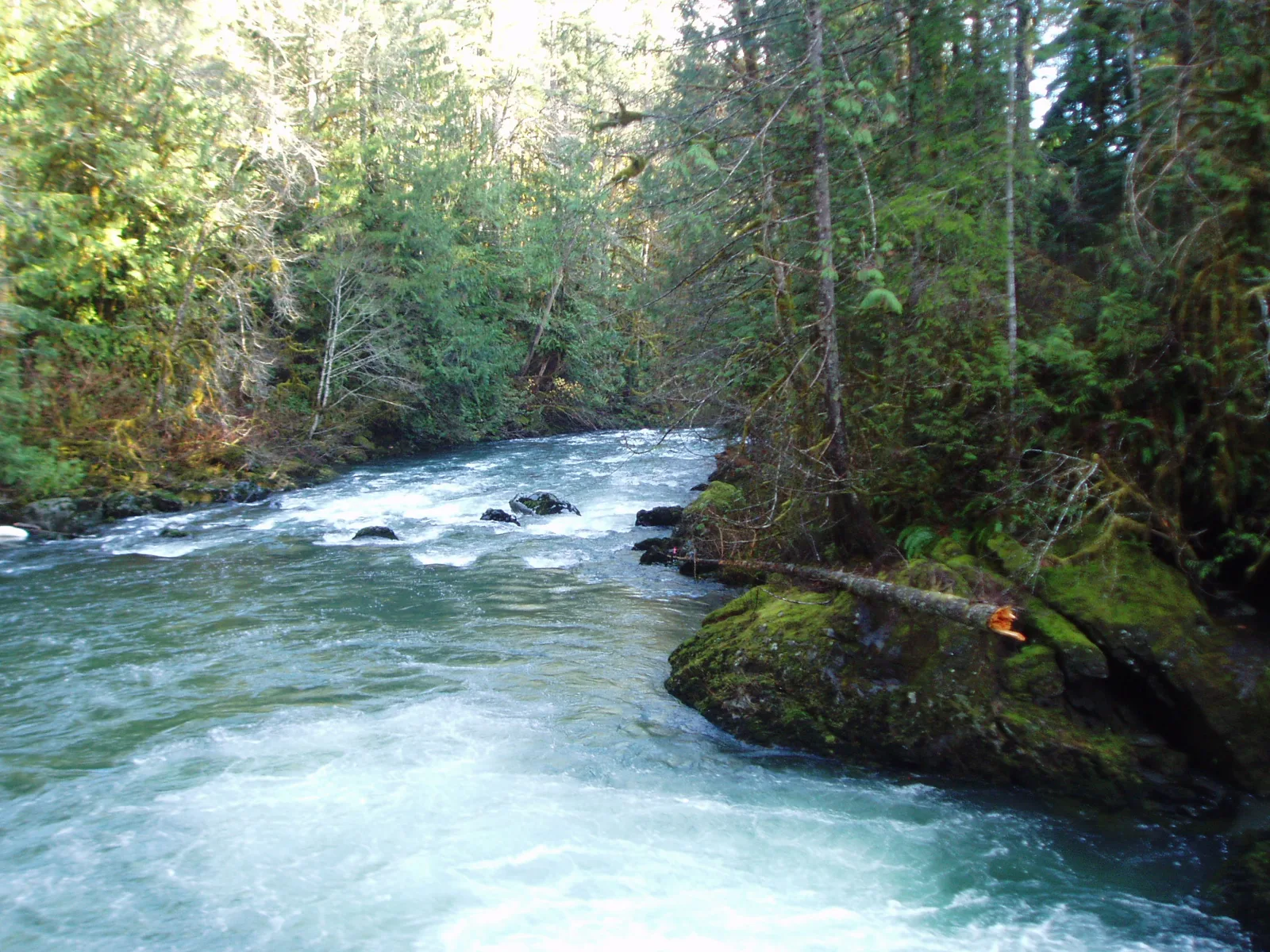
There are no toilets along the trail past the trailhead's, and the camps take their water from the river. At about 6.7 miles the trail crosses into the park, and camping beyond that line runs on the park's permit, toward Ten Mile Camp and the LaCrosse Basin lakes far above.
The Lower Big Quilcene
Quick facts. Bark Shanty Camp at 2.7 miles; Camp Jolly at 5.1 miles, moved east of its creek so no ford is needed; the full trail runs about 6.5 miles one way, 13 miles round trip; water runs all along the trail.
The Lower Big Quilcene is the valley floor counterpart to the Marmot Pass climb, and trip reports call it one of the best first backpacking trips in the forest, an easy grade with water all along it. Bark Shanty Camp stands at 2.7 miles, a large, level camping area in a grove of big trees, and just past it a bridge crosses the river at the Notch Pass Trail junction, which opens a loop back over the pass. Camp Jolly stands at 5.1 miles, moved to the east side of its creek so no ford is needed to reach it.
The full trail runs about 6.5 miles one way and ends at the Upper Big Quilcene trailhead, 13 miles round trip walked end to end and back, so the two trailheads also make a point to point shuttle between the valley and the pass.
Lower South Fork Skokomish
Quick facts. 8.5 miles round trip and 800 feet of gain; the old Camp Comfort ground at about 4 miles was washed away in 2007; most parties turn around at a bridge and waterfall about a quarter mile short of it; herds of Roosevelt elk frequent the area.
The Lower South Fork Skokomish runs 8.5 miles round trip and 800 feet of gain through old growth high above the river, and WTA's page points out the herds of Roosevelt elk that frequent the area. Its old destination, Camp Comfort at almost exactly 4 miles, was washed away in 2007. A 2024 backpacking report found the Comfort Camp sign still standing, with informal sites and fire rings by the river, and most parties now turn around at a bridge and waterfall about a quarter mile short of the old site.
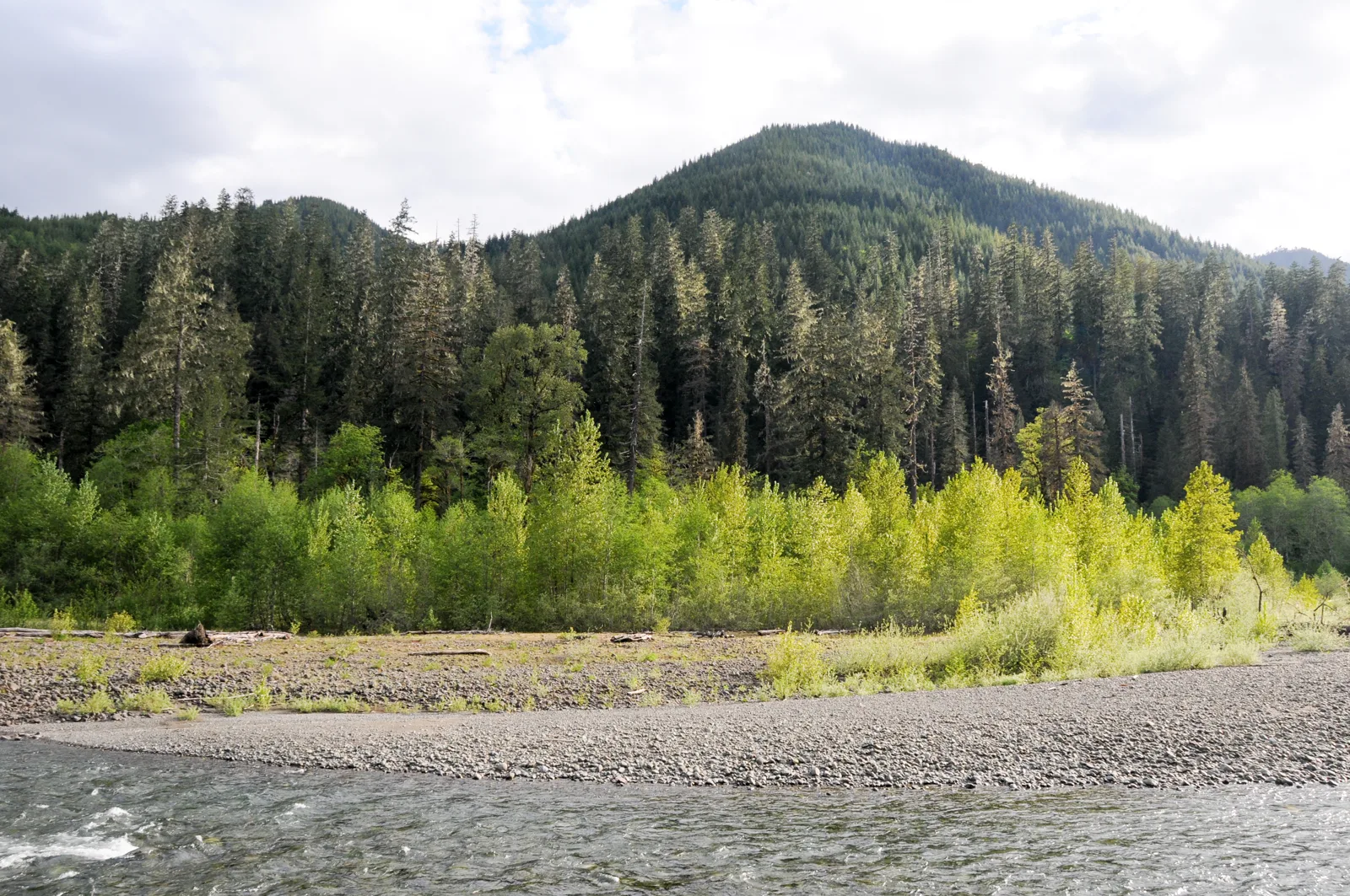
The trail itself continues 10.3 miles one way to the Upper South Fork trailhead and gets rugged past the 9 mile mark, and it is shared with mountain bikes and horses.
Lena Lake and Upper Lena Lake
Quick facts. The lower lake runs 7.2 miles round trip and 1,300 feet of gain, first come, with a composting toilet at the far side campground; the upper lake runs 14.0 miles round trip and 3,900 feet, with eight designated sites on a park permit; dogs come on leash at the lower lake and not past the park boundary.
Lower Lena Lake, up the Hamma Hamma, is the most popular first backpacking lake in the forest, 7.2 miles round trip and 1,300 feet of gain, and WTA jokes that the traffic on the trail is itself evidence of the lake's beauty. The main campground sits on the far side, about half a mile past the lake's near end, with a composting toilet, first come. Dogs come here on leash, which they cannot do past the park boundary.
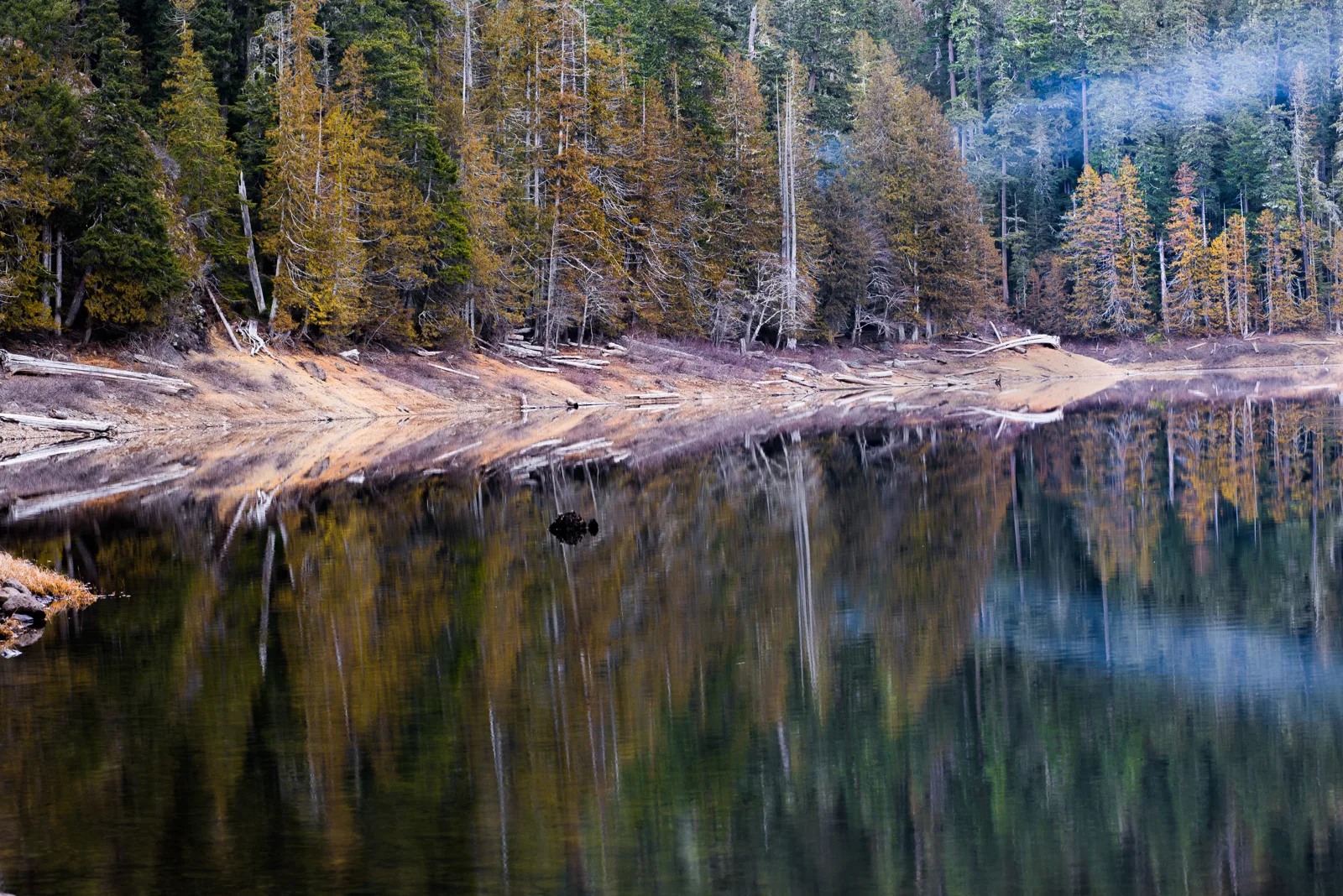
Upper Lena Lake is another trip entirely, 14.0 miles round trip and 3,900 feet of gain, inside the park, with eight designated campsites on a park wilderness permit that is limited year round. The last two miles are the steepest of the route, with a stretch where hikers pull themselves up on tree roots, and reports place a privy and a bear wire among the numbered sites. Milk Lake and Scout Lake stand as side trips from the upper lake.
Mildred Lakes
Quick facts. 9.0 miles round trip on WTA figures, with the real gain well above the listed 2,300 feet; a way trail, with route finding past Huckleberry Creek at about 2 miles; informal camps at the lower and upper lakes; campfires are prohibited at the lakes; this is the one trip in this section I have walked, as a day hike.
Mildred Lakes is the one trip in this section I have walked. I day hiked it once, up the Hamma Hamma to the end of the road, and I have wanted to go back with a pack ever since. What I remember is one massive, super steep climb, lakes that looked like great fishing water, and how beautiful they were when I got there. I also remember a great many bugs.
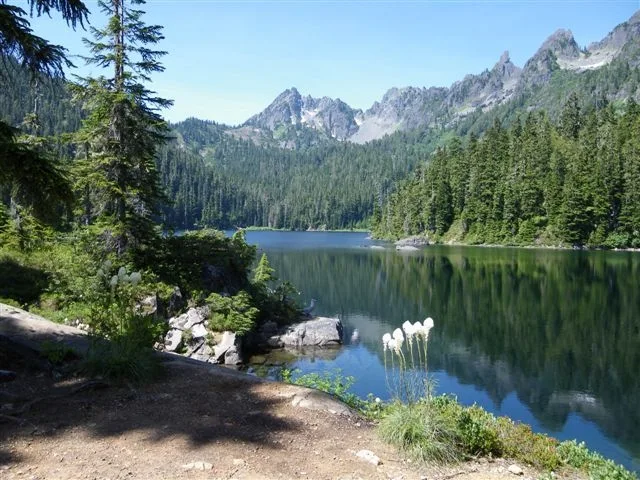
The trail record backs the memory at every point. WTA lists the hike at 9.0 miles round trip and 2,300 feet, and says in the same breath that the gain is deceptive, since the trail climbs steeply, plunges, and climbs again, and the guidebook description counts the real gain above 3,200 feet. The trail is a way trail built by hikers and fishermen, never officially constructed, root strewn and hard to follow past Huckleberry Creek at about 2 miles, where the wall I remember rises toward a 4,100 foot ridge before the drop through marshy ground to the first lake. Anglers are a fixture in the trip reports, and trout rise at the lakes.
Three lakes step up the basin, the upper the largest, with informal camps at the lower and upper lakes and no developed ground anywhere. Campfires are prohibited at the lakes. The trailhead stays quiet by the standards of its own road, a few cars where the Lena Lake trailhead down the road draws about twenty, per one report. My overnight there is still ahead of me, and everything about camping at the lakes in this entry is research, not my trip.
The Buckhorn loop
Quick facts. 20 to 21 miles in all, closing with a 3.5 mile road walk or a two car shuttle; camps at Shelter Rock, Camp Mystery, and Boulder Shelter along the way; there is no water at either pass; the Pacific Northwest Trail runs through the loop.
The trips above join into the forest's classic loop, and it is worth giving its real shape, because it is the trip this section keeps circling. From the Tubal Cain trailhead the line runs past the mine, over Buckhorn Pass, along the ridge to Marmot Pass, down to Boulder Shelter, and out the Upper Dungeness, closing with a 3.5 mile road walk or a two car shuttle. Trip reports put the whole circuit at 20 to 21 miles, and the Pacific Northwest Trail runs through it, which is why through hikers turn up in those reports on exactly this line.
The extensions stack from there. Home Lake adds about 8 miles and a park permit night. The B-17 spur and Buckhorn Lake add their short miles on the way past, and a Royal Basin overnight from the same trailhead the loop closes at adds roughly 13 to 14 miles, which is how a party builds a trip in this country toward 40 miles over four or five days. A loop over Buckhorn Pass is a trip I would like to do.
The park's interior valleys stay park ground under park rules. Enchanted Valley, up the East Fork Quinault from the Graves Creek trailhead, is a park quota area, not forest ground.
Seasons for backpacking
I camp in Washington from May through September, I do not winter camp, and I avoid rain where possible and camp in it when it comes. I camped in rain at Second Beach in August 2026. The park's summer permit season runs May 15 to October 15, and the coast material in this guide puts the north coast's best season at April through October. Snow decides the high country, and the quota areas at elevation run on narrower seasons set by snow conditions.
Fees and passes
All visitors to the park must have an entrance pass. A standard pass costs $30 for a private, non commercial vehicle, covers the vehicle and all its occupants, and is valid for seven consecutive days. Passes cost $15 to $30 depending on how you enter; the per-person pass applies to visitors 16 and older arriving on foot or by bicycle, and children under 16 enter free. The park does not accept cash.
Each overnight permit carries a non refundable $6 reservation fee, including for Annual Wilderness Pass holders. Adults 16 and older pay a recreation fee of $8 per person per night; youth 15 and under are free. The Annual Olympic National Park Wilderness Pass costs $45 per person and covers the per night camping fees for 12 months from the month of purchase for the individual pass holder only, and does not cover the $6 reservation fee. Pass holders still need permits and reservations.
Second Beach adds one more permit. Its trailhead is on Quileute Tribal land, and parking there takes a tribal parking permit, payable by app at the lot or at the Lonesome Creek Store in La Push, separate from the wilderness permit.
The Northwest Forest Pass covers Forest Service trailheads and day use sites and costs $30 annually or $5 a day. It covers national forest land around the park, but it is not a park pass and does not cover park entrance or the Quinault campgrounds' overnight fees.
Frequently asked questions
When do wilderness permits for summer release and where do they come from?
Reservations for the summer season, May 15 through October 15, open on April 15 at 7 a.m. Pacific Time, and Recreation.gov creates all permits. You can also get a permit by calling or visiting a Wilderness Information Center. There are no paper permits at trailheads, and the park holds no sites for same-day walk-ups.
Is a bear canister really required on the coast and where does one come from?
Yes. The park requires bear canisters in all wilderness areas. On the wilderness coast, store all food, garbage, and scented items in approved canisters. Wilderness Information Centers may lend canisters during business hours, free to permit holders on a first-come, first-served basis. The centers have a large supply that occasionally runs out over exceptionally busy weekends, and they do not reserve canisters in advance.
Which wilderness beach suits a first trip with small children?
I consider Second Beach and Third Beach best for families with young children, and the park lists the Second Beach trail as 0.7 miles. Other campers add that Second Beach's trailhead end crowds into a tent city on summer weekends, with a single privy, and that the far south end of the same beach stays quiet. Hike past the cluster, carry water in, and camp at the quiet end.
How do the tides decide where a beach camp goes?
Before setting out, use a tide chart to choose a campsite above the high tide water line and behind drift logs where they stand. The park directs campers to carry a tide chart and a topographic map showing the tidal heights at which headlands become hazardous, because the same tides that set the camp also govern the hike in and out. Campers report that tents have been soaked overnight when they judged the line by eye.
Can dogs come on the beach trails?
No; this answer is based on research. The park prohibits pets on trails, meadows, beaches, and in any undeveloped area, including park beaches and coastal trails on this coast. Pets are welcome in drive in campgrounds and on paved or dirt roads, on a leash no longer than six feet. Pets are allowed on Kalaloch area beaches and at Rialto Beach only as far as Ellen Creek. My dog does not come on our backpacking trips.
What is the best interior backpacking trip in Olympic National Park?
It depends on the trip you want. The Hoh River Trail is the rainforest walk, with camps strung along a mostly gentle river valley toward Blue Glacier. Enchanted Valley is the big interior valley trip, 13 miles each way to a meadow and the old chalet, and it sits in a quota area. Seven Lakes Basin and the High Divide make the alpine loop, with designated camps and permits limited year round. Royal Basin is the single basin trip, one valley, one lake, and the upper basin above it.
Do I need a permit to backpack in Olympic National Forest?
Not the park kind. National forest backpacking here runs without the park's wilderness permit quotas, and any trailhead permit is free and self issued where one is asked for. Parking is the pass part, a Northwest Forest Pass or an America the Beautiful Pass at the trailheads that require one. The line matters where a route crosses into the park, because Upper Lena Lake, Home Lake, and the Duckabush beyond the park boundary all run on park wilderness permits. Dogs can come on forest trails on leash, which they cannot do on park trails.
How long is the Buckhorn loop?
The loop hikers actually walk is 20 to 21 miles. From the Tubal Cain trailhead it runs past the mine, over Buckhorn Pass, along the ridge to Marmot Pass, down to Boulder Shelter, and out the Upper Dungeness, with a 3.5 mile road walk or a two car shuttle to close it. A trip gets near 40 miles only by stacking on side country, a Home Lake night inside the park, a Royal Basin overnight, or both.
Is Mildred Lakes a good first backpacking trip?
No. I day hiked it once, and it is the forest trip in this guide I have walked. The route is a way trail rather than a built trail, root strewn, steep, and easy to lose past Huckleberry Creek, with marshy ground and plenty of bugs at the lakes. For a first forest overnight, Lower Lena Lake is simpler and the Lower Big Quilcene is gentler, with water all along it.
Sources
National Park Service, Olympic National Park wilderness reservations page, for permit requirements, the April 15 release, issuance timing, and quota areas. Wilderness reservations page
National Park Service, Olympic National Park wilderness food storage page, for the canister scope and the Wilderness Information Center loan. Wilderness food storage page
National Park Service, Olympic National Park Wilderness Information Centers page, for center seasons, hours, and services. Wilderness Information Centers page
National Park Service, Olympic National Park wilderness coast page, for coast rules on fires, tides, pets, and water treatment. Wilderness coast page
National Park Service, Olympic National Park South Coast Route page, for the route distance, the segment distances, the tide restriction heights, the creek fords, and Jackson Creek as the water source south of Toleak Point. South Coast Route page
National Park Service, Olympic National Park Hoh River Trail page, for the trail distance, the elevation trend and range, the camp site counts, the pit toilet locations, the gravel bar camping, and the Martin Creek fire boundary. Hoh River Trail page
National Park Service, Olympic National Park fees page, for the entrance pass forms and the annual pass. Fees page
National Park Service, Olympic National Park pets page and wildlife safety page, for the pet rules and the frontcountry food storage rule. Pets page Wildlife safety page
National Park Service, Olympic National Park alerts and conditions page and current road conditions page, for the Mora Road closure and reopening, road forms, the Hoh entrance warning, and corridor cautions. Alerts and conditions page Current road conditions page
National Park Service, Olympic National Park pages for Shi Shi Beach, the Hoh River Trail, the East Fork Quinault River Trail, the Second Beach trailhead, and wilderness sanitation, for those places' facts in their agency forms. Shi Shi Beach page Hoh River Trail page Second Beach trailhead page, and the Ozette Loop page Wilderness sanitation page
Recreation.gov, Olympic National Park wilderness permit page, for the permit fee structure, the Annual Wilderness Pass, designated camps, and group sizes. Wilderness permit page
Washington Trails Association, North Coast Route and Cape Alava Loop pages, and its Buckhorn Wilderness and Hamma Hamma hike pages for Marmot Pass, Tubal Cain, the Dungeness, the Duckabush, the Big Quilcene, the South Fork Skokomish, Lena Lake, and Mildred Lakes, and its Shi Shi Beach, Enchanted Valley, and High Divide and Seven Lakes Basin hike entries, for the north coast route shape, the Ozette loop legs, and the Shi Shi distances. US Forest Service, Olympic National Forest 2026 seasonal campground schedule release, for the Willaby and Falls Creek seasons and the forest's first come rule. Seasonal campground schedule
Makah Tribe, official site, for the Makah Recreation Pass requirement and its current price and validity. Makah Tribe
Community record for this guide, camper reports and review accounts as labeled in the text, principally Washington Trails Association trip reports for the wilderness coast and the Hoh corridor, The Dyrt and Campendium campground pages for the frontcountry roster, and family media accounts of Olympic camping, paraphrased and attributed by venue in the text and never presented as agency fact.