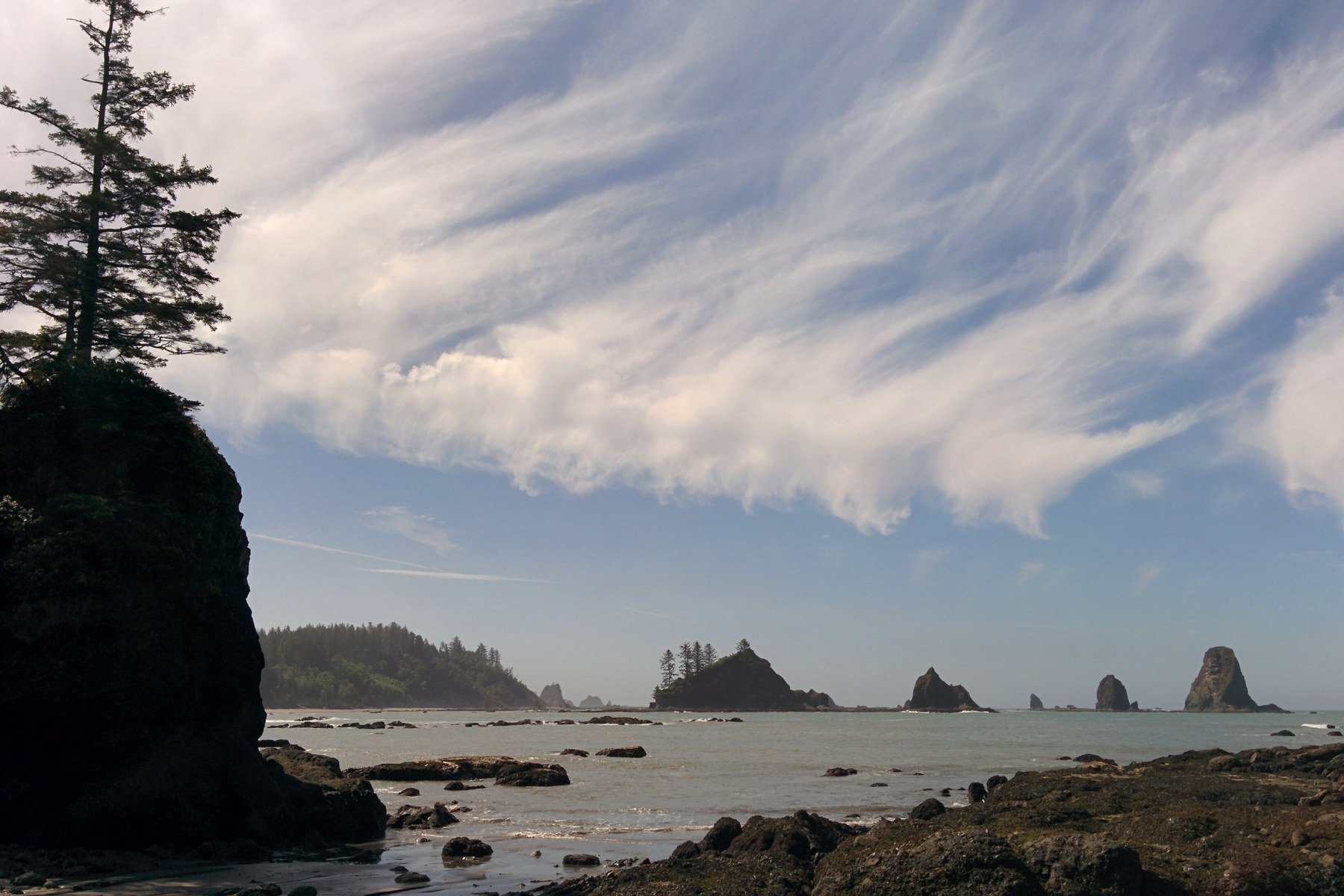
Olympic National Park holds its drive in campgrounds in three kinds of country. Two rainforest valleys hold campgrounds beside rivers, the coast holds three more within sound of the surf, and a mountain interior and its lakes hold the rest. Those campgrounds take reservations through Recreation.gov or fill first come at their registration boards, and their sites release in staggered waves by loop, laid out below campground by campground.
My basis for writing this guide is research. I have not stayed in any of the park's drive in campgrounds. I have camped at Bogachiel State Park on the peninsula's west side in 2017, and I have driven this park's roads for years. I researched the campgrounds using the park's own pages and other campers' reports. Backpacking on the wilderness coast and in the rainforest, the camping I have actually done in this park, has its own guide, Olympic Peninsula backpacking.
Readers planning a wider Washington trip will also want Washington campgrounds by region. Packing for any trip here starts from the camping checklist.
In this guide
At a glance
Two systems run this park, with drive in campgrounds running on campground reservations and first come sites. A campground reservation is not a wilderness permit, and a wilderness permit reserves no campground site.
The reservable campgrounds release their sites in staggered waves of six months, two weeks, or four days ahead. The stagger varies by loop inside each campground, so the same campground holds three different release dates at once. The first come campgrounds take no reservations at any time of year.
Wilderness backpacking runs on a separate permit system entirely, covered in the Olympic Peninsula backpacking guide.
| Trip type | Place | The catch | Read more |
|---|---|---|---|
| On the ocean bluff | Kalaloch Campground | Reservations required May 15 to September 20, and its loops release in three waves | Kalaloch Campground |
| The La Push beaches base | Mora Campground | Busy in September, and its reservable loops release in three waves | Mora Campground |
| The rainforest night | Hoh Rain Forest Campground | Steady demand even on rainy weekends | Hoh Rain Forest Campground |
| The Lake Crescent shore | Fairholme Campground | Its reservable loops release in three staggered waves | Fairholme Campground |
| The Hood Canal side | Staircase Campground | Old growth on the North Fork Skokomish River, and the park's east side door | Staircase Campground |
Current campground status
Checked November 6, 2026. Seasons and closures change, and this board rides the guide’s seasonal recheck cycle rather than standing as a permanent fixture.
| Ground | Status at this check |
|---|---|
| Staircase trails beyond the Rapids Loop | Closed in the Bear Gulch Fire recovery. The Rapids Loop is the one trail open at Staircase. |
| Willaby Campground | Closed for the season. Its 2026 season ended on October 30. |
| Falls Creek Campground | Closed for the season. Its 2026 season ended on September 18. |
| Dosewallips State Park | Winterized from November 15 to March 31, with water kept on at one block of sites and at the dump station. |
| Deer Park Campground | Closed for the winter. Its season runs June to mid October, on road conditions and snow melt. |
| Mora Road to Rialto Beach | Reopened on October 15, 2026, after a summer construction closure, a reminder that Mora and Rialto Beach depend on this one road. |
Choosing where to camp in Olympic National Park
The coast zone is the park's west edge. Its drive-in campgrounds are Kalaloch, Mora, and South Beach. A coast trip takes planning around a tide chart in a way no other zone in this park requires.
The rainforest and river zone holds the Hoh, Queets, Graves Creek, and North Fork campgrounds. The west side rainforests get several times the rain of the park's northeast corner; that figure is approximate. That rain is geography, not a warning. It is simply what this side of the park is like, and what you pack for.
The lake and mountain zone holds Fairholme on Lake Crescent, Staircase on the Hood Canal side, Heart O' the Hills above Port Angeles, Ozette at its lake, and Deer Park at 5,400 feet. These campgrounds share almost nothing except the park boundary, so choose a specific campground, not a landscape type.
A frontcountry campground means a car at the site, water where the campground provides it, and a registration process at the entrance.
Frontcountry bases on the coast, Kalaloch and Mora above all, put a wilderness beach within a day walk. A family can sleep at a drive in site, walk a beach with a tide chart, and return to the car at night. Campers in the record use Mora exactly that way for Second Beach, sleeping at the campground and day tripping the beach.
This guide covers the park's drive in campgrounds in its three zones, plus the peninsula places just outside the park that a park trip actually uses. The drive to beach towns and coastal state parks south of the park, Westport, Grayland, Long Beach, and Cape Disappointment among them, belongs to the Washington coast guide.
For a first wilderness trip with small children, start on the La Push beaches from a Mora base, and walk Second Beach before you sleep on it. If you sleep at the car, pick the zone first, Kalaloch for the coast and the Hoh for the rainforest, and let the loop stagger set your booking date.
Mora Campground and Rialto Beach hang on a single road. A permanent repair of riverbank erosion closed that road beyond Mora Campground from July 8 to October 15, 2026. Rialto Beach was unreachable by it while the campground stayed open. The road is open now. Check the park's alerts page when planning a coast trip in any season.
For help picking a site, see how to choose a campsite. Seasons and facility facts come from the agencies' own pages, and the agencies' pages govern where the two differ.
The campgrounds compared
The shortlist above picks five. This table counts everything this guide treats, the park campgrounds first and then the camping ground outside the park, so the systems can be compared in one place. Figures and fees are the operators’ published figures, checked in November 2026. Where an operator does not publish a count in those sources, the row describes the sites instead of inventing one.
| Campground | Sites | Season | How it is booked | Nightly fee | Water and toilets | RVs and trailers |
|---|---|---|---|---|---|---|
| Kalaloch Campground | 170 sites, most for rigs of 21 feet and a few for 35 feet | Open year round | Reservable through Recreation.gov in staggered loop releases, first come outside the reservation season | $24 a night | Potable water, flush toilets, and a dump station | No hookups; dump station, $10 per use |
| Mora Campground | 94 sites | Open year round | Reservable through Recreation.gov in staggered loop releases, first come outside the reservation season | $24 a night | Potable water, flush toilets, and a dump station | No hookups; dump station, $10 per use, summer only |
| South Beach Campground | 55 sites | Mid May to mid October | First come, first served | $20 a night | Flush toilets. No potable water | No hookups; no dump station published |
| Hoh Rain Forest Campground | 78 sites | Open year round | Reservable through Recreation.gov in staggered loop releases, first come outside the reservation season | $24 a night | Potable water and flush toilets | No hookups; no usable dump station |
| Queets Campground | 20 sites | Open year round | First come, first served | $15 a night | Pit toilets. No running water | No hookups; RVs and trailers not recommended |
| Graves Creek Campground | 30 sites | Open year round | First come, first served | $20 a night | Pit toilets. No running water. | RVs and trailers barred on the access road |
| North Fork Campground | 9 sites | Open year round | First come, first served | $20 a night | Pit toilets. No running water | No hookups; RVs and trailers not recommended |
| Fairholme Campground | 88 sites | Late April to late September | Reservable through Recreation.gov in staggered loop releases | $24 a night | Potable water, flush toilets, and a dump station | No hookups; dump station, $10 per use |
| Log Cabin Resort | 38 sites, with full hookup RV sites for rigs up to 35 feet and tent pads | May to October | Booked by phone through the resort, a park concession | $25 to $44 a night | Resort facilities on Lake Crescent | Full hookup sites |
| Sol Duc Hot Springs Resort | 82 campground sites and 17 RV sites with water and electric hookups | Reservations required from late March to the start of November | Through Recreation.gov, up to six months ahead, a park concession | $33 a night, RV park $58 | Flush toilets and running water in the campground | Campground dry; the separate RV park is water and electric, back in only |
| Staircase Campground | 49 sites | Open year round, with water and flush toilets in summer only | Reservable through Recreation.gov in staggered loop releases, first come outside the reservation season | $24 a night | Potable water and flush toilets in season | No hookups |
| Heart O’ the Hills Campground | 97 sites | Open year round | First come, first served | $24 a night | Potable water and flush toilets | No hookups; no dump station |
| Ozette Campground | 15 sites, and some flood in winter | Open year round | First come, first served | $20 a night | Potable water and pit toilets | No hookups; sites to 21 feet only |
| Deer Park Campground | 14 sites, tents only | June to mid October, on road conditions and snow melt | First come, first served | $15 a night | Pit toilets. No potable water | Tents only, no RVs or trailers |
| Bogachiel State Park | Standard and partial hookup sites, hiker and biker sites, and one tent only group camp, for rigs of 40 feet or less | Open year round, with winter camping listed | The state reservation system, up to nine months ahead | Per the State Parks fee schedule | Restrooms, showers, and a trailer dump | 6 partial hookup sites; trailer dump $5 per use |
| Dosewallips State Park | Standard and utility sites and cabins, for rigs of 40 feet or less | Open year round, winterized from mid November to the end of March, when only a block of sites keeps water | The state reservation system, up to nine months ahead | Per the State Parks fee schedule | Restrooms, showers, drinking water, and a trailer dump | 63 utility sites, 38 of them full hookup; trailer dump $5 per use |
| Willaby Campground | 21 sites, 19 drive in and 2 walk in tent sites | Late April to the end of October | Reservations through Recreation.gov, an exception to the forest’s first come rule | $25 a night | Restrooms; water taps at individual sites, per camper reports | No hookups; RVs capped at 16 feet |
| Falls Creek Campground | 31 sites, for rigs up to 16 feet, no hookups | Mid May to mid September | Reservations through Recreation.gov, an exception to the forest’s first come rule | $25 a night | Potable water and flush toilets | No hookups; RVs capped at 16 feet |
| Salt Creek Recreation Area | 92 sites, the first 39 with utility hookups | Open all year | About half the sites reservable online on the county calendar, booking opens January 1 for February 1 to October 31. Every site is first come from November 1 to January 31 | Standard $37 a night for county residents and $48 for non-residents; utility $43 and $56, on the county's published fee schedule | County park facilities on the bluff | Utility sites carry electric and seasonal water, no sewer; dump $10, free for registered campers |
| Dungeness Recreation Area | 66 sites with no utility hookups, plus eight hiker and biker sites | Open all year | Sites 1 to 24 are first come and sites 25 to 66 are reservable, on the same county calendar as Salt Creek | $32 a night for county residents and $43 for non-residents, on the county's published fee schedule | County park facilities on the bluff | No hookups; dump $10, free for registered campers |
| The move | Miles | Time | What the park measures between |
|---|---|---|---|
| Port Angeles to Lake Crescent | 21 | 30 minutes | Port Angeles Visitor Center and the Storm King Ranger Station |
| Port Angeles to Hurricane Ridge | 17 | 45 minutes | Port Angeles Visitor Center and the Hurricane Ridge Ranger Station |
| Lake Crescent to the Sol Duc | 16 | 1 hour | The Storm King Ranger Station and the Eagle Ranger Station at Sol Duc |
| Lake Crescent to Forks | 35 | Miles only in the park’s chart | Lake Crescent Lodge and Forks, from the mileage chart |
| Forks to La Push and Mora | 13 | Miles only in the park’s chart | Forks and the Mora Ranger Station, from the mileage chart |
| Forks to the Hoh | 31 | Miles only in the park’s chart | Forks and the Hoh Rain Forest Visitor Center, from the mileage chart |
| Mora to the Hoh | 47 | 1 hour 30 minutes | The Mora Ranger Station and the Hoh Rain Forest Visitor Center |
| Mora to Kalaloch | 48 | 1 hour 15 minutes | The Mora Ranger Station and the Kalaloch Ranger Station |
| The Hoh to Kalaloch | 40 | 1 hour | The Hoh Rain Forest Visitor Center and the Kalaloch Ranger Station |
| Kalaloch to Lake Quinault | 33 | 45 minutes | The Kalaloch Ranger Station and the Quinault Rain Forest Ranger Station |
| Port Angeles to Ozette | 76 | 2 hours | Port Angeles Visitor Center and the Ozette Ranger Station |
| Lake Quinault to Staircase | 126 | 2 hours 45 minutes | The Quinault Rain Forest Ranger Station and the Staircase Ranger Station |
| Staircase to Port Angeles | 100 | 2 hours 30 minutes | The Staircase Ranger Station and the Port Angeles Visitor Center |
Read as a trip, the bases run Port Angeles and Lake Crescent first, then Forks and La Push, then either the Hoh spur or the direct coast run to Kalaloch, then Lake Quinault, then the long leg to Staircase and back to Port Angeles. The Mora and Hoh legs are spurs off the Forks junction, so the legs through them should not be summed into a loop total, since the park’s own through figure from Port Angeles to Quinault by the west side is 128 miles and 2 hours 30 minutes. Ozette is a dead end spur off SR 112 on the north coast, reached from either end of the loop, and in the park’s table its closest measured base is Mora, at 65 miles and 2 hours, against 76 miles and 2 hours from Port Angeles.
Most readers of this guide start in Seattle, so the marquee bases carry a Seattle figure as well. These are planning times gathered from published peninsula guides, chiefly Hiking Washington’s Olympic camping guide and the Port Angeles visitor pages, read in November 2026. They count wheel time and a normal ferry crossing on the routes that use one, not ferry waits or summer traffic, which is why two honest sources can differ by half an hour on the same base, and why both figures are printed where they differ. The north side bases are usually reached by ferry, and the Hood Canal and south side bases by driving around through Tacoma and Olympia.
| The base | From Seattle |
|---|---|
| Staircase | About 2 hours 20 minutes |
| Lake Quinault, for Willaby and Falls Creek | About 2 hours 30 minutes to 3 hours, by the south route home through Aberdeen |
| Heart O’ the Hills | About 2 hours 35 minutes |
| Lake Crescent, for Fairholme and Log Cabin Resort | About 2 hours 45 minutes |
| Sol Duc | About 3 hours 15 minutes |
| Graves Creek, the Enchanted Valley trailhead | About 3 hours 30 minutes |
| Kalaloch | About 3 hours 30 minutes to 4 hours |
| Mora and La Push | About 4 hours, by the Bainbridge ferry route |
| The Hoh | About 4 to 5 hours |
| Ozette | About 4 hours 10 minutes |
Trips by number of nights
The legs above assemble into a small set of trip shapes. Each shape names its bases and its moves, and the links in the last column jump to the base entries further down this page.
| The trip | Nights | How it runs | Start with |
|---|---|---|---|
| A Seattle weekend, one base | 2 nights | Stay pitched at one close base. Staircase is about 2 hours 20 minutes from Seattle and Heart O’ the Hills about 2 hours 35, and the weekend is spent on the trails at the campground, the Staircase Rapids Loop at Staircase and the Lake Angeles Trail at Heart O’ the Hills. | Staircase |
| The north side from one base | 3 nights | Base at Fairholme on Lake Crescent, about 2 hours 45 minutes from Seattle. Sol Duc is a day trip up its own valley at 16 miles by the park’s ranger station measure, and Port Angeles is 21 miles and about 30 minutes east, with Heart O’ the Hills and the Hurricane Ridge road above it. | Fairholme |
| The west side, two bases | 4 nights | Mora first for the La Push beaches, then the one move of the trip, 47 miles and about an hour and a half south to the Hoh campground for the rainforest. If the trip is beaches over rainforest, Kalaloch takes the second base instead, at 48 miles and about an hour and a quarter from Mora. | Mora |
| The full loop | 6 to 7 nights | In from Seattle by the south route to Lake Quinault at about 2 hours 30 minutes to 3 hours, then up the coast, Kalaloch at 33 miles and about 45 minutes and Mora at 48 miles and about an hour and a quarter, closing at Lake Crescent and home at about 2 hours 45 minutes. The leg that shapes the loop is Quinault to Staircase, 126 miles and about 2 hours 45 minutes of east side driving, so the loop closes through Port Angeles and the ferry side rather than up the Hood Canal shore. | Lake Quinault |
RVs and trailers
Every campground the park itself runs is dry camping, with no hookups at any of the twelve, and at most of them the sites fit 21 feet, with a few sites to 35 feet. Dump stations stand at only three of them, Kalaloch, Mora, and Fairholme, at $10 per use, and the Hoh and Heart O’ the Hills state in their own listings that they have none. RVs and trailers are barred at Graves Creek and Deer Park and not recommended at Queets and North Fork.
No park run campground takes a rig over 35 feet, and the one longer option inside the park is the concession run Sol Duc RV Park at 36 feet. Longer rigs base outside the park, at Dosewallips and Bogachiel, where combinations run to 40 feet and Dosewallips carries sites with sewer hookups. Recreation.gov warns for Kalaloch, Mora, the Hoh, and Fairholme that the campground roads are narrow, with low tree branches and tight turns, steep at Fairholme, that maneuvering a large RV or trailer into a campsite may be difficult, and that no accommodation is made for a rig that cannot fit the site it reserved.
Where you dump follows the side of the park you are on. On the west side, Kalaloch and Mora carry stations at $10 per use, and Bogachiel, the state park below Forks, charges $5, waived for campers who paid for camping. On the Lake Crescent side, Fairholme charges $10, and the concession campground at Sol Duc charges $10, stated by its operator. On the strait side, Salt Creek and Dungeness charge $10, free to campers registered there, and on the Hood Canal side Staircase lists no station, and Dosewallips charges $5 on the same waived terms as Bogachiel.
The hookups in this guide live outside the park’s own campgrounds. Log Cabin Resort holds the only full hookup sites, Sol Duc’s separate RV park is water and electric only, and the two state parks and Salt Creek carry the rest of the utility sites, each set out in its entry below and in the comparison table above. Generator rules follow the operator, the park publishes none beyond quiet hours of 10 p.m. to 6 a.m., the state parks allow generators from 8 a.m. to 9 p.m., and the county areas set generator quiet hours from 9 p.m. to 8 a.m.
Private RV parks around the gateway towns are the other full-service option, outside this guide’s campground roster. West of Port Angeles, Elwha RV Park lists full-hookup sites, including big-rig pull-through sites that measure 70 feet long. Sequim carries Gilgal Oasis, whose paved sites have city water and sewer plus 30 or 50 amp service, and Rainbow’s End, a privately owned full-service RV park. In Forks, Forks 101 RV Park lists 33 full-hookup RV sites with 20, 30, and 50 amp service. They are worth knowing about when hookups and town services matter more than sleeping on public ground.
Reservations and permits
Drive in campgrounds and wilderness camps in this park are booked in two separate systems that never substitute for each other. The campgrounds run on Recreation.gov reservations and first come arrivals, and every night in the wilderness behind them runs on a wilderness permit, so a booked campsite does not cover a beach night and a permit does not hold a campground site.
In the summer peak season, campers can reserve sites at Kalaloch, the Hoh, Mora, Fairholme, and Staircase through Recreation.gov, with all of their sites reservable in that season. The campgrounds sell any unreserved or cancelled sites in person, first come, first served; outside the peak season, they also operate first come, first served.
Each campground releases sites in staggered blocks by loop, six months, two weeks, or four days in advance. No campground in the set has a single flat window. If you miss the six month release, you have not missed the campground, because the two week and four day loops have not released yet.
Loops A and B release six months in advance, loops C and D release two weeks in advance, and loops E and F release four days in advance. Kalaloch requires reservations from May 15 to September 20, 2026. The campground is open year round and operates first come, first served outside the reservation period, with self-registration at the campground.
Loop A releases six months in advance, loop C releases two weeks in advance, and loop B releases four days in advance. The reservation season for 2026 runs June 12 to September 6, with reservations required then, and outside it the campground is open year round on a first come, first served basis, with some campsites possibly closing during winter.
At Mora, loops A, B, and E release six months in advance, loop C releases two weeks in advance, and loop D releases four days in advance. At Fairholme, loop B and the majority of the walk-in sites release six months in advance. Loop C and most of the remaining walk-in sites release two weeks in advance, and loop A and walk-in site 85 release four days in advance. At Staircase, sites release in the same three staggered block releases by loop.
The primary pages do not specify which Staircase loops correspond to each release.
Mora is on the reservation system from May 15 to September 20, 2026, and Fairholme from May 15 to September 29, 2026. Staircase requires reservations from July 8 through September 29.
Campers experience the stagger as three chances rather than one window. The six-month loops are competitive. A national fast sellers roundup names Kalaloch among the campgrounds whose sites vanish in seconds at release. A Hoh reviewer tried to reserve from February and landed only September dates.
I have booked through Recreation.gov, which the park uses for both campground reservations and wilderness permits.
Campers can register in person for unreserved sites for one night only at the B Loop registration board at Fairholme, the Hoh, and Mora, first come, first served. Staircase offers the same fallback at its registration board, with no B Loop named. Kalaloch sells unreserved or cancelled sites in person but does not list a registration board.
Seven campgrounds take no reservations at any time of year, Deer Park, Graves Creek, Heart O' the Hills, North Fork, Ozette, Queets, and South Beach, each first come, first served with self registration. First come is a real second channel here.
Getting a first come site is mostly a matter of timing. At Heart O' the Hills, arriving Thursday or Friday morning gives a reasonable selection, and by Friday evening the campground can be nearly full. Deer Park fills early on good weather days, with no way to check ahead. At Ozette, one camper found five of fourteen sites occupied on a Memorial Day weekend.
Cancellations are the third channel. Two Hoh reviewers said they landed reservations through cancellations with little planning; those are individual accounts, not a success rate. One Kalaloch complaint describes reserved beach loop sites sitting empty on a single visit; it is one complaint about the no-show experience, not a no-show rate. No success rate for cancellation watching exists.
The per site limit is eight people, and the camping limit is fourteen consecutive days in the park per year, with Kalaloch, Mora, and the Hoh limited to seven days during the reservation window through peak season. The state parks run their own limit of ten days in a thirty-day stretch, and the county pair allows six people per site and fourteen consecutive nights. An extra vehicle costs $10 a night at the state parks, and the county pair registers an extra vehicle on arrival for a nightly fee. Alcohol follows the same split by system. It is permitted inside the park's campgrounds under the federal rule, though it is banned on Lake Crescent's beaches. At the state parks it is confined to a registered camper's own campsite, and the two county areas prohibit it altogether. Quiet hours run from 10 p.m. to 6 a.m., and checkout is at 11 a.m. Campers may sleep in vehicles only in authorized campgrounds.
Wilderness permits are a separate system with its own April 15 release, covered in the Olympic Peninsula backpacking guide.
Arrival runs on each system's own clock. In the park campgrounds, check-out is 11 a.m., and the federal campgrounds' own site records set check-in at 12:00 p.m., so the turnover sits at noon. Bogachiel and Dosewallips ride the state system, with check-in at 2:30 p.m. and check-out at 1:00 p.m. The county pair works by its gates instead, with Salt Creek's registered campers parking at the gate lot and walking in after hours, and Dungeness locking its gate at 10 p.m. from May to September and 9 p.m. from October to April, with registered campers walking in. Log Cabin books by phone through the resort, and its check-in is the latest in this guide at 4:00 p.m., with check-out at 11:00 a.m.
Groups book through their own channel at the park campgrounds. Kalaloch's group site takes phone reservations only, for 10 to 30 people, with a seven day maximum stay, at $40 a night for up to 10 people and $2 for each additional person. Sol Duc takes organized groups only, up to 24 people, with a seven day maximum stay, at $43 a night, and its group site stands on its own records beside the campground. Further group campsites at Kalaloch, Mora, and the Hoh open for online reservation in the peak season. Bogachiel's tent only group camp and Dungeness's reservable group campsite ride their own systems, as their entries describe.
The release calendar
The stagger described above, laid out as a calendar. A trip date decides which wave a site comes from, and the wave decides when to be at the screen.
| Release wave | What releases |
|---|---|
| 6 months ahead | Kalaloch loops A and B. Hoh loop A. Fairholme loop B and most of the walk-in sites. The Sol Duc Hot Springs Resort campground also books up to six months ahead |
| 2 weeks ahead | Kalaloch loops C and D. Hoh loop C. Fairholme loop C and the remaining walk-in sites |
| 4 days ahead | Kalaloch loops E and F. Hoh loop B. Fairholme loop A and walk-in site 85 |
| Across the same three waves | Mora and Staircase release their loops across the same three waves. No campground in this set has a single flat window |
The reservation seasons themselves run inside those waves. In the 2026 cycle, reservations were required at the Hoh from June 12 to September 6, at Fairholme from May 15 to September 29, and at Sol Duc from March 20 to November 1. Outside a campground’s reservation season, its sites run first come, first served. The season dates move a little each year and ride this guide’s seasonal recheck each January.
Campgrounds
I have not stayed in any of the park's twelve park run drive in campgrounds, or at the two concession run campgrounds treated briefly below. I have stayed at Bogachiel State Park, outside the park. Each park entry takes its key facts from the park's own pages and its character from campers' accounts.
The park run campgrounds have no electrical hookups. The two concession run campgrounds in the lake and mountain zone, Log Cabin Resort and Sol Duc, are the exceptions. Food storage in frontcountry campsites follows its own rule. Store food in your vehicle, in a park provided food locker, or in an animal resistant food container, at all times.
Coast zone
Kalaloch Campground
Quick facts. 170 sites, most for rigs to 21 feet and a few to 35 feet; reservable through Recreation.gov in staggered loop releases, first come outside the reservation season; open year round; potable water; flush toilets; a dump station. Nightly fee $24. Check-in 12:00 p.m., check-out 11:00 a.m. RVs and trailers camp dry here, with no hookups anywhere, and a dump station stands in the campground at $10 per use.
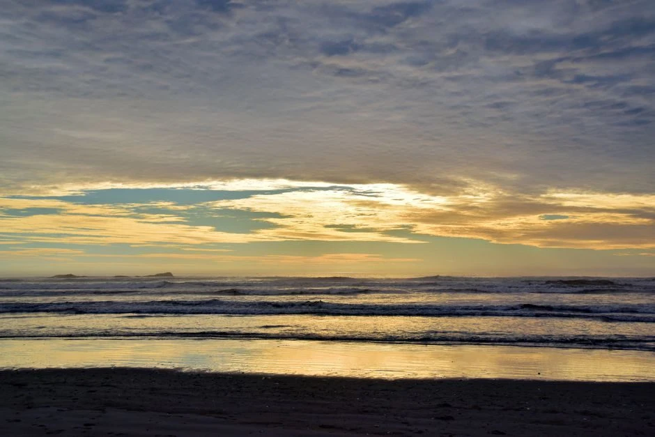
Kalaloch is the park's coast base camp, with 170 sites, open year round, though it may close temporarily during severe weather, with flush toilets, potable water, and a dump station. Sites take vehicles of 21 feet, with a few taking 35 feet. Its loop stagger runs A and B at six months, C and D at two weeks, and E and F at four days, with reservations required from May 15 to September 20, 2026.
Tent pad sizes vary by site, and the agency's own site pages show it. One A loop site carries an 8 by 8 foot tent pad, described as a small site for one tent with parking for one car only. An E loop site has a 14 by 8 foot pad, so check the individual site when choosing one for a tent.
Campers describe the sites as tight, and many are sloped enough that leveling blocks are standard advice. The campground splits between an open bluff row, with wind and views and little privacy, and forested loops with shade and high humidity, one Campendium camper measuring humidity above 75 percent inside and out in late June. Sites backing Highway 101 carry traffic noise that dies down at night, and Campendium accounts add animal proof food storage bins at the campground. Camper reports on the restrooms split, leaning clean across the wider record, with the worst reports concentrated in September stays at the end of the season. Campers disagree about cell service at Kalaloch, with reviews leaning poor on every carrier while the larger reporter samples rate Verizon and AT&T well.
In the forested loops, thick brush screens many sites from the road and from each other, even where the parking spurs sit close together. Camper reports prize the sites along the bluff and the ocean facing sites, the ones where the ocean is the view from camp.
It is the largest coast campground and the most contested when reservations open, with the central coast beaches a short drive away; a camper who wants it takes the sites as they come, tight or sloped.
As a base, Kalaloch serves its own day beaches. The Tree of Life is walked to from the campground loops, and Beach 4 is a few minutes’ drive north, with Ruby Beach beyond it. The wilderness coast route does not start here, since its southern trailhead is Third Beach above La Push, so Kalaloch is a day use base only.
Erosion is closing ground here. Bluff erosion has permanently closed a number of the ocean bluff campsites in loops A, D, and E, and the 2024 cabin removals came from the same erosion system. Water splits by loop, from restroom spigots for loops A, B, and C and the fill station across from site D016 for loops D, E, and F. The beach below is closed to razor clam harvest, and the Kalaloch Creek Nature Trail beside the campground bars pets, though the beaches allow them. Watch for sneaker waves on every coast walk here, and never turn your back on the surf.
Mora Campground
Quick facts. 94 sites; reservable through Recreation.gov in staggered loop releases, first come outside the reservation season; open year round; potable water; flush toilets; a dump station. Nightly fee $24. Check-in 12:00 p.m., check-out 11:00 a.m. RVs and trailers camp dry here, with no hookups, and a dump station stands in the campground at $10 per use in summer.
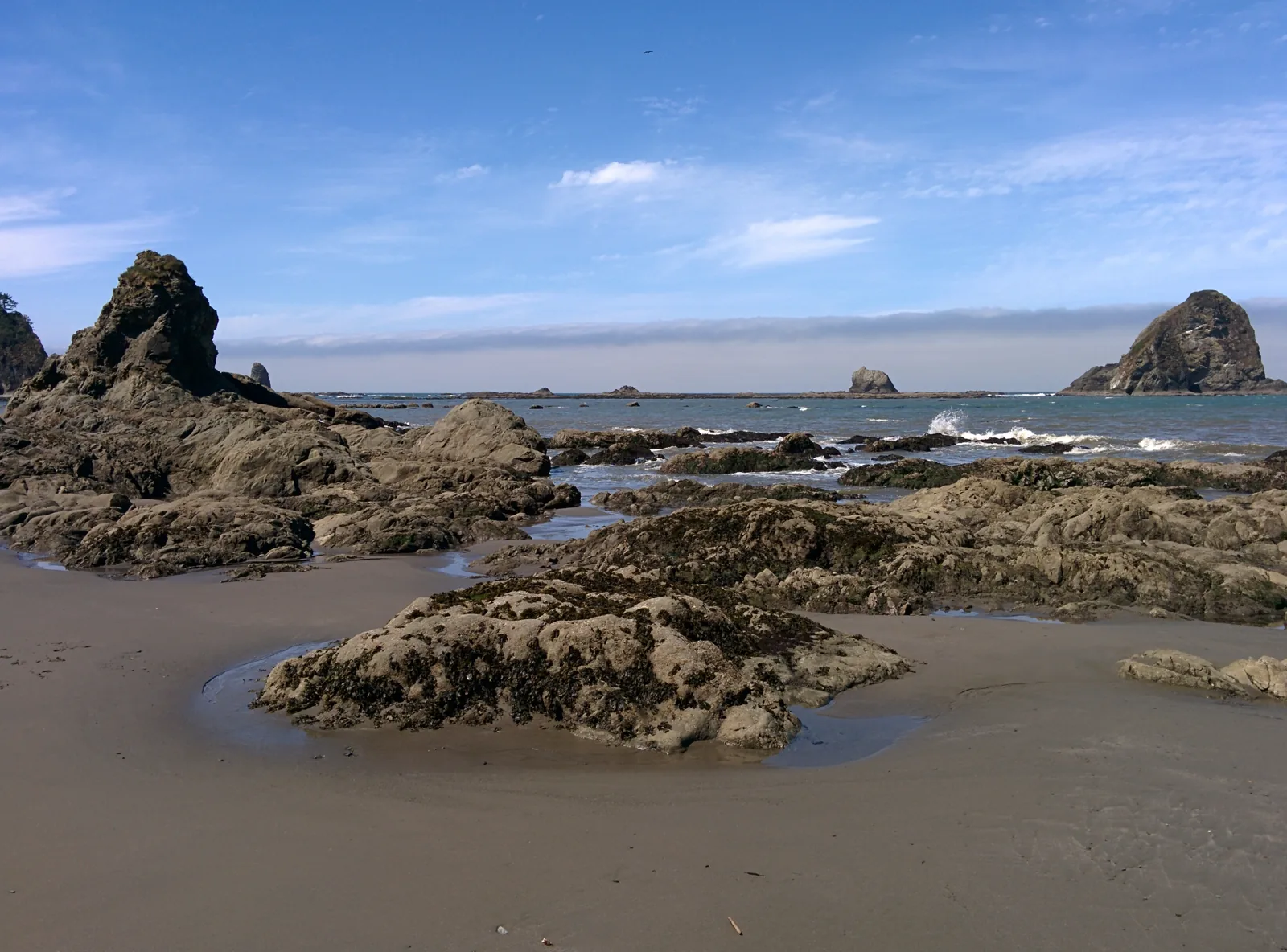
Mora holds 94 sites in coastal forest, two miles from Rialto Beach, some with views of the Quillayute River. It is open year round, though it may close temporarily during severe weather, with flush toilets, potable water, and a dump station. Its stagger runs A, B, and E at six months, C at two weeks, and D at four days. Mora takes reservations from May 15 to September 20, 2026, and is first come, first served outside that period, though some loops may close in winter. During the reservation season, a one night fallback is available at the B Loop registration board.
Campers on The Dyrt describe Mora in consistent terms. The sites are large and private under Sitka spruce and Douglas fir, quiet for the campground's size, and dark under the canopy. Tent fit runs small to medium, most sites holding one tent comfortably and some two, with loop A backing the road and loop E backing the river, and some reviews add heated bathrooms. Campers describe the bathrooms as clean and well kept. Verizon is the carrier that works at Mora, and campers report T-Mobile service is poor to absent.
The loops are paved, with short asphalt spurs opening into broad dirt site areas ringed by ferns and brush. Campers note that Loop E backs onto the Quillayute River, though most of its sites take no river view and there is no direct river access from the loop.
Mora is busy in September, even after Labor Day in a September 2017 account, and quiet in October. Two 2026 accounts describe October stays as very quiet. One account describes a quiet Thursday followed by a crowd arriving on Friday.
Mora is also the drive in base for the wilderness coast's northern end. Campers staying at Mora frequently take day trips to Rialto Beach and also visit Second Beach. The ranger station beside the campground is where its campers get tide charts and wilderness permits, so a backpacker can sleep at Mora the night before or after a Second Beach trip.
Mora is the base for the La Push beaches, the coast ground I know best in this park. Rialto Beach is two miles from the campground, and the trailheads for Second Beach and Third Beach sit in and above La Push, the beaches I have camped and the start of the South Coast route south. A night at Mora needs no wilderness permit, and a night on those beaches does, and the ranger station here is where its campers pick up tide charts and permits.
Mora's beach is Rialto, reached on foot only by walking beside a narrow road with no sidewalk. Swimming is not recommended at Rialto, and drift logs become a threat at high tides, and a temporary accessible ramp stands at the Rialto parking area in summer. Sneaker waves run this coast too, so keep eyes on the surf at Rialto and at the La Push beaches.
South Beach Campground
Quick facts. 55 sites; first come, first served; mid May to mid October; no potable water; flush toilets. Nightly fee $20. Check-in 12:00 p.m., check-out 11:00 a.m. RVs and trailers camp dry here, with no hookups, and the park publishes no dump station at this campground.
South Beach holds 55 sites on a bluff overlooking the Pacific, with beach access, open from May 19 to October 10, 2026. It is first come, first served. South Beach has flush toilets but no potable water, so campers report filling up at Kalaloch.
Campers describe it as the opposite of Kalaloch. It is an open bluff field above the beach, with sites close together and no trees or bushes between them, and constant surf noise. Wind is strong enough that one camper's whole strategy was parking behind the restroom block as a windbreak. It works as Kalaloch's overflow in practice, and one camper arrived from a Kalaloch reservation whose site did not fit their rig and was sent here by a ranger. Campers warn that a site behind the front row can lose its ocean view entirely once RVs fill the bluff row.
When Kalaloch is full, South Beach is a nearby alternative, with exposure and no drinking water. Plan for it as overflow, with water filled at Kalaloch and a tent ready for strong wind.
South Beach serves the same Kalaloch bluff ground as its neighbor to the north, the day beaches below the bluff and the campground’s own beach access, and it works as the overflow base when Kalaloch fills. It plays the same role as Kalaloch, a day trip base rather than a route trailhead.
The management beach definition that closes the Kalaloch shore to razor clam harvest anchors at this campground's own beachfront, so the same closure regime reaches the beach below the bluff. Sneaker waves are the standing surf warning here, on top of the wind the bluff is known for.
Rainforest and river zone
Hoh Rain Forest Campground
Quick facts. 78 sites; reservable through Recreation.gov in staggered loop releases, first come outside the reservation season; open year round; potable water; flush toilets. Nightly fee $24. Check-in 12:00 p.m., check-out 11:00 a.m. RVs and trailers camp dry here, with no hookups, and the Hoh has no usable dump station.
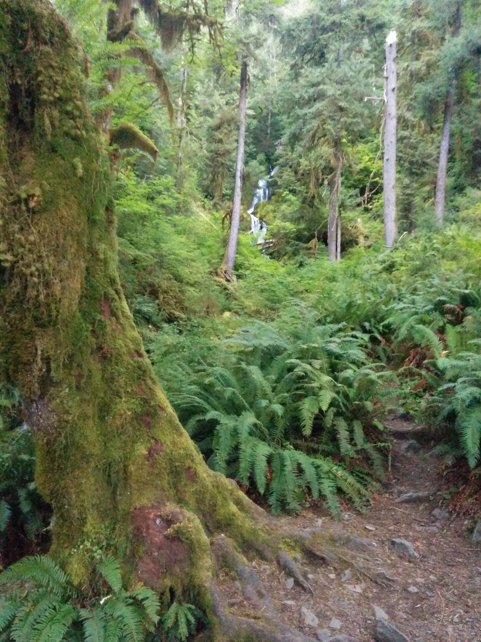
The Hoh Rain Forest Campground holds 78 sites on the park's camping page, with flush toilets, potable water, and some riverside sites along the Hoh River, and food lockers at loop restrooms on its Recreation.gov facility page. Its stagger runs A at six months, C at two weeks, and B at four days. Reservations are required from June 12 to September 6, 2026, with first come outside that window and a one night fallback at the B Loop registration board inside the reservation season.
The park's alerts page states that parking at the Hoh Rain Forest is limited in summer. It recommends arriving before 8 a.m. or after 5 p.m. to avoid long wait times at the entrance station, up to two hours. Campers report traffic backed up for miles, and two accounts put the wait at over an hour even midweek.
Even with a reservation, plan your arrival time.
Campers describe small but well spaced sites among moss draped old growth; riverside sites in loops A and C fill first, and deer and elk walk through campsites. Campers report no dedicated tent pads and sloped, very hard soil, and one August camper called the bathrooms inadequate for the loop counts. Campers praise the bathrooms as clean, and several advise bringing your own soap, since the restrooms often have none. There is no AT&T or T-Mobile service to count on at the Hoh, and Verizon reports are mixed. Campers single out the river side sites, the ones close enough to walk down to the Hoh River, as the private picks.
Site choice inside the Hoh is a light choice. What does not change with the loop is the moisture, which is constant. Loop A sites open onto grass, with asphalt spurs and tables set on the lawn, while B and C sites are narrower spurs in the ferns. Campers draw a clear line between the loops. Loop A takes the sun and holds the bigger, more open sites, while Loops B and C sit in deep shade and denser forest.
The Hoh campground is the base for the Hoh River Trail, which leaves from the trailhead beside the campground and the visitor center. I have backpacked that trail to the Blue Glacier, and its camps and shapes are treated in the backpacking guide’s rainforest section. The visitor center loops start here too, the Hall of Mosses at 0.8 miles and the Spruce Nature Trail at 1.2 miles. The campground runs on campground reservations, and the trail runs on wilderness permits, two systems sharing one trailhead.
Two small camps run by the state Department of Natural Resources serve this same valley as first come alternatives. Hoh Oxbow holds 8 sites on US 101 by the river, with a boat launch, and Minnie Peterson holds 9 sites on Upper Hoh Road at the rainforest edge, both first come, first served with no fee beyond a Discover Pass.
The Hoh's access is one road, and it has failed before: the Upper Hoh Road's December 2024 washout closed the valley until a state funded repair reopened it on May 8, 2025, so a closure here strands the whole rainforest. The dump station is closed indefinitely, with the nearest dumps at Bogachiel, 23 miles, and Kalaloch, 33 miles, payment required at both. The visitor center runs daily in summer, usually closes from January into early March, and keeps Friday through Sunday hours in spring and fall. The valley's rain is the fact behind all of it, at 140 inches in an average year.
Queets Campground
Quick facts. 20 sites; first come, first served; open year round; no running water; pit toilets. Nightly fee $15. Check-in 12:00 p.m., check-out 11:00 a.m. RVs and trailers are not recommended here.
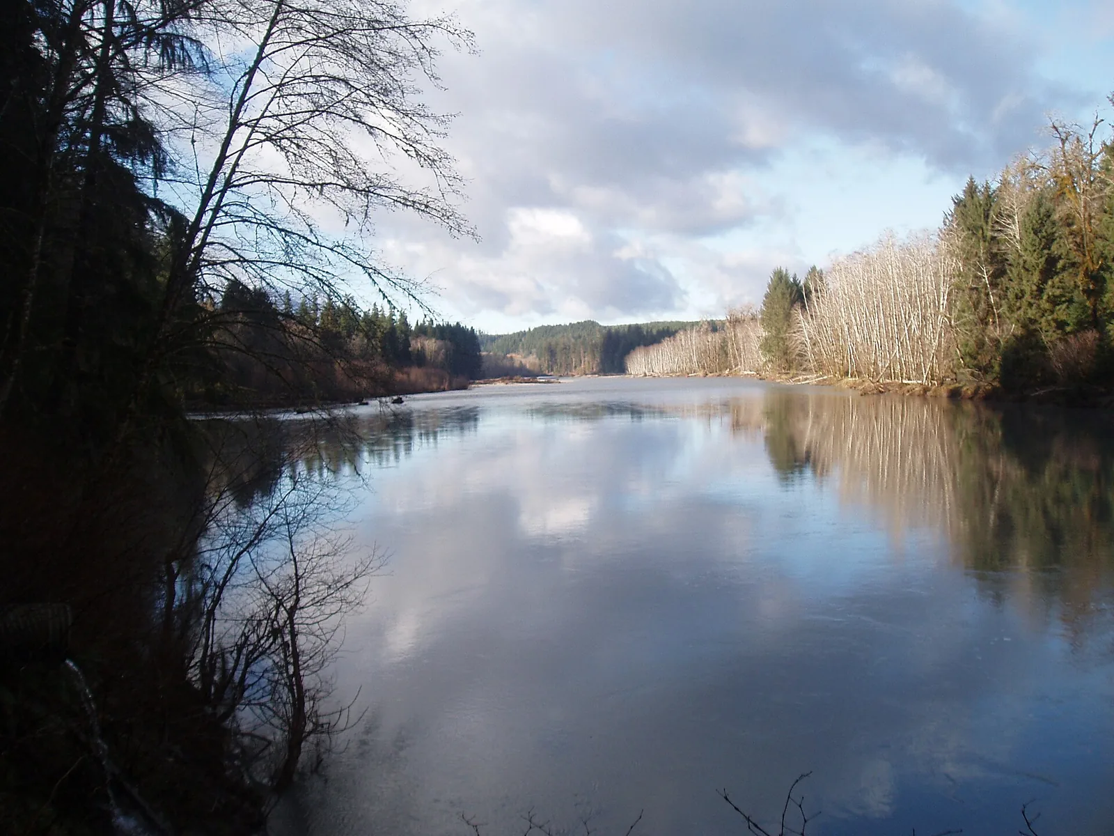
Queets holds 20 sites, open year round, though it may close temporarily during severe weather, first come, first served, with pit toilets and no running water, and rigs not recommended. A past mudslide means campers can reach it only from the Upper Queets Road. Hazardous weather can close the roads and campground on short notice, so check the park's road and weather line before a trip.
Campers describe a long approach and a quiet river campground. The drive runs ten to fifteen miles of narrow gravel, with high clearance advisable and no cell service. The campground holds spacious unlabeled sites along a loud river, rarely full, with a single vault toilet praised as well maintained. Multiple reviewers report bear activity, and campers need to treat water. Campers describe the sites beside the river as well spaced and spacious, with the river in view.
Queets suits a camper who brings drinking water, water treatment, and food storage, and wants the river valley without the Hoh's entrance line.
Queets serves one piece of ground, the Queets River Trail, and reaching it starts with a ford of the Queets River itself at the campground. The trail then runs primitive up the valley and ends at 15.8 miles at the end of trail. There is no separate trailhead drive, since the camp is the trailhead.
The ford is the trail's first fact, in the trail page's current form: a crossing of the Queets River at the campground, commonly waist deep in summer, difficult or impossible in heavy rain or snow melt, with July through September the best season. Sam's River Loop, the campground loop, is the ford free walk for campers who stay on this side.
Graves Creek Campground
Quick facts. 30 sites; first come, first served; open year round; no running water; pit toilets; RVs and trailers are not allowed. Nightly fee $20. Check-in 12:00 p.m., check-out 11:00 a.m. RVs and trailers are barred on the road to this campground and are not allowed at it.
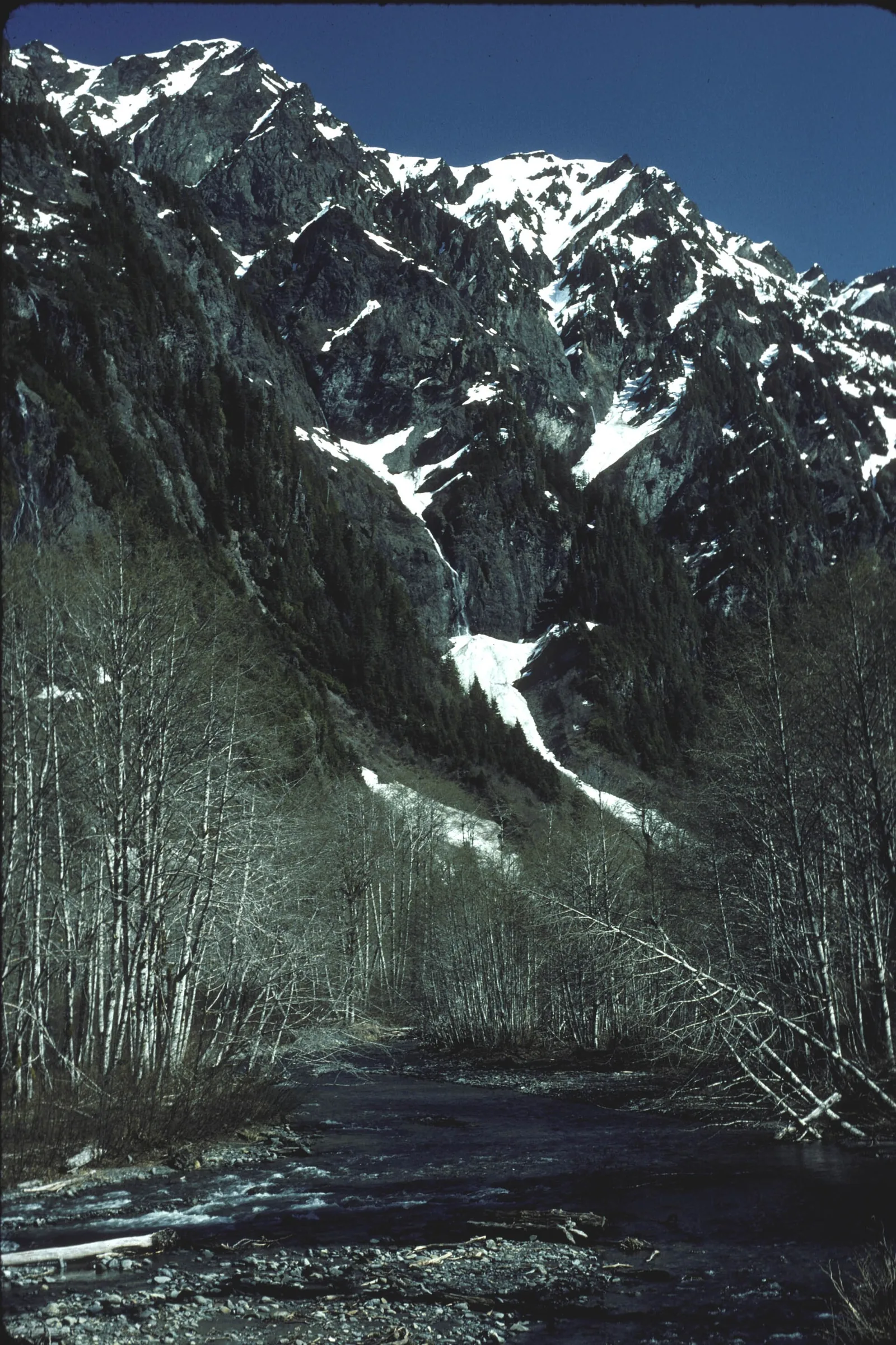
Graves Creek holds 30 sites, open year round, though it may close temporarily during severe weather, first come, first served, with pit toilets and no running water. Ordinary vehicles can reach the campground on a narrow, winding gravel road six miles from the South Shore Road intersection, but recreational vehicles and trailers are prohibited on both the road and at the campground.
Campers describe the Quinault side's quiet campground. The interior loop is shadier, and the creek is audible from most sites. A summer weekend camper found it half full and very quiet. Campers name the river backing sites as the favourites, in two groups, sites 1 to 5 and sites 17 to 20.
One pit toilet serves all thirty sites, with lines on peak weekends, and ferns dense enough to filter most direct light. Multiple reviews report bear and coyote sightings and recommend storing food in a vehicle, which is also the frontcountry rule.
Graves Creek is also on the trailhead side of the Quinault valley, with access to Enchanted Valley from this side.
Graves Creek sits at the trailhead for the East Fork Quinault River Trail, the 13 mile walk into Enchanted Valley, which makes this the night before base for the valley, with Pony Bridge camp 2.5 miles up the trail. The valley is a quota area in season, so the pairing runs campground first come below and wilderness permits above.
North Fork Campground
Quick facts. 9 sites; first come, first served; open year round; no running water; pit toilets. Nightly fee $20. Check-in 12:00 p.m., check-out 11:00 a.m. RVs and trailers are not recommended here.
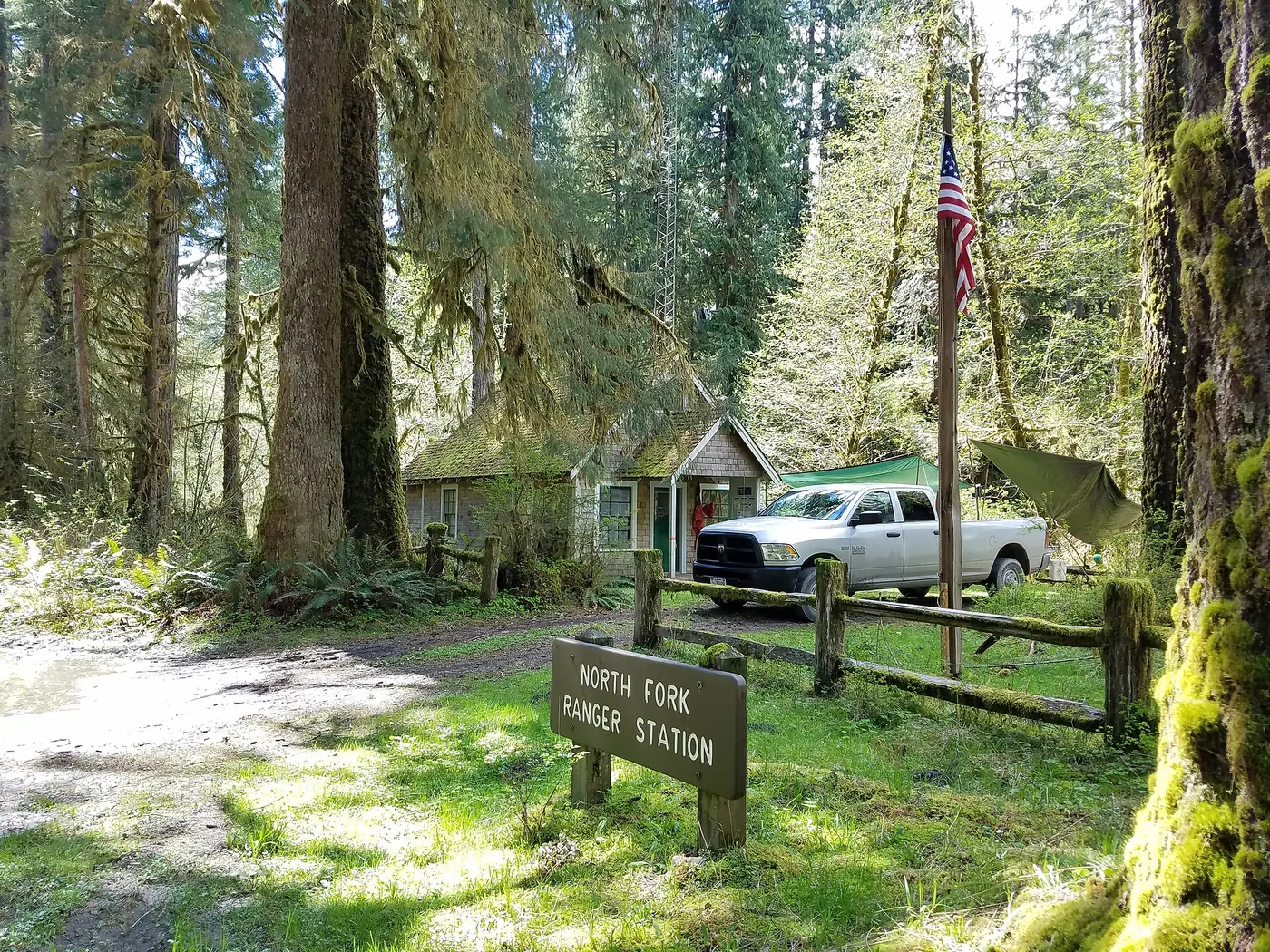
The park describes North Fork as a small and remote campground for campers seeking solitude. It has 9 first come, first served sites, pit toilets, and no running water. It is open year round but may close temporarily during severe weather. The park does not recommend it for recreational vehicles and trailers.
North Fork is the last ground on the North Fork Road, and the North Fork Quinault River Trail leaves from the road end beside the campground, with the Halfway House site its named first destination up the valley. The pairing is a walk out of camp, with no drive between the site and the trail.
Lake and mountain zone
Fairholme Campground
Quick facts. 88 sites; reservable through Recreation.gov in staggered loop releases; late April to late September; potable water; flush toilets; a dump station. Nightly fee $24. Check-in 12:00 p.m., check-out 11:00 a.m. RVs and trailers camp dry here, with no hookups, and a dump station stands in the campground at $10 per use.
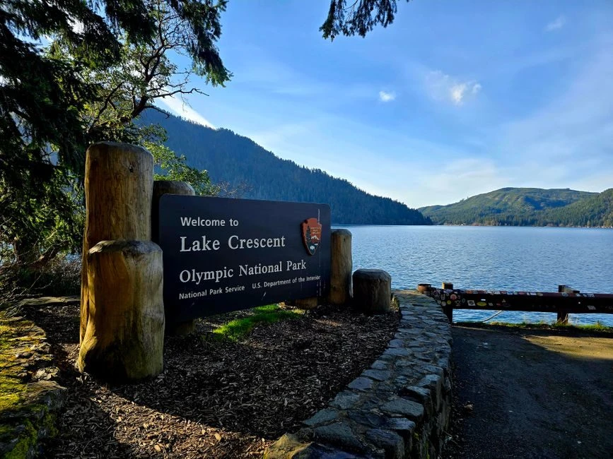
Fairholme has 88 sites and is open April 25 to September 29, 2026, with flush toilets, potable water, and a dump station. Its sites sit by Lake Crescent with a nearby boat launch, and food lockers stand in some, but not all, sites. Campers swim, paddle, and kayak from the shore here.
Fairholme has the most detailed staggered reservation schedule in the set. Reservations for Loop B and most walk-in sites open six months ahead; reservations for loop C and most remaining walk-in sites open two weeks ahead. Reservations for Loop A and walk-in site 85 open four days ahead.
Campers must reserve sites from May 15 to September 29, 2026. The campground may open first come, first served in spring before that season, depending on weather. The B Loop registration board handles the one night fallback.
Older camper accounts describe Fairholme when it was first come, first served, before the staggered reservation schedule reached it. A 2018 review from that era describes sites very small, right next to one another, and no privacy, with the convenience being Lake Crescent itself. That crowding observation dates from the first come era; Fairholme has since replaced its first come system. Another guide’s account adds a store at the entrance renting kayaks. The lake is the draw and the sites are the compromise, and the practical step, as at Kalaloch, is to read the individual site page when choosing a site.
Spacing at Fairholme varies by site, with some pads open and close to their neighbors and others screened by ferns and trees.
Many sites sit on sloped ground, and campers advise leveling blocks as standard kit here. Cell service at Fairholme is poor to absent on all three carriers, with Verizon the most likely to show some coverage. Highway 101 noise reaches much of the campground, and campers name it as the main drawback here, with sites farther from the road reading quieter. Campers mostly describe Fairholme’s bathrooms as clean, though a few reports call the facilities meager.
Campers prize the sites at the edge of the lake, the ones where the site itself sits on the water. Reports split on Loop A site 1. One party found it very spacious, with room for children to play. Another found it tiny and badly unlevel, a slanted rock in the forest. Campers single out the walk in tent sites on the water as worth the haul from the car, and warn that the way down to them is a steep, short hill.
Fairholme’s paired ground is the Sol Duc side. The park’s own table measures Lake Crescent’s Storm King station to the Sol Duc station at 16 miles and an hour, and the Seven Lakes Basin loop leaves from the Sol Duc trailhead at the end of that road. On the lake itself, Marymere Falls is a short drive east, and the Spruce Railroad Trail’s west end is the end of the lake Fairholme campers are closest to.
Water stands at each bathroom here, and spigots also run along the trails to the walk in campsites. The corridor's firewood seats are the Fairholme Store, Lake Crescent Lodge, and Log Cabin Resort, and the nearest gas is 17 miles west on Highway 101 at the SR 113 junction.
Log Cabin Resort RV and Campground
Quick facts. 38 sites, with full hookup RV sites for rigs to 35 feet and tent pads; booked by phone through the resort, a park concession; May to October; resort facilities on Lake Crescent. Nightly fees run $25 to $44. Check-in 4:00 p.m., check-out 11:00 a.m. The resort’s full hookup sites are the only full hookups in this guide.
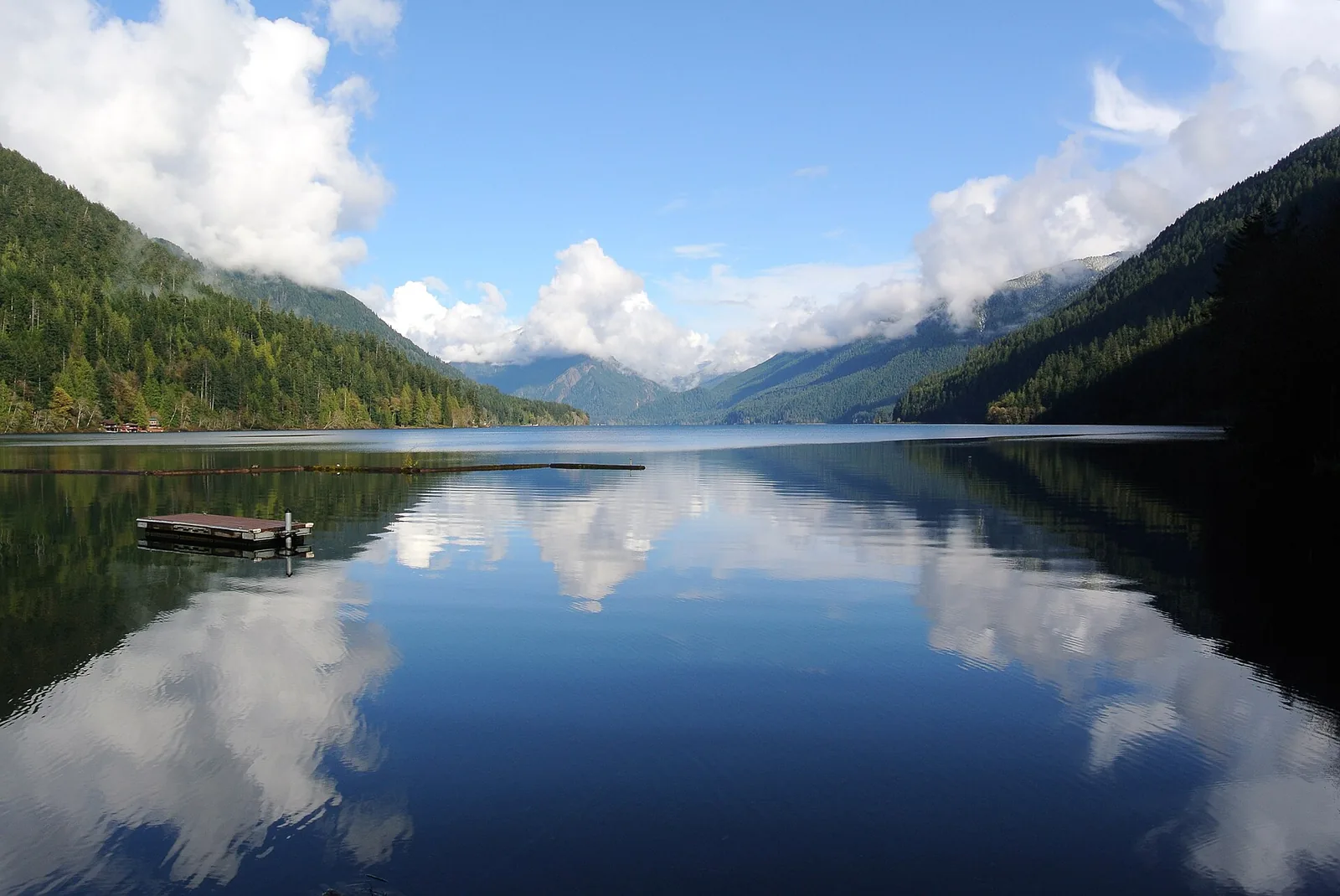
Log Cabin Resort runs this campground on Lake Crescent's northeast shore under a park concession, so it sits outside the park run set. It holds 38 sites, with full hookup RV sites for rigs up to 35 feet, group tent camping on four tent pads, bike in tent sites, and ADA tent sites. Its season runs May to October, and sites book by phone through the resort rather than through Recreation.gov.
Log Cabin Resort’s ground is Lake Crescent’s east shore, where the resort stands near the Lyre River end of the Spruce Railroad Trail. The pairing is shore ground and that trail, walked from the resort’s end of the lake.
Sites here cap at 4 people per site, against the park wide limit of 8. The resort's facilities run to laundry, a cafe, a gift shop, a convenience store, and boat rentals.
Sol Duc Hot Springs Resort RV Park and Campground
Quick facts. 82 campground sites and 17 RV sites with water and electric hookups; booked through Recreation.gov up to six months ahead, a park concession; reservations required from late March to the start of November; running water; flush toilets. Nightly fee $33, RV park $58. Check-in 12:00 p.m., check-out 11:00 a.m. The campground itself is dry, and the resort’s separate RV park is water and electric only, back in only, for rigs of 26 to 36 feet.
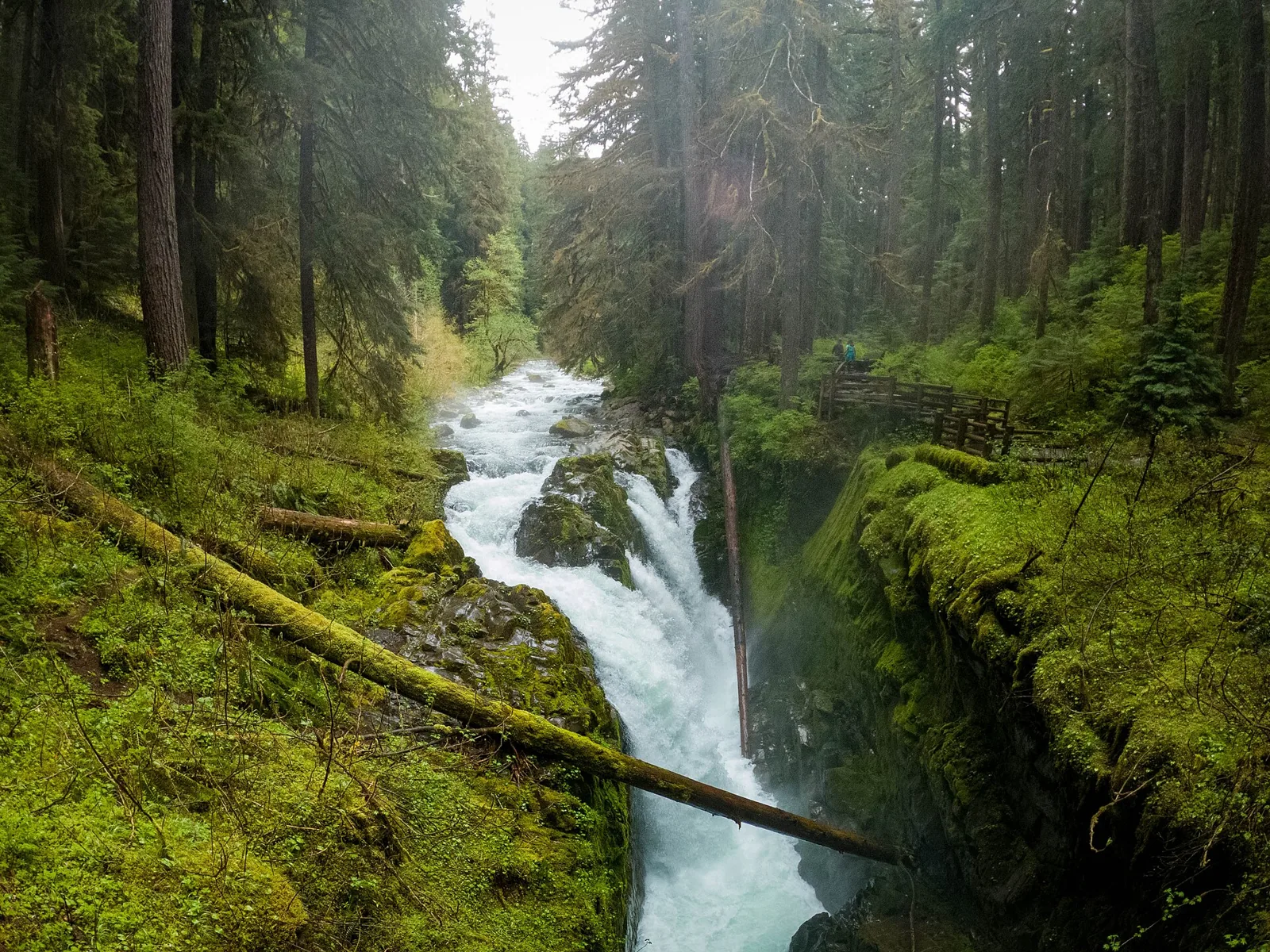
Sol Duc Hot Springs Resort operates this campground and RV park up the Sol Duc valley, also under a park concession. The campground holds 82 sites along the river in old growth, with flush toilets, running water, and food lockers, and the separate RV park holds 17 back in gravel sites with water and electric hookups. Reservations are required from March 20 to November 1, 2026, through Recreation.gov, up to six months ahead. Campground sites fit rigs of 21 feet, a few up to 35 feet, and the resort's hot springs pools next door are the draw that fills it. Campers describe the hosts and resort staff as helpful and welcoming.
The two halves of Sol Duc read differently on the ground: the campground loops are dirt pads in deep old growth shade, while the RV sites sit open in a gravel lot. Campers describe the wooded loop sites as the spacious ones, with forest screening between sites. Campers describe the water and electric RV sites as a parking lot, tight enough that neighbours share space.
Campers describe the campground loops as quiet, with very little road noise. Cell service at Sol Duc is spotty and site dependent, with AT&T the most likely to register and no carrier dependable.
The resort campground is the base for the Sol Duc Falls walk, 1.6 miles round trip from a trailhead a short drive up the road, and for the Sol Duc trailhead system behind it, where the Seven Lakes Basin and High Divide loop begins. Most campers come for the falls first, with the basin as the backpacking trip beyond it.
DNR’s Bear Creek Campground sits on the same river along US 101 at milepost 206, 16 first come sites with two toilets and a scenic overlook, free beyond a Discover Pass.
The resort states its own connectivity, with no phone service and no internet access on the property and a phone for guest use in the main lodge. The pools print as dated operator figures, checked November 9, 2026: three mineral pools typically at 98 to 107 degrees and a freshwater pool at 50 to 85 degrees, with per session access at $19 for adults, $15 for children 4 to 12, and $15 for seniors over 62, and towel rentals at $5.
Staircase Campground
Quick facts. 49 sites; reservable through Recreation.gov in staggered loop releases, first come outside the reservation season; open year round, with water and flush toilets in summer only; potable water in season; flush toilets in season. Nightly fee $24. Check-in 12:00 p.m., check-out 11:00 a.m. RVs and trailers camp dry here, with no hookups.
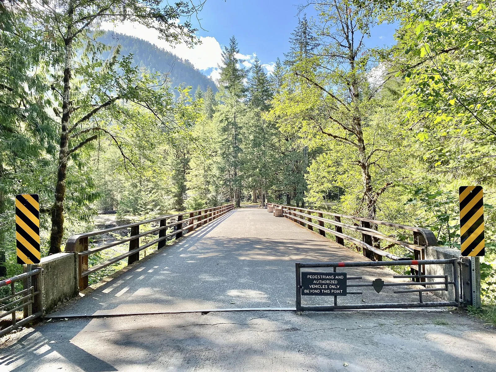
Staircase has 49 sites, with flush toilets and potable water available during the summer season when the campground is open. Forest Service Road 24, a gravel road along Lake Cushman, leads to the campground. The road is often closed completely from November to May. Campers must reserve sites from July 8 through September 29.
Outside that period, sites are first come, first served with self registration. The registration board handles the one night fallback. Reservations open in staggered blocks by loop, with no loop letters specified.
The Staircase developed area is open, including the Staircase Rapids Loop trail, the campground, and the ranger station. All other trails in the Staircase area remain closed during the Bear Gulch Fire recovery, so plan backcountry trips elsewhere until the closure lifts.
Campers describe the east side's family campground. Riverside sites sit under large Douglas fir and hemlock, the Rapids Loop is the named family hike, summer ranger programs run, and the park provides bear boxes. Campers describe the gravel road as bumpy and dusty, with serious potholes in the last two miles. Accounts differ on site spacing: one TripAdvisor account calls the sites very closely packed, while a summary on another review site describes peaceful, spacious campsites, and the reports stay mixed. Campers rate the flush toilets here among the cleanest in the park.
Staircase sites are broad dirt clearings in old growth, many edged with logs, with trees standing between most sites. Campers note that the sites run along the river here, and the river side spots draw the praise.
Campers describe Staircase as quiet and peaceful. Campers report no cell service at Staircase on any carrier, T-Mobile, AT&T, or Verizon.
Staircase currently serves one trail. The Staircase Rapids Loop, 2.1 miles, starts at the campground, and every other trail in this corner of the park remains closed in the Bear Gulch Fire recovery, so the Flapjack Lakes and North Fork Skokomish ground behind the closure is not served from this base for now.
Heart O' the Hills Campground
Quick facts. 97 sites; first come, first served; open year round; potable water; flush toilets. Nightly fee $24. Check-in 12:00 p.m., check-out 11:00 a.m. RVs and trailers camp dry here, with no hookups, and there is no dump station.
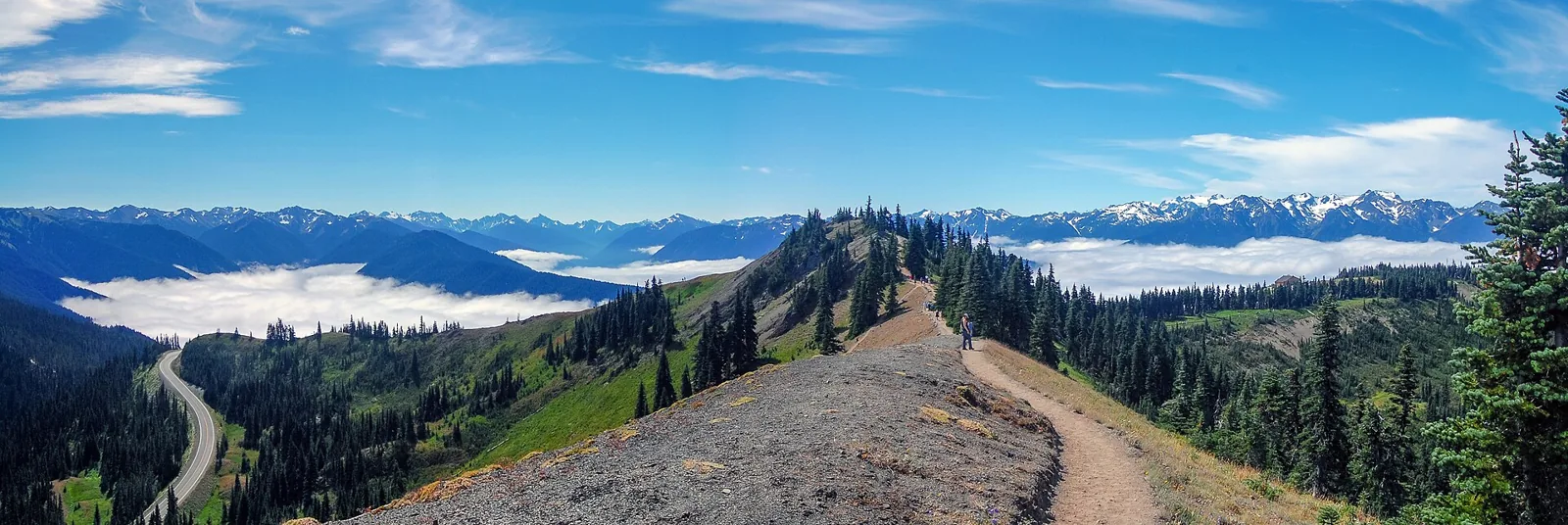
Heart O' the Hills holds 97 sites, open year round, first come, first served, with flush toilets and potable water. It is walk in only during heavy snowfall, in the agency's wording. It is a base near Port Angeles for the park's northeast corner and Hurricane Ridge when the road is open.
Arriving Thursday or Friday morning gives campers a reasonable selection. By Friday evening the campground can be nearly full, though July weekends typically still have sites for a mid morning arrival. Campers report that most sites are small, with room for one tent or two compact tents. Loops A, C, and E better accommodate larger tents; loops B and D are tighter. Campers warn that the pull through sites run short and unlevel, some of them badly.
Shared bear boxes stand throughout camp; store food in a vehicle if a box is not adjacent to your site. Campers have reported bear activity nearby. In one detailed account, a camper claimed and paid for a site but left it unmarked; a later arrival took it without checking the self registration board. That single report is a reminder to check the registration board, not just a site's appearance.
Heart O’ the Hills stands five miles up the Hurricane Ridge Road from Port Angeles, on the park’s measured 17 mile, 45 minute run to the ridge station, and the Lake Angeles Trail leaves from the campground itself, 7.4 miles and 2,350 feet, so its campers can walk to a trail from their sites. The ground it pairs with is the Hurricane Ridge day area at the top of that road.
Above its gate, the Hurricane Ridge Road carries a winter form of its own: from Thanksgiving weekend to the last weekend in March it closes to motor vehicles Tuesday through Thursday and on non holiday Mondays, and every vehicle must be below the gate by 5 p.m. in the winter use season.
Ozette Campground
Quick facts. 15 sites, and some flood in winter; first come, first served; open year round; potable water; pit toilets. Nightly fee $20. Check-in 12:00 p.m., check-out 11:00 a.m. RVs and trailers camp dry here, with no hookups, and its sites run to 21 feet only.
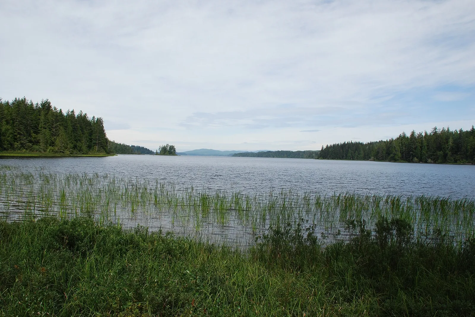
Ozette has 15 first come, first served sites, pit toilets, and potable water. It is open year round, though severe weather can close it temporarily. Camping is primitive in winter, and some sites flood. Flooding and landslides have frequently closed or caused detours on the access highway, State Route 112. The park advises checking with the state transportation department before a trip.
Campers describe a small lakeside campground at the end of a long, winding paved road. Sites tend to be small but vary in size. One camper reports that some accommodate rigs, while some grassy tent sites are too small for a tent. Its pressure is strikingly low: the same camper found five of fourteen sites occupied on a Memorial Day weekend. Campers warn that the low sites flood in heavy rain, and that the sites beside the lake can go under water in a downpour.
Ozette is a drive in base for the coast camps. A night at the campground needs no wilderness permit, but a night on the beach behind it does.
Ozette Campground is the trailhead camp for the Ozette Triangle, whose loop starts at the ranger station here and runs a little over nine miles through Cape Alava and Sand Point. The beach camps on that loop are limited year round and run on wilderness permits, and the ranger station here does not lend bear canisters, so the canister travels in with the party.
Tides run this entry's beach half. Carry a tide chart for the Triangle and never guess a headland crossing, and watch for sneaker waves that can run up the beach without warning. Harvest at Ozette runs on the park's fish and shellfish seasons, so check the current regulations before taking anything. Fires split at Sand Point, where they are not permitted north of Yellow Banks to Wedding Rocks, on the stretch the Triangle walks. Winter camping here may be primitive, with pit toilet only and no water, and the campground's boat launch stands on the lake for campers who bring a boat.
Deer Park Campground
Quick facts. 14 sites, tents only; first come, first served; June to mid October, on road conditions and snow melt; no potable water; pit toilets. Nightly fee $15. Check-in 12:00 p.m., check-out 11:00 a.m. RVs and trailers cannot use this campground, which is tents only, and its road is not suitable for them.
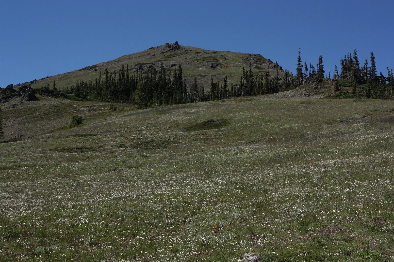
Deer Park has 14 first come, first served, tent-only sites at 5,400 feet. It opens June to mid October, depending on road conditions and snow melt. A steep, winding gravel road leads to the campground and is not accessible to recreational vehicles. Pit toilets serve it, and it has no potable water and no trash cans.
Campers report that the gravel road runs eighteen miles and the sites are well spaced. The campground usually fills early on nice weather days, with no way to know ahead how many sites are left.
Deer Park sits at the end of its road at 5,400 feet, and the ground it pairs with is the high country there, the Blue Mountain summit at the campground and the Deer Ridge Trail dropping toward the park interior. The pairing is trailhead ground only, since the camp and the trails share one road end.
Camping outside Olympic National Park
Bogachiel State Park
Quick facts. Standard and partial hookup sites, hiker and biker sites, and one tent only group camp, for rigs of 40 feet or less; the state reservation system, up to nine months ahead; open year round, with winter camping listed; potable water; restrooms; showers; a trailer dump. Check-in 2:30 p.m., check-out 1:00 p.m. Six of its sites carry power and water hookups, and the trailer dump costs $5 per use, waived for campers who have paid for camping.
I camped at Bogachiel State Park in the summer of 2017, the one frontcountry stay I can claim on the peninsula. The park sits on Highway 101 south of Forks and provides a base for touring the western Olympic Peninsula. Its campground offers standard and partial hookup sites and hiker and biker sites, accommodates rigs of 40 feet or less, and holds one group camp for tents only. It sits on the Bogachiel River, lists winter camping among its activities, and holds restrooms, showers, and a trailer dump among its amenities.
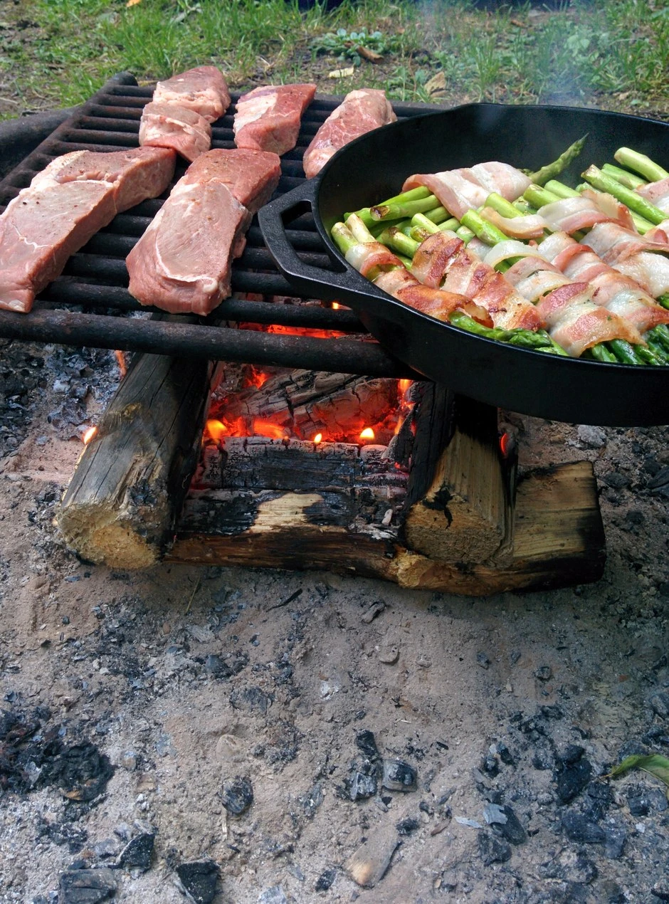
See Best Washington State Parks for Camping for more about Bogachiel. Bogachiel is a Forks side base in a rainforest river setting inside the state parks system.
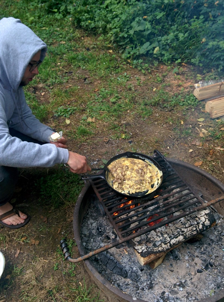
Bogachiel is the one campground in this guide I have camped, and its pairing is the Forks side. The state park’s own page frames the Hoh Rain Forest as a 40 minute drive from here, which makes this the state park base for a rainforest day while the coast bases are full, and its full treatment sits in the state parks camping guide.
Campers beyond our own stay describe the same rainforest shade, and many use the park as a base for Forks, the Hoh, and Rialto Beach. Highway 101 noise is the contested point, with most campers who mention it calling it noticeable and a smaller number calling it background. Several also report rusty, mineral tasting tap water. The sites pair asphalt spurs with grass living areas, many of them screened by brush and split rail fencing, though some sites sit close together.
Winter splits this campground: sites 1 to 25 stay reservable all year, sites 32 to 40 close from November 1 to March 31, and water is off from November 1 to March 31 except near the dump station and at site 12 by the restroom. The elk rule prints in the agency's own words: elk have the right of way, stay back 100 feet, and never offer food.
Dosewallips State Park
Quick facts. Standard and utility sites and cabins, for rigs of 40 feet or less; the state reservation system, up to nine months ahead; open year round, winterized from mid November to the end of March, when only a block of sites keeps water; drinking water; restrooms; showers; a trailer dump. Check-in 2:30 p.m., check-out 1:00 p.m. Its 63 utility sites make it the hookup heavyweight of this guide, and the trailer dump costs $5 per use, waived for campers who have paid for camping.
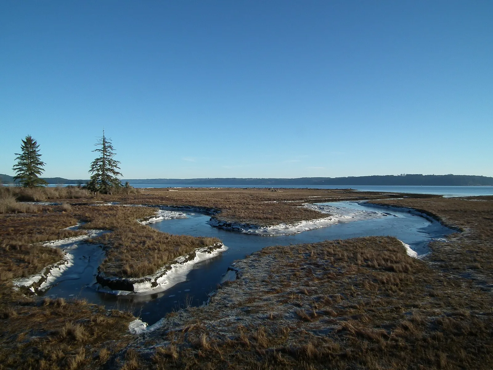
Dosewallips State Park is a year round camping park on Hood Canal and the Dosewallips River, at Brinnon on Highway 101. It offers cabins, standard and utility sites, accommodates rigs of 40 feet or less, and lists showers, restrooms, drinking water, and a trailer dump among its amenities. Its amenities also include an amphitheater and interpretive opportunities. There is no boat launch at the park; the nearest launch is seven miles south at Triton Cove State Park. From November 15 to March 31 the campground is winterized and only sites 21 to 29 have water, with a winter water supply near the dump station. The showers take quarters or tokens at 50 cents, with one shower in each restroom.
Campers report Highway 101 and logging truck noise here, worst in the loops nearest the road and fading late at night. Privacy splits by section, with the meadow and open sites exposed and the riverside and wooded tent sites more private. Elk move through the campground, and campers report them in camp regularly.
An east side arrival passes this park on the way to Staircase. It is not the park's walk in Dosewallips Campground up the washed out Dosewallips Road.
Dosewallips serves its own Hood Canal shore and the river mouth at the park. Its link to the valley behind it comes with a warning, since the Dosewallips Road is washed out above the state park and every trail up that valley currently starts with about 6.5 miles of road walk. The canal shore is the ground this base actually serves.
The shellfish regime here runs on two approvals, a WDFW season and a Department of Health approval, checked the same day, and part of the park's south beach is closed to harvest year round below the marked line. The river carries its own warning in the agency's form: no formal swimming area, and the river can be swift and is not suitable for young children. Elk keep the same distance rule as at Bogachiel, 100 feet, and never offer food.
The Lake Quinault national forest campgrounds at Willaby and Falls Creek
Quick facts. Willaby is a Forest Service campground on Lake Quinault with 21 sites (19 drive in and 2 walk in tent sites); reservations through Recreation.gov, an exception to the forest’s first come rule; open late April to the end of October; a potable water system; a barrier free flush toilet. Falls Creek has 31 sites for rigs to 16 feet with no hookups; reservations through Recreation.gov; open mid May to mid September; potable water; flush toilets. Nightly fee $25 at both. Check-in 12:00 p.m., check-out 11:00 a.m. at both. Both campgrounds cap RVs at 16 feet and offer no hookups.
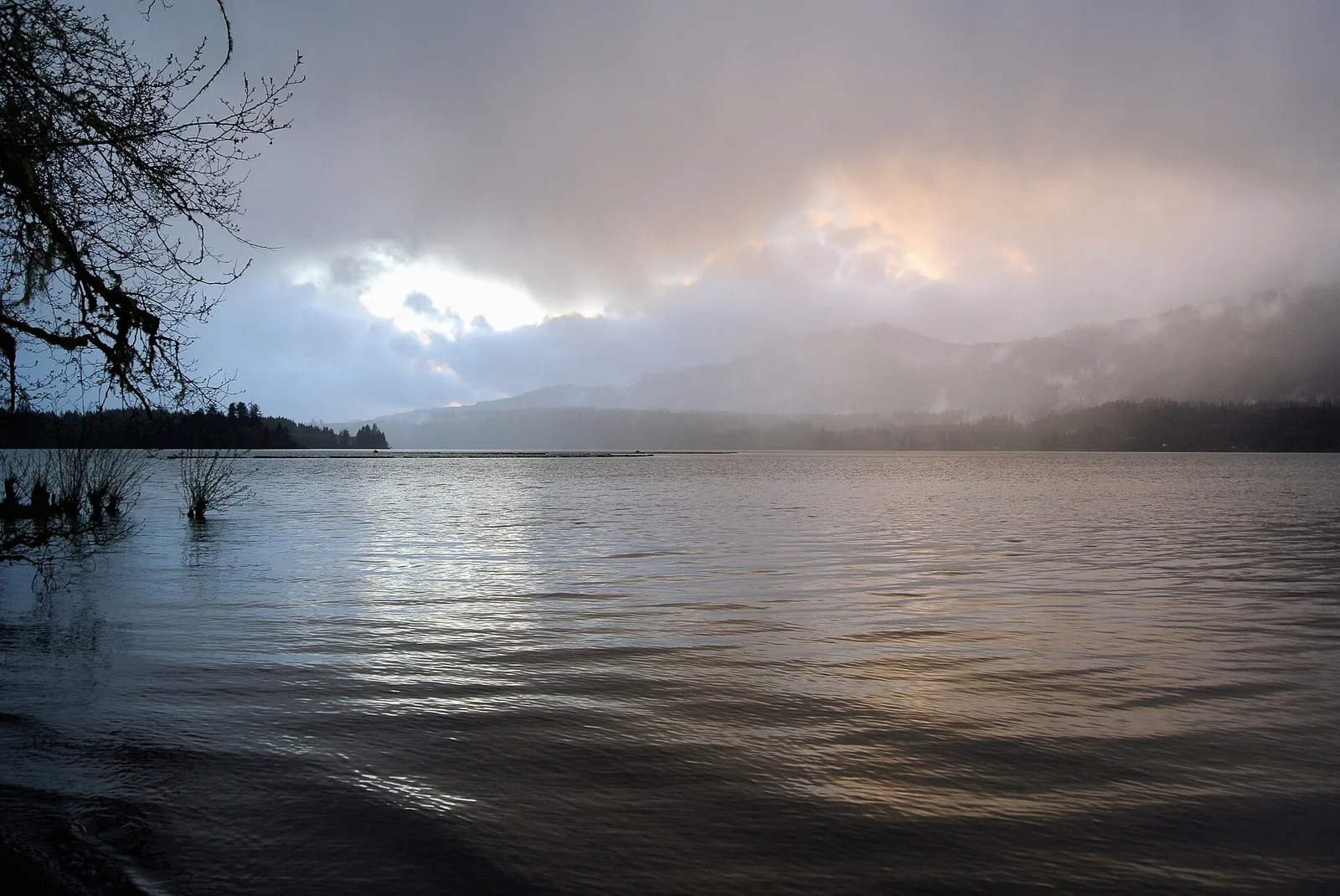
Two Forest Service campgrounds on Lake Quinault's south shore are outside the park; campers book them through Recreation.gov. Willaby Campground's 2026 season runs April 27 to October 30. Falls Creek Campground's 2026 season runs May 18 to September 18, with 31 campsites accommodating tents, trailers, and rigs up to 16 feet, no hookups, a potable water system, and flush toilets including a barrier free flush toilet. Both charge fees and are the two exceptions to the Olympic National Forest's first come, first served rule for its other campgrounds. The Forest Service's 2026 dates are subject to change.
Campers report that by late season in both 2025 and 2026 the Falls Creek restroom building had failed, with the men’s room out of service, the women’s room down to one working stall, and the portable toilets standing in for the building described as full or overflowing.
Campers praise Willaby’s restrooms as clean, and several report the rebuilt restroom’s electronic faucets broken or its sinks out of service in the fall. Campers describe Willaby as quiet and peaceful, with road noise only at the sites beside the road. Campers describe Willaby’s camp host as helpful and quick to respond. Campers report poor cell service at both campgrounds, Verizon weak at best and T-Mobile poor to absent, with AT&T marginal at Willaby and split at Falls Creek, no service in the park’s reviews and good coverage in the wider camper reports.
Willaby sites are compact paved spurs tucked into brush and trees, many with the table and fire area a few steps below the spur, and the lakeside sites opening straight onto the shore. Falls Creek sites run from open grassy pads near the lake to dirt sites enclosed by brush and trees deeper in, and the walk in sites sit apart from the drive in loop.
Campers treat sites 11 and 12 as a pair. Together they suit two parties camping side by side. On its own, site 11 reads private only while its neighbour stands empty. Campers describe site 12 as steps from the restroom with water beside the site, and one party fit a 21 foot camper van into its driveway, past the campground’s posted 16 foot cap.
Campers praise site 15 as a bigger site right on the lake, quiet and more secluded than its neighbours, with the big spruce trailhead beside it. Campers say about half the sites sit on the lake, that those are the ones to get, and that the choice ones, on the lake and away from the road, are reserved ahead.
Campers point tent campers to Falls Creek’s walk in sites along the creek, the secluded ones under the big trees, as the private end of the campground. Campers warn that site 13 runs small, with a tent pad sized for about a 7 by 7 tent. Campers warn that site 1 is a tight fit, car sized rather than truck sized, and sits right next to the host site. Campers describe site 11 as a spacious, reasonably private tent site close to the lake, with a water tap beside it.
The two Quinault campgrounds serve the lake’s south shore rainforest trail system, whose loops leave from the ranger station ground beside Willaby, with Falls Creek’s own creek and falls at the second campground. Willaby and Falls Creek are the lake level bases, and Graves Creek, treated in the rainforest zone above, is the trailhead camp for Enchanted Valley, a distinction worth keeping because readers confuse the two Quinault bases.
Both grounds sit on Quinault Indian Nation water for fishing and boating: Nation permits are bought through local merchants, and boats pass a Nation inspection before launching. Willaby holds a boat launch inside the campground, and Falls Creek holds the lake's second Forest Service launch, with a CCC covered shelter and three day use picnic sites on its shore. Campers swim from the lakeshore sites at both campgrounds. Falls Creek's directions carry the agency's own warning about the sharp left turn on the approach. Of Willaby's 21 sites, 20 stand reservable, and 17 of Falls Creek's 31 do.
Salt Creek Recreation Area
Quick facts. 92 sites, the first 39 with utility hookups; about half the sites reservable online on the county calendar, and every site first come from November 1 to January 31; open all year; seasonal water at the utility sites; county park facilities on the bluff. Nightly fee, on the county's published fee schedule, is $37 for a standard site for county residents and $48 for non-residents, and $43 for a utility site for county residents and $56 for non-residents. Its utility sites carry 30 and 50 amp electric and seasonal water, with no sewer at any site, and the dump station is $10 for campers not registered at the park and free for registered campers. The entrance gates open 6 am to 10 pm from May to September and 7 am to 9 pm from October to April.
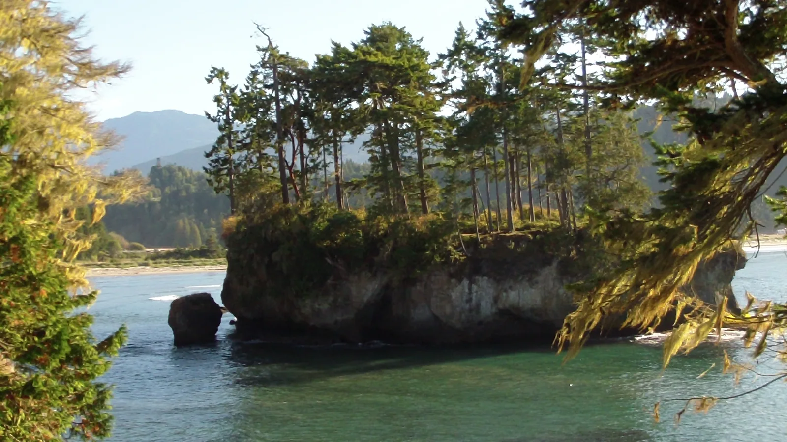
Clallam County runs this campground on the Strait of Juan de Fuca, about 15 miles west of Port Angeles. It holds 92 sites on the bluff above the water, the first 39 with utility hookups and the rest without, with tide pools below the bluff and the World War II Camp Hayden emplacements in the park. The campground is open all year. About half the sites are reservable online, booking opens January 1 for February 1 to October 31, and every site is first come from November 1 to January 31. Campers find the utility loop sites tight and close together, while the wooded loop reads more private and spacious.
Salt Creek’s ground is below its own bluff, the Crescent Bay tidepools and beach, with the Striped Peak Trail leaving from inside the recreation area. The day use ground holds a playground, sand volleyball and basketball courts, horseshoe pits, and a playing field. The tidepools sit inside the Tongue Point Marine Life Sanctuary, where county ordinance bars removing any marine life, and WDFW lists shellfish harvest on the park's beach as closed year round. The pairing is the shore below the camp, reached on the campground’s own paths.
Phones roam here: the campground sits close enough to Canada that devices pick up Canadian towers, while United States carrier service runs weak. Winter halves the restrooms and winterizes the faucets, and the site map is a patchwork of reservable and first come numbers under a three day advance rule and a six person site limit.
Dungeness Recreation Area
Quick facts. 66 sites with no utility hookups, plus eight hiker and biker sites; sites 1 to 24 are first come and sites 25 to 66 are reservable on the county calendar; open all year; county park facilities on the bluff. Nightly fee, on the county's published fee schedule, is $32 for county residents and $43 for non-residents. No site here carries hookups, and the dump station is $10 for campers not registered at the park and free for registered campers. The entrance gate locks at 10 p.m. from May to September and at 9 p.m. from October to April, and registered campers can walk in after the gate locks.
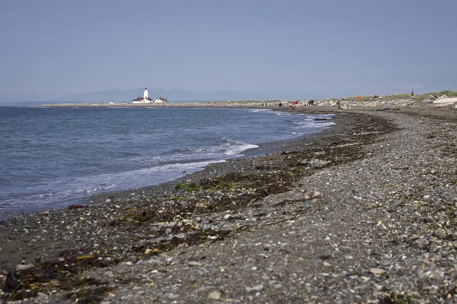
Clallam County also runs this campground on the bluff above the strait northwest of Sequim, at the trailhead for the Dungeness Spit. It holds 66 forested sites in two loops with no utility hookups, plus eight first come hiker and biker sites. Sites 1 to 24 are first come and sites 25 to 66 are reservable, on the same county calendar as Salt Creek, and the campground is open all year. The entrance gate locks at 10 p.m. from May to September and at 9 p.m. from October to April, and registered campers can walk in after the gate locks.
Campers consistently describe the restrooms and showers here as clean. A playground stands in the second loop. Campers report real cell service here, with T-Mobile strongest, AT&T good, and Verizon usable.
Dungeness Recreation Area stands at the trailhead for the Dungeness Spit, and the spit walk is the pairing, 11 miles round trip with 130 feet of gain to the New Dungeness Lighthouse and back. It is the simplest arrangement outside the park, since the campground is the trailhead and the walk is one out and back trip.
Pets split at the refuge boundary: leashed dogs belong to the county campground, and the refuge beyond it prohibits them. The refuge itself charges $3 a day or $12 for its annual pass, with children under 16 free, and its parking lot is mandatory, with a full lot meaning come back later. Winter halves the restrooms and winterizes the faucets here too. The hiker and biker sites, A to H, run at one person per site and $10 a night each.
DNR campgrounds around the park
A second public layer rings the park on state Department of Natural Resources land. Nine small DNR campgrounds sit in the state forests on the park’s west side and along the strait, all of them open year round, first come, first served, and free beyond a Discover Pass, with a stay limit of seven days in a thirty day period. They are primitive camps, vault toilets and picnic tables at most, and drinking water is the exception, with Lyre River the only one of the nine whose DNR page states potable water. Trailer ceilings run from 20 feet at Lyre River to 30 feet at the rest.
By corridor, the Hoh side holds Hoh Oxbow with 8 sites, Minnie Peterson with 9, and the primitive river camps at Cottonwood and South Fork Hoh, neither with a published site count. US 101 by the Sol Duc River holds Bear Creek with 16 sites. State Route 112 along the strait holds Lyre River with 11 sites and Sadie Creek with 6. The Clearwater drainage holds Coppermine Bottom on the river and Upper Clearwater with 6 sites inside the Clearwater Corridor natural area, and Yahoo Lake, a remote camp at 2,400 feet in Jefferson County with a 500 foot trail from its parking area to the water, sits beyond them, open at DNR’s last published check.
One closure governs the set right now. Upper Clearwater closed on June 1, 2026 for the remainder of 2026 under state budget cuts, and DNR has published no reopening date. Treat the other eight as the working set until DNR announces a change.
Family camping in the park
The family experience described here is only what my family has actually done.
Second Beach and Third Beach are the beaches I identify as best for families with little legs. The walk to Second Beach is 0.7 miles, descending 200 feet through forest to the sand. A preschooler can walk that distance at their own pace, with some carries.
The community record's conditions are what a family meets at Second Beach. The trailhead end crowds into a tent city on summer weekends. There is a single privy at the trail end, dogs appear despite the prohibition stated below, and some groups camp without canisters. Walk past the trailhead cluster to the far south end, where the same beach runs quiet, and carry water in; Second Beach is pack-in water in practice.
Kalaloch and Mora are the coast bases where a preschooler sleeps near the car, with flush toilets and potable water in their loops. A family travel guide lists fireside ranger programs at the Hoh, Mora, and Kalaloch campgrounds. Mora is busy in September and quiet in October.
The water is cold, and the surf is unsafe for small children to swim in. The park states that strong currents, cold water, and hidden rocks make swimming hazardous, and its Mora page states swimming is not recommended at Rialto Beach due to strong surf, rocks, and rip tides. Children can play in the sand and among drift logs and explore tidepools at low tide; check the tide chart first.
I have built lean-to shelters as forts with my daughter on the Washington Olympic coast.
The park prohibits pets on trails, meadows, beaches, and in undeveloped areas, including coastal trails and beaches. You may bring pets to drive-in campgrounds and paved or dirt roads; keep them on a leash no longer than six feet, never leave them unattended, and collect their waste. Pets are allowed on Kalaloch area beaches and on the half-mile stretch of Rialto Beach from the parking lot to Ellen Creek. Our dog does not come on our backpacking trips because animals are usually prohibited where we go.
For a first family trip on this coast, sleep at Mora or Kalaloch, walk Second Beach with the tide chart, and save the overnight on the sand for the far south end, past the trailhead cluster.
Seasons in the park
I camp in Washington from May through September, I do not winter camp, and I avoid rain where possible and camp in it when it comes. I camped in rain at Second Beach in August 2026.
Kalaloch and Mora run reservations from May 15 to September 20, 2026, and the Hoh runs from June 12 to September 6. Fairholme runs from May 15 to September 29, with the campground itself open April 25 to September 29, and Staircase requires reservations from July 8 through September 29. South Beach's season runs May 19 to October 10, 2026, and Deer Park runs from June to mid October, depending on snow melt.
September is still busy at popular coast campgrounds, including Mora. Campers report October is quiet, with a choice of sites and very quiet stays. Midweek beats weekend in every season the record mentions, and the Hoh entrance delay runs all summer, not just in July.
The coast and rainforest are wet in every month I camp. Campers use rain shelters and careful tent placement to handle the wet weather.
Winter here is researched, not camped. Heart O' the Hills is walk-in only during heavy snowfall; campers report that spigots are off and that the walk in may be through snow. Deer Park Road and the Hurricane Ridge Road close in snow during winter.
Fees and passes
All visitors to the park must have an entrance pass. A standard pass costs $30 for a private, non commercial vehicle, covers the vehicle and all its occupants, and is valid for seven consecutive days. Passes cost $15 to $30 depending on how you enter; the per-person pass applies to visitors 16 and older arriving on foot or by bicycle, and children under 16 enter free. The park does not accept cash.
The Olympic National Park Annual Pass costs $55, provides entry for one year from the month of purchase, and is available at park visitor centers and entrance stations. The park accepts America the Beautiful passes for entrance.
The Northwest Forest Pass covers Forest Service trailheads and day use sites and costs $30 annually or $5 a day. It covers national forest land around the park, but it is not a park pass and does not cover park entrance or the Quinault campgrounds' overnight fees.
The Discover Pass covers state parks on the peninsula, including Bogachiel, Dosewallips, Fort Worden, and Sequim Bay, and costs $45 annually or $10 for one day. It is not a federal pass. Overnight campers do not need a Discover Pass to park inside the park where they are staying, and Mora and the Hoh do not accept it. Fishing inside the park needs no Washington fishing license except from the ocean shore, where a state license is required. Salmon and steelhead need a free Washington catch record card, shellfish harvest from the park's ocean shore needs a state shellfish and seaweed license, and the park's fish and shellfish regulations booklet carries the seasons and limits for park waters.
My household holds both passes, a Discover Pass and a Northwest Forest Pass, and neither has ever shaped where we camped. I consider both passes standard equipment for an outdoor family here.
Showers, campfires, resupply, and emergencies
Showers
Showers are the gap in the park system. The twelve campgrounds the park itself runs list toilets and water among their facilities and no showers, so a camper based at any of them washes at a sink or travels for a shower. The exceptions stand outside that set, at the two concession resorts and the state and county grounds, whose entries carry their own facilities. Where a shower run matters, the nearest ones measure out at 6 miles south of Kalaloch at the Queets Trading Post or 28 miles north at Bogachiel, at Bogachiel 23 miles from the Hoh, and at Bogachiel 35 miles from Fairholme.
Campfires and firewood
Campfires belong in the campgrounds' fire rings and grates, and the fire rules start with the land manager. Inside the park, the park's own rules govern each campground, and when conditions turn dry the park can ban campfires outright, so the current restriction is a check before every trip on the park's alerts and conditions pages. The county layer sits outside that, and Clallam County's burn ban expressly does not reach the park's campgrounds, which is why the order matters, the manager's rule on the ground first and the county and state layers around it.
Wood follows the buy where you burn rule. Buy firewood within about 10 miles of the campground rather than hauling it in, because moved wood moves the insects and diseases that kill these forests. Inside the roster, wood is sold at the concession seats, at Kalaloch Mercantile, in the Hoh's B Loop near the host sites from May through September while it lasts, and at the Fairholme Store, Lake Crescent Lodge, and Log Cabin Resort along the lake. Where no wood is sold, the park allows collecting dead and down wood under 6 inches across, within 100 feet of the campground and below 3,500 feet.
Resupply
Resupply on this loop is thin, and two grounds carry the roster's real stores. Kalaloch Mercantile, at the campground, stocks groceries alongside beer, wine, ice, firewood, and propane, the roster's one sourced seat for propane and for ice. On Lake Crescent, the Fairholme Store at the campground carries groceries, ice, and boat rentals in summer. Beyond those two, food inside the park runs on the lodge pattern, with restaurants at the park's four lodges and the resorts' own store and deli at Sol Duc.
The Hoh is the isolation case. The rainforest has no food service, and its nearest gas is 31 miles away, so a Hoh trip fuels and provisions before the Upper Hoh Road. Kalaloch's ranger station stands 36 miles south of Forks, and Heart O' the Hills sits five miles from Port Angeles, the roster's easiest resupply run. For the rest of the loop, the working rule is the Highway 101 corridor towns, Forks and Port Angeles to the north and west and Aberdeen for the Quinault side, reached on the drive legs measured above.
Emergencies and alerts
Conditions on this peninsula change faster than any guide can print, so the check is part of the trip. Before leaving, read the park's alerts and conditions pages for closures, washouts, and fire restrictions, and use the status board at the top of this guide, which carries its own checked date, for the campgrounds' current state. On the road, the entrance queues and washouts the entries describe are those same facts arriving live, so build the check into the departure morning rather than the night before.
If someone is hurt, call 911 first, because dispatch decides where a patient goes. The peninsula's hospitals stand in five towns, and each ground's hospital town follows its catchment. Forks Community Hospital serves the west side grounds, the Hoh, Queets, Kalaloch, South Beach, Mora, Fairholme, and Bogachiel. Olympic Medical Center in Port Angeles serves Heart O' the Hills, Log Cabin, Salt Creek, and Dungeness, and Sequim has no hospital of its own. Harbor Regional Health Community Hospital in Aberdeen serves the Lake Quinault grounds, Mason General in Shelton serves Staircase, and Jefferson Healthcare in Port Townsend serves Dosewallips. Sol Duc sits between two catchments, so Forks and Port Angeles both stand as its hospital towns. These assignments were checked against the state's facility records on November 9, 2026, and the Washington Department of Health facility search is the locator for verifying any hospital before a trip.
Food storage, programs, and access
Food storage in the frontcountry runs wider than food. The park's current rule covers food, dirty dishes, garbage, and every scented item, stored in a vehicle trunk or an animal proof locker whenever they are not in use, against birds and rodents as much as bears. Keep a clean camp around the clock, because unattended dishes and trash are what teach wildlife to work a campground.
Summer ranger programs run at Heart O' the Hills, the Hoh, and Staircase in the park's own program season, and the visitor centers and campground boards carry the current schedules. The park's Junior Ranger booklet is available at any visitor center, and its Ocean Stewards program runs for ages four and up.
Access is a stated field at every park campground. Ten grounds and Log Cabin carry the park's accessible designation in full, Kalaloch's is qualified, North Fork and Queets are accessible at the toilet only, and South Beach is stated not accessible, with flush toilets that are not wheelchair accessible and no beach access trails. Outside the park's own set, Bogachiel holds one ADA accessible campsite with accessible restrooms and showers, Dosewallips lists accessible campsites and restrooms among its facilities, the two Quinault campgrounds each hold accessible camp and picnic sites with barrier free toilets, and the two county areas each hold two ADA accessible campsites, sites 39 and 71 at Salt Creek and sites 17 and 60 at Dungeness. Service animals stand on their own rule, in the park's words, dogs classified as service animals are individually trained to perform a specific task that assists a person with a disability, and service dogs are legally permitted anywhere that visitors can go, on a leash of 6 feet or less. The park's accessibility pages also cover hearing and vision access, with ASL interpreters and captions, assistive listening, audio description, and braille and tactile materials.
Two small systems close the set. Laundry exists at exactly one roster ground, Log Cabin Resort, and prints nowhere else because nowhere else is verified. Money runs cashless at the park entrance, first come sites self register at the campground, and the county pair takes cards only, Visa and Mastercard at Salt Creek, with no checks, cash, or coins.
Frequently asked questions
Which Olympic campgrounds take reservations and which are first come?
Five campgrounds accept reservations through Recreation.gov during the summer peak season: Kalaloch, the Hoh, Mora, Fairholme, and Staircase. They sell unreserved or cancelled sites in person, first come, first served. Seven take no reservations at any time of year: Deer Park, Graves Creek, Heart O' the Hills, North Fork, Ozette, Queets, and South Beach. The five also run first come outside their reservation seasons.
How far ahead do the reservable loops release?
Each campground releases sites by loop in three blocks: up to six months, two weeks, or four days in advance. Kalaloch runs A and B at six months, C and D at two weeks, and E and F at four days, and the Hoh runs A at six months, C at two weeks, and B at four days. No campground in the set has a single flat window, so a missed six month release leaves the two week and four day loops still to come.
When is the campground season?
The reservable campgrounds run their reservation windows between mid May and late September. Kalaloch and Mora run May 15 to September 20, 2026, the Hoh runs June 12 to September 6, Fairholme runs May 15 to September 29 with the campground itself open April 25 to September 29, and Staircase requires reservations from July 8 through September 29. Kalaloch, Mora, and the Hoh are open all year and run first come outside their reservation windows.
Which pass do I need?
Every visitor needs a park entrance pass, $30 for a private vehicle for seven days, or the Olympic National Park Annual Pass at $55, and the park accepts America the Beautiful passes and takes no cash. The Discover Pass covers the state parks in this guide, Bogachiel and Dosewallips among them, and the Northwest Forest Pass covers Forest Service trailheads and day use sites around the park.
Which campground is the best base for the wilderness coast?
Mora, for most parties. It sits two miles from Rialto Beach, the La Push trailheads for Second Beach and Third Beach are close above it, and those beaches are the start of the South Coast route. Ozette Campground is the base for the northern route, standing at the Ozette Triangle trailhead. Every beach night behind those bases runs on a wilderness permit, treated in the backpacking guide.
Which campground is the base for Enchanted Valley?
Graves Creek, which sits at the East Fork Quinault trailhead, 13 miles from the valley. Willaby and Falls Creek on Lake Quinault are lake level bases and are not the trailhead, a distinction that matters when the plan is a valley trip, since the valley itself is a quota area in season.
Can you drive through the park from one side to the other?
No road crosses the park. Highway 101 runs around it, and the drive legs in this guide are the loop around the edge, which is why Lake Quinault to Staircase measures 126 miles and 2 hours 45 minutes in the park’s own table despite the two bases looking close on the map. Trips here are built as out and back spurs off the loop, not crossings.
Which campground should a first Olympic trip choose?
The one that matches the trip’s center. Kalaloch for the ocean bluff, the Hoh for a night in the rainforest, and Fairholme for the Lake Crescent shore are the three marquee forms, and the shortlist at the top of this guide pairs each with its catch. A first trip usually picks one center and day trips from it rather than moving camp every night.
Is there cell service at the campgrounds?
Mostly no, so plan on being offline. Campers report no service on any carrier at Staircase, poor to absent service at Fairholme and at the Lake Quinault campgrounds, and spotty, site dependent service at Sol Duc, where AT&T is the most likely to register. Verizon is the carrier that works at Mora, Dungeness is the exception with real service and T-Mobile strongest, and Kalaloch is disputed, with reviews leaning poor on every carrier while the larger reporter samples rate Verizon and AT&T well.
How big an RV or trailer can the campgrounds take?
The park’s own campgrounds are built small. Most sites fit 21 feet, a few take rigs to 35 feet, and no park run campground takes anything longer. The concession run Sol Duc RV Park takes 36 feet, with water and electric only. Longer rigs base outside the park, where Log Cabin Resort holds the guide’s only full hookup sites, to 35 feet, and Bogachiel and Dosewallips take combinations to 40 feet.
Sources
National Park Service, Olympic National Park camping page, for the campground list, site counts, seasons, facilities, reservation forms, and general regulations. Camping page
Hiking Washington, Olympic National Park camping guide, and the Port Angeles visitor pages, for the published Seattle planning times. Hiking Washington Olympic camping guide
National Park Service, Olympic National Park Getting Around page, for the miles and times table and the mileage chart behind the drive legs. Getting Around page
National Park Service, Olympic National Park overnight reservations page, for the reservable set and the in person sale of unreserved or cancelled sites. Overnight reservations page
National Park Service, Olympic National Park alerts and conditions page and current road conditions page, for the Mora Road closure and reopening, road forms, the Hoh entrance warning, and corridor cautions. Alerts and conditions page Current road conditions page
National Park Service, Olympic National Park fees page, for the entrance pass forms and the annual pass. Fees page
National Park Service, Olympic National Park pets page and wildlife safety page, for the pet rules and the frontcountry food storage rule. Pets page Wildlife safety page
Recreation.gov, facility pages for the Mora, Hoh, Fairholme, and Staircase campgrounds and the Falls Creek Campground, for loop releases, facility notices, and campground details. Mora Campground Hoh Campground Fairholme Campground Staircase Campground Falls Creek Campground
Washington State Parks, Bogachiel and Dosewallips State Park pages, for those parks' campground forms and amenities. Bogachiel State Park Dosewallips State Park
US Forest Service, Olympic National Forest 2026 seasonal campground schedule release, for the Willaby and Falls Creek seasons and the forest's first come rule. Seasonal campground schedule
Clallam County Parks, Salt Creek Recreation Area and Dungeness Recreation Area pages and the county reservation policy, for those campgrounds' site counts, seasons, and reservation forms.
Elwha RV Park, Gilgal Oasis RV Park, Rainbow’s End RV Park, and Forks 101 RV Park operator pages, for the private gateway parks note in the RVs and trailers section. Elwha RV Park Gilgal Oasis RV Park Rainbow’s End RV Park Forks 101 RV Park
Community record for this guide, camper reports and review accounts as labeled in the text, principally Washington Trails Association trip reports for the wilderness coast and the Hoh corridor, The Dyrt and Campendium campground pages for the frontcountry roster, and family media accounts of Olympic camping, paraphrased and attributed by venue in the text and never presented as agency fact.
Washington State Department of Natural Resources, Olympic Peninsula Forests page, for the DNR campgrounds around the park, their site counts, stay limits, and the Upper Clearwater closure. Olympic Peninsula Forests page

Our mission is to provide users with high-quality, minimally biased camping and hiking-related content that fosters a love of nature. We want to cultivate a love of camping and hiking outdoors as essential to a great life. We aim to inspire, entertain, and inform you from our own outdoor experiences.
We assess each recommendation independently before suggesting it. We might receive a commission if you purchase through the links we provide. As an Amazon Associate, we earn from qualifying purchases. Learn more >
PO Box 46371
Seattle, WA 98146
USA
Phone: +1-206-737-3084
© Outdoor Footprints