Dispersed camping is the free, undeveloped end of camping in Washington. You drive a forest road, pull into a site that is already there, and camp with no water, no toilets, no trash service, and no fee for the stay itself, whether the camp is a ground tent, a trailer, or a tent run off the back of the vehicle, the form our SUV tents guide scores. It is sometimes called boondocking in the RV world and primitive camping in older guides. What the form buys, beyond the saved fee, is unstructured time, with no program, no amenities, and the quiet behind the sleep and stress benefits of being outside that the research measures. This guide covers the undeveloped end; the state’s developed campgrounds are gathered, region by region, in the Washington campgrounds by region guide.
The catch is that Washington has no single dispersed camping rule. Nearly every land manager in the state runs its own stay limit, in its own form. The form changes at boundaries a camper cannot always see from the driver’s seat.
The spread is wide. On the Olympic National Forest the limit is 21 days per calendar year in total, not 21 days at a time. Near Seattle the limit is 14 consecutive days in one place outside the developed campgrounds, and 28 days in a year in total. On unposted Washington DNR land the default is 10 days in any 30. On some state land there is no dispersed camping at all, only designated campgrounds, and inside the three national parks the whole product is a permit and a designated site.
Each agency’s stay limit is stated in that agency’s own terms in the rules section, and the road sections that follow it carry the limit for their ground.
In this guide
- Dispersed camping in Washington at a glance
- Passes and what they cover
- Stay limits and rules by land manager
- I-90 and the roads facing Seattle
- Olympic Peninsula forest roads
- Mountain Loop Highway and Beckler River Road
- Cle Elum valley and the east slope
- Baker River and the Mount Baker Highway
- Gifford Pinchot forest roads
- DNR designated campgrounds
- Green Dot country and east side wildlife areas
- BLM land in Washington
- Tucannon River and the Blue Mountains
- Fire restrictions and emergencies
- Frequently asked questions
- Sources
Dispersed camping in Washington at a glance
There is no Washington dispersed camping rule. There are at least seven different stay limit forms in use across the state’s public land, and each belongs to the agency that manages the land under your tires. The Forest Service alone runs four different forms across its six Washington forests. State land adds two more, and the Bureau of Land Management’s national form makes another. A camper who learns one forest’s rule and carries it into the next forest is working from the wrong rulebook.
The shared baseline is simpler. At a dispersed site in Washington, expect no potable water, no toilets, and no trash service unless an entry below says otherwise. No dispersed site in this guide takes a reservation. Every one is first come.
Expect no fee for the stay itself on Forest Service, DNR, BLM, and WDFW land. What you bring in, you pack out, including human waste where each road’s record calls for it. Everything past that baseline, the stay limit, the fire rule, the pass on the dashboard, is set by the agency that manages that land.
One correction matters more than any other in this guide. Roundups and older posts across the web describe the Olympic National Forest limit as 21 consecutive days. The forest’s own order says otherwise. The Olympic limit is 21 days per calendar year in total, across the whole forest, and the 14 consecutive day figure in the same order belongs to developed recreation sites. A camper planning a three week Olympic stay on the strength of the web’s version is planning a stay the order does not allow.
The author’s own dispersed camping in Washington is on Forest Service land off Interstate 90, west of Snoqualmie Pass. He drove a Toyota Tacoma to the end of an old logging road that was unmaintained and rough in certain spots, and camped where the road ended. He carried his own water and a shovel for sanitation. He found the spot the way most dispersed campers find theirs.
He studied a map for roads that looked like they went somewhere in the mountains, and he drove until he found a place to stop. One of those camps was in July 2014, at the end of a logging road along Interstate 90 outside Seattle. He has not done much of it since. A dispersed site is never guaranteed, and he prefers being at a campsite to hunting for one.
Two big systems sit outside this guide’s product entirely. Washington State Parks allow camping only in designated areas or under a ranger’s direction, so no state park land appears below as a dispersed option. The three national parks, Olympic, Mount Rainier, and North Cascades, run permit systems with designated camps, and their rules close the rules section below. Where a road crosses a park boundary, dispersed camping ends at the boundary, and two entries below carry that boundary on the ground.
Two named closures also shape the map before any road is chosen. Dispersed camping is closed along part of the Middle Fork Snoqualmie corridor, on Forest Roads 56 and 5640 west of the pass. At Lake Cushman on the Olympic Peninsula, dispersed camping is prohibited outright under a forest order that runs through April 30, 2027. Both closures get their full treatment in the sections that own them.
Passes and what they cover
One distinction governs every pass in this guide. A pass parks the vehicle. No pass permits a dispersed stay, and no pass pays for one. The stay itself is free on the land covered here, and it is governed by the stay limits in the next section. Passes decide what it costs to leave the vehicle at a trailhead, a day use site, or a state land access point along the way.
The Discover Pass is the state land pass. It costs $45 for an annual pass and $10 for a day pass, at prices checked in November 2026. Those prices took effect on October 1, 2025, and the older $30 and $35 figures still circulating in roundups are out of date.
The pass is required for vehicle access to Washington State Parks, DNR, and WDFW lands. One annual pass transfers between two vehicles, though only one vehicle at a time. It does nothing on national forest land or BLM land, and no federal pass substitutes for it on state land.
The Northwest Forest Pass is the national forest parking pass. It costs $5 for a day pass and $30 for an annual pass. It covers parking at developed trailheads and day use sites on national forest land, and the interagency annual and lifetime passes do the same job. The confusion between the two passes costs real money.
The community record includes a fine written at a national forest trailhead, where a driver displayed the state pass that does nothing there. In this guide the federal pass bites at trailheads standing beside dispersed roads, where a camper parks to hike during the day. The interagency passes also cover the day use fee at the BLM’s Yakima River Canyon sites, which the BLM section below takes up.
WDFW land carries one more instrument. A Vehicle Access Pass, which comes with a Washington hunting or fishing license, covers vehicle access to WDFW lands on its own. A camper without one uses the Discover Pass on the same land. Either pass parks the vehicle. Neither changes the WDFW stay limit, which is set by rule and by posted notice at each unit.
For a state land weekend the arithmetic is simple. A day pass costs $10 and an annual costs $45. Four day passes cost $40 and five cost $50, so the annual pass is the better buy from the fifth day on. Campers who mix state and federal land in one trip may carry both passes, and the dashboard is where the two systems meet.
Stay limits and rules by land manager
Every stay limit in this guide belongs to a land manager, and this section is organized the same way. Find the agency that manages the land, and its form is the form that governs. The subsections after it carry each system’s full rule set, including the distance rules, the fire rules, and the exceptions that a table cell cannot hold.
A second misunderstanding is nearly as common as the first. Many campers believe that moving a short distance restarts the stay clock. On most Washington systems it does not. The Okanogan-Wenatchee requires 30 days off the forest entirely.
The Olympic counts the whole calendar year. The Colville measures a location by a five mile radius. Each subsection below states its own system’s mechanics, because the mechanics are where the forms differ.
| Land manager | Stay limit | How the limit runs | Set by |
|---|---|---|---|
| Mt. Baker-Snoqualmie National Forest | 14 consecutive days at one location, 28 days total per calendar year, outside developed campgrounds | Both counts run across the whole forest | Forest order |
| Olympic National Forest | 21 days per calendar year in total | The year is the limit. Moving to a new site does not reset it | Forest order |
| Gifford Pinchot National Forest | 14 consecutive days in one spot, 28 days total per calendar year | Both counts run across the whole forest | Forest order |
| Okanogan-Wenatchee National Forest | 14 consecutive days, then off the forest, with no return before 30 days, and 28 days per calendar year | The 30 days away is part of the limit, not a suggestion | Forest order |
| Colville National Forest | 14 consecutive days in one location, with a location measured by a five mile radius, then off the forest, and 28 days per calendar year | Same joint order as the Okanogan-Wenatchee, under the Colville’s own order number | Forest order |
| Umatilla National Forest in Washington | 14 days in any 30 day period | A rolling window, not a consecutive count | Forest order |
| Washington DNR lands | The posted limit governs. Where no limit is posted, 10 days in any 30 day period | The unposted count runs across all department lands together, from the first night | State rule, WAC 332-52-300 |
| Bureau of Land Management lands | 14 days in any 28 day period | Then move, often 25 to 30 miles, before camping again in the area | National rule |
| Washington fish and wildlife lands | 21 days within a 30 day period, unless a posted notice at the unit allows otherwise | Posted unit rules vary the default in both directions | State rule, WAC 220-500-100 |
Forest Service dispersed camping basics
Dispersed camping is the Forest Service’s own term for camping outside a developed campground on national forest land. It carries no fee and no services. No permit is required for the stay itself, and no pass pays for it or permits it.
Campers use sites that already exist rather than cutting new ones. The forest’s motor vehicle use map governs which roads are open to vehicles, and how far a vehicle may pull off them. Posted closures and forest orders sit on top of the baseline wherever they apply.
Each Washington forest then sets its own stay limit by forest order, and the six forests do not agree. The four subsections after this one state each forest’s form in its own terms. Fire rules, food storage orders, and distance rules from water vary the same way. The forest named on the sign at the boundary is the authority for the land inside it.
Two habits protect the product everywhere it exists. Camp in sites that already exist, and leave no trace of the stay. Keep vehicles on the roads the motor vehicle use map designates. The distance a camp must sit from water is each forest’s own figure, and the forest subsections below state them from each forest’s own pages.
Mt. Baker-Snoqualmie National Forest
The stay limit is 14 consecutive days at the same location outside a developed campground, and 28 days in total per calendar year outside developed campgrounds. Those figures are the forest’s last published stay order. The forest’s alerts and notices page is the live check for the order currently in force, and it is worth reading before a long stay. The limit is the rule behind this forest’s roads in the guide, from Tinkham Road to the Mountain Loop Highway and the Baker River country.
Food storage runs forest wide. Food and refuse must be stored in a bear resistant manner, or kept attended, anywhere on this forest, under an order in force into April 2027. Campers use existing sites, at least 100 feet from water, and pack out trash. One closure overrides the baseline near Seattle. Dispersed camping is closed along the Middle Fork Snoqualmie corridor, Forest Roads 56 and 5640, even though the same roads carry heavy day use.
Olympic National Forest
The Olympic stay limit is the most misreported rule in Washington dispersed camping. The forest’s order allows 21 days of camping per calendar year in total. It is not 21 consecutive days, and it is not per site.
The order’s 14 consecutive day figure applies inside developed recreation sites, a different product. The current order runs from June 2026 into June 2028 with the same figures, so the annual cap is the figure to plan on. Every Olympic entry in this guide states the limit the same way.
That distinction is where the web’s error comes from. The order speaks to both camping products in one document. The consecutive day figure that belongs to the developed campgrounds has been read onto the dispersed land, and the wrong version is now the most repeated one on the web. The order is the authority, and it counts the year.
The road rules are the tightest in the state, a 150 foot corridor where the Colville and the Okanogan-Wenatchee allow 300 feet. On roads where the motor vehicle use map allows dispersed camping, vehicles stay within 150 feet of the road’s centerline. A vehicle parks within one vehicle length of the road’s edge. The forest’s dispersed camping guidance puts camps at least a quarter mile from developed sites and 200 feet from water, with campfires below 3,500 feet.
It names seven designated dispersed areas. Those figures come from published listings rather than the order itself, with the forest’s dispersed camping page as the live check. No forest wide food storage order stands on the Olympic. The canister rule campers meet at the trailhead belongs to Olympic National Park next door, not to the forest.
Gifford Pinchot National Forest
The stay limit is 14 consecutive days in one spot and 28 days in total per calendar year. The forest shares its stay order with the Colville, under a joint order in force to September 30, 2027. Where the motor vehicle use map displays the dispersed camping symbol, camping runs within 150 feet either side of the designated road. Sites sit at least 100 feet from water, on the figure other published listings give.
The forest’s roads run from the Packwood and Randle country to the flanks of Mount Adams and Mount St. Helens. No forest wide food storage order stands on this forest. The forest’s own dispersed camping listing names Chambers Lake, on Forest Road 2150, as a dispersed camping area with a pit toilet. The Gifford Pinchot forest roads section below works from there.
Okanogan-Wenatchee National Forest
This forest’s stay form is the most mechanical in the state. A camper may stay 14 consecutive days. The camper must then leave the forest, and may not return to camp before 30 days have passed. Total camping is capped at 28 days per calendar year.
The order behind the form runs to May 18, 2027. Moving to a new drainage inside the forest does not satisfy the rule. The break has to be off the forest entirely.
The form rewards planning. A camper who spends two weeks on this forest in July cannot legally camp on it again until the 30 days away have run. By then the year’s 28 day cap may already be half spent. Long stays here are a budget, spent once.
Food storage is forest wide here too. Since September 2024, food and attractants must be stored in a bear resistant manner anywhere on the forest. The French Cabin Creek entry below repeats the requirement, because bears are a named presence there. On roads the forest’s travel documents designate, camping uses existing routes within 300 feet of the road’s centerline, and not within 100 feet of water.
One named campground mixes the products. Long Meadow Campground, in the Naches district, is listed by the forest as developed and dispersed camping in one. Dispersed camping there runs to upwards of eight camps at the site, the two forms side by side.
Colville National Forest
The Colville runs the same joint stay order as the Okanogan-Wenatchee, under its own order number. Fourteen consecutive days in one location, then off the forest with no return before 30 days have passed, and 28 days per calendar year. A location here is measured by a five mile radius, the widest definition in the state.
The road corridor is also the widest in the state, matched only by the Okanogan-Wenatchee’s. Where the motor vehicle use map allows it, camping runs within 300 feet of a road’s centerline, and a vehicle may park up to 30 feet from the road’s edge. Seasonal road closures run from December 1 to March 31.
The forest’s named dispersed land is described from its own pages, with no road entry of its own in this guide. Sullivan Creek, east of Metaline Falls, carries the fullest facility set of the forest’s named dispersed lands. The forest improved the area in 2019.
Its campsites cluster at Moon Flats, John’s Creek, Conto Gulch, and the Gypsy Meadows horse camp, with fire rings, animal resistant food lockers, and toilets, and no day use fee. North Fork Chewelah Creek, on the Chewelah side, is a large open area with a vault toilet, a picnic table, and fire rings. It has no potable water, and camper listings describe it as first come.
Umatilla National Forest in Washington
Only the Washington land is in this guide’s scope. The forest’s Washington acres sit in Garfield, Asotin, Columbia, and Walla Walla counties, in the Pomeroy Ranger District. The stay limit there is 14 days in any 30 day period, under an order in force to May 26, 2028.
The form is a rolling window rather than a consecutive count. The Tucannon River entry below is this forest’s one Washington road in the guide. The district’s Washington land is Blue Mountains country, and the road entry carries its character.
Washington DNR lands
DNR sells two different camping products, and keeping them apart matters. The department runs about 80 designated campgrounds, covered in their own section below. True dispersed camping is a separate, smaller product, allowed only in named forests and prohibited in others.
A Discover Pass covers vehicle access to both. Neither product carries an added camping fee. The designated campgrounds run first come, first served.
The stay rule starts with the posted sign. Where a limit is posted, the posted limit governs. Where no limit is posted, the default under WAC 332-52-300 is 10 days in any 30 day period.
That count runs across all department lands together, not forest by forest. It starts on the first night, and the site must be vacated by 1:00 p.m. Posted limits vary by forest. Several forests post 7 days in 30, the Capitol State Forest campgrounds post 7 days in 365 per campground, and the Yacolt Burn posts 10 days in 365.
The conditions for dispersed camping on department land are strict. There is no dispersed camping at day use only sites, and no dispersed campfires. Camps sit at least 200 feet from water and 500 feet from developed facilities, on durable surfaces.
Everything packs out, and backcountry sites carry no toilets, tables, water, or fire pits. The forests where dispersed camping is allowed include the Olympic Peninsula state forests, Elbe Hills, Tahoma, the Ahtanum at BBQ Flats, Loomis, Loup Loup, and Little Pend Oreille. It is prohibited in the Capitol State Forest and the Teanaway Community Forest, where the designated campgrounds are the whole offer.
Bureau of Land Management lands
The BLM’s dispersed rule is a national form, and this guide prints it in that form. A camper may stay 14 days in any 28 day period. The camper must then move, often 25 to 30 miles, before camping again in the same area. The rule frames the use as short term recreation, not long term living.
Posted closures govern wherever they stand, and the BLM’s local office is the check for the land in question. Washington’s BLM entries below are mostly developed recreation sites, and they carry their own site rules where the BLM publishes them. The Yakima River Canyon campgrounds post a 7 day limit and Liberty posts 14 days, and those site rules are the ones that govern on their land.
Washington fish and wildlife lands
WDFW’s default stay limit, under WAC 220-500-100, is 21 days within a 30 day period, unless a posted notice at the unit allows otherwise. Residence camps are prohibited. Campfires may not exceed three feet across or three feet high unless a unit posts otherwise.
Pets stay leashed from April through July. Fireworks are prohibited on WDFW land year round. A Discover Pass or a Vehicle Access Pass covers the vehicle.
Posted unit rules vary the default in both directions, and the variation is the story on this land. Banks Lake and the Soda Springs unit post 14 days in 30. The Desert and Sun Lakes units keep the 21 day default. Sinlahekin allows camping only in its designated campgrounds.
The Duckabush unit allows no camping at all. Units with no figure of their own, including the Gloyd Seeps and Yakima River units, stand at the WAC default. The posted notice at the unit is the final word, and the unit entries in this guide print the posted figures where the department publishes them. One seasonal block overrides unit rules across the east side.
From June 15, and until further notice, eastern Washington WDFW land carries heightened restrictions. There are no fires, including in rings. Stoves are allowed, and no motor vehicles run off developed roads, as the department’s current notice states them.
Where dispersed camping is not allowed
Washington State Parks are the first exclusion. Under WAC 352-32-030(2), camping in a state park is allowed only in designated areas or under a park ranger’s direction. There is no dispersed product anywhere in the park system. The three national parks are the second. Olympic National Park requires a wilderness permit and designated camps.
Mount Rainier requires a wilderness permit and designated camps, and caps a stay at four consecutive nights in one camp. North Cascades allows backcountry camping by permit at designated sites only, with no dispersed camping anywhere in the complex. Its limits are 30 nights per calendar year across the complex, and 14 nights from July 1 to September 1. A road that crosses a park boundary loses its dispersed camping at the line. The practical effect shows up inside two entries below, where the dispersed land ends at a park boundary on the same road.
I-90 and the roads facing Seattle
Interstate 90 is the closest dispersed camping to Seattle, and it is also where the state’s rule patchwork starts. Two national forests meet at Snoqualmie Pass, with two different stay forms. The entries below run west to east, the way a Seattle camper drives them.
Tinkham Road and the South Fork Snoqualmie
Quick facts: sites, established pull-off sites with fire rings along Forest Road 55; stay limit, 14 consecutive days at one location and 28 days per calendar year outside developed campgrounds, the Mt. Baker-Snoqualmie form; potable water, none, with the South Fork Snoqualmie River beside the road, and all surface water needs treatment; restrooms, none; fires, in existing fire rings, under the forest’s restriction orders; vehicle pass, none for the stay; road, about five miles of heavily potholed gravel, muddy after rain and slow going for low clearance vehicles, with the longest vehicle on the listing record 28 feet; resupply, North Bend.
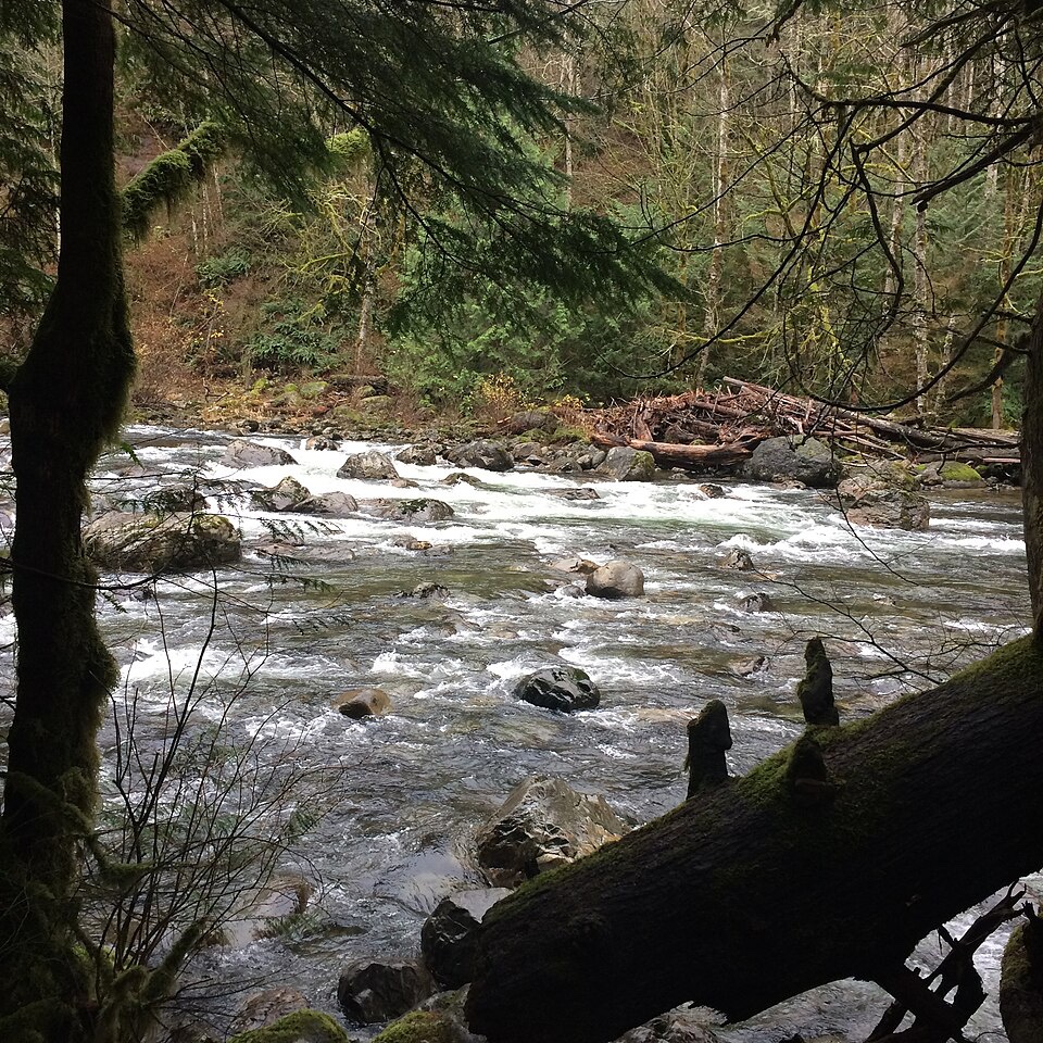
Tinkham Road leaves Interstate 90 at exit 42 and follows the South Fork Snoqualmie River for about five miles. The pull-off sites sit in second growth forest between the road and the river. It is the closest dispersed road to Seattle in this guide, and on summer weekends it behaves like it. The pull-offs nearest the exit fill first.
The listing record is consistent on what the extra miles buy. The farther sites up the road are cleaner and more private. The listing record’s site notes add that the potholes run the whole five miles rather than only the first stretch.
The same record splits the road by vehicle. Ordinary cars manage the first stretch going slow, and reviewers advise clearance and four wheel drive for the rougher miles beyond it. Interstate traffic noise reaches the sites, and reviewers report heavy mosquitoes in season. The record also carries repeated reports of long term occupants and stolen cars along the road, part of the road’s near end character.
The road’s sanitation record is its weak point. The firsthand record describes trash and human waste left by earlier campers at a level that needs stating rather than softening. There are no toilets and no trash service anywhere on the road. Pack out everything, including human waste, and carry a shovel at minimum. The author’s own practice in this country ran the same way, with his own water carried in and a shovel for sanitation.
The author’s dispersed camps in this country were at the end of an old logging road. No road was named for those camps, and this road is not assigned to them here. The developed Tinkham Campground stands near this road for campers who want a serviced site instead.
One limit closes the picture. Part of the Middle Fork Snoqualmie corridor, the next drainage north, is closed to dispersed camping under forest order, along Forest Roads 56 and 5640. Tinkham Road is the open dispersed road on the South Fork.
I-90 east of Snoqualmie Pass
Quick facts: sites, roadside sites on forest roads around the summit and the upper Yakima basin; stay limit, two forms meet at the pass, the Mt. Baker-Snoqualmie form to the west and the Okanogan-Wenatchee form to the east, 14 consecutive days, then off the forest for 30 days, and 28 days per calendar year; potable water, none at dispersed sites; restrooms, none at dispersed sites; fires, under each forest’s restriction orders, and east side restrictions commonly begin earlier in dry years; road, forest roads off the interstate exits east of the pass; resupply, Snoqualmie Pass and Cle Elum.
The summit is a rules boundary as much as a weather one. West of the crest the Mt. Baker-Snoqualmie form governs. East of it the Okanogan-Wenatchee form takes over, with its 30 days away built into the limit. Fire restrictions split at the same line, and the east side’s commonly begin earlier in a dry year. A camper crossing the pass with a stay half spent should count the days under the form of the land the tent is on.
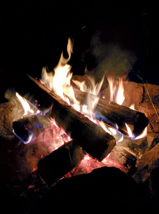
The Gold Creek corridor, just east of the summit, is trailhead and picnic area country, and it is not a named dispersed road in this guide. Dispersed use around Keechelus Lake and Kachess Lake runs at the general forest form, on forest roads above the reservoirs. The listing record for the Kachess side describes flat logging road sites with fire pits above the lake, up a climb reviewers call rough in anything but a pickup. Those roads close in winter, when the unplowed surface becomes a snowmobile route, and reviewers report heavy mosquitoes and scattered trash in season.
The serviced fallbacks are Denny Creek Campground and Tinkham Campground to the west, and Kachess Campground and Wish Poosh Campground to the east. The named dispersed substance on the east side is the Cle Elum valley, which has its own section below.
Greenwater and Forest Road 70
Quick facts: sites, established sites with fire rings along Forest Road 70 and the Pyramid Creek Road; stay limit, 14 consecutive days at one location and 28 days per calendar year outside developed campgrounds, the Mt. Baker-Snoqualmie form; potable water, none, with Pyramid Creek and the Greenwater River beside the roads, and all surface water needs treatment; restrooms, none; fires, in existing fire rings, under the forest’s restriction orders; vehicle pass, none for the stay, with a Northwest Forest Pass for parking at the Greenwater Lakes trailhead; road, Forest Road 70 east of Greenwater, with sites in the first miles and along Pyramid Creek; resupply, Greenwater for basics and Enumclaw for full service; cell service, no coverage on Verizon, AT&T, or T-Mobile at the Lost Creek listing, by that listing’s report.
Forest Road 70 climbs east out of Greenwater on the White River side of the crest, and its established sites are the dispersed country for the whole Enumclaw facing slope. The sites sit in big timber along the road and along Pyramid Creek, many with fire rings already built. The sites are free and first come, and the listing record for the road’s Lost Creek end describes easy access and a quiet character away from the highway.
The road fills quickly in summer. Its cleanliness varies with the campers before you, and the trash facilities on the road are reported overflowing in season. Pack out everything you bring.
The road doubles as a hiking base. The Greenwater Lakes trailhead stands a short hike from the lower sites, and the pass on the dashboard there is for the trailhead parking, not for the camping. Greenwater itself is a wide spot with basics. Enumclaw, down the highway, is the full service town.
A second set of pull-offs climbs Huckleberry Creek on Forest Road 73, on camper listings. Summer carries one soundscape note. A shooting range operates in the Greenwater country, and its noise is part of the record for light sleepers. The listing record for the Greenwater forest roads describes potholes deep enough to turn small sedans back, and stretches where reviewers advise all wheel drive. Its pull-offs scatter along the gravel close to the river, and reviewers report trash and shot up trees at some sites.
Olympic Peninsula forest roads
The Olympic National Forest wraps the national park on every side, and its dispersed camping runs on the forest roads that radiate from the peninsula’s towns. One rule governs the whole section. The stay limit is 21 days per calendar year in total, the annual cap stated in the rules section above, and it binds every entry that follows.
Forest Road 29 and Forest Road 2918
Quick facts: sites, a large field area and established sites along Forest Road 29, with river sites along Forest Road 2918; stay limit, 21 days per calendar year in total, the Olympic form; potable water, none, with the Calawah and Sitkum rivers along Forest Road 29 and the Sol Duc River along Forest Road 2918, and all surface water needs treatment; restrooms, none; fires, in existing fire rings, under the forest’s restriction orders; vehicle pass, none for the stay; road, Forest Road 29 is paved at its lower end and gravel beyond, with big rigs working the lower miles, by camper listings; resupply, Forks, with Joyce and Port Angeles serving the Forest Road 2918 side.
Forest Road 29 heads east out of Forks, following the Calawah and Sitkum rivers into the rainforest fringe. Its camping centers on a large field area a short way up the road, with established sites scattered along the lower miles. The listing record treats it as one of the most RV friendly dispersed roads in the state. A 37 foot fifth wheel stayed there in late September and had the field nearly to itself.
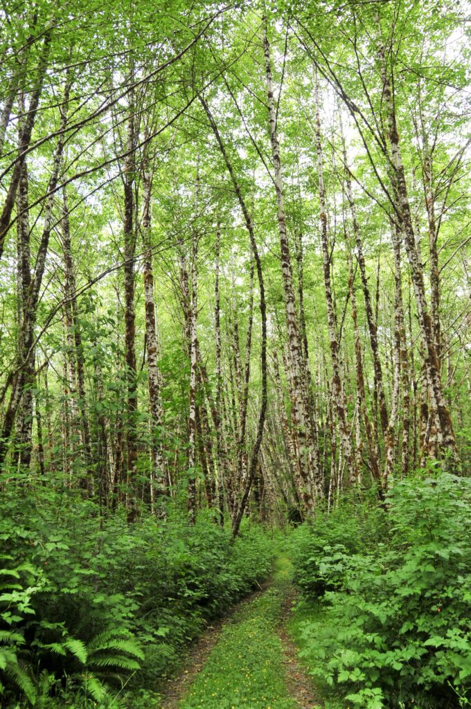
The listing record adds the road’s texture. Logging trucks work the road on weekdays. The field’s openness takes sun for solar panels and a clear sky for satellite internet where the timbered sites around it do not. Reviewers also report late season company on the road’s upper arms, with motocross riders, mudders, and shooting parties using the country in September.
The annual cap shapes how this road gets used. Twenty one days is the whole year’s allowance on this forest, not a per visit figure. A camper who spends a late season stay here, in the solitude the listing record describes for that season, has spent the year’s Olympic dispersed camping. That arithmetic is the entry’s real limit, and it is the one the web’s roundups get wrong.
Forest Road 2918 climbs the Sol Duc drainage on the peninsula’s north side, and its sites sit along the river. The road’s first miles run inside Olympic National Park, where there is no camping of this kind at all. The dispersed sites begin where national forest land begins.
The upper road is rougher than Forest Road 29, and the listing record treats it as high clearance country. The freecampsites record describes a paved and gravel road where the sites begin a little way up, mostly tent campers and a few vans among them. Trailer friendly sites are few, one big rig capable site stands out, and the turnaround is easy. Neither road offers water or toilets. Everything packs out.
Hood Canal and the east Olympics
Quick facts: sites, pullouts along the Hamma Hamma River road, and the former Elkhorn and Dosewallips campgrounds beyond the Dosewallips Road washouts, reached on foot or by bike; stay limit, 21 days per calendar year in total, the Olympic form; potable water, none; restrooms, none; fires, under the forest’s restriction orders; vehicle pass, none for the stay; road, Forest Road 25 up the Hamma Hamma is gravel, and the Dosewallips Road ends at washouts about six and a half miles below the former campgrounds; resupply, Hoodsport, Brinnon, and Quilcene.
The Hamma Hamma River road, Forest Road 25, carries pullouts past Lena Creek Campground into the canal’s quietest corner. The sites are small. They suit vans and tents better than trailers.
The forest’s road rule applies here as everywhere on the Olympic. Camping runs within 150 feet of the road’s centerline where the motor vehicle use map allows it. The listing record describes a handful of small spots strung along the creek, extremely quiet in the reviewers’ telling, with mosquitoes heavy by September.
The Dosewallips Road ends at washouts, from a 2002 slide and a 2016 washout, and vehicle access goes no farther. Beyond the washouts, the former Elkhorn and Dosewallips campgrounds serve as dispersed sites for campers who hike or ride in the six and a half miles. The form is walk in camping on a campground’s bones, and it is described here as the record that names it describes it. The six and a half miles in are the price of this camping form, a campground’s bones with nobody driving in.
Two more names rest on a firsthand roundup and nothing more. Quinault Ridge Road, Forest Road 2419 near Lake Cushman, and Forest Road 2312, on the east side of Wynoochee Lake, are named there as productive dispersed roads. No agency page settled either, and no more is claimed for them here.
The Lake Cushman road
Quick facts: sites, none, dispersed camping is prohibited on this road; stay limit, prohibited under Forest Order 06-09-23-01 through April 30, 2027; road, Forest Road 24, the Lake Cushman road, and Forest Road 2451, to the Olympic National Park boundary; resupply, Hoodsport.
Lake Cushman is the road where dispersed camping does not exist, and it earns its entry because roundups keep sending campers here. Forest Order 06-09-23-01 prohibits dispersed camping along Forest Road 24 and Forest Road 2451 as far as the national park boundary, and the order runs through April 30, 2027. Across that boundary, the park’s wilderness permit system governs, so the road offers no legal dispersed option on either side of the boundary. Big Creek Campground is the developed form on the road. The order, not the roundups, is the current word.
Mountain Loop Highway and Beckler River Road
Mountain Loop Highway
Quick facts: sites, pullout clusters along the gravel middle section and along the Sauk River; stay limit, 14 consecutive days at one location and 28 days per calendar year outside developed campgrounds, the Mt. Baker-Snoqualmie form; potable water, none, with the South Fork Stillaguamish and Sauk rivers beside the road, and all surface water needs treatment; restrooms, none; fires, in existing fire rings at many pullouts, under the forest’s restriction orders; vehicle pass, none for the stay; road, paved from Granite Falls to Barlow Pass, then about 14 miles of single lane gravel, then paved to Darrington, and the gravel section closes seasonally in winter; rigs, most pullouts are small, and trailers and RVs are not recommended on the gravel section; resupply, Granite Falls and Darrington; cell service, none on the gravel middle section.
The Mountain Loop Highway links Granite Falls and Darrington around some of the most storied hiking country in the Cascades. Its dispersed camping, on the community record, is dozens of unmarked pullouts along the gravel middle section and the Sauk River. The riverside spots are the prize. The road’s pattern is that they fill by Friday afternoon in summer, and the campers who arrive Thursday hold them. The pullouts ask little of a vehicle on the paved ends and more on the gravel, where the road narrows to a single lane in places.
The listing record sharpens the pattern. The better sites sit past the end of the pavement, where driveway style pull-ins carry their own fire rings above the river. One current listing describes site after site along the gravel past Barlow Pass, varying widely in size and pleasantness. Reviewers also report car break-ins along the highway, and heavy trash near the paved stretch.
The Verlot Public Service Center, on the highway east of Granite Falls, is the highway’s information point, and the forest’s road page carries the gravel section’s winter state. The loop’s two towns split the supplies. Granite Falls serves the west end and Darrington the east, and the gravel middle has nothing to sell you.
The highway’s campgrounds are covered in the Mountain Loop Highway camping guide. This entry carries the dispersed layer only. The stay form is the forest’s, the water is the two rivers treated before drinking, and everything packs out.
Beckler River Road
Quick facts: stay limit, 14 consecutive days at one location and 28 days per calendar year outside developed campgrounds, the Mt. Baker-Snoqualmie form; road, Forest Road 65, past Beckler River Campground toward Jack Pass.
Beckler River Road runs up the Beckler River from the Skykomish valley, past the developed campground of the same name toward Jack Pass. Its dispersed camping, sites, sanitation record, and road facts are stated in full in the Skykomish River camping guide. This entry states the stay form, which is the forest’s standard form above, and points there for the road’s record.
Cle Elum valley and the east slope
Cle Elum valley forest roads
Quick facts: sites, roadside sites along the Salmon La Sac Road and the North Fork Teanaway Road; stay limit, 14 consecutive days, then off the forest with no return before 30 days, and 28 days per calendar year, the Okanogan-Wenatchee form; potable water, none; restrooms, none at dispersed sites; fires, under the forest’s restriction orders, and east crest restrictions commonly begin early in dry years; food storage, bear resistant storage is required forest wide; vehicle pass, none for the stay; road, the Salmon La Sac Road runs paved, then gravel past the developed campground, and the spur roads roughen quickly into high clearance country; resupply, Cle Elum, Roslyn, and Ronald.
The Salmon La Sac Road runs north from Roslyn and Ronald, past Salmon La Sac Campground and into the upper Cle Elum River country. The developed campground holds 69 sites, about 40 of them reservable, and it is the road’s serviced anchor. Dispersed sites run along the road and its spurs, beside and beyond the developed land.
The road is the valley’s busiest, and its spur network is where the quiet sites are. Roslyn and Ronald are small towns with small services. Cle Elum, down the valley, is the full stop, and campers stock there before turning up either road.
The Teanaway splits at a forest boundary, and the split decides the product. Below the boundary, the Teanaway Community Forest allows camping only at its designated campgrounds, which the Teanaway guide covers in full. Above it, national forest land along the North Fork Teanaway Road opens to dispersed camping under the Okanogan-Wenatchee form. The same river road crosses from one camping product to the other. A camper who does not know which side of the line the tent is on does not know the rule that governs the night.
One named area carries the valley’s fullest dispersed record, and it stands on the Cle Elum River itself.
French Cabin Creek Recreation Area
Quick facts: sites, dispersed sites along Howson Creek, the Little Salmon La Sac River, and the back side of Lake Cle Elum; stay limit, 14 consecutive days, then off the forest with no return before 30 days, and 28 days per calendar year, the Okanogan-Wenatchee form; season, typically late April to early November; potable water, none; restrooms, none; nightly fee, none; fires, under the forest’s restriction orders; food storage, bear resistant storage is required forest wide, and bears are commonly seen in this area; vehicle pass, none to camp, with a Northwest Forest Pass for trailhead parking nearby; road, Forest Road 4308; resupply, Cle Elum and Roslyn; cell service, essentially none.
French Cabin Creek Recreation Area is the Cle Elum valley’s named dispersed camping area. It is a Forest Service dispersed camping area on the west bank of the Cle Elum River north of Cle Elum Lake, reached by Forest Road 4308 at 2,260 feet. The forest’s own page for the area is the governing source, and it is unusually plain about what the area is.
No fees are required. No facilities are available. Campers pack out all trash and dispose of waste responsibly, and potable water is not available.
The season typically runs from late April to early November. The stay limit is the forest’s general form, because the area’s page states none of its own. Fourteen consecutive days, then off the Okanogan-Wenatchee National Forest entirely, with no return to camp before 30 days have passed, and 28 days of camping per calendar year in total. No pass is required to camp here. A Northwest Forest Pass covers trailhead parking nearby, and the two products should not be confused, because the pass is for the parking, not the camping.
Bears are commonly seen in this area, and the forest calls for food storage. The forest wide order behind that call requires food and attractants to be stored in a bear resistant manner anywhere on the Okanogan-Wenatchee. Cell service at the area is essentially none. Cle Elum and Roslyn are the resupply towns, for fuel, food, and ice before the drive up Forest Road 4308.
Little Naches and Forest Road 19
Quick facts: sites, dispersed sites along Forest Road 19 and its spur roads; stay limit, 14 consecutive days, then off the forest with no return before 30 days, and 28 days per calendar year, the Okanogan-Wenatchee form; potable water, none, with the Little Naches River beside the road, and all surface water needs treatment; restrooms, none at dispersed sites; fires, under the forest’s restriction orders; food storage, bear resistant storage is required forest wide; vehicle pass, none for the stay; road, Forest Road 19 runs paved, then gravel, and camper listings describe the spur roads as high clearance country; resupply, Naches and Cliffdale, with Yakima for full service.
Forest Road 19 climbs the Little Naches River from State Route 410 near Cliffdale, on the forest’s Naches side. The listing record adds the road’s weekly rhythm, busy with riders on summer weekends and quiet at midweek, when reviewers find very little traffic. One named listing spot, Lost Meadow, stands in the freecampsites record as a first come dispersed spot with no services reported, and nothing more is claimed for it here. Its dispersed sites line the river road and the spurs that climb out of the canyon. This is an OHV and motorcycle road at heart.
Crow Creek is its named riding country, and engine noise is part of the summer record here in a way it is not on the guide’s quieter roads. Campers who want silence should weigh that before choosing it. Its sites also serve the trailheads that branch off the road, so the road works as a base for the district’s hiking as well as its riding.
The food storage order applies with full force. Bears work this drainage, and food and attractants must be stored in a bear resistant manner anywhere on the forest. Kaner Flat Campground and Little Naches Campground stand on the road as the serviced fallbacks. Naches is the supply town, and Yakima carries everything else.
Tieton River and Rimrock Lake
Quick facts: sites, dispersed sites around the Rimrock Lake recreation area, with 6 to 15 sites on the South Fork Tieton arm by camper listings; stay limit, 14 consecutive days, then off the forest with no return before 30 days, and 28 days per calendar year, the Okanogan-Wenatchee form; potable water, none; restrooms, none at dispersed sites; fires, under the forest’s restriction orders; food storage, bear resistant storage is required forest wide; vehicle pass, none for the stay; road, US 12 serves the lake shore, and a dirt road runs 1 to 2 miles from pavement on the South Fork arm by the same listings, which give a 45 foot maximum RV length; resupply, Naches and Yakima.
Rimrock Lake spreads along US 12 west of Naches, and its recreation area carries the Tieton River’s dispersed camping as its published listings describe it. The lake shore sites serve the boating and fishing traffic the highway brings. The road’s camping culture in that record is RV and family based, a basecamp pattern rather than a solitude pattern.
The South Fork Tieton arm leaves the pavement south of the lake. Its figures come from camper listings, a small set of sites a mile or two up a dirt road, and they are given as listing figures rather than the forest’s. Willows Campground, on the Tieton River below the lake, is the developed fallback. The forest wide food storage order and the stay form govern both arms, whichever side of the lake the tent lands on.
The listing record for the South Fork arm adds texture the figures do not carry. Its first spots in are well used and torn up, and reviewers advise driving farther down for better ground. The turnoff dirt runs soft, and reviewers report stuck vehicles in it. Highway 12 sits across the river, and its traffic noise reaches the sites.
Baker River and the Mount Baker Highway
Baker Lake Road
Quick facts: sites, pull-offs along Forest Road 11 above and beside Baker Lake; stay limit, 14 consecutive days at one location and 28 days per calendar year outside developed campgrounds, the Mt. Baker-Snoqualmie form; potable water, none; restrooms, none at the pull-offs, by camper listings; fires, in existing fire rings at a number of pull-offs, under the forest’s restriction orders; vehicle pass, none for the stay; road, gravel, passable to ordinary vehicles by camper listings; resupply, Concrete.
Baker Lake Road, Forest Road 11, runs the lake’s east shore north from the Baker River Road. Pull-offs scatter along its length, many of them directly above or beside the water. The listing record gives the road its one crowding data point. Reviewers report finding open sites without much trouble even on Labor Day weekend. At the road’s end, the listing record describes sites along the lake in campground style closeness, filled by early evening on busy weekends.
Dust from passing traffic is the standing complaint, and trash at some spots argues for scouting a pull-off before settling into it. The same listing record warns that mosquitoes run heavy in summer, that July evenings carry noise across the water from the lake’s traffic, and that September quiets the road down. Shannon Creek Campground and the tent camping up the road are the serviced fallbacks. Reviewers reported a mice problem at the road’s end sites across one September. A second listing covers the dirt road toward the Anderson and Watson Lakes trailhead, where stone ring sites string along the miles with views over the lake and the dam.
State Route 542 and the Nooksack River
Quick facts: sites, pullouts and primitive sites along the North Fork Nooksack River; stay limit, 14 consecutive days at one location and 28 days per calendar year outside developed campgrounds, the Mt. Baker-Snoqualmie form; potable water, none; restrooms, none at dispersed sites; vehicle pass, none for the stay, with a Northwest Forest Pass or an interagency pass for parking at Heather Meadows and Artist Point; road, State Route 542 east of Glacier, with Forest Road 33 serving dispersed sites on the Maple Falls side; resupply, Glacier, with Bellingham for full service.
The Mount Baker Highway climbs the North Fork Nooksack from Maple Falls through Glacier to Heather Meadows and Artist Point. Its dispersed layer is the pullouts and primitive sites along the river, one listing among them describing camping on the riverbed itself. A dispersed listing on Forest Road 33 covers the Maple Falls side. The river is the highway’s companion the whole way up, and the pullouts sit between the road and the water.
The distinction from the passes section applies at the highway’s top. Parking at Heather Meadows and Artist Point is a pass product. The camping along the river below is not.
Gifford Pinchot forest roads
The Gifford Pinchot is a big, spread out forest, and its dispersed country is the least itemized in the state. Its roads below are the named ones. The Packwood and Trout Lake country is described from the forest’s own listings. The Cougar and Mount St. Helens country rests on the community record.
Packwood, Randle, and Trout Lake
Quick facts: sites, roadside sites along Forest Roads 21, 23, and 25, with a named dispersed camping area at Chambers Lake on Forest Road 2150; stay limit, 14 consecutive days in one spot and 28 days per calendar year, the Gifford Pinchot form; potable water, none; restrooms, a pit toilet at Chambers Lake, and none elsewhere; fires, under the forest’s restriction orders; vehicle pass, none for the stay; road, Forest Road 25 is the paved through route from Randle south to Forest Road 90 at Swift Reservoir, and its gates close seasonally in winter, with the forest’s roads and alerts pages as the live check; resupply, Packwood, Randle, and Trout Lake.
The north side roads run out of Packwood and Randle. Forest Road 21 and Forest Road 2150 carry the dispersed sites. Chambers Lake, on Forest Road 2150, is the one the forest’s own dispersed camping listing names, with a pit toilet where most dispersed land has none.
The listing record adds one named site beyond Iron Creek Campground, reached by a short steep dip that reviewers warn small cars and trailers off. Its stone fire rings and roomy tent sites sit beside a creek, and fall reviewers found it alone and undisturbed. Reviewers describe the paved road south of Randle as rough, pull off room for a bumper pull trailer as scarce, and cell service as ending inside the forest.
The Trout Lake roads run south of Mount Adams on Forest Road 23. On both sides, camping runs within 150 feet either side of designated roads where the motor vehicle use map displays the symbol. The stay form is the forest’s joint form, 14 days in one spot and 28 in the year.
Cougar and Mount St. Helens
Quick facts: sites, dispersed sites along Forest Roads 90, 9038, 83, and 81, on the community record; stay limit, 14 consecutive days in one spot and 28 days per calendar year, the Gifford Pinchot form; potable water, none; restrooms, none; fires, under the forest’s restriction orders; vehicle pass, none for the stay; road, Canyon Creek’s practical ceiling is about 22 feet, on the community record; resupply, Cougar.
The Cougar roads stand on the community record, cross checked between two independent roundups. Forest Road 90 and Forest Road 9038 carry dispersed sites near Cougar and the Lower Lewis River Falls. On the Mount St. Helens side, Forest Road 83 and Forest Road 81 carry the same pattern. The Gifford Pinchot stay form and fire rules govern all of it. Only the forest’s own listing would put these roads on the agency record, and until that exists they print as the community’s roads.
DNR designated campgrounds
This section exists because DNR runs two camping products and one of them is not dispersed camping. In the Capitol State Forest, dispersed camping is prohibited outright, and the designated campgrounds are the entire offer. In the Ahtanum, the two products stand side by side.
Capitol State Forest campgrounds
Quick facts: sites, designated campgrounds only, Margaret McKenny, Middle Waddell, Fall Creek, and Porter Creek; stay limit, 7 days total within 365 days per campground; booking, first come, first served, with registration on arrival; season, May 1 to November 30, and the campgrounds close from November 30 to April 30; nightly fee, no added camping cost with a valid Discover Pass; vehicle pass, Discover Pass; resupply, Olympia.
The Capitol State Forest is the clearest form statement in this guide. There is no dispersed camping in this forest. The four designated campgrounds are the whole camping product, and they are carried here so that nobody goes looking for a dispersed offer that does not exist. The forest is Olympia’s backyard, and its campgrounds carry the capital’s weekend traffic.
Fall Creek is the small end of the set at 8 sites. Porter Creek holds 16. Margaret McKenny and Middle Waddell are the large campgrounds, and this guide prints no count for either, because the department’s own surfaces do not agree on one. The listing record adds the campgrounds’ shared texture, creekside settings, sharp turns that test big rigs, and daytime noise from a shooting range nearby. Middle Waddell’s listing record describes an off road vehicle campground’s character, dust and machines, with the creek reached from its loops.
One dated closure governs the current season. Margaret McKenny and Middle Waddell are closed through summer 2026 for hazard tree work tied to laminated root rot. The department’s Capitol State Forest page is the live check for their state in the 2027 season. The mechanics elsewhere are simple. Sites are first come, campers register on arrival, and the Discover Pass that covers vehicle access carries no added camping cost.
Tahuya and Green Mountain
Quick facts: sites, designated campgrounds and horse camps, including Tahuya River Horse Camp, Green Mountain Horse Camp, Camp Spilman, and Kammenga Canyon; stay limit, the posted limits under the DNR rule, with the unposted default of 10 days in any 30 day period across department lands; vehicle pass, Discover Pass; road, Camp Spilman takes RVs to 30 feet; resupply, Belfair.
The Tahuya State Forest is an ORV and equestrian forest on the Kitsap Peninsula, and its camping product matches its use. The offer is horse camps and designated sites, not dispersed land. Drive in access at Tahuya River Horse Camp and Green Mountain Horse Camp runs on weekends only, from Memorial Day to Labor Day, and only when hosts are present.
Camp Spilman is the year round campground. The forest rides busy on summer weekends, and its camps fill with the riding traffic. Its trails are the draw, and the campgrounds serve the riders who come for them, horse and machine alike. The listing record matches that character, describing heavy ATV use and a high noise level at Camp Spilman, with a creek running along the campground.
Ahtanum State Forest
Quick facts: sites, designated campgrounds at Ahtanum Campground, Tree Phones, and Clover Flats, with true dispersed camping at BBQ Flats; stay limit, 10 days in any 30 day period across department lands where no limit is posted, the DNR default; potable water, none, with a broken water line noted at Ahtanum Campground on the department’s current page; fires, campfires are allowed at Ahtanum Campground on the department’s current page, under the fire rules in force; vehicle pass, Discover Pass; road, Ahtanum Campground takes trailers to 32 feet, up the North Fork Ahtanum Creek past Ahtanum Meadows; resupply, Yakima.
The Ahtanum State Forest, west of Yakima, is where DNR’s two products stand side by side, and the entry labels them separately. The forest’s creeks are its map. Ahtanum Creek and its North Fork organize the campgrounds, and the roads follow the water.
The designated campgrounds are Ahtanum Campground, Tree Phones, and Clover Flats. The true dispersed camping is at BBQ Flats, under the statewide dispersed conditions from the rules section. The stay default is the department’s, 10 days in any 30 where nothing is posted.
Ahtanum Campground stands in its normal seasonal form on the department’s current page. Campfires are allowed. There is no potable water, and the page notes a broken water line, so campers carry water in. Vehicle access into the forest’s upper country closes from December 8 to May 1. Yakima is the supply base for the whole forest.
Green Dot country and east side wildlife areas
L.T. Murray, Wenas, and Colockum
Quick facts: sites, dispersed pull-offs along Green Dot roads, with a designated campground at Wenas; stay limit, two defaults meet here, 21 days within a 30 day period on WDFW parcels and 10 days in any 30 on DNR parcels, and the parcel under the tent decides; potable water, none; restrooms, none; fires, campfires are prohibited from April 15 to October 15 on the L.T. Murray, and where fires are allowed, down wood under 12 inches in diameter may be gathered for use at the site; vehicle pass, Discover Pass or Vehicle Access Pass; road, motor vehicles stay on Green Dot roads, which run rocky and single lane in places, with most used pull-offs 2 to 3 miles in by camper listings, and many roads gated from December 1 to May 1 on the same listings; resupply, Ellensburg, Selah, and Yakima.
The Green Dot system is a road system before it is a place. Across the L.T. Murray Wildlife Area, the Wenas country, and the Colockum, the roads signed with green dots are the open roads, and motor vehicles stay on them. This is sagebrush and bunchgrass country, open in a way the west side forests are not, and the wind is part of camping here.
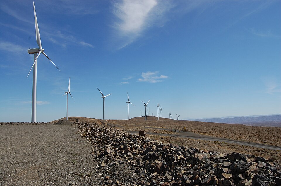
Camping is a road activity here. On the L.T. Murray, vehicle camping is prohibited beyond 100 feet of an open road, and no permanent camps are allowed. The parking flats are gravel, Joe Watt Canyon’s among them, and there are no restrooms.
At Joe Watt Canyon, reviewers describe a gate that looks locked and is not, it unhinges on a chain, above a rocky road where four wheel drive is strongly advised. The sites there are grassy and mostly sloped, with little shade, ants rather than mosquitoes, and quiet nights above the valley. Robinson Canyon’s listing record describes established campsites by their fire rings on a grassy meadow beside a stream, quiet and easy to reach.
Two stay defaults interleave across this country, and the boundary between them is a parcel line, not a road sign. WDFW parcels run at 21 days within a 30 day period. DNR parcels run at 10 days in any 30. The camper’s job is to know which agency’s land the tent is on.
Wenas Campground is the designated campground in the set, primitive and unpatrolled in the listing record, with no piped water, toilets, hookups, or telephone service. The Wenas country is the Yakima side’s door into the system, reached from Selah. Across the divide, BBQ Flats in the Ahtanum is its DNR twin in form, dispersed land under the department’s default.
The seasonal rules carry weight here. Campfires are prohibited on the L.T. Murray from April 15 to October 15, a window that covers most of the camping season. The elk feeding sites close from early December to May 1. Reviewers report the same closure posted at Robinson Canyon’s gate, December through May 1.
Gates found closed stay closed behind you, and the roads are not to be used when they are soft and wet. One more unit belongs to this country. Dispersed camping is allowed on WDFW’s Yakima River Unit. It carries no stay figure of its own, and it stands at the WAC default of 21 days within a 30 day period.
Columbia Basin wildlife areas
The basin’s WDFW units run on posted variation, and each unit below keeps its own form. The shared conditions are distance and fire. These are remote units at the ends of long gravel approaches, with Moses Lake, Ephrata, and Coulee City as the supply towns. From June 15, and until further notice, the eastern Washington restriction block from the rules section applies across all of them.
Grant County’s own automatic burn restriction runs June 1 to September 30 on unincorporated land, and by its terms it does not change state or federal campground rules. No unit in this set carries potable water. The lakes beside them are surface water, and surface water needs treatment before drinking.
Desert Wildlife Area
Quick facts: sites, dispersed camping across the unit’s coulee and pothole country; stay limit, 21 days within a 30 day period, the WAC default; fires, October through April.
The Desert Unit, west of Moses Lake, is the basin’s best known dispersed land, a pothole and coulee landscape of small lakes and basalt. It keeps the WDFW default whole. Its fire window is the basin pattern, fires from October through April.
Sun Lakes Wildlife Area
Quick facts: sites, dispersed camping on the unit; stay limit, 21 days within a 30 day period, the WAC default; fires, October 1 to April 30.
The Sun Lakes Unit runs along the coulee lakes below Dry Falls. It keeps the WAC default as its stay form, with the basin’s fire window stated to the day, October 1 to April 30.
Banks Lake Wildlife Area
Quick facts: sites, a designated campground at the Ankeny Water Access Site, plus dispersed camping on the unit; stay limit, 14 days in any 30 day period; fires, October 1 through April, unless posted otherwise.
Banks Lake mixes the forms on one shoreline. The designated campground at Ankeny is the serviced end. The dispersed land runs at the posted 14 days in 30, half again tighter than the WDFW default, and the unit’s fire window matches the basin pattern. The developed campgrounds around Banks Lake and the coulee lakes stand in the Eastern Washington camping guide.
Soda Springs Unit
Quick facts: sites, camping within 50 feet of roads on the unit; stay limit, 14 days in any 30 day period; fires, only at Leidl Park and Stinson Flat campgrounds.
The Soda Springs Unit, in the Yakima River canyon country, ties its camping to the road edge. Camp within 50 feet of the roads. Fires leave the dispersed land entirely and live only at the unit’s two named campgrounds.
Gloyd Seeps Wildlife Area
Quick facts: sites, several parking areas serve as the unit’s camping form; stay limit, 21 days within a 30 day period, the WAC default, with no figure of the unit’s own; restrooms, none.
Gloyd Seeps is the basin’s quiet unit, seeps and wetlands north of Moses Lake. Its camping runs at the statewide default, and the unit’s page lists several parking areas and no campground. No restroom stands on the unit, and no stay figure of its own varies the statewide default.
Sinlahekin Wildlife Area
Quick facts: sites, designated campgrounds only, 11 of them with vault toilets; stay limit, 21 consecutive days.
The Sinlahekin, in the Okanogan valley, is the designated only form on WDFW land. It is named as its own kind, rather than blurred into the dispersed pattern around it. Camping lives in the unit’s designated campgrounds. There is no dispersed product here.
Duckabush Unit
Quick facts: sites, none, the unit allows no camping.
The Duckabush Unit, on Hood Canal, allows no camping at all. It stands in this section as the named nil, so the wildlife area pattern is not read onto it by a camper driving out on a wrong assumption.
BLM land in Washington
The Bureau of Land Management holds a thin estate in Washington, and its named recreation sites here are mostly developed campgrounds rather than dispersed land. They print under that label. Their site rules, where the BLM publishes them, replace the national dispersed form for the land they cover.
Yakima River Canyon
Quick facts: sites, four campgrounds among five river access sites on State Route 821, Umtanum, Lmuma Creek, Big Pines, and Roza, with Bighorn a day use site; booking, reservable from May 1 to September 30, and first come from October 1 to April 30; season, year round; potable water, none; restrooms, vault toilets; nightly fee, $15 per night for camping and $5 for day use; stay limit, 7 days; fires, in the sites’ fire rings, under the restrictions in force; vehicle pass, interagency passes cover the day use fee, and the Discover Pass is not valid on BLM land; road, State Route 821 through the canyon; cell service, limited, in the BLM’s own description; resupply, Ellensburg and Yakima.
The Yakima River Canyon holds more than 9,000 acres of BLM land along the river between Ellensburg and Yakima, and its five access sites are the canyon’s recreation spine. Four of them take camping. Bighorn, the fifth, is day use only.
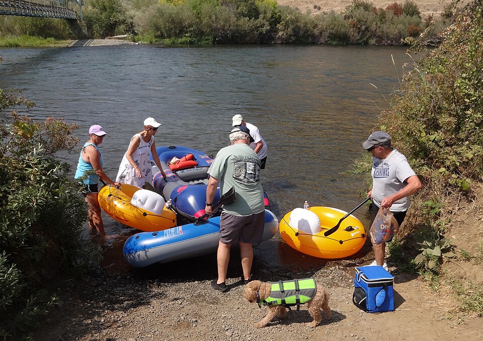
Umtanum sits at milepost 16, Lmuma Creek at milepost 12, Big Pines at milepost 10, and Roza at milepost 7. The sites carry vault toilets, picnic tables, fire rings, and dumpsters. They carry no hookups and no potable water, and the BLM describes cellular reception in the canyon as limited.
The listing record’s figures make Big Pines the large campground at about 40 sites, with Umtanum at 18, Lmuma Creek at 7, and Roza at 6. A campsite takes 10 people and 2 vehicles, with one RV per site and a $10 charge for an extra vehicle. Construction at Big Pines and Roza may close sites for up to two weeks in a season, and Recreation.gov is the check before a trip. One boundary runs inside the entry. The footbridge at Umtanum crosses to WDFW land, and at its far end the WDFW stay rule and fire rules replace the BLM’s.
Juniper Dunes
Quick facts: sites, primitive dispersed camping around the staging and open areas; stay limit, 14 days in any 28 day period, the BLM national form; potable water, none anywhere in the area; restrooms, none; fires, open fires are prohibited, and camp stoves only; vehicle pass, none for camping, with ORV registration and tags required for riding; road, a paved county road, then a very primitive sand road, high clearance four wheel drive, and trailers do not belong at the upper staging area; resupply, Pasco, about 7 miles away.
Juniper Dunes, outside Pasco, is three designations in one sand sea. The Juniper Dunes Wilderness, designated in 1984 at 7,140 acres, is fenced, and no motorized or mechanized use enters it. The OHV open area covers 3,920 acres. An Area of Critical Environmental Concern covers 8,620 more. The camping is primitive and dispersed, under the BLM’s national stay form, in a place with no water and no facilities of any kind.
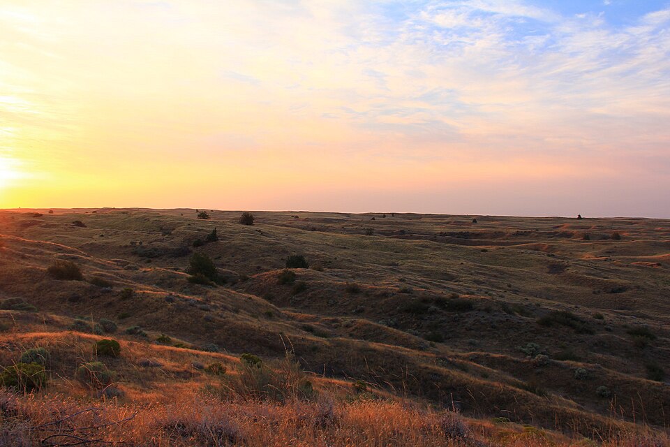
The riding rules are part of the camping here. The area draws more than 30,000 visitors a year, most of them OHV riders, and spring and summer run busy, spring first. Helmets are required, whip masts fly orange flags, and ORVs carry registration and tags.
Campers pitch near the staging areas, where the sand is packed and the riding starts, and the wilderness fence is the line the machines do not cross. The dunes rise to 130 feet over the northernmost western juniper grove in the country. Shade is scarce, open fires are banned outright, and the sand road in decides which vehicles should attempt it. Reviewers warn that navigation apps mislead here, sending drivers to the wrong side of the dunes, where no camping is.
Liberty Recreation Site
Quick facts: sites, a designated BLM recreation site with 15 campsites on Williams Creek; season, year round, with snow closing access in winter; potable water, none; restrooms, two vault toilets; nightly fee, none; stay limit, 14 days; hookups, none; trash, pack out all trash; road, off US 97 south of Swauk Pass, by Liberty Road and Pine Gulch Road; cell service, limited; resupply, Cle Elum.
Liberty Recreation Site is the BLM’s developed form in the Swauk country. It is a small designated campground rather than dispersed land, and it is labeled as such so its rules are not read as dispersed rules. The BLM’s own page settles the facts. Fifteen campsites, two vault toilets, no fees, a 14 day limit, and no potable water or hookups. The site stays open year round, with snow closing its access in winter, and cellular reception is limited.
The listing record adds the campground’s texture. Reviewers describe two distinct areas with sites well placed apart and a small stream through the site. The campground filled on a Father’s Day weekend, with campers spilling across the road, and stood empty on a midweek visit. The old mining town stands nearby, and reviewers warn that the ground around it is claimed up with mining claims.
Tucannon River and the Blue Mountains
Tucannon River
Quick facts: sites, dispersed camping at the forest’s general form along the Tucannon corridor, anchored by the developed Tucannon Campground; stay limit, 14 days in any 30 day period, the Umatilla form; potable water, none at the campground or at dispersed sites; restrooms, vault and pit toilets at the campground, and none at dispersed sites; nightly fee, none for dispersed camping, and the campground charges $8 a night from March 1 to October 31 and no fee from November to February, on the agency’s data record; road, the Tucannon River Road up from State Route 12; cell service, no signal at the campground on its record; resupply, Pomeroy.
The Tucannon River drains the north face of the Blue Mountains in Garfield County, in the Umatilla National Forest’s Pomeroy Ranger District. Tucannon Campground anchors the road with 18 sites, vault and pit toilets, tables, and fire rings. It is open year round, with its services running from March 1 to October 31. It has no potable water, and its own record reports no cell signal. Pomeroy is a small town, and the road’s campers stock there before the road climbs.
The road’s dispersed camping runs at the forest’s general rule, 14 days in any 30 day period. No agency page names a dispersed destination on this road, and this entry claims none. The Last Resort RV Park’s dump station, with potable water for a fee, is the road’s dump point on the listing record. The Wooten Wildlife Area borders the road’s country, and on that land the WDFW rules, not the forest’s, govern the night. The listing record names two more small developed campgrounds in the drainage, Teal Spring and Pataha, quiet campgrounds with tables, fire rings, and a pit toilet each.
Fire restrictions and emergencies
Fire restrictions
Fire rules stack, and the stack runs in jurisdiction order. The land manager’s restrictions come first. On national forest land those are the forest’s restriction stages and orders.
On WDFW land, the June 15 eastern Washington block from the rules section is the form that layer takes. A fire ring at a dispersed site is never permission by itself. The manager’s current restriction decides whether the ring may be used at all.
DNR’s layer runs on its own geography. The department publishes fire danger and burn restrictions by Fire Danger Rating Area, not by county, and its burn portal is the check for state land. Counties add a layer of their own, in forms that differ county by county.
Yakima County’s automatic restriction runs June 1 through August 31 under its ordinance. Cities can hold their own rule inside their limits. A governor’s statewide ban can override every layer under it, as one did through September 30, 2026.
By late summer in a dry year, the practical effect is that east side dispersed camping becomes a stove activity. Campers plan their cooking around the bans rather than around the fire ring. The working habit is short.
Before any fire at a dispersed site, check the agency that manages the land, then the county the site sits in. Both checks take minutes. Both are named in the Sources below, at the agencies’ own pages.
Emergencies
In an emergency, call 911 first. A dispersed site has no address, so the location to give is the forest road number and the nearest highway or milepost. Note both when you make camp, not when you need them. Do not count on cell coverage at a dispersed site, which makes the note worth taking on arrival.
County alert systems carry the warnings that matter out here, from fire evacuations to flood notices. Washington’s Emergency Management Division maintains the index of county alert systems. A charged phone is not a plan where there is no signal.
Tell someone at home the road name and the road number before you go. Signing up for the alerts of the county you are camping in, before the trip, is the cheapest safety step in this guide. The entries above name each road’s resupply towns, and the full service towns among them are where help concentrates.
Frequently asked questions
Is dispersed camping free in Washington?
Yes, for the stay itself, on national forest, DNR, BLM, and WDFW land. No pass pays for a dispersed stay or permits one. Passes enter the picture at the vehicle, at trailheads, day use sites, and state land access points. Developed exceptions charge their own fees. The BLM’s Yakima River Canyon campgrounds charge $15 a night, and DNR’s designated campgrounds carry no added cost with a valid Discover Pass.
How long can you stay at a dispersed site in Washington?
There is no single answer, because there is no single rule. The forms run from 21 days per calendar year in total on the Olympic National Forest, to 14 consecutive days in one place near Seattle. A 28 day annual cap stands behind the Seattle form.
Then come 10 days in any 30 on unposted DNR land, and 21 days within a 30 day period on WDFW land. The stay limits section above states each manager’s form in full, and its table collects all nine forms in one place. The agency that manages the land your tent is on sets the limit.
Is the Olympic National Forest limit 21 consecutive days?
No. The forest’s order allows 21 days per calendar year in total, across the whole forest. The 14 consecutive day figure in the same order applies inside developed recreation sites. Roundups that print 21 consecutive days for dispersed camping on this forest are printing the rule wrong.
Do I need a Discover Pass to dispersed camp?
On state land, the Discover Pass covers vehicle access to DNR and WDFW land, and a Vehicle Access Pass covers WDFW land on its own. On national forest and BLM land the Discover Pass does nothing. Where a pass applies, it parks the vehicle. It never permits the stay, and it never changes the stay limit.
Can I camp anywhere in a national forest?
No. Dispersed camping uses existing sites, along roads the motor vehicle use map designates, and inside the corridor distances where a forest sets them. Closures override the baseline, as the Middle Fork Snoqualmie closure does west of Snoqualmie Pass.
Park boundaries end it outright. The stay clock keeps running wherever you stop inside the forest. The forest’s own order and map are the authority for the land in question.
Can I dispersed camp in a state park or a national park?
No, in either system. State parks allow camping only in designated areas or under a ranger’s direction. Olympic, Mount Rainier, and North Cascades national parks run wilderness and backcountry permit systems with designated camps. Neither system has a dispersed product.
Where is the closest dispersed camping to Seattle?
Tinkham Road, off Interstate 90 at exit 42, the closest dispersed road to Seattle. Its pull-off sites line Forest Road 55 along the South Fork Snoqualmie. Greenwater and Forest Road 70 are the south side alternative, reached through Enumclaw. Both roads fill on summer weekends, Tinkham first. At Tinkham the easy pull-offs nearest the exit go earliest, and the road’s far end is the fallback.
Can I have a campfire at a dispersed site?
Sometimes, and the answer is never the fire ring’s to give. Where fires are allowed, they belong in existing rings, under the manager’s current restrictions. On DNR land there are no dispersed campfires at all. County restrictions and statewide bans stack on top of the manager’s rules, and the fire section above gives the checking order.
Can I camp anywhere along the Teanaway River road?
No. The road crosses a boundary that changes the product. In the Teanaway Community Forest, camping is allowed only at the designated campgrounds. On the national forest land above the boundary, dispersed camping opens under the Okanogan-Wenatchee stay form. Which side of the line the tent is on decides the rule.
Can I dispersed camp at Lake Cushman?
No. Forest Order 06-09-23-01 prohibits dispersed camping along the Lake Cushman road and Forest Road 2451 through April 30, 2027, and the national park across the boundary runs a permit system. Big Creek Campground is the road’s developed camping. Roundups that still list shoreline dispersed sites there are out of date.
Sources
The stay limits in this guide come from the instruments themselves. The Forest Service orders for the Mt. Baker-Snoqualmie, Olympic, Gifford Pinchot, Okanogan-Wenatchee, Colville, and Umatilla national forests carry the forest forms. They include the Olympic order’s 21 day annual cap and the Lake Cushman prohibition order. Washington’s administrative code carries the state forms, WAC 332-52-300 for DNR lands, WAC 220-500-100 for fish and wildlife lands, and WAC 352-32-030 for state parks. The Bureau of Land Management’s national dispersed camping guidance carries its 14 days in any 28 day period form.
Its Spokane District pages carry the Yakima River Canyon, Juniper Dunes, and Liberty site facts. Recreation.gov carries the canyon’s booking and capacity record. Pass prices are the agencies’ published prices, checked in November 2026.
Road facts come from the managing agencies’ own pages for each forest, department, and district. They come also from the forests’ motor vehicle use maps and travel documents, and from DNR’s burn portal and the counties’ restriction pages for the fire section. Texture identified in the entries as listing reports, road character, crowding, and cell reports, comes from the public listing records for the named roads, principally The Dyrt, Campendium, and freecampsites.net. Where an agency publishes nothing for a road, the entries say so on the evidence that exists.